Jack Kendrick
@jackendrickwx
Carolina weather, sports, photography || @NCState Meteorology Class of '25.
Please consider donating to any of these organizations to help out recovery bpr.org/bpr-news/2024-…

The power of water. This is why roads close and you don't go around barricades. (📸: Camp Easter Rd. and N.C. 2 in Southern Pines)
Word is out—we've released our initial 2025 fall foliage predictions! It's important to remember that at this point in the season, our maps try to depict "normal" timing. As fall approaches, we begin to fine tune the forecast to match regional anomalies!
🍂 @ExploreFall has issued its first foliage outlook for 2025! ⬇️ wral.com/autumn-in-two-…
Anyone else noticed that cook out signs are just various menu items with nothing else? It’ll just be BLUEBERRY SHAKE QUESADILLA CHICKEN NUGGETS no promo tagline no prices just straight things
Welcome to NC, where even the clouds line up for a tray combo. #cookout #shelfcloud Pic: Vanessa Freeman
All time Carolina weather screenshot right here
Y'all OK over there in Sumter?! Malfunctioning sensor registering a temp of 106° with a dew point of 104°!

Jazz Chisholm participating in the pop fly derby #HRDerby

Patchy fog across the Carolina Piedmont this morning with yet another morning of valley fog in SWNC. Mornings like this are a dime a dozen in mid-late summer.
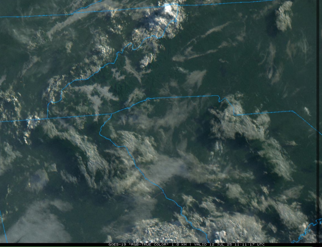
#WPC_MD 0631 affecting Southern Appalachians into the Carolinas Piedmont, #ncwx #vawx #scwx #tnwx #gawx #kywx, wpc.ncep.noaa.gov/metwatch/metwa…
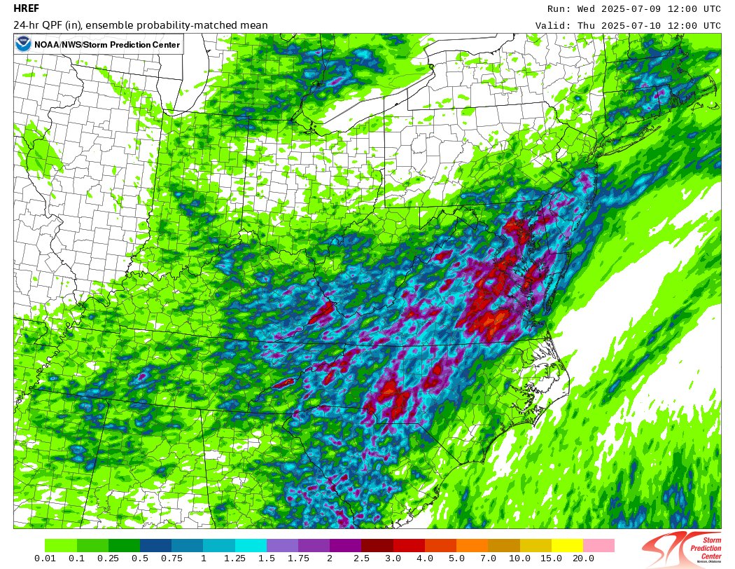
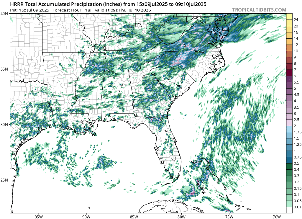
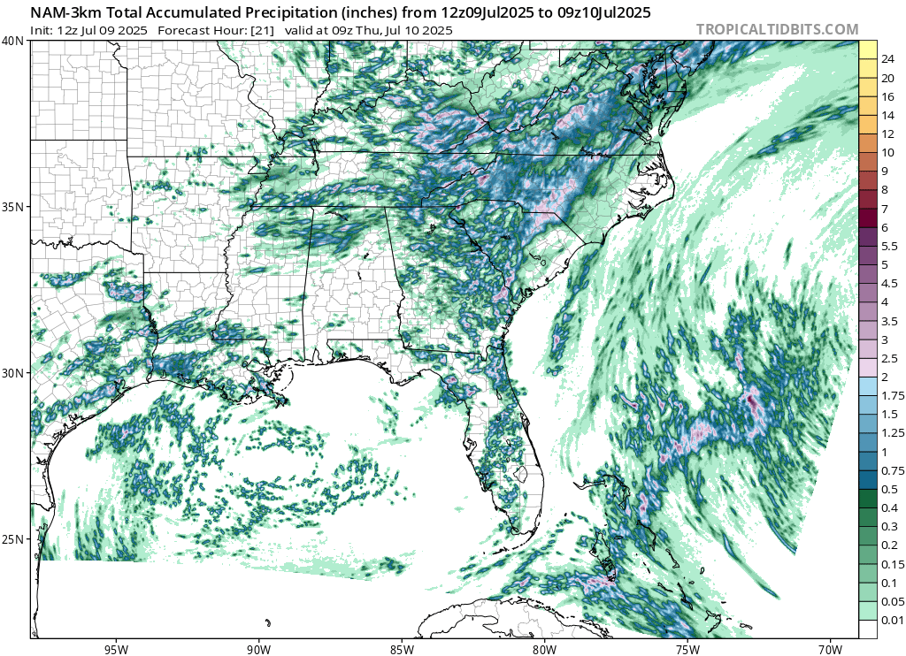
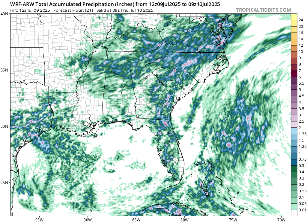
CAMs are all painting a fairly similar picture for central NC today, with a stripe of 2-3"+ (localized higher amounts) possible through tomorrow AM. Some discrepancies with where exactly, but that's to be expected with summertime convection. Keep an eye out for flooding today!
Well. That answers that. Damage to the Eno River State Park suspension bridge from yesterday’s record flooding. Photo from NC State Parks & Rec on FB
This picture is one I took of a different sign on the suspension bridge, but I’d be very interested to know where the water is at here as well. Certainly the bridge itself is submerged.
No rail service for a while between Raleigh and Greensboro. Found this picture of a washout around Hillsborough, NC. @NWSRaleigh #ncwx
Record flooding at the Eno River in Durham and Orange Counties North Carolina. Bridge at Pleasant Green Road in Huckleberry Springs at the Pleasant Green access. Spoiler, that's not a boat ramp in the picture but a parking lot where hikers access the Eno trails.
This picture is one I took of a different sign on the suspension bridge, but I’d be very interested to know where the water is at here as well. Certainly the bridge itself is submerged.
A picture says 1,000 words. The Hurricane Fran sign on the Eno River is under water. Photo: Ken Wynne - Durham
This view on a normal day 👇 Record flooding along the Haw this morning. #NCwx
Bridge across the Haw in Saxapahaw this morning.
🚨A rapidly evolving situation with Haw River still rising quickly. A new forecast has been issued with a new crest at 31.9 ft. If this occurs it will be the 2nd highest crest at this gauge. The record crest is 32.83 ft back in September 1996 from Hurricane Fran. #NCwx
🚨 Haw River at Haw River is now forecast to surpass Major Flood Stage and crest 27.5 feet. At 27 ft portions of the town of Haw River begin to flood. If the stage were to reach 28 ft, flood waters would reach the bottom of the bridge across I-40. #NCwx
The water isn’t done rising in Chapel Hill regardless, but watching this heavy band back in western Orange Co. Don’t want to see that swing through to the east. #NCwx
HOUSE SUBMERGED IN FLOOD WATERS in Chapel Hill, North Carolina, right now! Major flooding continues from the remnants of Tropical Storm Chantal.