NWS Raleigh
@NWSRaleigh
Official X Account for National Weather Service, Raleigh, NC. Details: http://weather.gov/nws_x
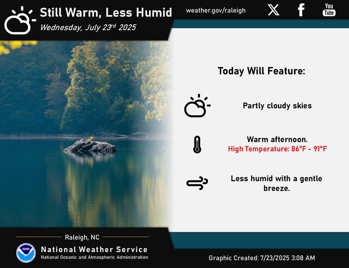
☀️ It will still be warm today, but less humid with a gentle breeze. 🥵 Enjoy this break from the heat as dangerous heat returns to the forecast Friday through the weekend. #NCwx
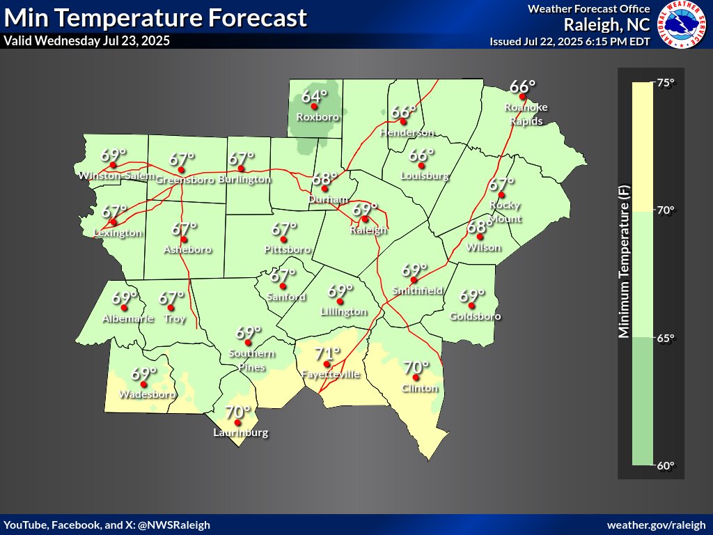
🌡️ Here is tonight's low temperature forecast. Temperatures are expected to dip into the upper 60s to around 70 tonight. This could be the first time below 70 degrees since July 6th in the Triad and June 21st in the Triangle. This is back to average for this time of year. #NCwx
Lower humidity levels are starting to filter in from the north and east as high pressure builds south. Even better conditions will exist tomorrow! #NCwx
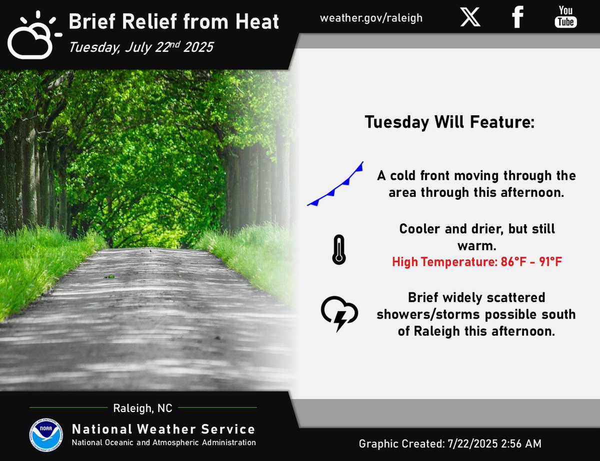
⛅️Cooler and drier today, but still warm. ⚡️Widely scattered showers/storms possible south of Raleigh towards the NC/SC border this afternoon. #NCwx
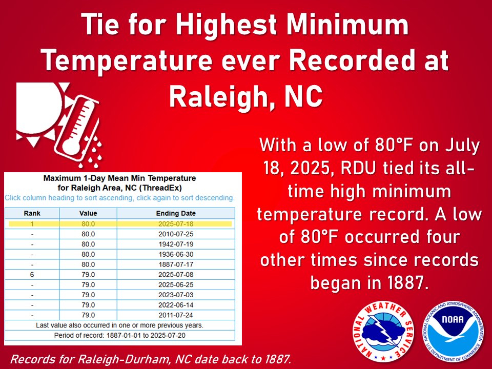
It's been a busy few days, but it's worth noting that Raleigh-Durham Airport only got down to a low of 80 degrees on July 18, which ties the all-time record high minimum temperature. This occurred four other times since records began: in 2010, 1942, 1936, and 1887. #ncwx
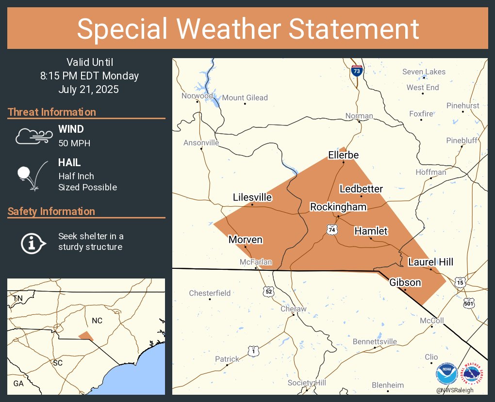
A special weather statement has been issued for Rockingham NC, Hamlet NC and East Rockingham NC until 8:15 PM EDT
A special weather statement has been issued for Wadesboro NC, Polkton NC and Norwood NC until 7:30 PM EDT

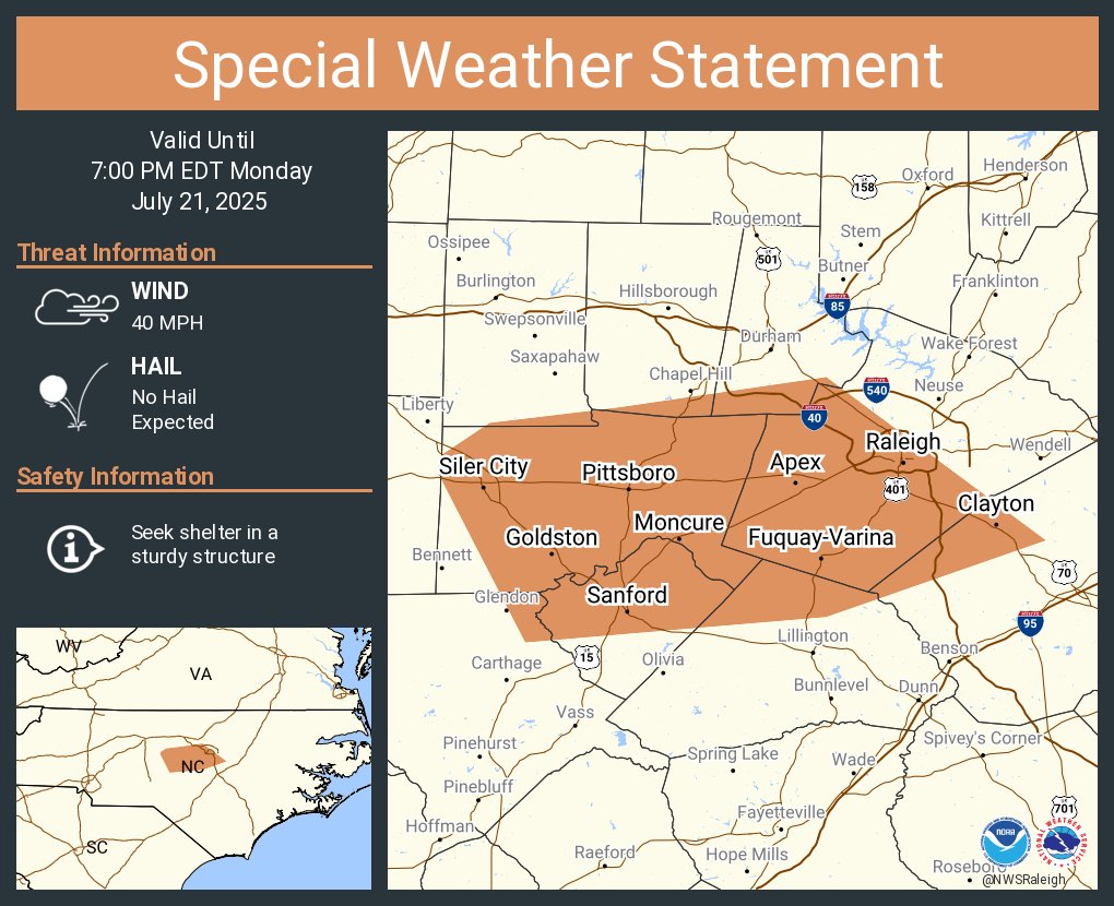
A special weather statement has been issued for Raleigh NC, Cary NC and Apex NC until 7:00 PM EDT
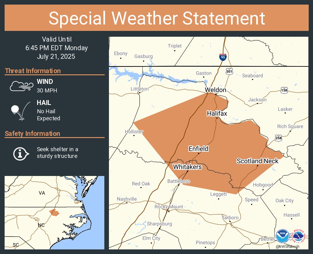
A special weather statement has been issued for Enfield NC, Scotland Neck NC and Weldon NC until 6:45 PM EDT
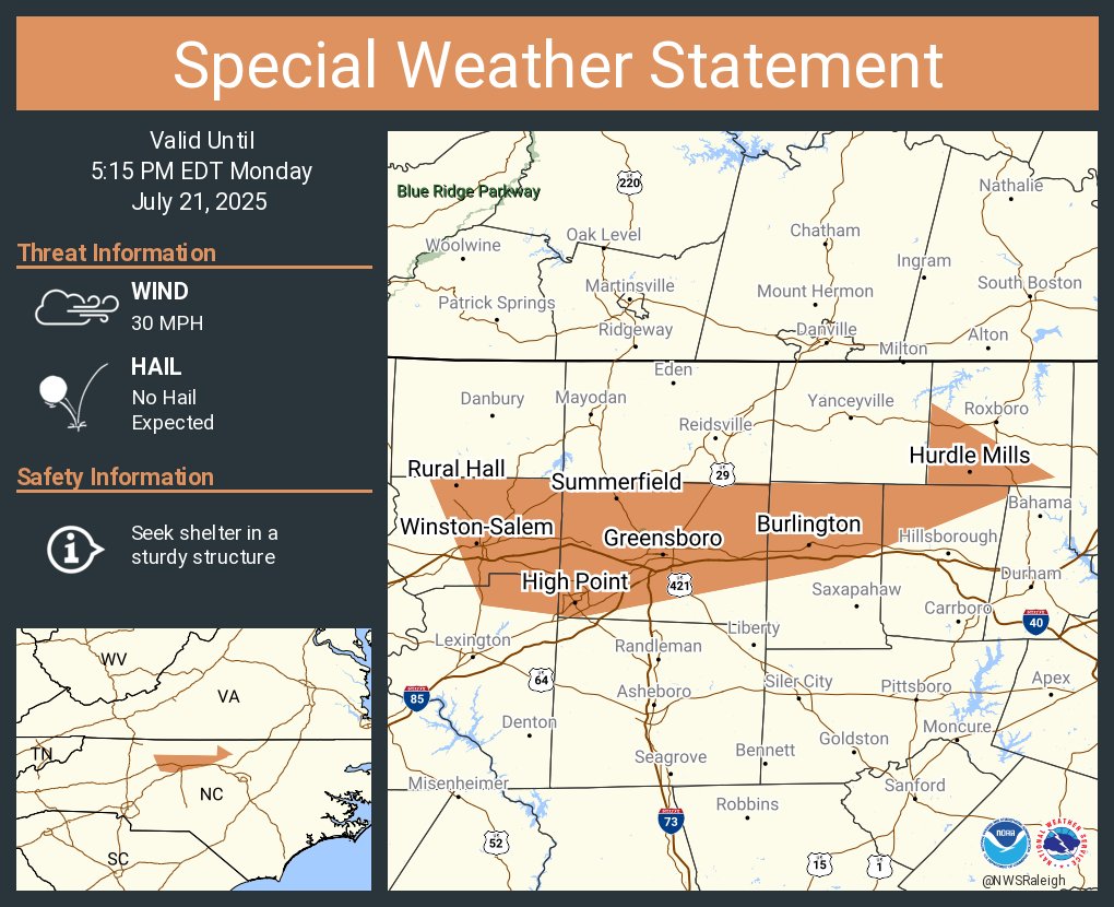
A special weather statement has been issued for Greensboro NC, Winston-Salem NC and High Point NC until 5:15 PM EDT
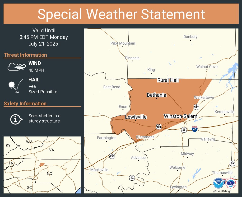
A special weather statement has been issued for Winston-Salem NC, Lewisville NC and Rural Hall NC until 3:45 PM EDT
Want an update on the upcoming weather? Check out our latest routine weekly briefing here: youtu.be/pGftTizvDQc #NCwx
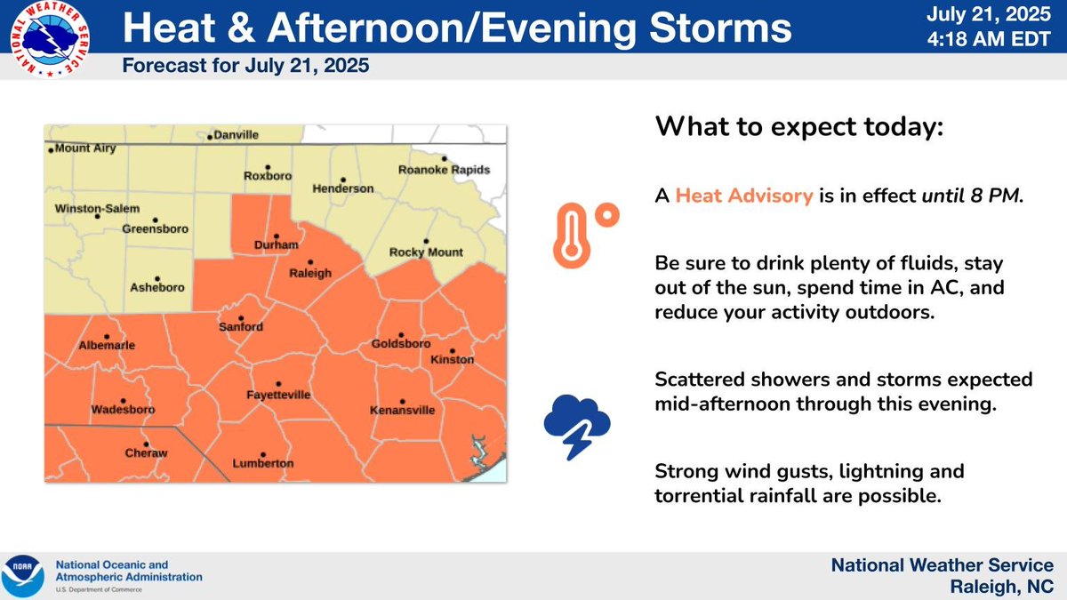
Another hot and humid day expected today. A Heat Advisory will be in effect from 11 AM until 8 PM. Scattered storms will be capable to strong wind gusts, lightning and torrential rainfall. #NCwx
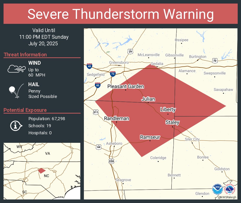
Severe Thunderstorm Warning continues for Pleasant Garden NC, Randleman NC and Liberty NC until 11:00 PM EDT
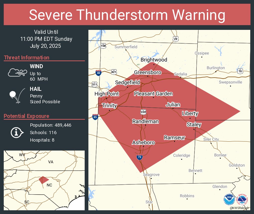
Severe Thunderstorm Warning including Greensboro NC, High Point NC and Asheboro NC until 11:00 PM EDT
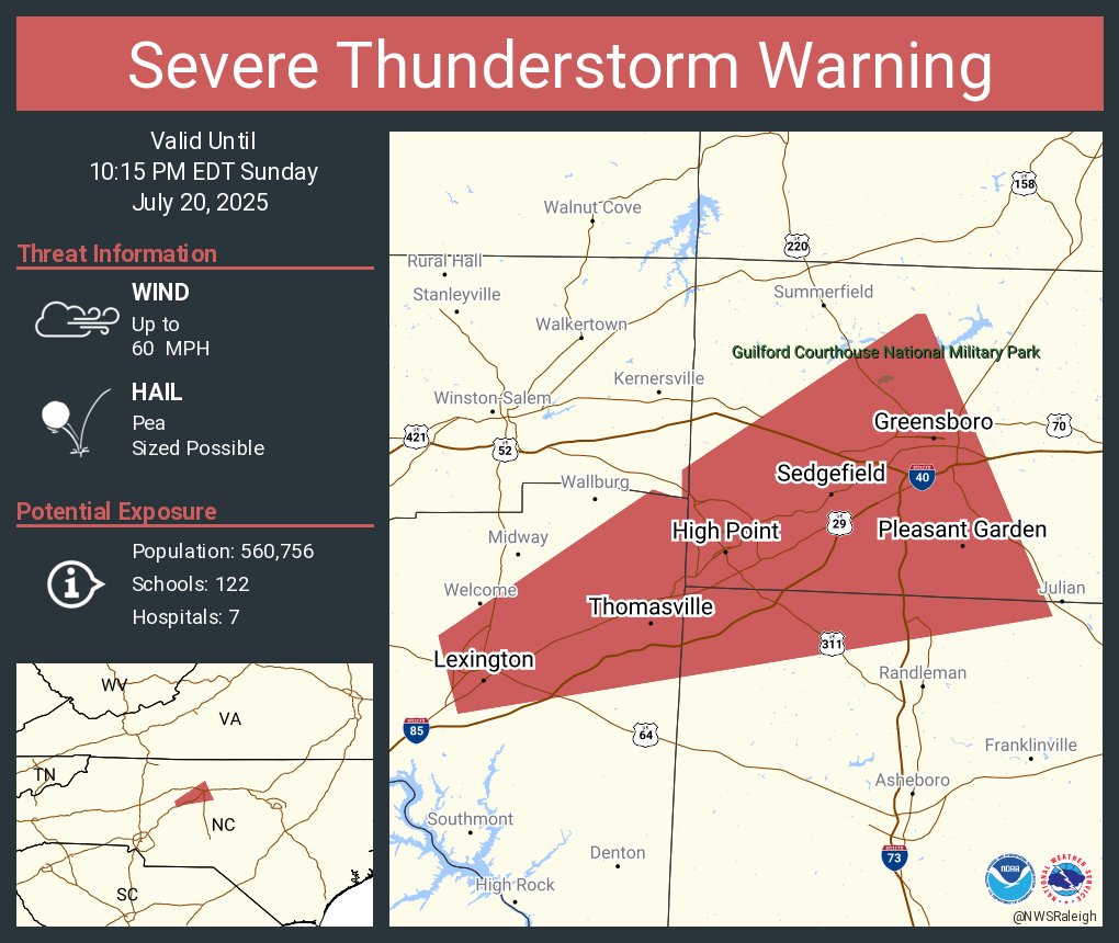
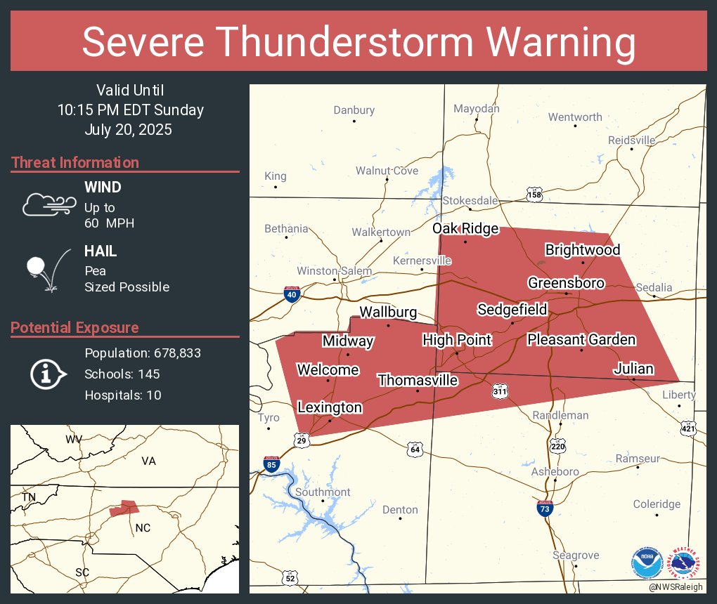
Severe Thunderstorm Warning continues for Greensboro NC, High Point NC and Thomasville NC until 10:15 PM EDT
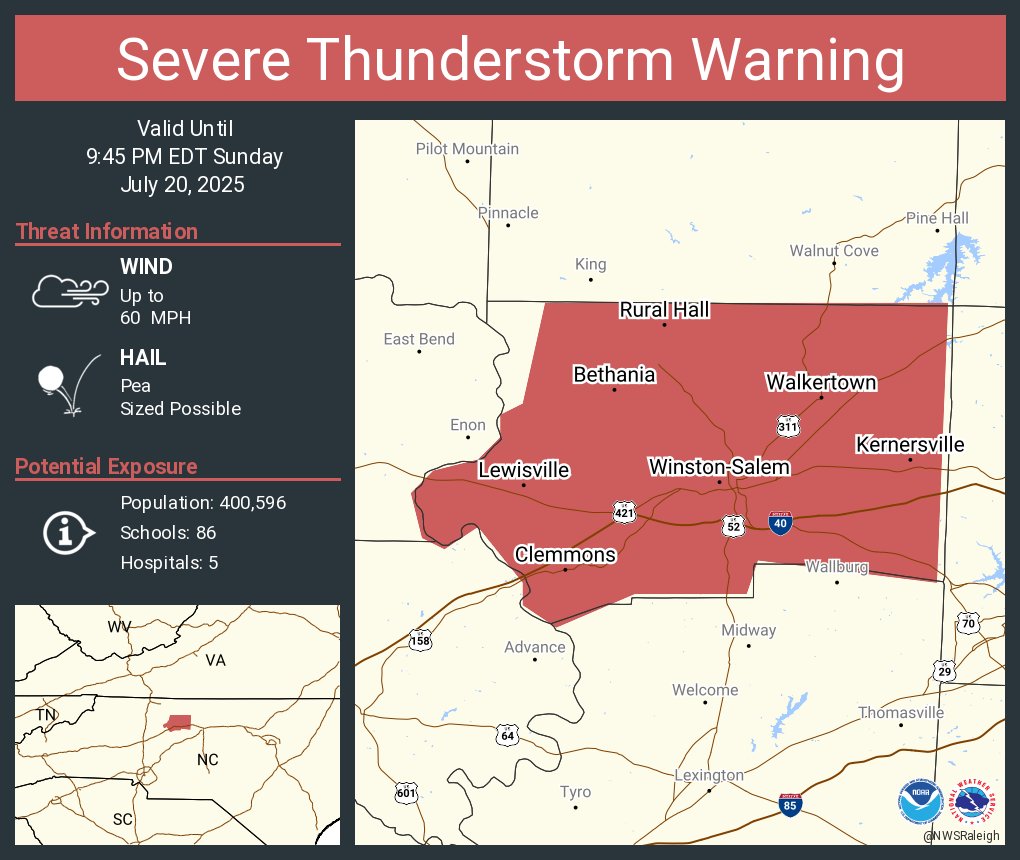
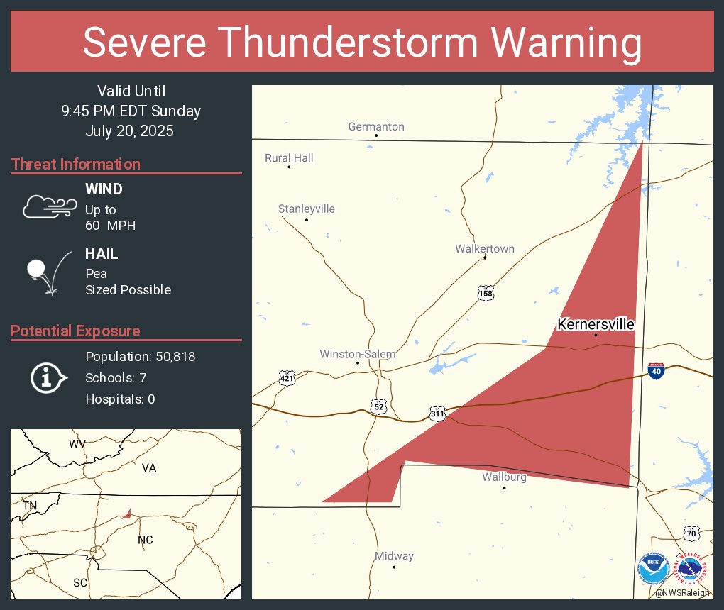
Severe Thunderstorm Warning continues for Kernersville NC until 9:45 PM EDT
Severe Thunderstorm Warning including Greensboro NC, High Point NC and Thomasville NC until 10:15 PM EDT
9:00 PM radar update: a few isolated thunderstorms are moving into the Triad. Isolated damaging wind gusts are possible with these storms. A severe thunderstorm warning is in effect for Forsyth county until 9:45 PM, with the potential for 60 mph winds. #NCwx
Severe Thunderstorm Warning including Winston-Salem NC, Kernersville NC and Clemmons NC until 9:45 PM EDT