Josh Morgerman
@iCyclone
Hardcore hurricane chaser. Mississippi transplant. Proud Harvard man. Righteous Bay Rat. The #HurricaneMan.
Curious what it's like to go through a high-end Cat-5 #hurricane? Here's my #DORIAN video from the #Bahamas. Unlike a lot of my recent work, this is no teaser—it's a full-length video that brings you through whole experience from my POV. Two notes: youtu.be/DV-PLJq4HD4
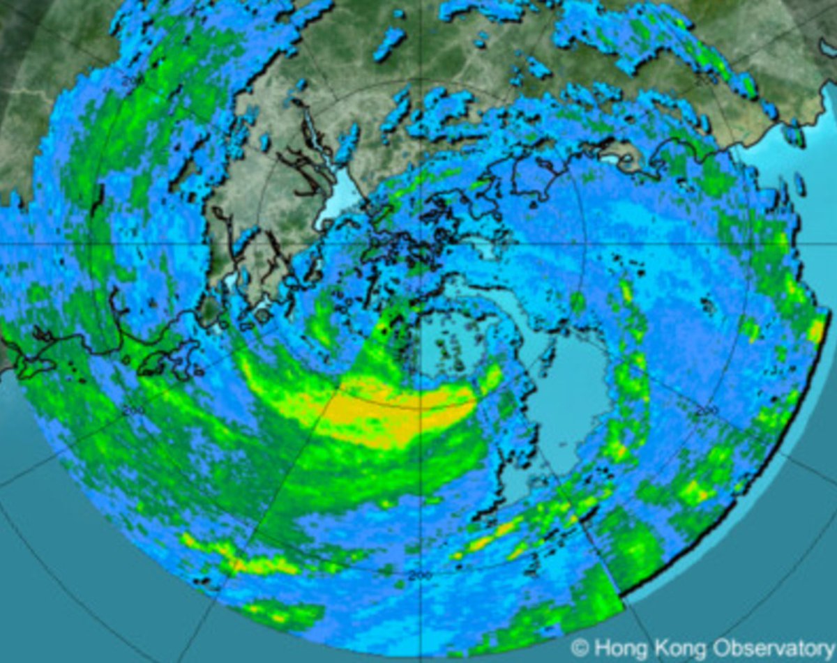
WIPHA is scraping close to Hong Kong this Sunday morning. Radar shows well-organized cyclone with apparent eye & eyewall. Hong Observatory & JTWC class this as Cat-1 #typhoon, but JMA is stubbornly keeping it as TS despite surface obs that suggest it is, in fact, a typhoon. Odd.
Been working on this for a while - thanks to The Hill for publishing this op ed I worked on talking about the importance of NOAA's hurricane forecasts, including the research that underpins it all. Thanks to the writing team that helped as well! There has been some promising…
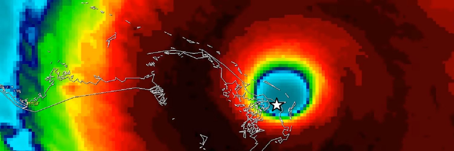
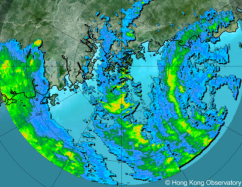
TS #WIPHA (#CrisingPH) is pulling away from #Philippines (pink) after causing flooding & travel disruptions there. It's looking a little more organized as it crosses South China Sea, & it could be near #typhoon intensity when it passes near #HongKong (star) in about 24 hours.
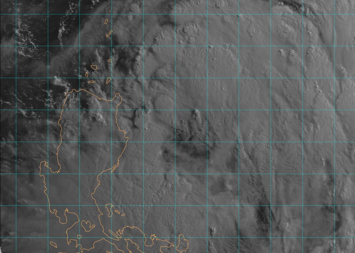
This unsightly mess is TS #WIPHA. The Filipinos call it #CrisingPH. I call it Butt Ugly. Models were initially aggressive with it, & I almost chased it. Fortunately, I didn't. Despite its ugliness, this thing & conjoined monsoon will cause big flooding—esp. in #Philippines.
In NYC. Having prime rib tonight. My mother frowns upon it—dismisses it as "that wedding meat." Hurricane Man does not have Hurricane Mom's sophisticated palate.
Join us LIVE this Wednesday, July 23 at 9AM ET as we dive into everything happening in the tropics with legendary hurricane hunter Josh Morgerman (@icyclone)! 🌀 Bring your questions, your curiosity, and your coffee! ☕📺
I recently started noticing a rooster in the neighborhood. I've never seen him, but I hear him—crowing at sundown & sunup. I'm so into it.

Feel like the GFS is broken. It doesn't crank out fantasy porn anymore. 🙁
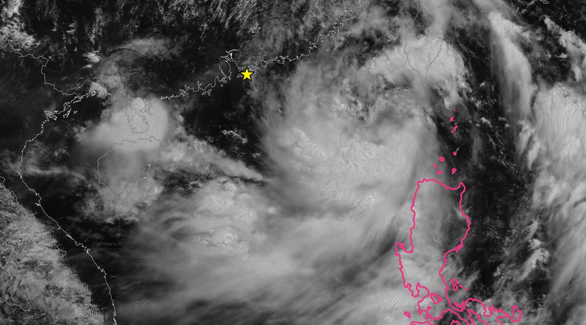
TS #WIPHA is now within radar range of Hong Kong. It ain't exactly what I'd call a fine specimen, but it has an easily identifiable center and decent banding. Estimated winds are 55 knots. It'll be a stormy Sunday morning in Hong Kong.
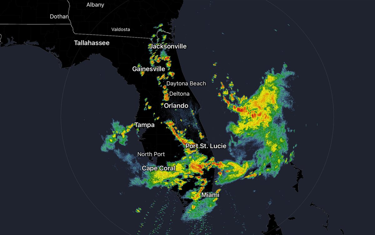
The day's total here was 2.79 in, with most of it (2 in) falling in ~35 minutes early in the evening. The rain is all gone now. And the frog chorus is at Level 11—as loud as I've ever heard it. #Invest93L
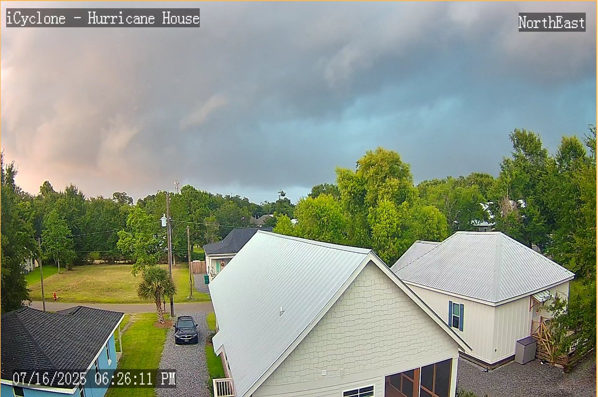
The view from Hurricane House just before it started to absolutely pour. Just got 2 in (50.8 mm) in just over 30 minutes, & it's still coming down hard. Continuous, intense lightning & thunder. But not terribly windy: peak gust 22 knots.
If you got excited by #Invest93L... you got played. (O' course I knew all along it was gonna be garbage. 😎)
JOIN US! We are 30 minutes away from going LIVE on ALL social platforms! This gives you the chance to interact with Hurricane Hunter @iCyclone & WeatherNation's own @DrJimTV Submit your questions or comments below, or in our live chat to have Dr. & The Dude discuss them on-air!
Mixed vibes from #Invest93L. On one hand, clear & persistent cyclonic turning with apparent center & favorable conditions ahead in Gulf. On other hand, models hate it—global models, hurricane models, intensity guidance, etc. (Even ICON gave up on it.) Lots of rain either way.
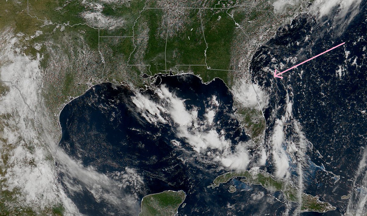
Kind of at a loss Re: #Invest93L. The models are universally dissing it hard—even the usually excitable hurricane models. And the intensity guidance is beyond sad. And yet... and yet... it has a decent cyclonic turning on radar, and it's curiously persistent.
I deleted my post highlighting another *extremely* stupid post because I decided I didn't even want to shine a light on that level of stupid.
Wow. I hadn't looked at the radar since KMLB came back online and when I did, I was kinda surprised. That convective pattern is definitely giving cyclonic vibes. #tingles #Invest93L
Excited to see some hurricane models run this afternoon, now that we have Invest 93L. 🙂 Especially curious what HAFS-A & HAFS-B have to say, because those models can get pretty rowdy.
Join us to talk Tropics and all your Top Weather Stories! We're LIVE with Josh Morgerman (@icyclone) and Dr. Jim Siebert answering all your forecast questions. Join us Wed. 7/16 at 9am ET.