
Weather World
@WeatherWorldPSU
A @psumeteo Weather & Climate Communications Group production since 1983. Catch us weekdays at 5:30p & 5:45p on @WPSU & 6:45p on @pcntv. Always streaming!
.@jmnese catches up with 2011 graduate of @psumeteo Christine Waters, who now works as an Associate Director of Insurance Industry Services for @Moodys: youtu.be/K5TXMCRY_tI @PSUEMS @WPSU @pcntv
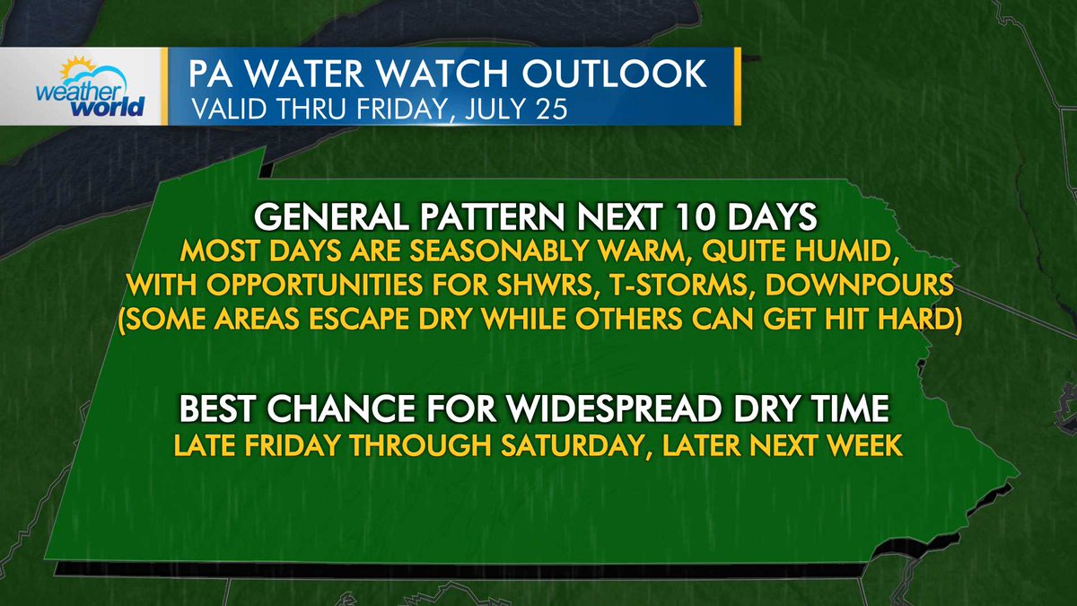
We see more hit-or-miss rainfall on the way for the next 10 days. Some areas will stay on the dry side, while others may deal with localized flooding. The best chance for widespread dry time may be late Friday through Saturday, and then again later next week. @WPSU @pcntv
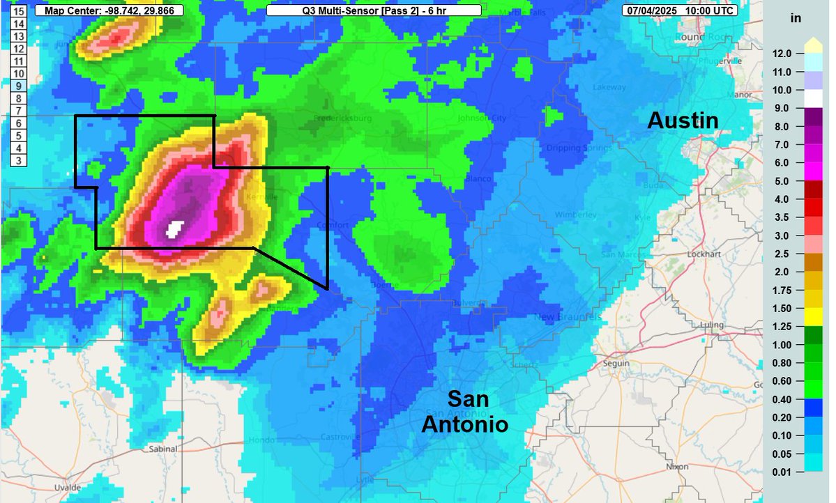
.@jmnese takes a closer look at the meteorological setup for the deadliest rainfall flood event to occur in the US since 1976 that unfolded in the Texas Hill Country last weekend in this edition of WxYz: youtu.be/QxqTfA1CtW4 @WPSU @pcntv @PSUEMS @psumeteo
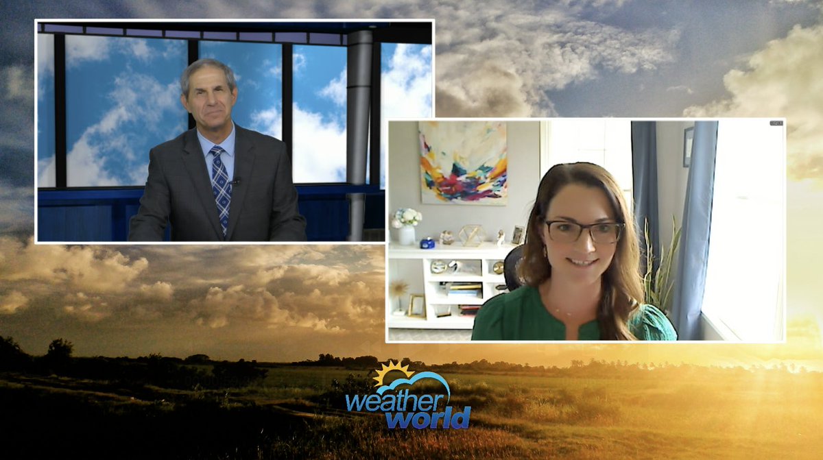
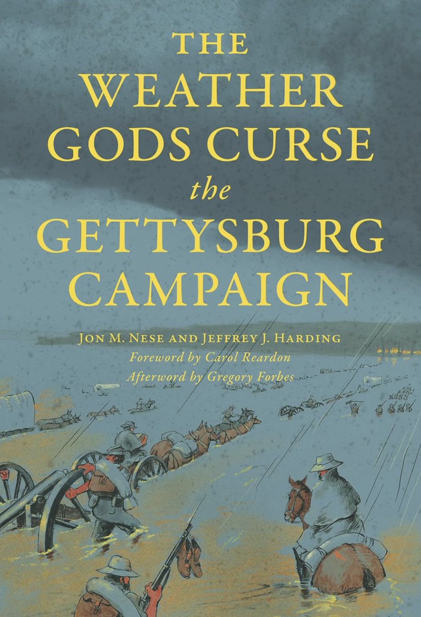
.@MarisaFerger chats with @jmnese about the book that he co-authored with Jeffrey J. Harding, "The Weather Gods Curse the Gettysburg Campaign": youtu.be/q93xznuDVqU
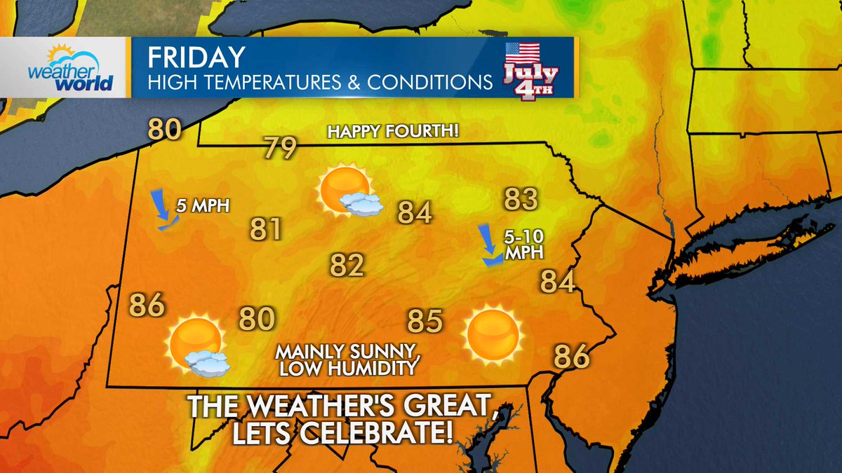
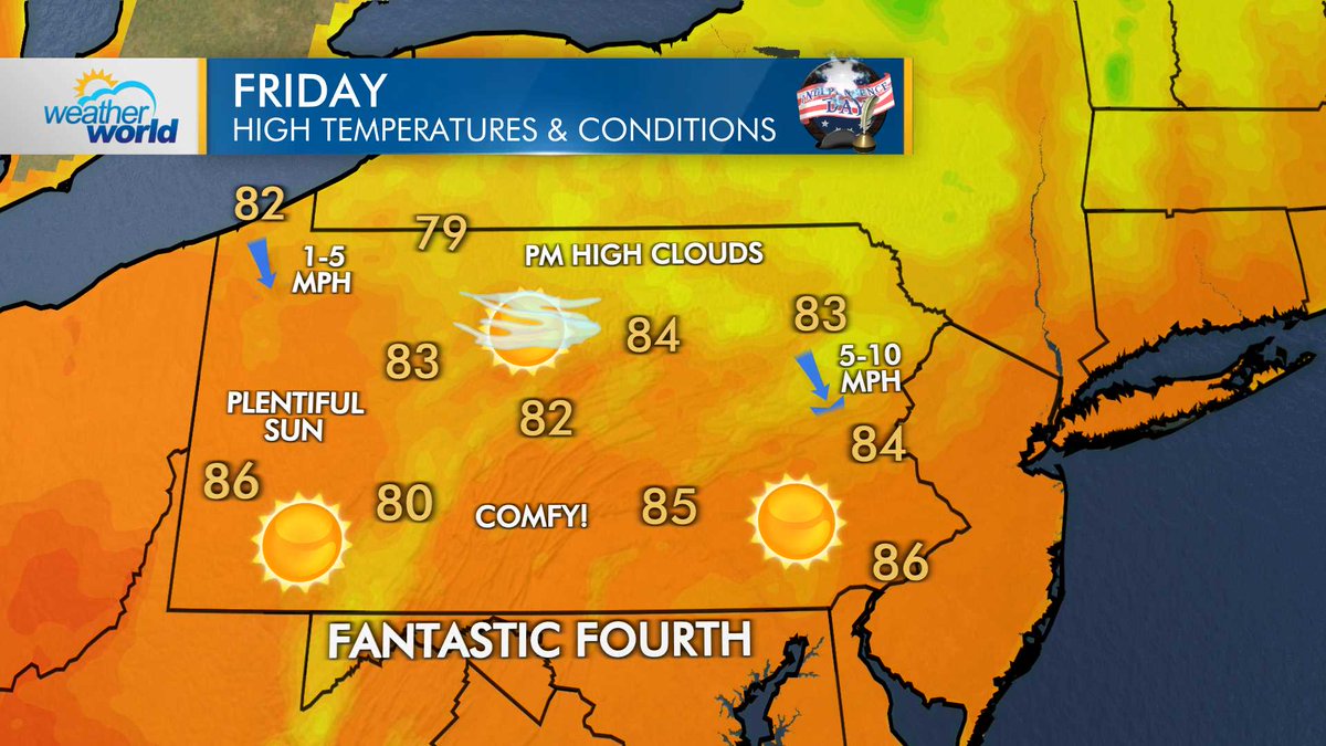
After a cold front crosses this evening, expect a bright and comfortable #IndependenceDay with high pressure in control throughout Pennsylvania.
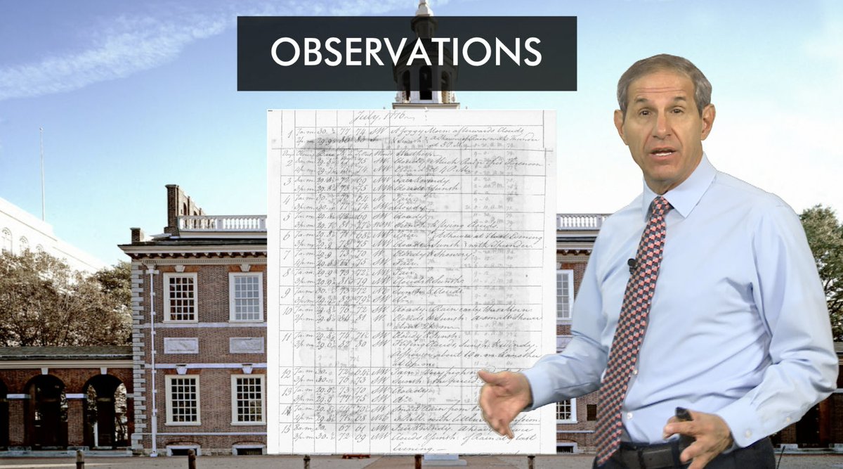
.@jmnese uses observations from, among others, Thomas Jefferson himself to reconstruct the weather of July 4, 1776 in this week's edition of #WxYz: youtu.be/QHnzKN4g7l4
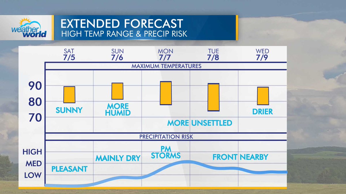
Expect a bright and pleasant Saturday before we introduce more heat and humidity for the end of the holiday weekend. Most will stay dry Sunday, then our next system moves in for the beginning of next week.
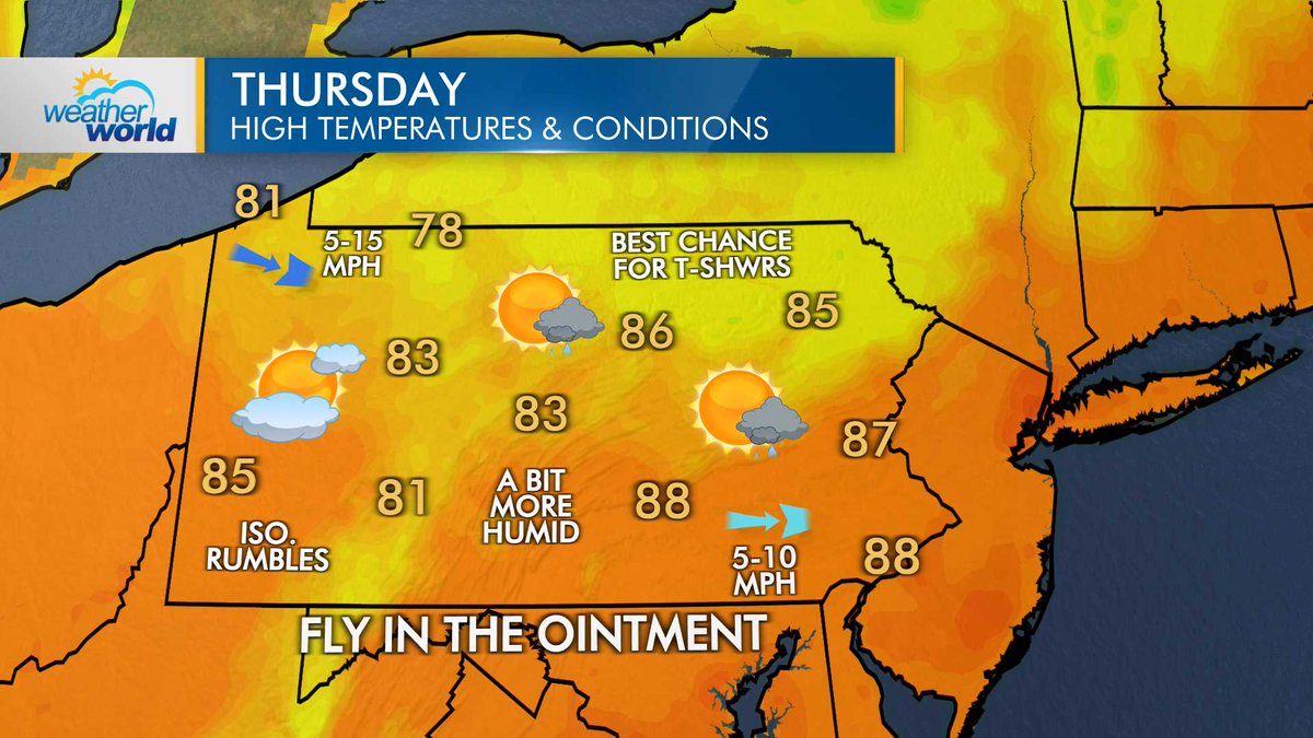
A fast-moving front will bring a slight uptick in humidity on Thursday and the chance for spotty thundershowers, especially in northern and NE PA. Behind the front, high pressure settles in for a fantastic Fourth.
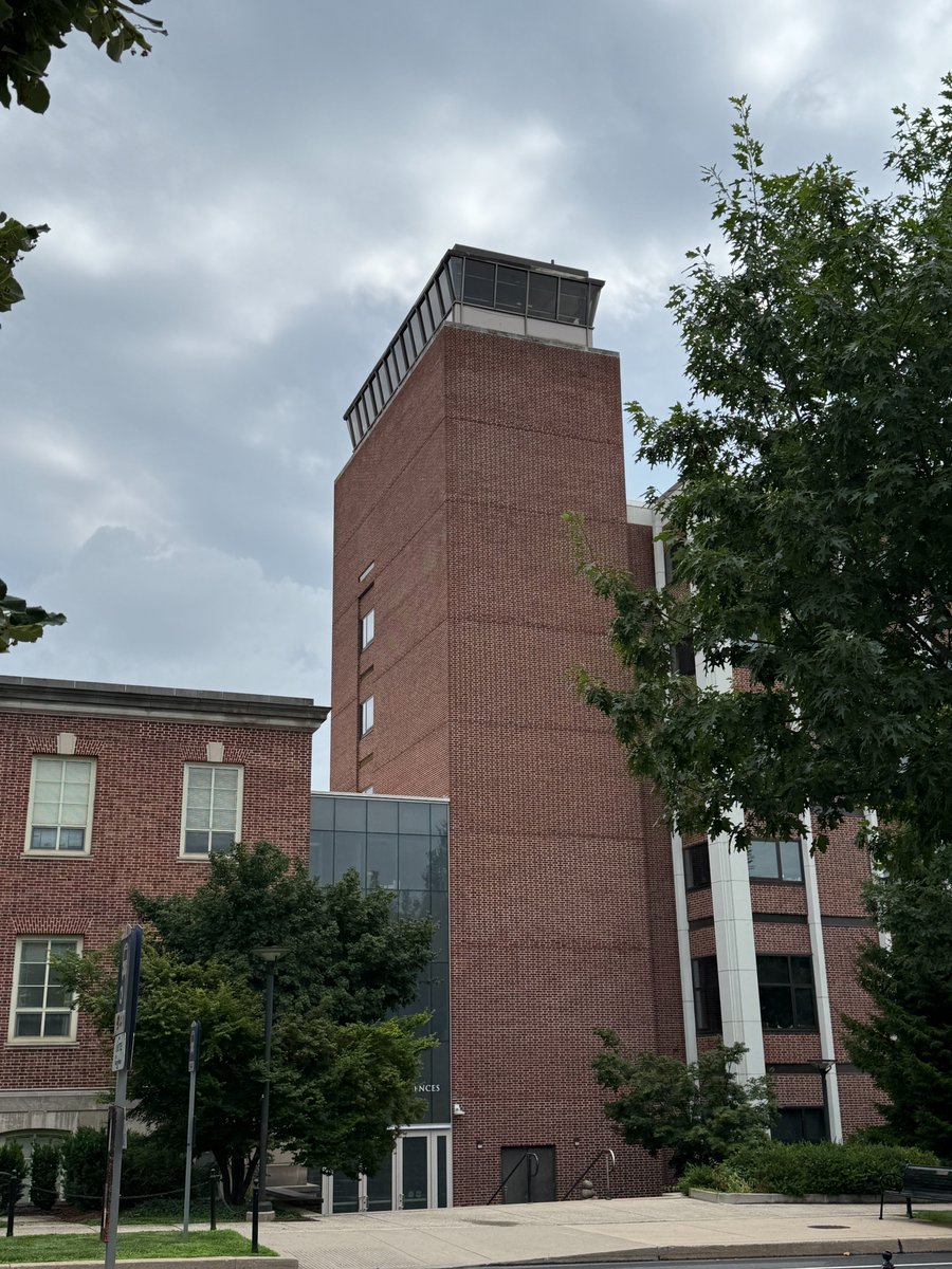
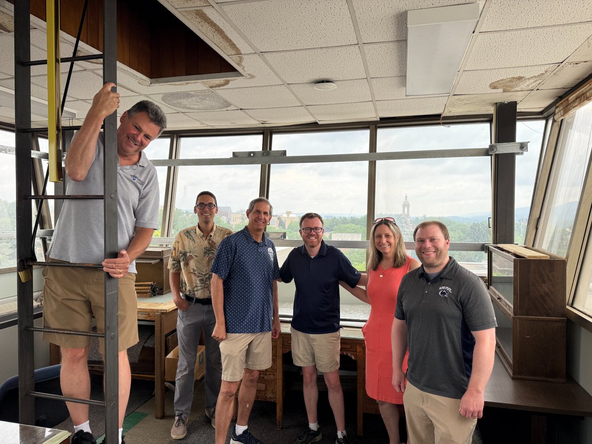
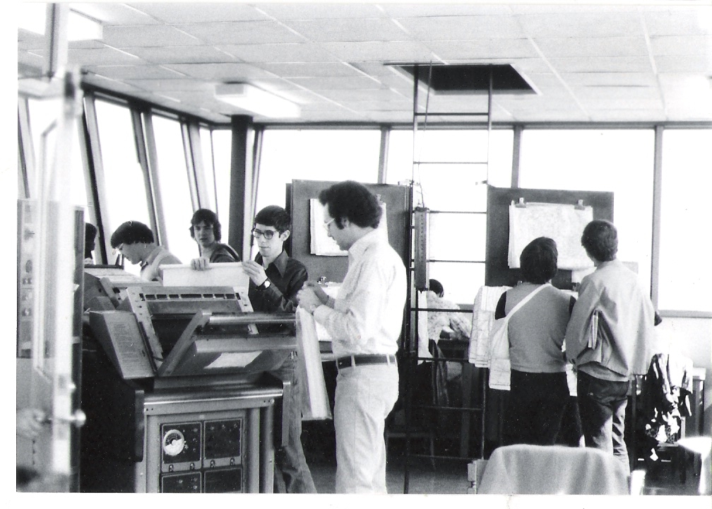
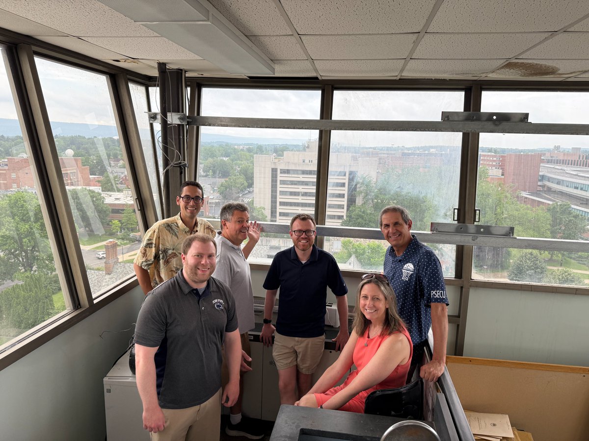
The Weather & Climate Comm Group took a field trip to the former weather station of @psumeteo in the tower atop Deike Building today! This was used in the 1960s & 70s before the Walker Building was built in 1976. Plenty of history & some pretty great views up here! @PSUEMS
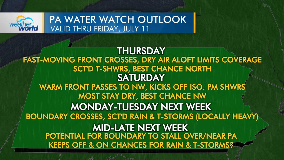
After the cold front crosses the Commonwealth tonight, we see minimal precip chances through the holiday weekend. Isolated t-showers will be possible north on Thursday & NW on Saturday. Most stay dry. Turning unsettled again next week with the potential for a stalled boundary.
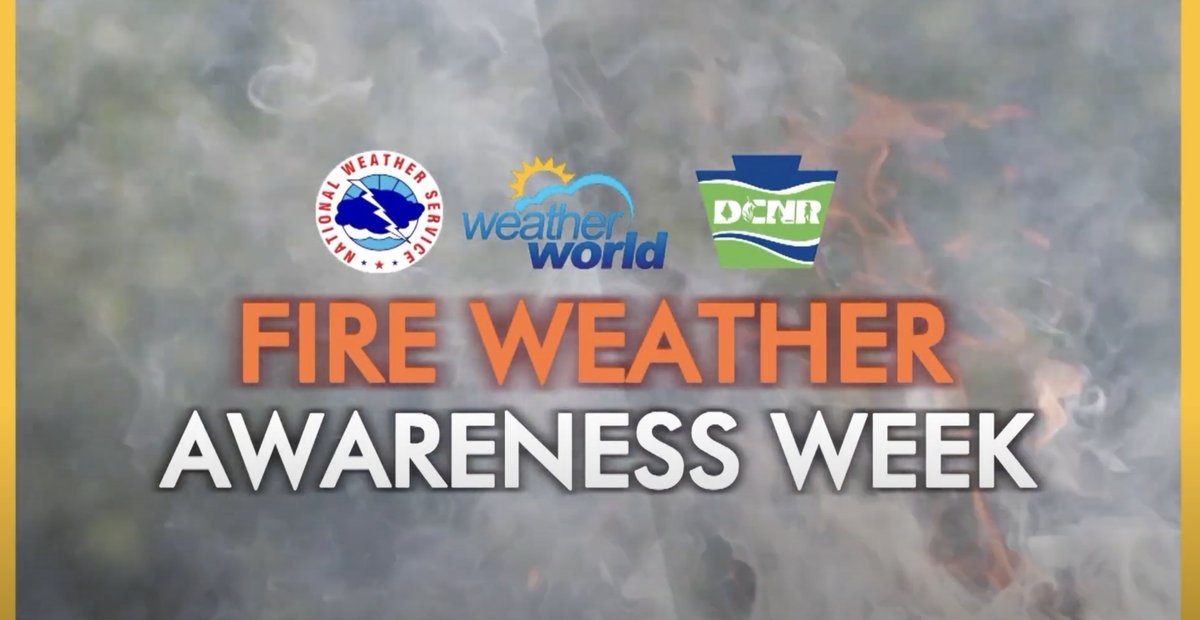
We're honored to have placed in the 2025 Professional Keystone Media Awards! •Enterprise Reporting (2nd) "Halfway to Groundhog Day" •Feature (1st) "Hurricane Ivan - 20 Yrs Later" •Public Service (1st) - "Fire Wx Awareness Week" @MarisaFerger @WxReppert @jmnese @WPSU @pcntv
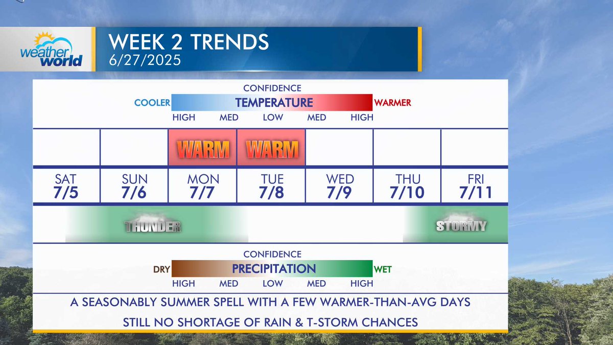
We see minimal anomalies either side of average heading into the first half of July. Still plenty of opportunities for rain.
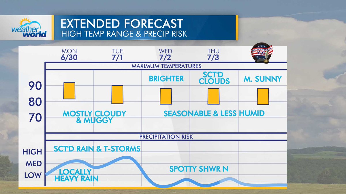
Muggy and unsettled to begin next week before a cold front crosses on Tuesday. Expect a seasonable and comfortable stretch of days heading into Independence Day weekend.
Another 90°+ day yesterday in State College (91°) makes it a 4-day heat wave. This is the first 4+ day heat wave since 2021, and only the 4th in the last 15 summers. You need to go back to July 2011 to find a 5+ day heat wave at the @penn_state COOP site. #pawx #ctpwx
Penn State Professor’s New Book Traces Weather’s Role in the 1863 Gettysburg Campaign. @jmnese @psumeteo @PSUresearch msn.com/en-us/news/us/…
Heat is part of our summer soundtrack. But, extreme heat is the number one weather-related killer in the U.S. With that in mind, the NWS and the CDC have teamed up to create a new tool called #HeatRisk: youtu.be/--8UAw1aA2w

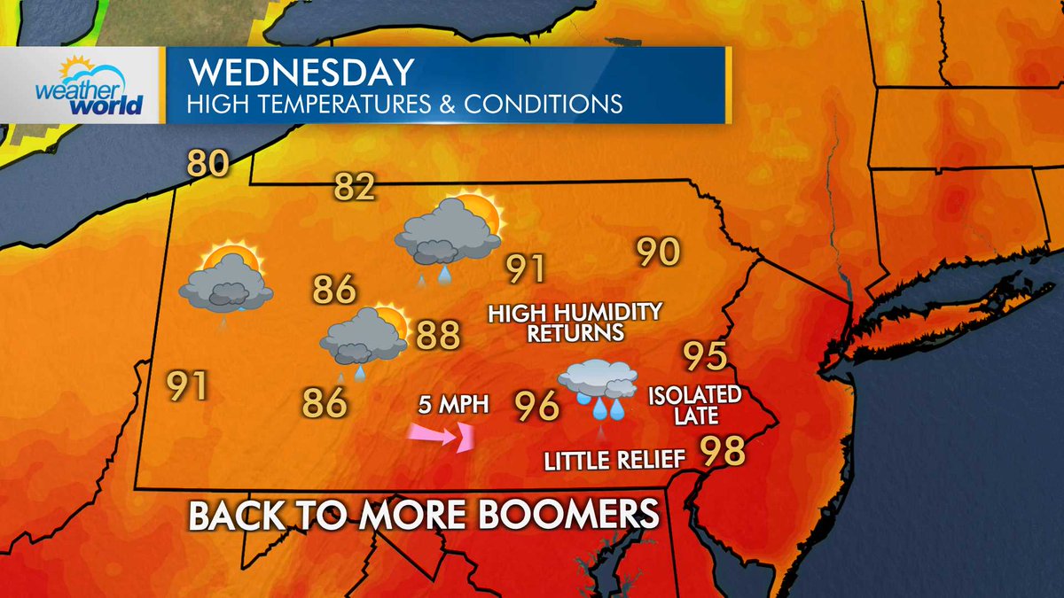
After another day of near-record/record heat across the Northeast, our temps won't climb quite as high on Wednesday (but it will still be hot!). A boundary will stall overhead, bringing more clouds and scattered rain/t-storm, especially during the afternoon and evening.
Many thanks to Karen Walker of the Centre County Gazette for chatting w/ me about the project. statecollege.com/centre-county-…
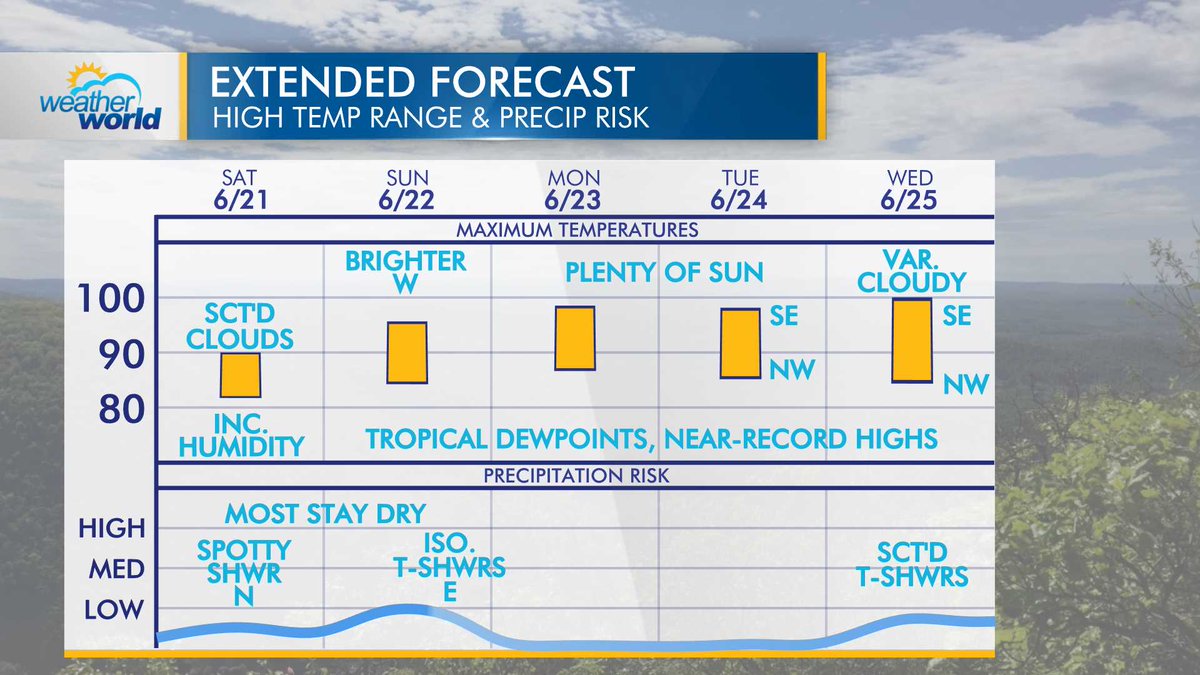
The first heatwave of summer arrives this weekend with feels-like values in the triple digits through early next week. Most will stay dry this weekend and into the first half of next week with a ridge of high pressure over the eastern US.
Recent grad @denyswx discusses severe weather and its impacts in Pennsylvania with Luke LeBel, a graduate student in @psumeteo: youtu.be/J0McbgECuvc @PSUEMS @WPSU @pcntv