WBKO First Alert Weather
@WBKOWeather
Local. First. Now. The First Alert Weather team from @WBKOtv tweets the latest alerts, conditions & forecasts for #SCKY! #wbkowx #kywx #bgky
RADAR UPDATE: Scattered showers and storms are developing from Russellville to BG and Glasgow. Some locally heavy rainfall is likely with storms today
SOKY looks to remain hot over the next week. A heat advisory is in effect for most of the viewing area through Thursday at 7pm.
Meet Your Meteorologists Day is tomorrow, July 24th! We are collecting school supplies for the new school year in partnership with the Boys and Girls Club, as well as programming weather radios and answering your weather questions! 2727 Russellville Road Bowling Green, Kentucky
We've secured another donation to this month's 3DG!
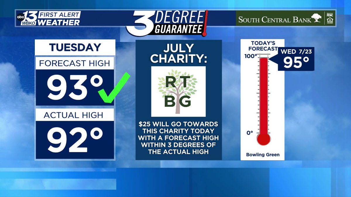
The heat index will likely be between 100 and 105 for most of Wednesday afternoon. #kywx
If you are heading to the coast for an end of summer trip before the kids head back to school, GOOD NEWS, no tropical systems are expected to develop over the week.
2 MONTHS AWAY! It won't be long before those pumpkin spice lattes are calling your name.
A Heat Advisory will go into effect tomorrow afternoon and continue into the early evening. The feel-like temperature could be as high as 105.
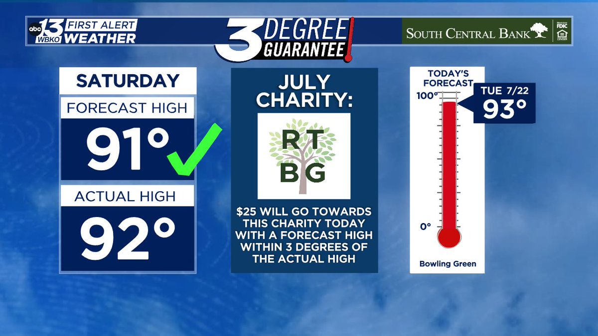
We've secured another donation to this month's 3DG!
Another storm with heavy rain and gusty winds is moving into Bowling Green from the northwest. Here is the shelf cloud moving over the city.
RADAR UPDATE (3:46 PM): Storms with heavy rain continue to advance into Edmonson and Warren counties. Wind gusts up to 40 mph possible.
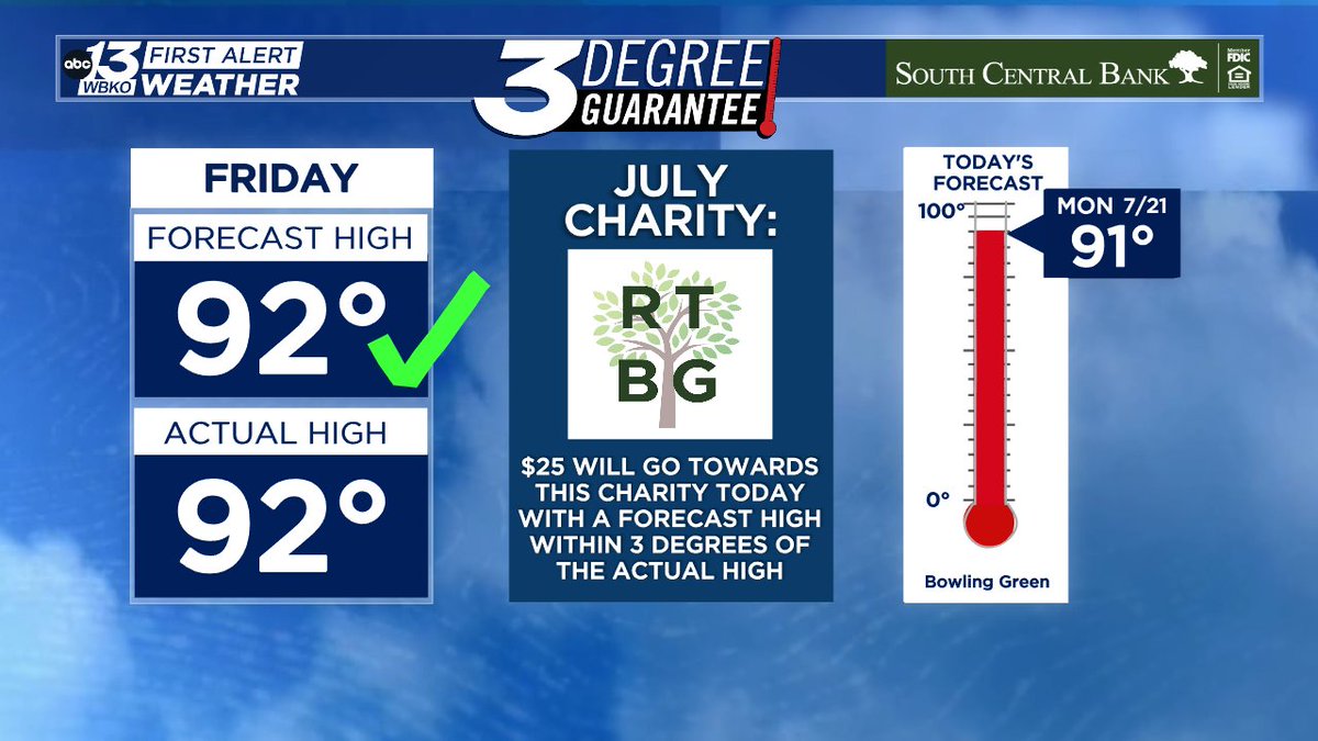
We've secured another donation to this month's 3DG!
Rain showers have managed to avoid much of our area for today but temperatures have stayed hot. The heat stays with us tomorrow with heat indices pushing to near 105 degrees, as well as scattered storm chances.
Steamy conditions as heat indices reach into the lower triple digits. Please make sure you, as well as your four legged friends, are staying properly hydrated and taking frequent cool breaks!
Rain is beginning to end across the region. High temperatures and humidity return for Sunday as a heat advisory is in effect for most of the area. Heat indices will be near 105 degrees.
Heavy rain, lightning and winds up to 40 mph are moving through Warren and Logan counties. These storms are not severe but you may want to head inside for a bit while these pass on through Barren, Simpson, and Allen counties.
Severe Thunderstorm Warning for Hopkins, Muhlenberg, Christian, McLean Co. until Jul 19 4:30PM. Check WBKO.com, WBKO-TV, and WBKO social media for more details. @WBKOWeather @wbkotv #wbkowx #kywx
FIRST ALERT: Heavy showers and storms are moving in from the north. While they have stayed below severe limits so far, higher wind gusts up to 50 mph and flash flooding are possible. Areas of 2 or more inches of rain have been reported with this line.
FIRST ALERT: Heavy rainfall is set to move in shortly to our communities further to the north. This line is has winds up to 40mph and torrential downpours. Flash flooding could become a threat over the next few hours.
Flash Flood Warning for Warren, Logan, Simpson Co. until Jul 18 9:30PM. Flooding is occurring or is imminent! Check WBKO.com and WBKO-TV for more details. @WBKOWeather @DavidWolter1 @wbkotv #wbkowx #kywx