Taylor Trogdon
@TTrogdon
Deputy Associate Director/Forecast Operations Specialist/CIRA/@noaagsl, @Mizzou/@gocreighton grad. Working in the space between research and operations.
This is possibly my favorite time-lapse that I've ever taken. Watching the colors explode then transition thru the spectrum is spectacular.
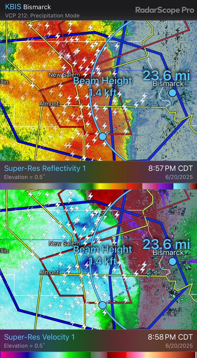
105-110 mph just above 1000’ radar beam height heading to Bismarck, ND. Textbook northern plains summer bow echo developing. This should have longevity through the evening and is a high-end wind threat as it moves east.
Tornado of the year so far, in my opinion. Slow storm motion lends to a meandering, unobstructed tornado.
The best 360 @insta360 reframe Timelapse known to man. Captures the full lifecycle of the Wallace/Wallfleet Nebraska tornado. 77 minutes of mind blowing footage condensed down to 1 minute. Streamed LIVE on the @RadarOmega app.
Multiple tornadoes developing east of DIA along convergence/moisture boundary. Colorado supercells rarely disappoint.
I hate to admit that he is right about one thing. They do, in fact, not want to talk to you.
Stopped to check out the National Weather Service Nexrad (next generation radar) station.
A beautiful loop illustrating forward-propagation versus supercells moving right against the mean wind and ultimately the difference in net motion.
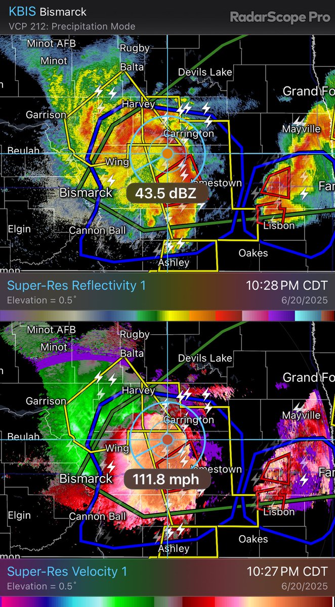
Given the storm environment, this is an almost guaranteed derecho across the northern plains. Eventual absorption of the pair of supercells ahead of the line will occur over the next hour with an exceptional damaging wind threat continuing with episodic tornadoes through the…
I’m glad you’re getting a chance to (partially) rest. It was a pleasure being your neighbor at MEG during the earlier years — take care.
A Letter From David Drobny, Founder of NashSevereWx. nashvillesevereweather.com/2025/06/06/a-l…
One of the better examples of “if you hear thunder, you’re close enough to be struck.” This bolt from the blue is over 40 miles from the nearest storm.
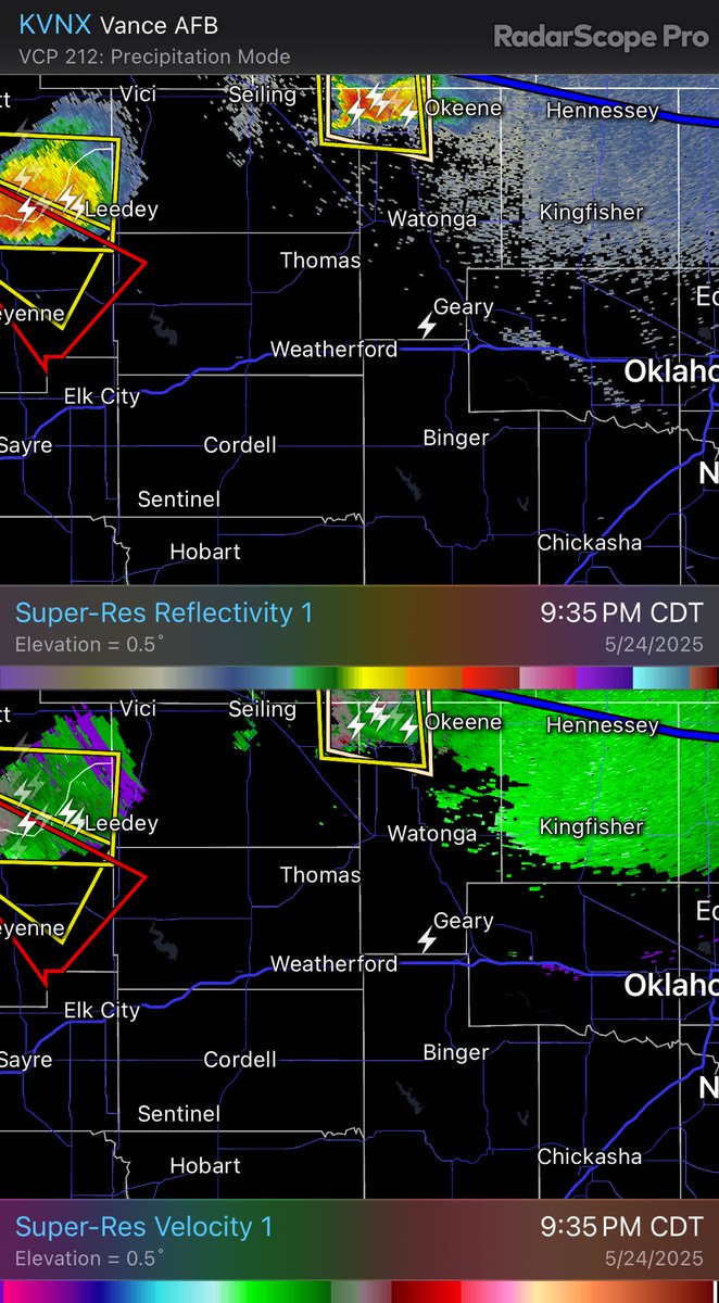
The original left-split from the dominant right mover in NW OK has persisted and is now encountering much higher 0-1km SRH, anchoring on the deep moisture gradient and beginning to turn right. This is an uncommon evolution and it remains to be seen if this will produce a tornado,…
This could very well turn into a classic plains significant tornado outbreak today with the environment in place. Would not at all be surprised to see multiple strong to violent and long-track tornadoes this afternoon.
It’s safe to say that environmental parameters are maximized with this mature supercell south of Norman, OK. A strong to violent tornado is likely.
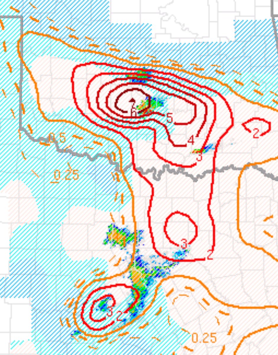
This storm was right on the moisture gradient and RFD contribution led to tornadogenesis over downtown St. Louis with a debris ball evident on radar.