Taylor Kanost
@TKanost
@WACHFOX Chief Meteorologist GJT➡️RNK➡️DSM➡️HSV➡️CAE
Uranus is warmer than we thought. New computer modeling techniques revealed that Uranus generates internal heat. This is similar to our solar system’s other gas giants, like Jupiter or Neptune. go.nasa.gov/44HzIKx
Uranus is warmer than we thought. New computer modeling techniques revealed that Uranus generates internal heat. This is similar to our solar system’s other gas giants, like Jupiter or Neptune. go.nasa.gov/44HzIKx
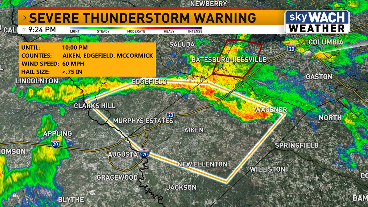
A Severe Thunderstorm Warning is in effect until 10:00 pm for Aiken, Edgefield and McCormick Counties. #scwx
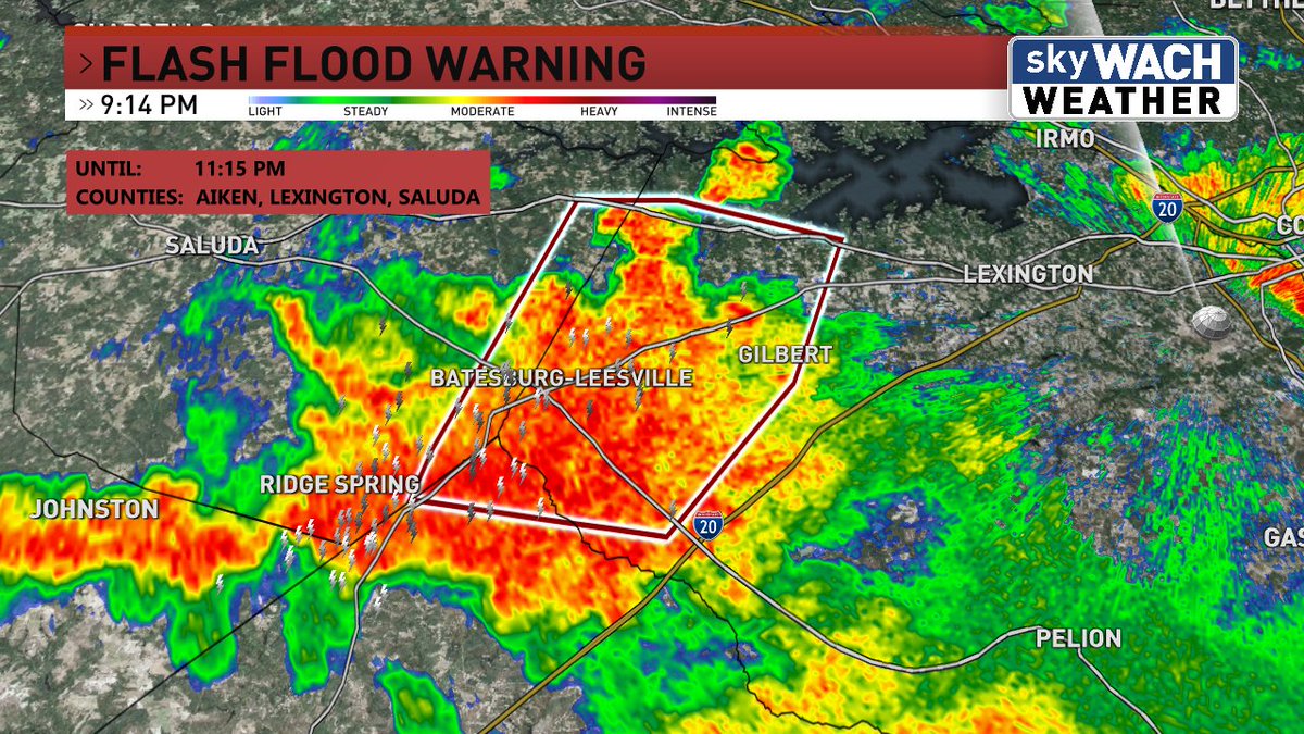
A Flash Flood Warning is in effect for Aiken, Lexington and Saluda Counties until 11:15 pm. #scwx
A few big rainmakers moving through Richland and Lexington Counties right now. Watch out for ponding on roads. #scwx
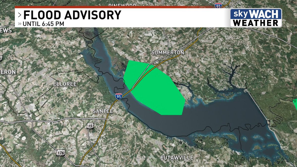
A Flood Advisory is in effect until 6:45 pm for Clarendon County. #scwx
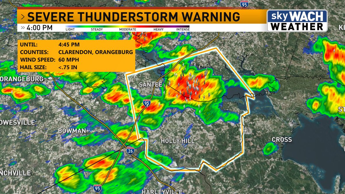
A Severe Thunderstorm Warning is in effect until 4:45 pm for Clarendon and Orangeburg Counties. #scwx
How about this?! The peak heat index at Congaree National Park yesterday afternoon was 116. #scwx

The worst of the humidity in the Midwest is more oppressive than anywhere else in the U.S. BUT the South's humid season feels like it's never going to end. As someone that's lived in both places, I have to make a ruling here.... Summers in the South are worse. @GregSankey
Let’s confuse Non Midwesterners: Corn Sweat
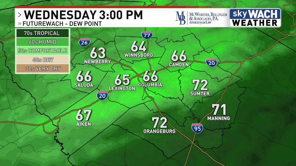
We are likely going to get a BRIEF break from the typical July humidity on Wednesday. Dew points in the 60s this time of year = manna from heaven. #scwx
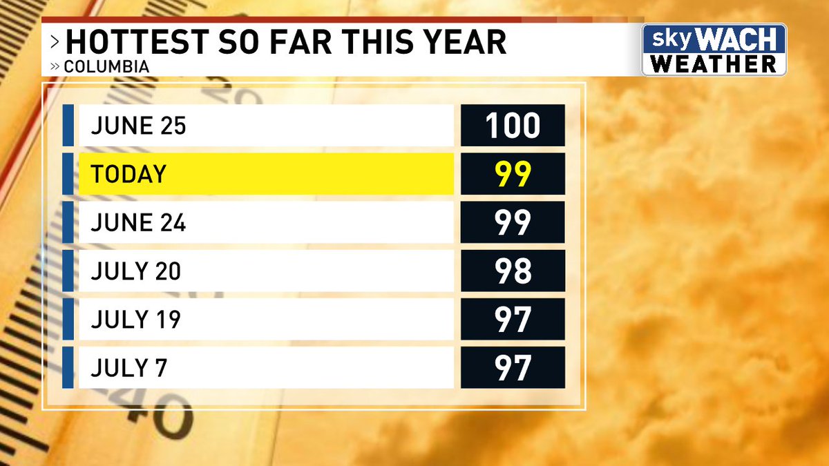
The past three high temperatures in Columbia: 97, 98, and 99. Ouch!

Not too much to worry about in the tropics for the home stretch of July. wach.com/weather/hurric…

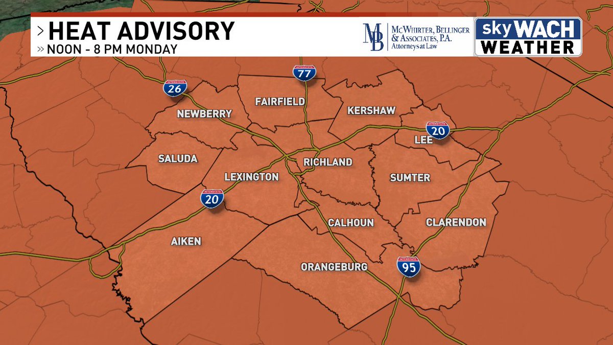
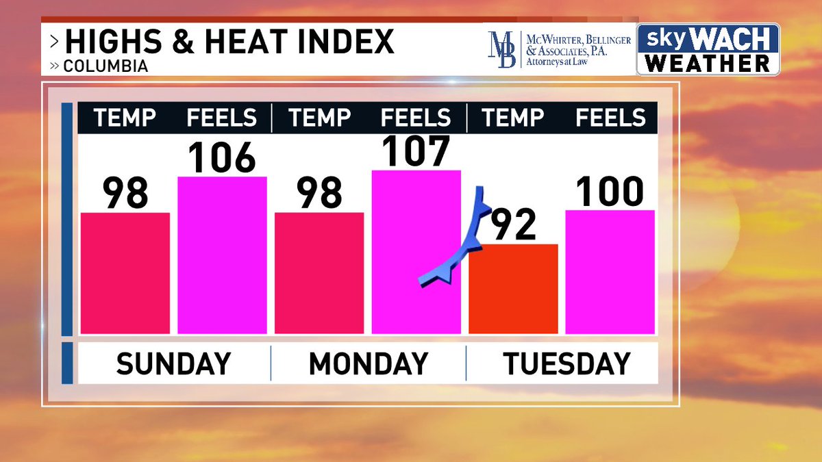
A Heat Advisory will be in effect from noon to 8 pm on Monday. Heat index values could climb as high as 110.
A couple more scorchers ahead of us before a cold front brings temperatures back to a less awful spot on Tuesday.
My four year old today
For some reason I woke up pissed off more than ever!!


⛈ SEVERE THUNDERSTORM WARNING ⛈ 📍 Fairfield, Kershaw, Richland & Sumter Counties ⚠️ Until 7:15 PM 💨 Wind gusts up to 60 MPH 🌩 Hail up to 1 inch in diameter Take cover indoors now! Stay away from windows and avoid travel if possible. #SCWX