rokas ratkus
@RRatkus
Cartographer producing intricately detailed history maps in the modern age of simplicity. Mapmaker of major Europa Universalis IV game mods as well.
shopify decided to terminate my website after launching today because of suspicious activity... i guess etsy... etsy.com/shop/kartenverk

apparently my map was too big for reddit so it ended up being an embed fail, reposted a 20 mb one here: reddit.com/r/eu4/comments… you can use the deviantart link at the bottom of my website to get above-20mb download by the way
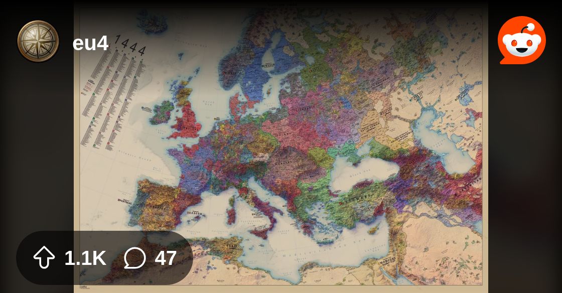
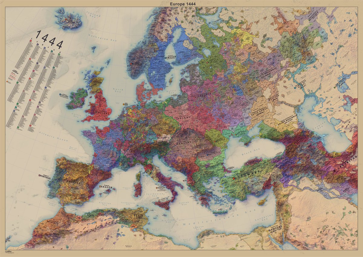
i've finally released my map reddit.com/r/eu4/comments… kartenverk.com
it seems like i have to delay the release of the map for a week once more as i still don't have the pallets of tubes if i had released it last week, people would've been waiting 3 weeks for maps to be delivered, next friday it'll be instant shipment with up to 7d delivery
seems like i unfortunately have to delay the release of the map until Friday, apparently when you order a few pallets instead of a few boxes from your suppliers they take longer here's at least something
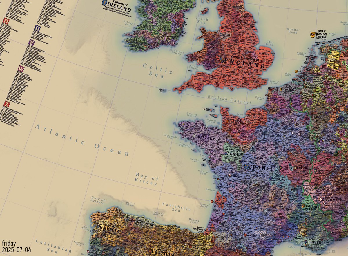
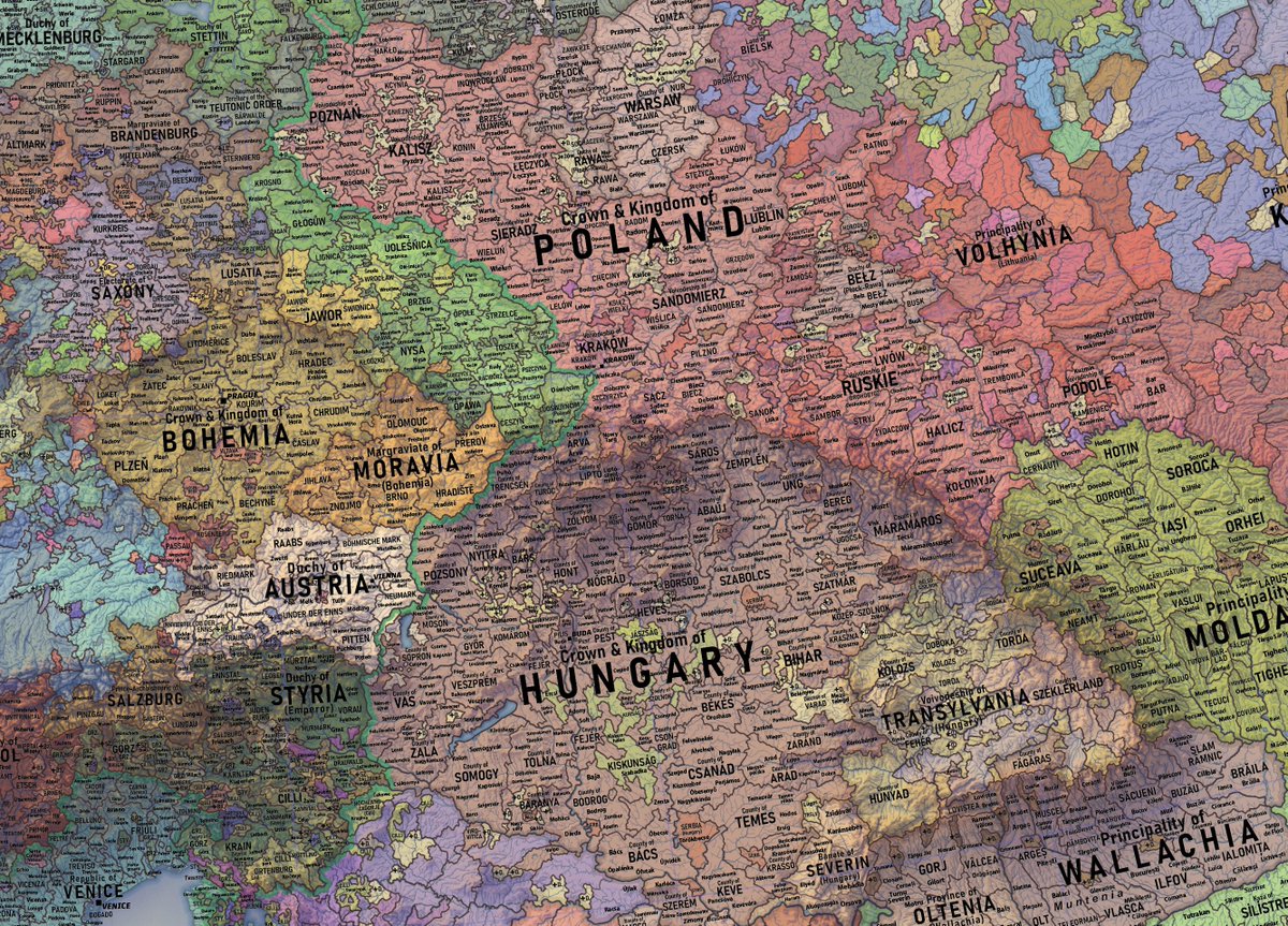
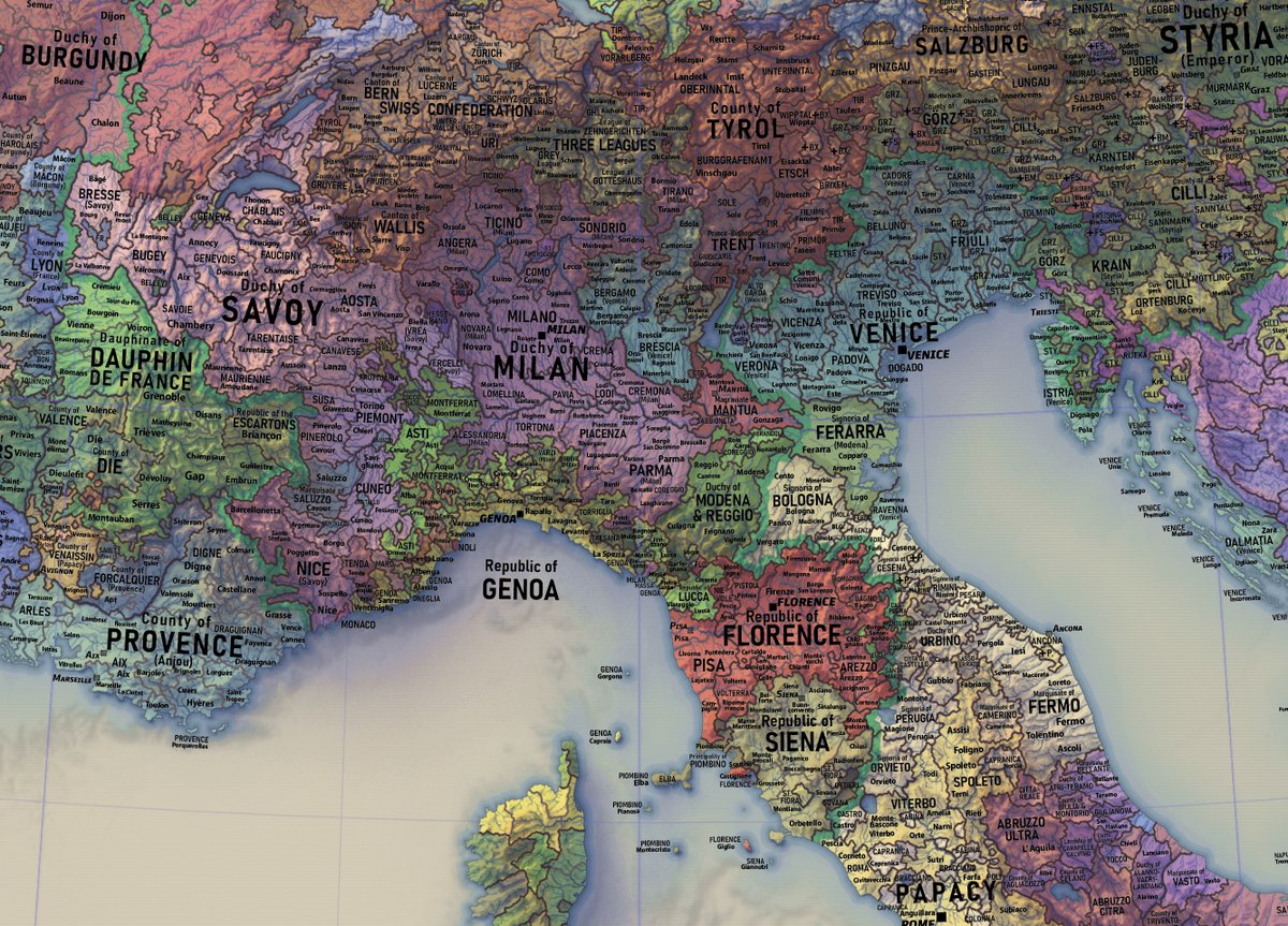
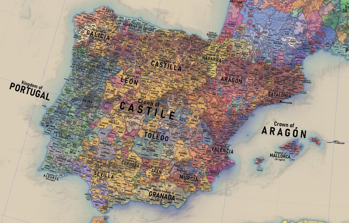
the new 1444 map will have a plethora of coats of arms across europe. will take some time to add
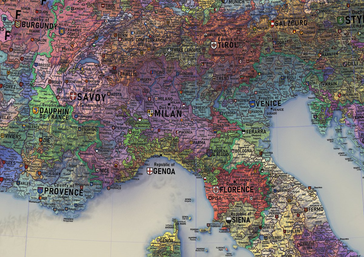
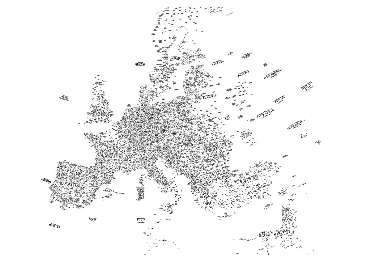
haven't posted progress of the 1444 map labelling in a while, so here it is forming a more continuous continent now
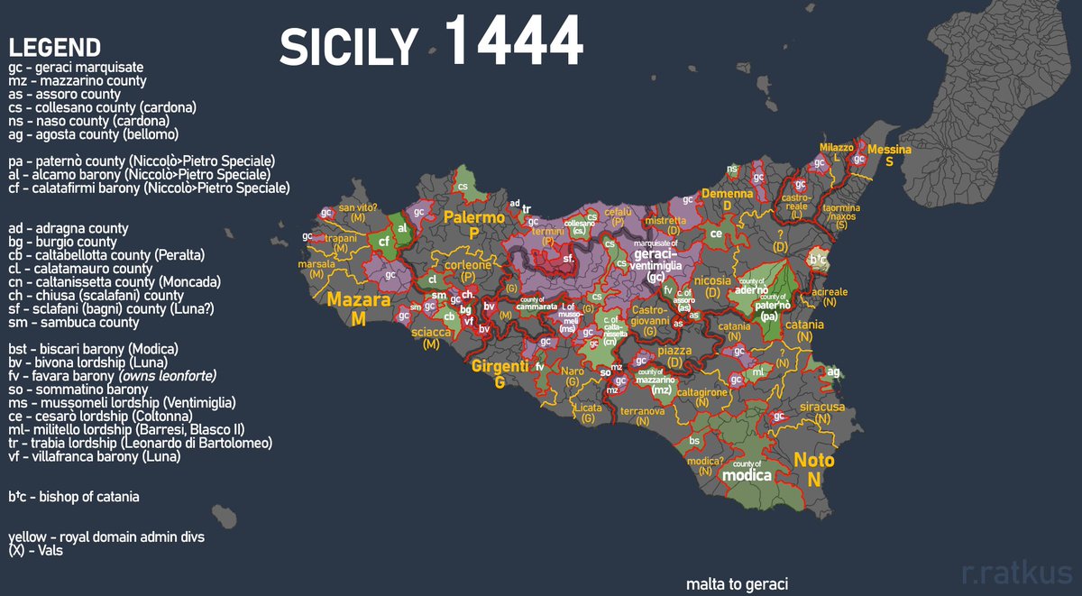
a small research map - sicily in 1444, just to figure the counties and whatnot that were there
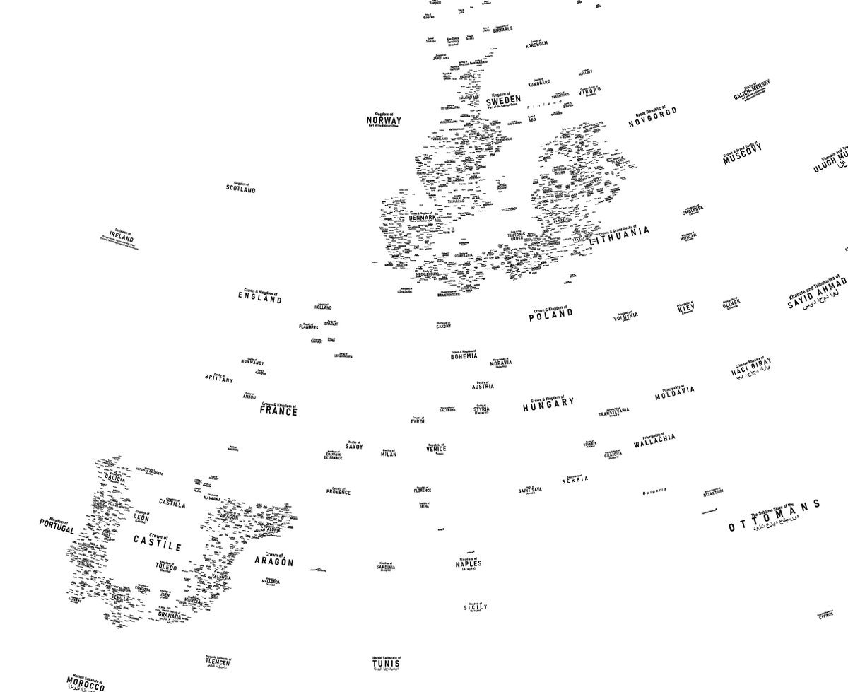
The labels for the new 1444 europe map are forming a map by themselves, better overview of the labelling progress so far
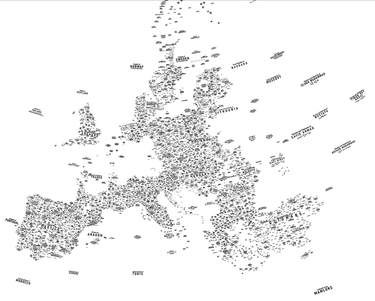
more of labelling progress of the europe 1444 map, haven't posted in a while
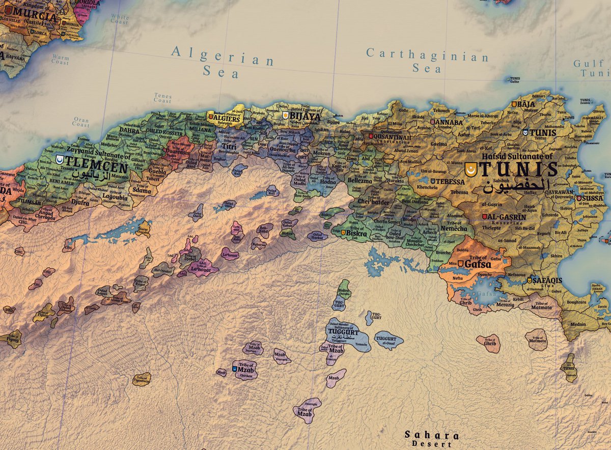
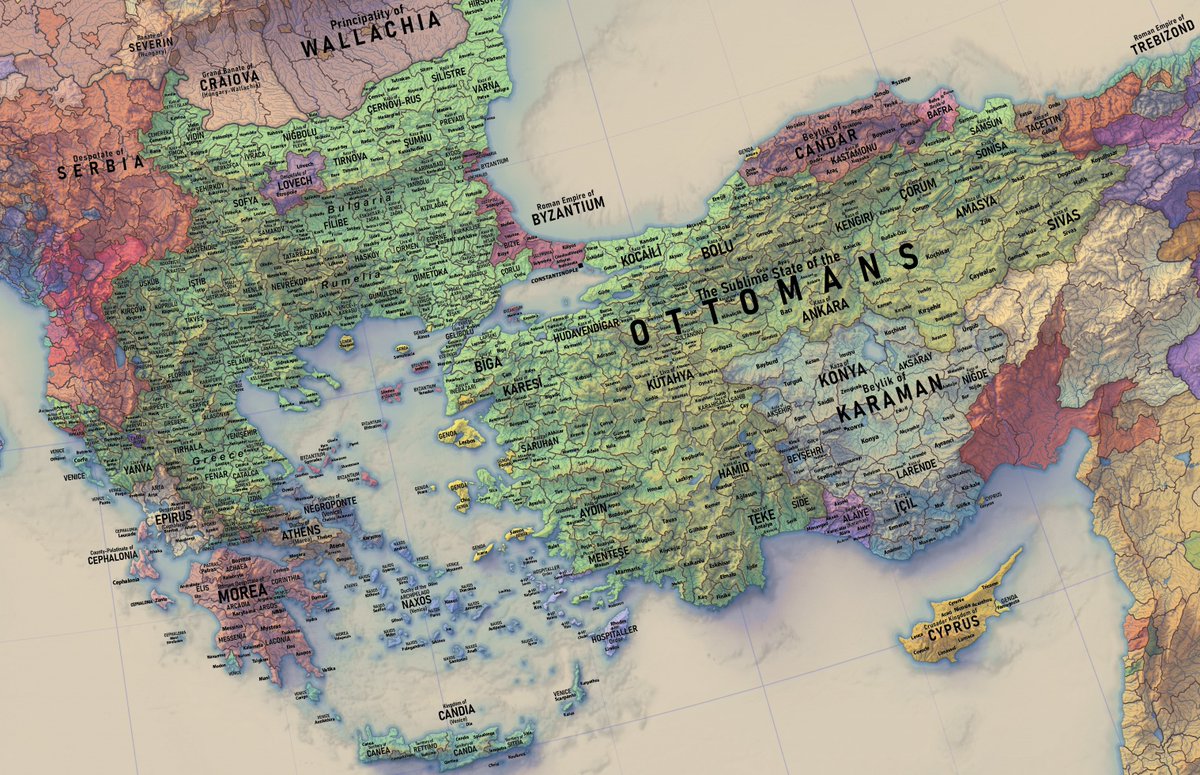
labelling progress on the new 1444 europe map - iberia and ottoman lands
i'll try to get the text bit of my 1444 europe map done over this month, can't walk for five weeks after being hit by a car but at least now i have a lot of free time to get the labels done for this map, the continent will slowly take shape in labels
doing the text bit of the new 1444 Europe map - i decided to go with a more 19th century style in which the map is covered with a wall of placenames. artsy shields to be added later. classic styling as well.
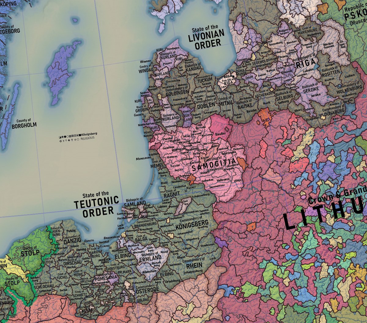
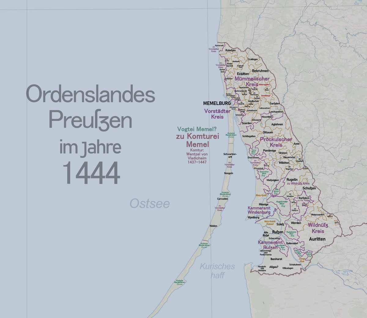
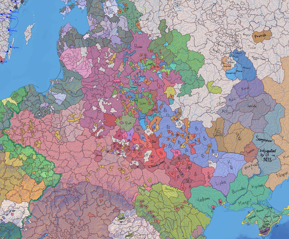
have been working on a little bit of a research side project - Teutonic order/Prussia in 1444, starting from the northernmost bit, Memel, which happens to be the area I am from it's fun making maps of things that haven't been properly mapped yet, basically teutonic municipalities
slowly but surely the new 1444 map is starting to shape up in colours
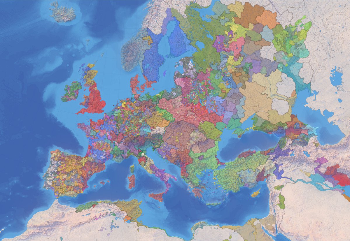

ahh the more fun part of mapmaking - coloring them up after drawing all of these lines (1444 europe)
1444 Europe has to be the worst border gore Europe has ever seen