Vintage Maps
@vintagemapstore
Exploring the world through the lens of cartography and design. 🗺️ Vintage maps, propaganda posters, modern infographics, and heraldry.
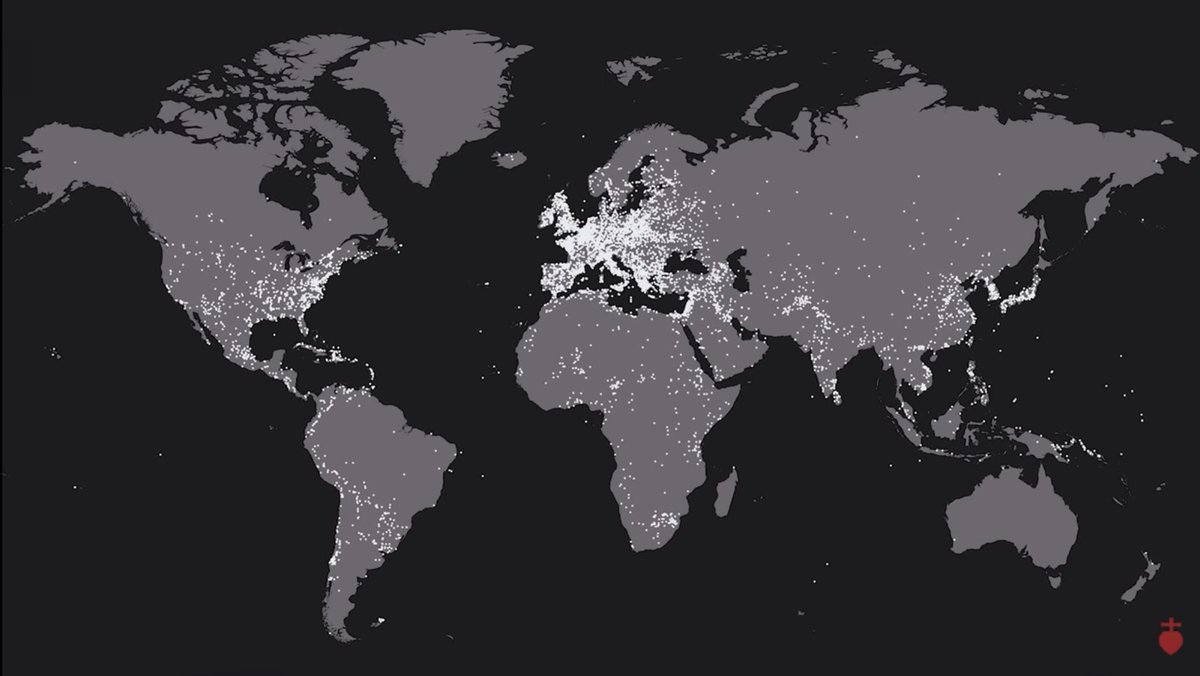
Map of every battle since 2500 BC according to Wikipedia (10,624 battles)

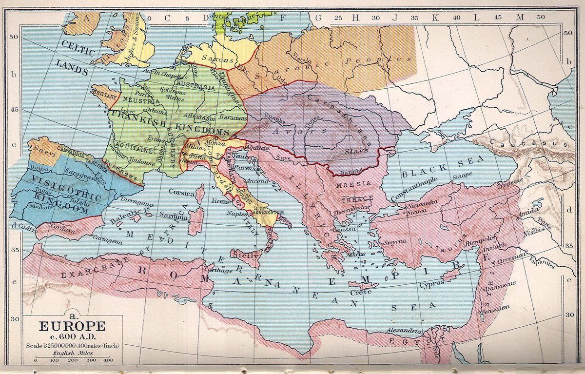
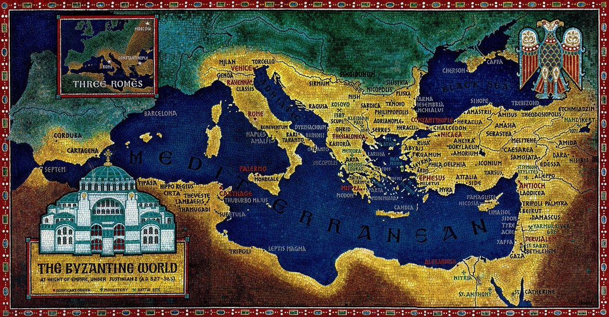
Europe and Byzantine Empire after Justinian's Reign, 600 AD
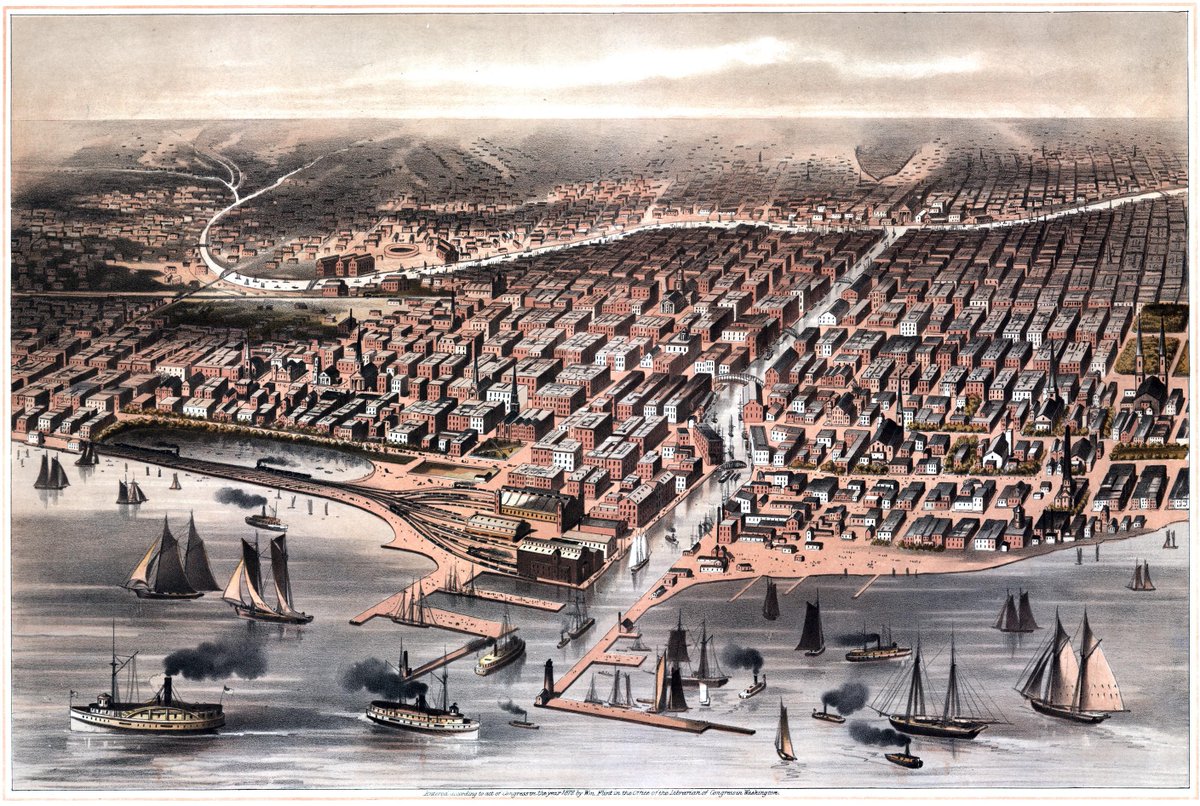
The island of Manhattan in 1879, birds-eye-view vintage map
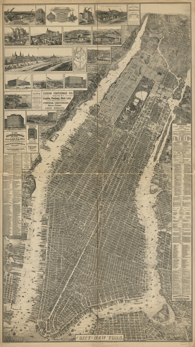

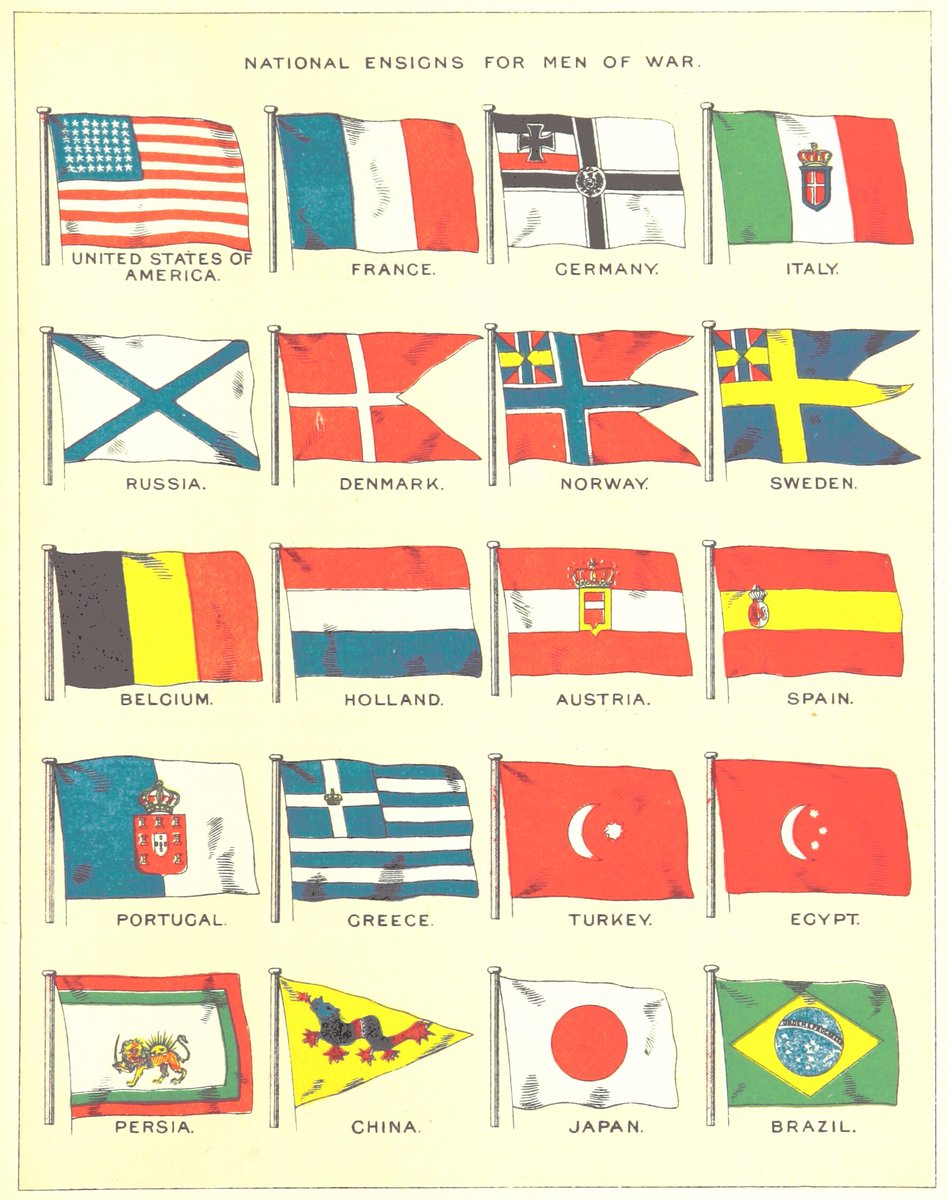
Illustration depicting the national ensigns for naval warships from various countries, published in "Orient Line Guide" (Fifth edition), authored by William John Loftie, London, 1894. Collection: British Library.


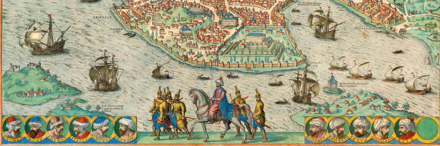
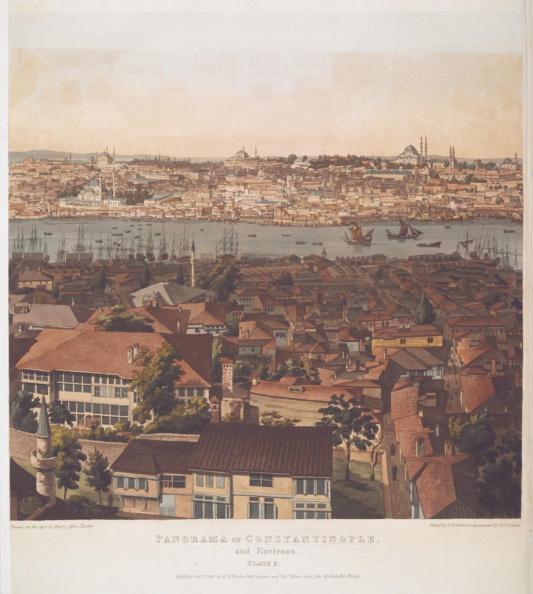
View of Constantinople (modern-day Istanbul), painted in the early 1800s by Henry Aston Baker
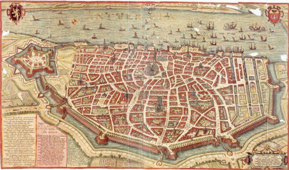
The fortification of Antwerp, Belgium. It was build in the 16th century by order of the Holy Roman Emperor Charles V to protect this major city with its important port during the Dutch Revolt. Most of the constructions were demolished around 1860 due to the expansion of Antwerp.
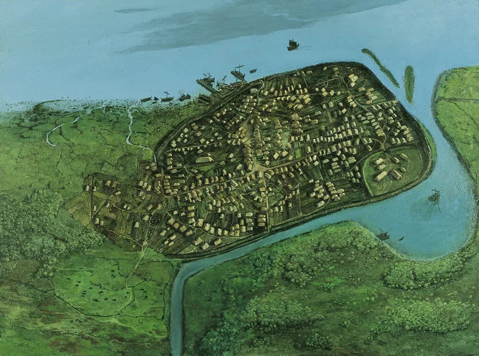
Viking-Age Dublin in AD 1000, Ireland. Illustration: via Early Ireland.
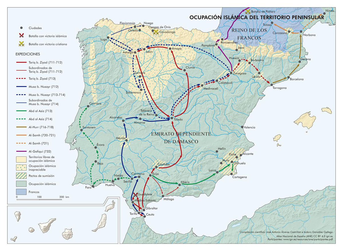
Muslim occupation of the Iberian Peninsula early in the 8th century


The Byzantine World - At the height of empire, under Justinian. (527-565 AD).
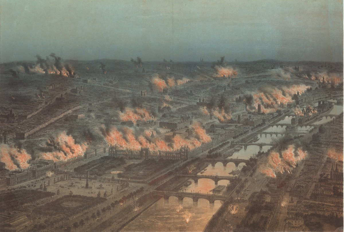
Paris Burning during the "Bloody Week" at the end of the Paris Commune era (May 1871)
Chicago, Illinois, USA, as it was right before the great fire - c. 1871