PC Weather Boy
@PC_WeatherBoy
Weather enthusiast and hobbyist who loves tracking and following the weather! Tropics, local and National weather.
Satellite loop this morning over the Gulf showing the Gulf low we have been tracking now moving towards Tx. NHC still giving it a 10% chance for development but will remain a rain maker for the area before it spin back around for another chance.
NHC still keeping development chances for this area in the Gulf at 10%. Not seeing much of anything happening here to be honest.

Latest 12Z EURO ensembles are out. All eyes fixed on the Caribbean with in the next 10 days. Development is very likely…concern for the US…we shall sea…

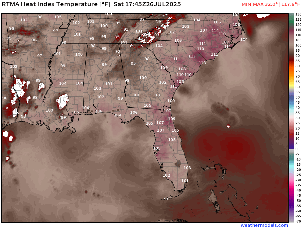
This heat is just craziness!!! Current heat indexes across the South East this afternoon. The Carolinas are burning up!

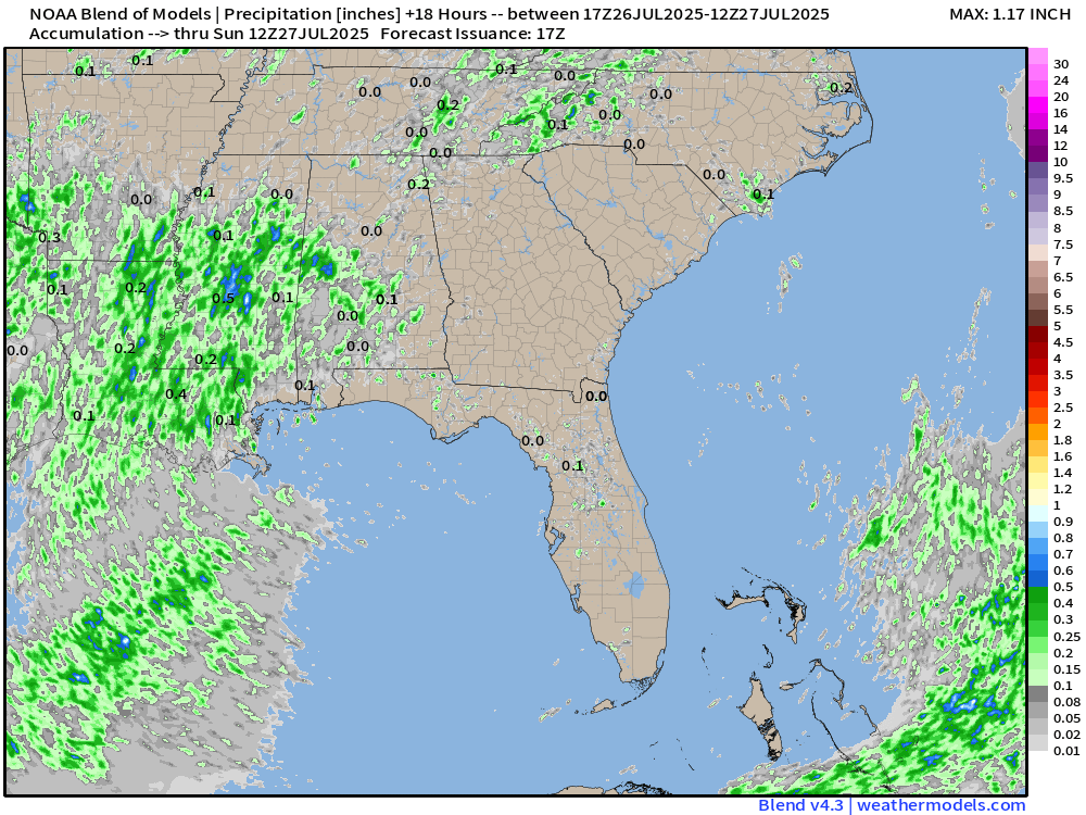
Potential rain coverage for your Saturday. Dry for many...but really hot!!!

Good Saturday morning! Another clean and clear NHC Map. Lets see how long this lasts.

Current model runs of the EURO/EUROAI/GFS all dated August 4th at 8am, 10 days out from today...7/25/25. The EURO models develop this potential wave and bring it either into or near the vicinity of the Bahamas while the GFS does nothing with the wave at this time frame. I will…


Current look at radar this evening across West Central FL. All action looks to be moving to the West with rains coming down at a good clip across the Tamps Bay area.
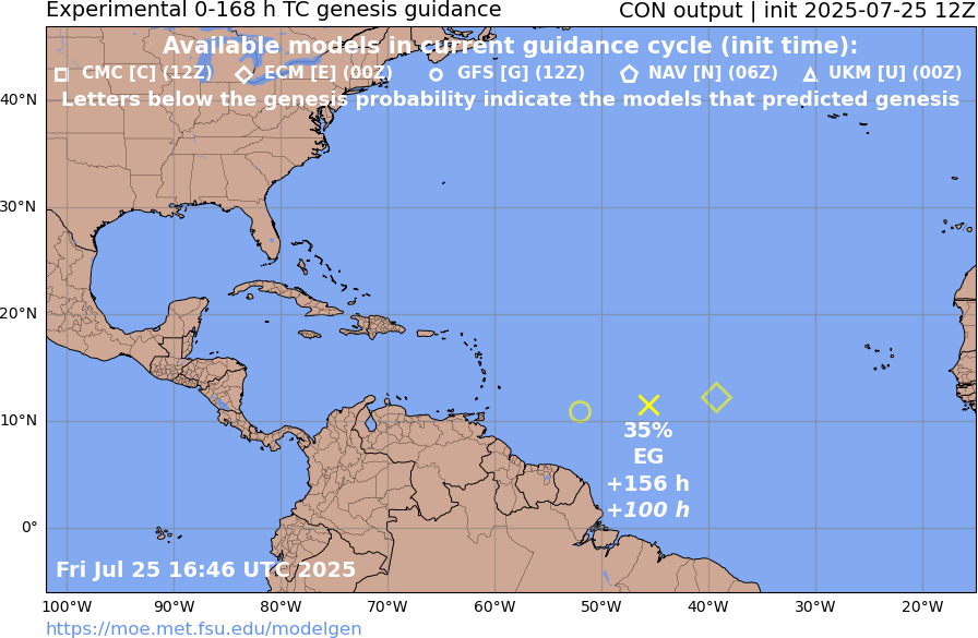
The next wave set to come off the African coast is expected to be one to monitor, given the early signals we are getting across the models. The latest EURO ensembles give this wave a 70-80% chance of TD development by the end of next week.

Models are starting to come into agreement that potentially into next week, we will likely see tropical development in this region of the MDR.

If you have to do any yard or outside work on Monday of this coming week...take proper heat precautions. Heat indexes are going to be off the charts!

Future loop from the HRRR not showing much today by way of rains for the Peninsula. Some afternoon storms looking to get going between Brooksville and Ocala area with the majority of the rains focused around the FL PH.
More Saharan dust expected to impact FL today and thru the weekend moving out by Sunday.
Potential rain fall accumulation totals expected this weekend across the SEAST. Gonna fairly dry for many with lots of heat.

Get ready for the heat this weekend! Heat indexes likely to reach triple digits on Sunday from FL all the way up to North Dakota.

All these weenies posting 300+ hour deterministic model runs of hurricanes hitting the US coast are probably going to scare the real storms away.
Latest EURO AI ensembles this morning with in 10-12 days showing the same signal as the EURO and GFS of a wave moving into the Lesser Antilles and potentially cutting a tad to the North. Nothing to worry about at all right now with this system. Likely a fish storm.

According to the latest EURO and GFS ensemble forecasts, a tropical system is likely to develop and approach the Lesser Antilles by August 1st or 2nd. While there is consensus on the system's initial trajectory, the models diverge on its subsequent path. I will provide updates as…

