NY State Weather Risk Communication Center
@NYSWRCC
The State Weather Risk Communication Center at @UAlbany is a partnership with the New York State Division of Homeland Security and Emergency Services.
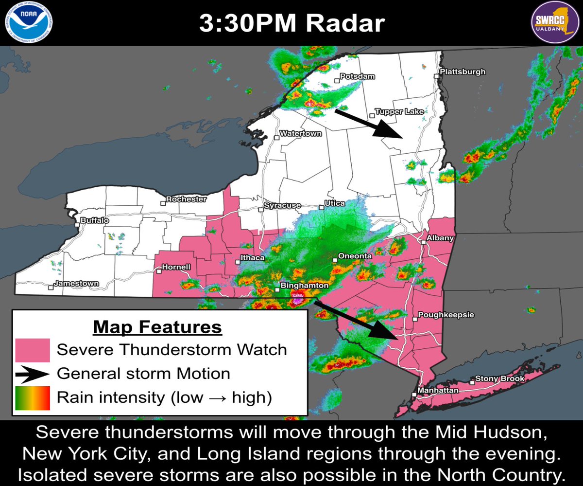
Thunderstorms are developing over central eastern parts of the state. These storms will strengthen & become more widespread as they approach the Mid-Hudson, NYC & LI regions. Some storms may become strong-to-severe with isolated-to-scattered damaging winds through about 8PM.
If you're in New York City and you're stepping out for work, to go vote, or just for a stroll ... it's possible you haven't experienced a below 90F feels-like temperature in over 24 hours. Today won't be any different. Find a cooling center near you here: finder.nyc.gov/coolingcenters/
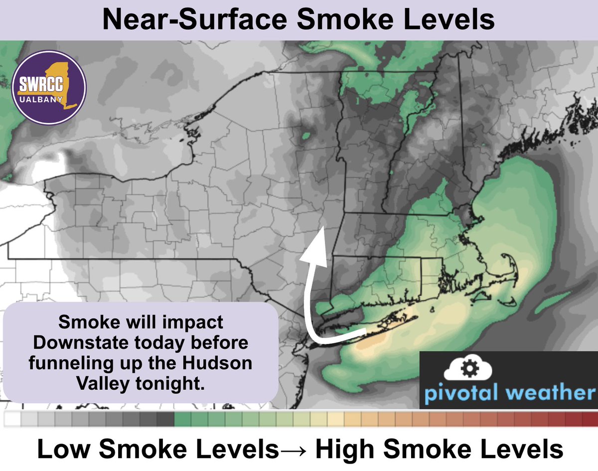
Air quality alerts have been issued for all of eastern NY today as wildfire smoke moves south to north now through tomorrow morning. Sensitive individuals should consider limiting outdoor physical activity.
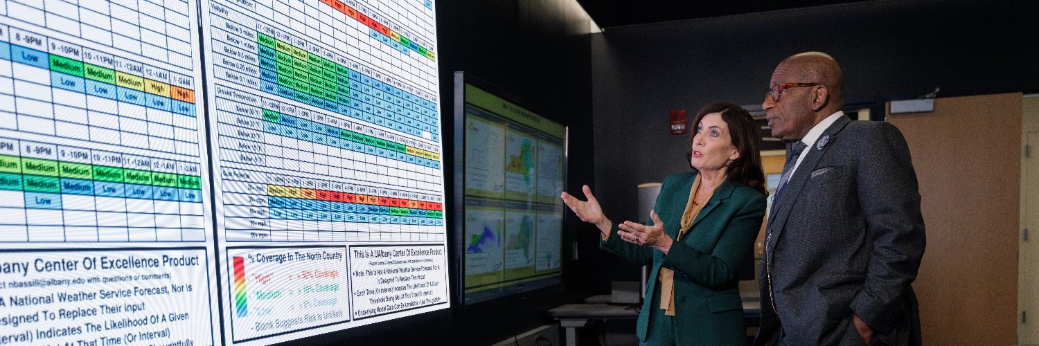
This morning our team hosted @GovKathyHochul and @DHSESCommish at our Center to discuss ways we can keep NYers safe during extreme weather. Planning for a Texas-sized flood was a top concern. Afterward, Director Nick Bassill spoke alongside Governor Hochul & Commissioner Bray.
Extreme weather is no longer rare: it’s our new normal. No matter what happens in Washington, we are prepared to keep New Yorkers safe. Join me live: governor.ny.gov
Thunderstorms with a history of damaging winds and large hail are entering the Mid-Hudson region, and will likely impact the evening commute. The severe risk will persist across the Mid-Hudson and Downstate through about 8-9 PM.
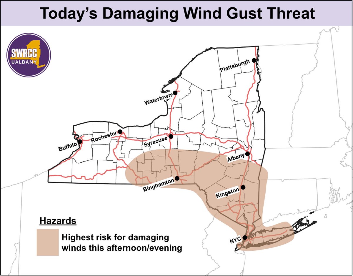
New York: Isolated-to-scattered damaging wind gusts are possible this afternoon and evening. The greatest risk is across the tan shaded area below.
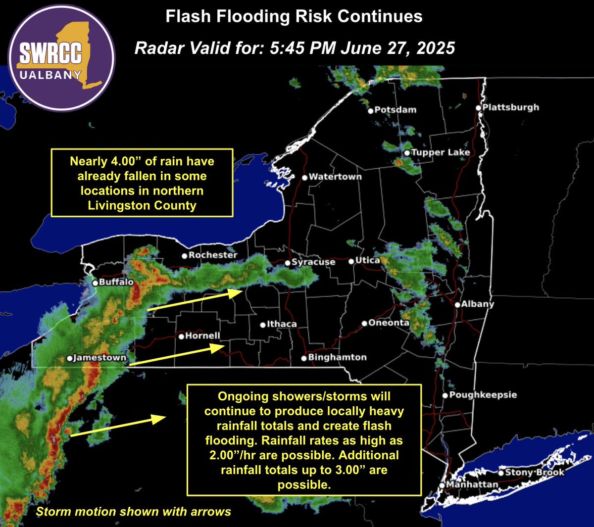
Nearly 4.00" of rain has already fallen in northern Livingston County since 2PM. More showers & storms will continue to create a flash flooding risk through this evening. Stay weather-aware & sign up for real-time alerts in your area by texting your county or borough to 333111.
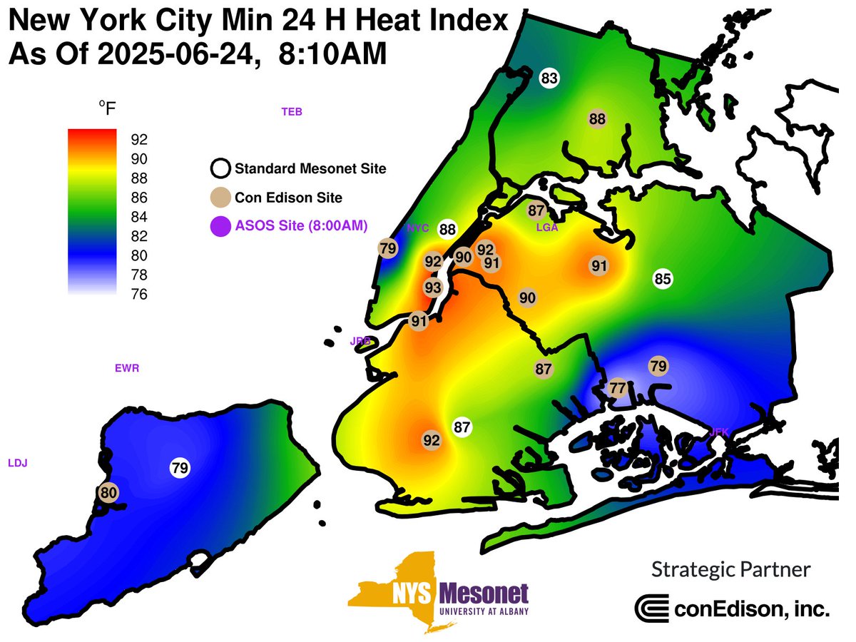
Over the last 3 days, there have been over 300 heat-related emergency department visits in #NYC, and 141 just yesterday (the most since at least 2016). Why? Extreme, prolonged heat with no respite. Here's a map of consecutive hours of 85F+ feels-like temperatures. Almost 4 days!

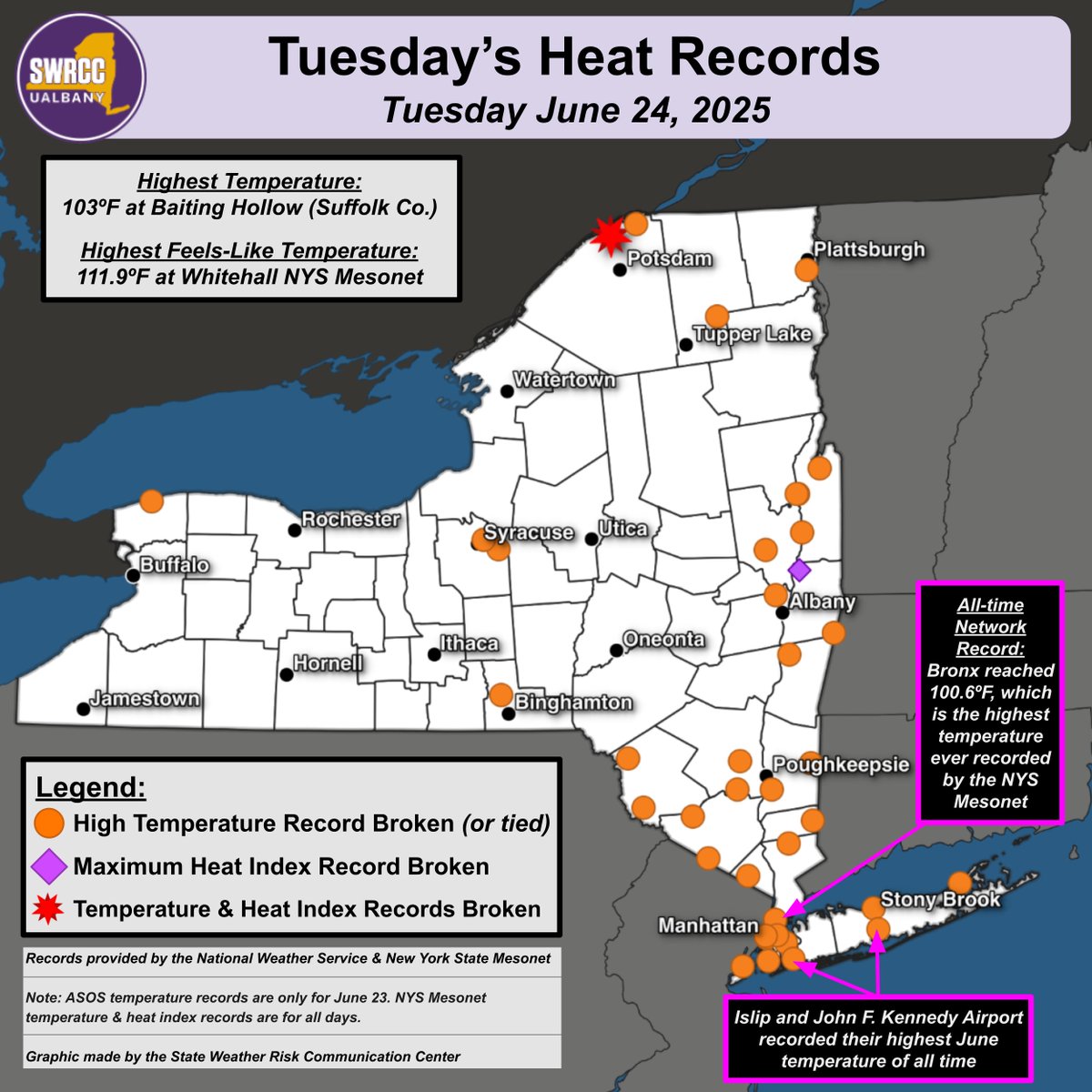
Yesterday was once again a record-breaking day across NY. Here are some of the "hot"-lights: -Several long-running weather stations recorded their warmest ever June temperature, such as at JFK airport. -The @nysmesonet network recorded their first ever 100F temperatures.
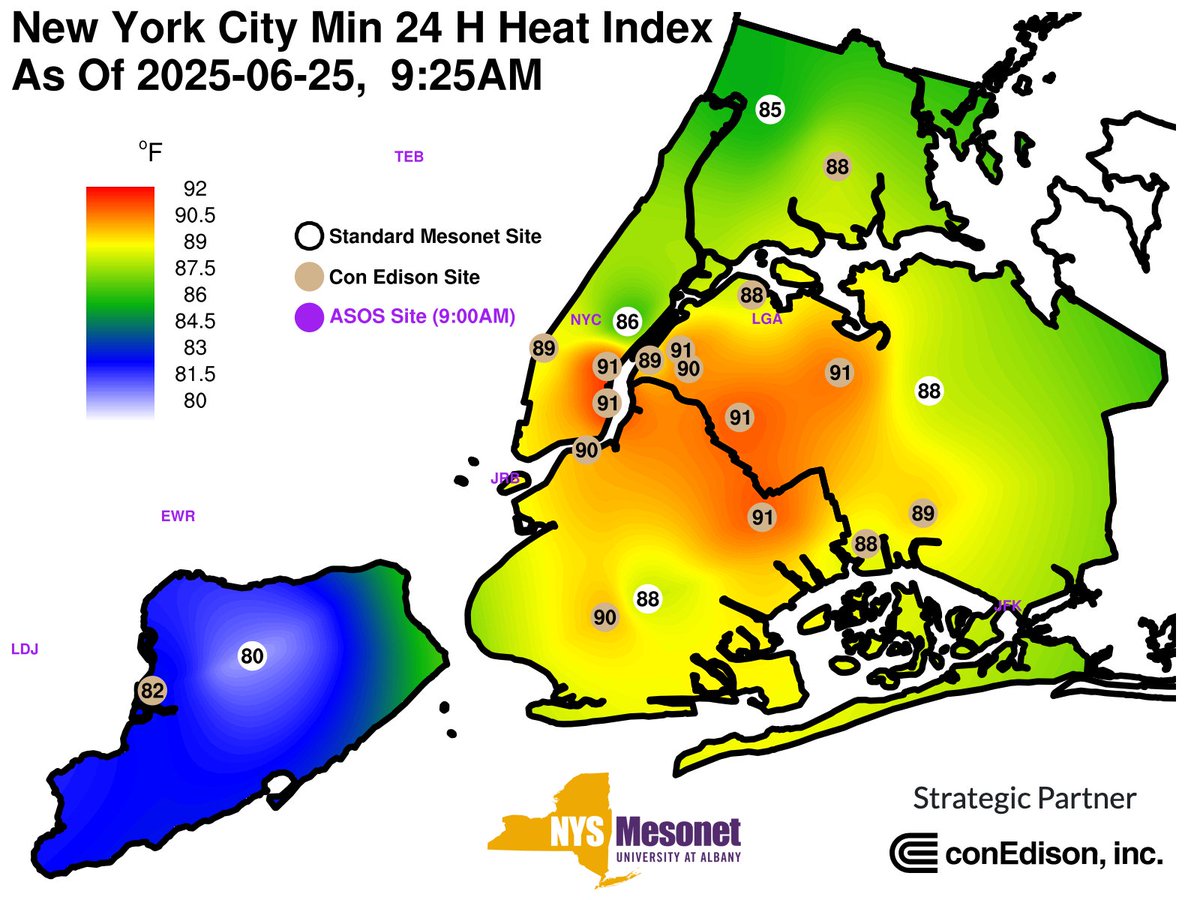
While parts of upstate NY will start seeing relief from the heat, #NYC and much of downstate NY will be hot once more. Overnight, parts of NYC never dipped below a 90F degree "feels-like" temperature. This was true for the the previous night too, which may compound heat impacts.
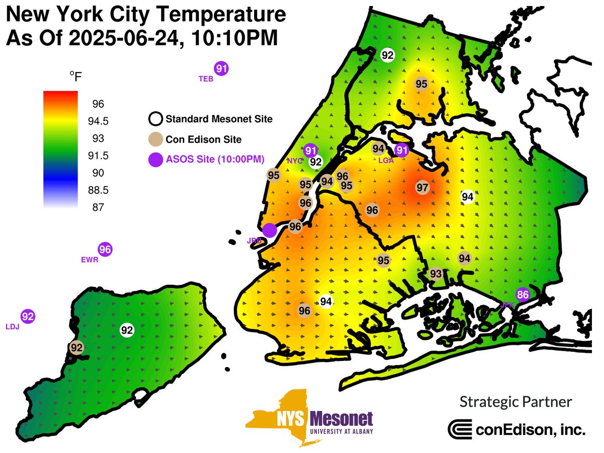
It's 10PM and the temperatures across much of #NYC are *still* in the mid-90s. Thankfully, the humidity has abated somewhat, which should make many cooling units slightly more effective. However, for those without air conditioning, it's likely to be another oppressive evening.
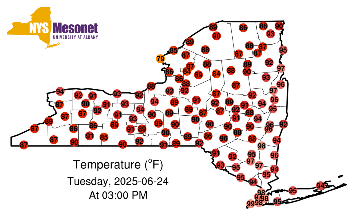
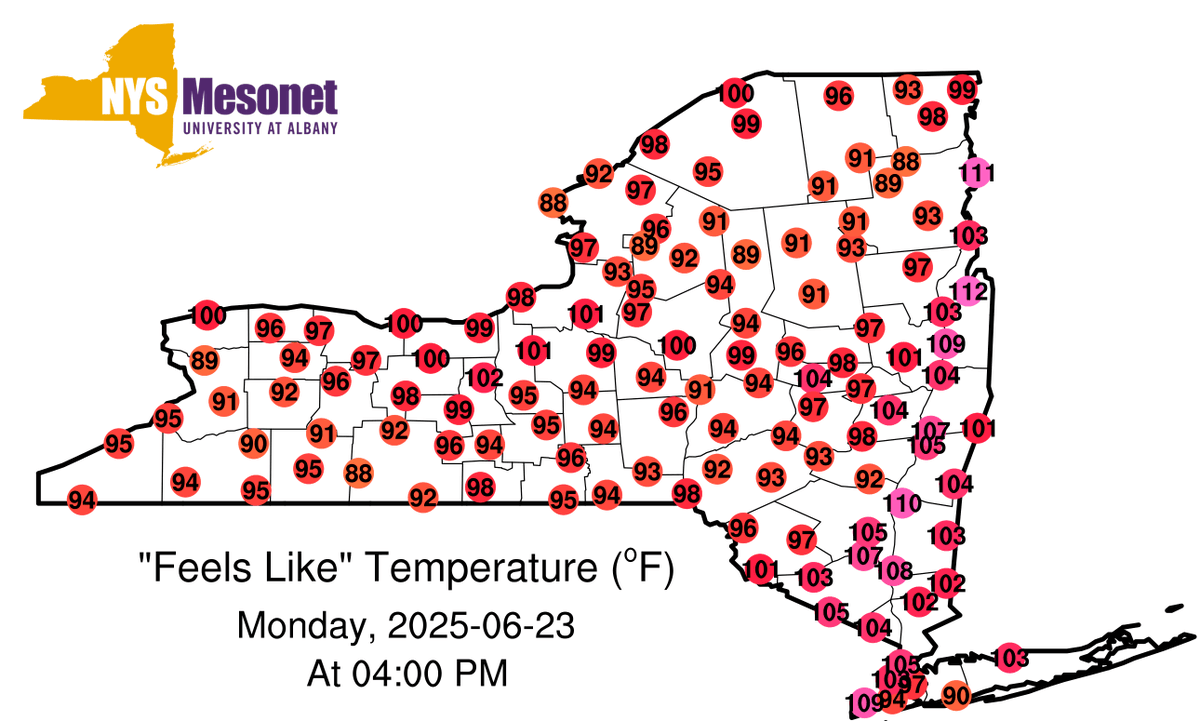
While it's not quite as humid today, temperatures are even warmer! At 3PM, much of eastern NY is near 100F. Some long-running weather stations have broken records. Nearly all of #NYC is between 97-100F right now, with even warmer feels-like temperatures.
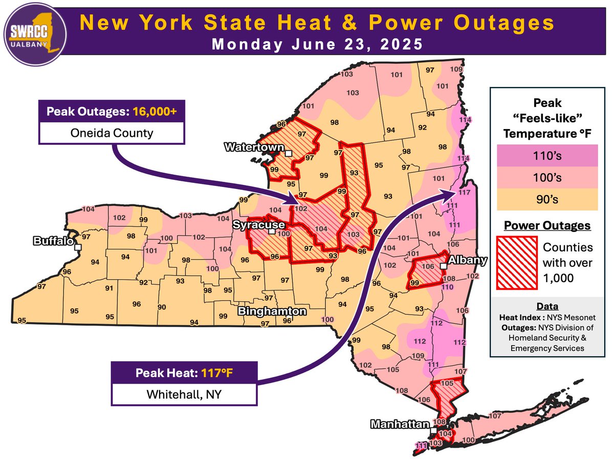
Extreme heat and power outages aren't a great combination. This map shows peak feels-like temperatures on Monday via the @nysmesonet as well as counties that peaked at 1,000 or more customer outages.
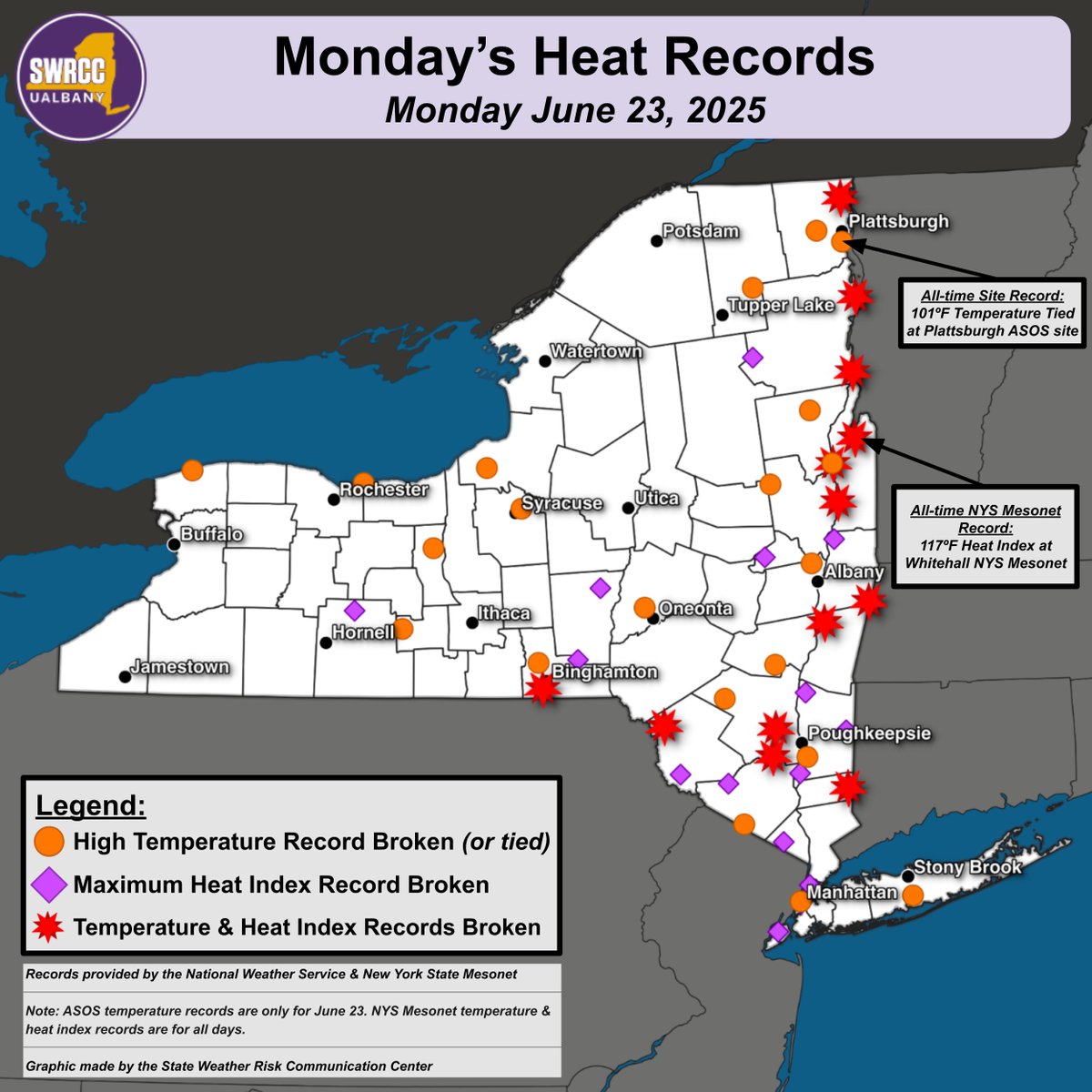
Many high temperature and high heat index ("feels like") records were tied or broken across NY yesterday. We've compiled these records for both traditional long-running stations ("ASOS") as well as @nysmesonet stations. It's likely you don't live far from a broken record!
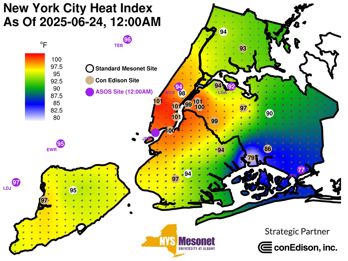
While hot temperatures affected all of NY on Monday, urban areas such as #NYC are feeling the brunt of the heatwave tonight. At midnight, most of NYC feels like its warmer than 90F while some locations even feel like 100F. Do whatever you can to stay cool tonight!
At 4PM, the feels-like temperature is likely near or just past its daily peak. It's been an oppressively hot day, and tomorrow will be similar. Some of the preliminary "highlights": Peak feels-like temperature: 117F, at Whitehall Peak temperature: 100F, at Plattsburgh
As of 1PM, the day's first 110F degree feels-like temperature has been observed. Numerous other stations are between 100-110F. In fact, the @nysmesonet's Ticonderoga station recorded a brand new all-time record high feels-like temperature of 113.7F just a few minutes ago! 🥵

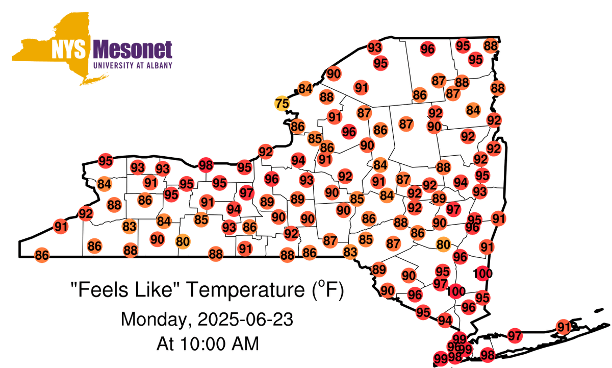
As of 10AM, the day's first 100F degree feels-like temperatures have already appeared at locations in the Hudson Valley. Additionally, many of those in the Mohawk Valley still recovering from power outages over the weekend are already experiencing feels-like values around 90F.
Power outages due to strong storms compound the impact of significant heat, due to the loss of air conditioning and refrigeration. There are still about 50K customers without power as of 1PM. For those that don't get their power back, tomorrow will be even more challenging.
Over 90% of the state is under a Major @NWS HeatRisk due to hot & humid temps today. Due to storms & flooding, several areas are experiencing power outages. If you've been impacted, find a cooling center near you: ☑️ NYS: on.ny.gov/3LhK9tN ☑️ NYC: finder.nyc.gov/coolingcenters/
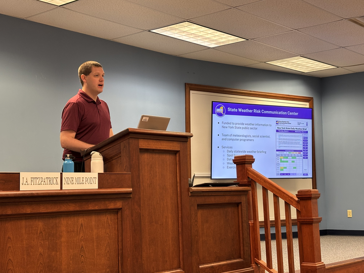
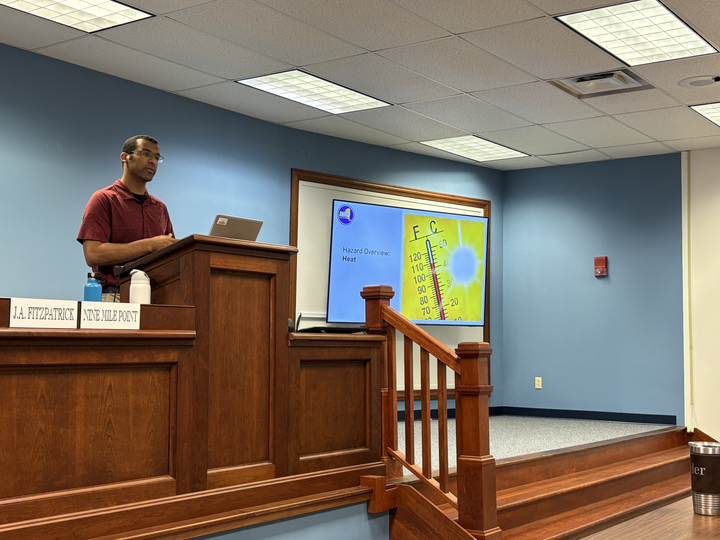
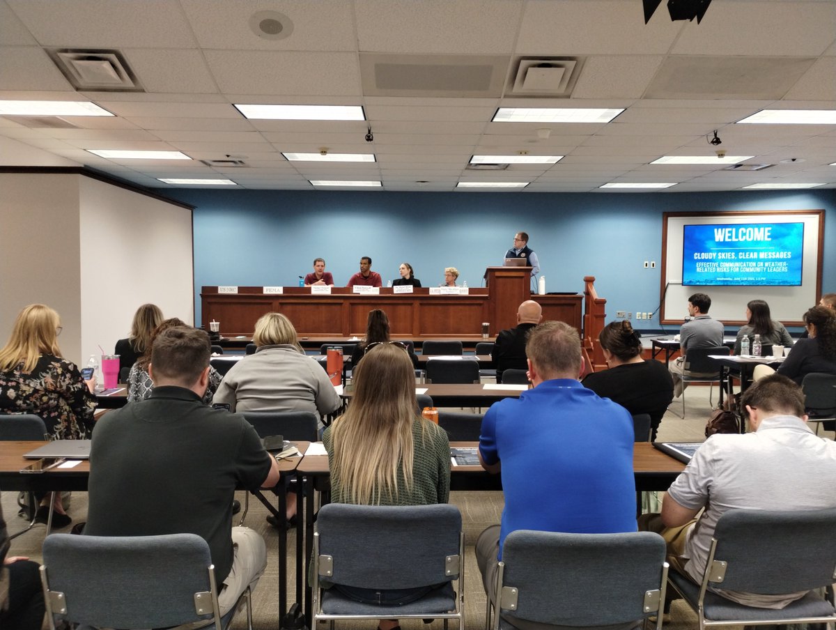
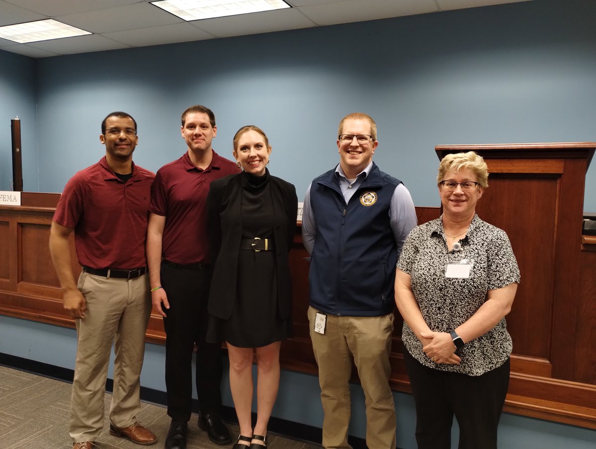
Last week SWRCC Staff presented on weather basics and protective actions for the @OswegoCountyEMO & @OswegoHealthDpt “Cloudy Skies, Clear Messages: Effective Communication on Weather-Related Risks for Community Leaders” workshop. We love providing resources for our partners!