NYS Div. of Homeland Security & Emergency Services
@NYSDHSES
DHSES will never call you asking for personal information. If you receive such a call, it is a scam. Do not share your personal information.
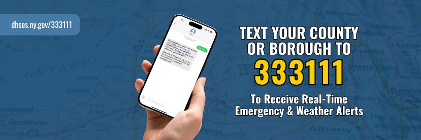
There is a new and easy way to get real-time emergency and weather text alerts for events happening in your area! Just text your county or borough with no spaces to 3-3-3-1-1-1. Learn more about triple three triple one by visiting our website at dhses.ny.gov/333111
Thunderstorms are developing over central eastern parts of the state. These storms will strengthen & become more widespread as they approach the Mid-Hudson, NYC & LI regions. Some storms may become strong-to-severe with isolated-to-scattered damaging winds through about 8PM.

#FirePreventionFriday: If you're camping in an RV this summer, make sure to keep fire safety top of mind: ✔️ Check fire alarms & propane systems ✔️ Keep exits clear ✔️ Have a fire extinguisher ready ✔️ Practice fire drills with your family 🔗 Learn more: on.ny.gov/4mjdlBf

Damaging winds & continuous ground lightning are occurring with these storms. Move indoors immediately. Remember, if you can hear thunder, you are close enough to be struck by lightning. Torrential rainfall is occurring & may lead to minor urban and poor drainage flooding.
Doppler Radar is estimating winds close to 70 mph 370 ft above ground level. This storm is capable of producing damaging winds. Take shelter indoors until it passes!
Severe Thunderstorm Warning for NYC. The primary threat this afternoon and evening is damaging wind gusts, which can topple trees, down power lines, and cause dangerous flying debris. Residents are urged to secure all loose outdoor objects, including patio furniture, trash bins,…
Severe Thunderstorm Warning continues for New York NY, Brooklyn NY and Staten Island NY until 4:00 PM EDT. This storm will contain wind gusts to 70 MPH!
Our Incident Management Team (IMT) is teaming up with @NYstateparks to support Saratoga Spa State Park during the @SPACsaratoga concert series! Over 14 days, we’re assisting @nys_parkpolice & Parks staff with managing 12 events across 14 days for the benefit of public safety.


When thunder roars, go indoors! ⛈️
Stay alert if you're in the mid-Hudson Valley, Litchfield Hills, or eastern Catskills through 5PM today as storms continue to develop. Damaging winds, hail, lightning & heavy downpours are the main hazards. Head indoors if you see flashes/hear thunder! #nywx #mawx #ctwx #vtwx
The @NWSSPC is monitoring conditions for a potential severe thunderstorm watch this afternoon as thunderstorms are beginning to develop to our northwest. The current probability of a severe thunderstorm watch issuance is 60 percent.
12:07pm CDT #SPC_MD 1777 , #mawx #riwx #ctwx #nywx #njwx #pawx, spc.noaa.gov/products/md/md…
Over 60% of the state's population is under a Major HeatRisk this afternoon & evening with "feels-like" temps between 95°-105°F. Thunderstorms are likely statewide through 8PM. Southeast regions could see more severe storms with heavy rain & strong winds. Monitor your forecast.


#EmergencyPreparedness: What’s YOUR survival style? 🎒 Discover which preparedness kit matches your vibe—because being prepared never goes out of style! Ready to gear up? 🔦🥫📻 Let us know your survival style in the comments! ⬇️


It's hot 🥵 today and tomorrow so we're creating a few "sprinkler zones" in the Bronx to help NYers stay cool 🧊! Spray caps help reduce water waste, prevent low pressure & discolored water AND are a refreshing fun way to cool off! Locations in the 🧵
DEC and @HealthNYGov have issued an air quality health advisory for ozone today, July 25th, for NYC Metro and Long Island. 👉 Latest AQI forecast: extapps.dec.ny.gov/cfmx/extapps/a… ☎️ Air Quality Hotline: 1-800-535-1345
Temperatures are rising downstate. Plan ahead and stay safe today during the extreme heat: ✔️ Stay in the AC if you are vulnerable to heat ✔️ Hydrate even if you're not thirsty ✔️ Avoid outdoor activity 11AM–4PM ✔️ Wear light & loose clothes ✔️ Check on neighbors & older adults
[Key Messages for 7/25/25]: Heat & humidity will combine to produce max heat indices of 100 to 105°F. Severe thunderstorms are possible this PM with the primary threat from damaging wind gusts of 58 mph or greater. There is a localized flash flood threat in any heavier downpours.
DYK? Using a fan during a heat wave may be more harmful than helpful if indoor air temperatures are hotter than your body temperature. It’s important to know when it’s too hot for a fan. For more information, visit: health.ny.gov/environmental/…
Hot & humid conditions with "feels-like" temps of 96-101°F continue across eastern NY today. Heat Advisories are in effect for the Capital Region, Mid-Hudson, NYC & LI. Severe thunderstorms could also affect these regions this afternoon—with possible high winds & flash flooding.


Tomorrow, "feels-like" temperatures are expected to reach between 100-105°F in the downstate area. This type of heat is extremely dangerous & should be taken seriously. Prepare now—locate a cooling center near you, make a plan for your children & pets, and remember to hydrate!

An Excessive Heat Watch and Heat Advisory are now in effect for much of the downstate area Friday. Heat index values of 100 to 105 F are expected. Hydrate, avoid strenuous outdoor activities and wear lightweight, light-colored & loose-fitting clothes.

🚨 Every part of New York? Hot. 🚨 Your car? Hotter. Your attitude when driving? Let’s keep that cool. Temps are up, and patience can melt fast. Take a breath. Sip some water. Ease up on the gas. You can’t control the weather, but you can control your driving.
New Yorkers, "feels-like" temperatures will be in the upper 90s today & tomorrow in several areas of the state. 1️⃣ Hydrate! Drink plenty of water, even if you’re not thirsty. 2⃣ Avoid strenuous outdoor activities. 3⃣ Wear lightweight, light-colored & loose-fitting clothes.

Hot & humid conditions are expected across the entire state today & continuing into Friday. Heat advisories are in effect for several areas. Stay cool & hydrated. Scattered thunderstorms may also impact parts of the state today, with more severe storms in portions of Western NY.


Heads up New Yorkers! The heat is ON—feels-like temps are soaring to 90-105 degrees over the next two days throughout the state. Stay hydrated 💧, wear sunscreen 🧴, and keep cool 😎 indoors. Let’s beat the heat together and stay safe!