NWS Severe Tstorm
@NWSSevereTstorm
Official Twitter National Weather Service account used to distribute experimental severe thunderstorm impact graphics. Read more at: http://goo.gl/cCCw1s
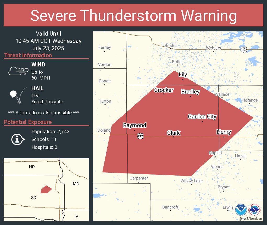
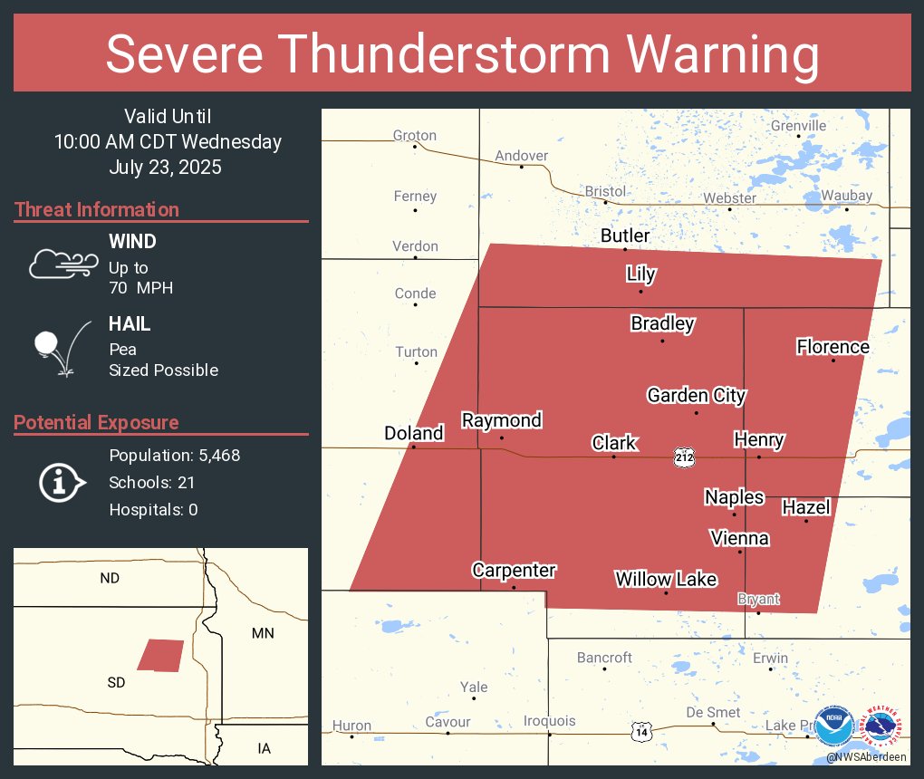
Severe Thunderstorm Warning including Clark SD, Henry SD and Bradley SD until 10:45 AM CDT
Severe Thunderstorm Warning continues for Clark SD, Florence SD and Henry SD until 10:00 AM CDT
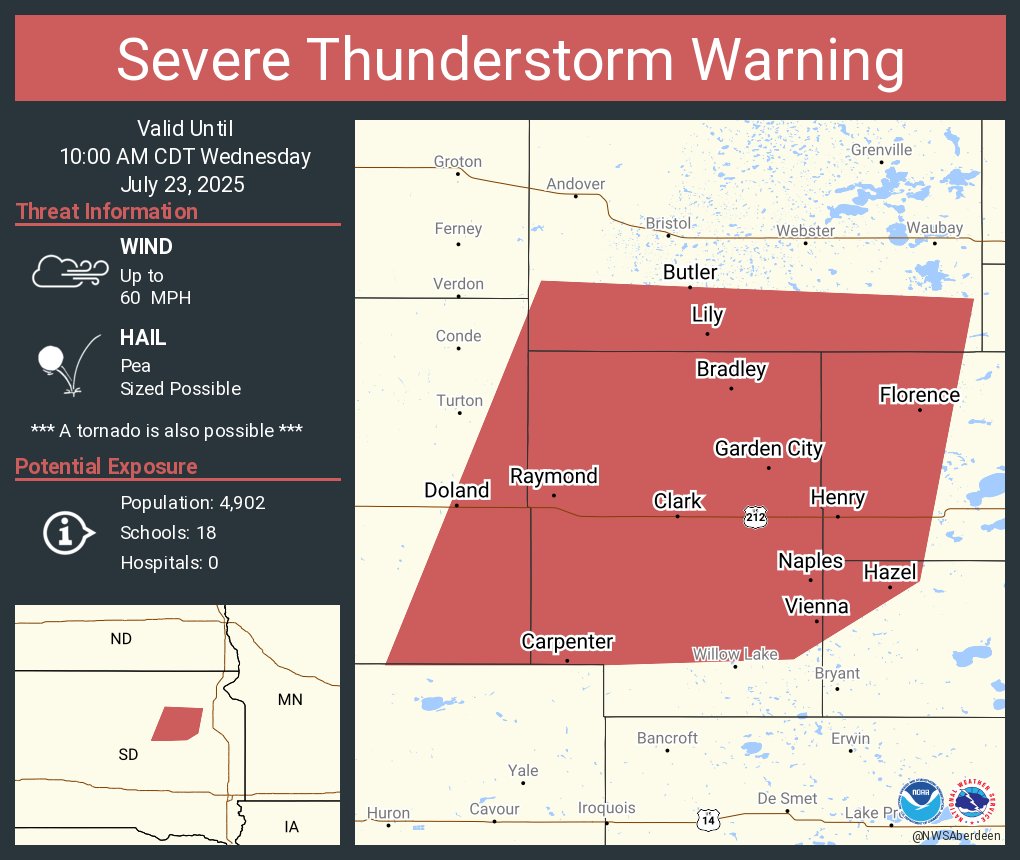
Severe Thunderstorm Warning continues for Clark SD, Florence SD and Henry SD until 10:00 AM CDT

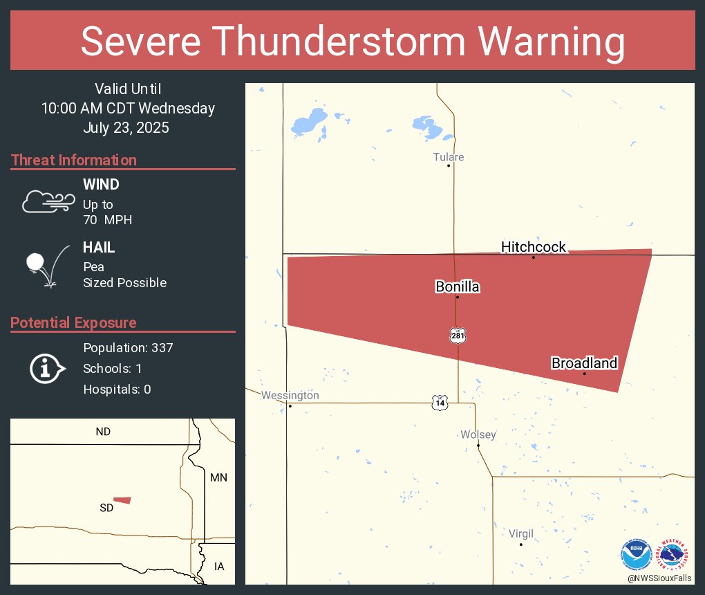
Severe Thunderstorm Warning including Hitchcock SD, Broadland SD and Bonilla SD until 10:00 AM CDT. This storm will contain wind gusts to 70 MPH!
Severe Thunderstorm Warning continues for Clark SD, Florence SD and Henry SD until 10:00 AM CDT

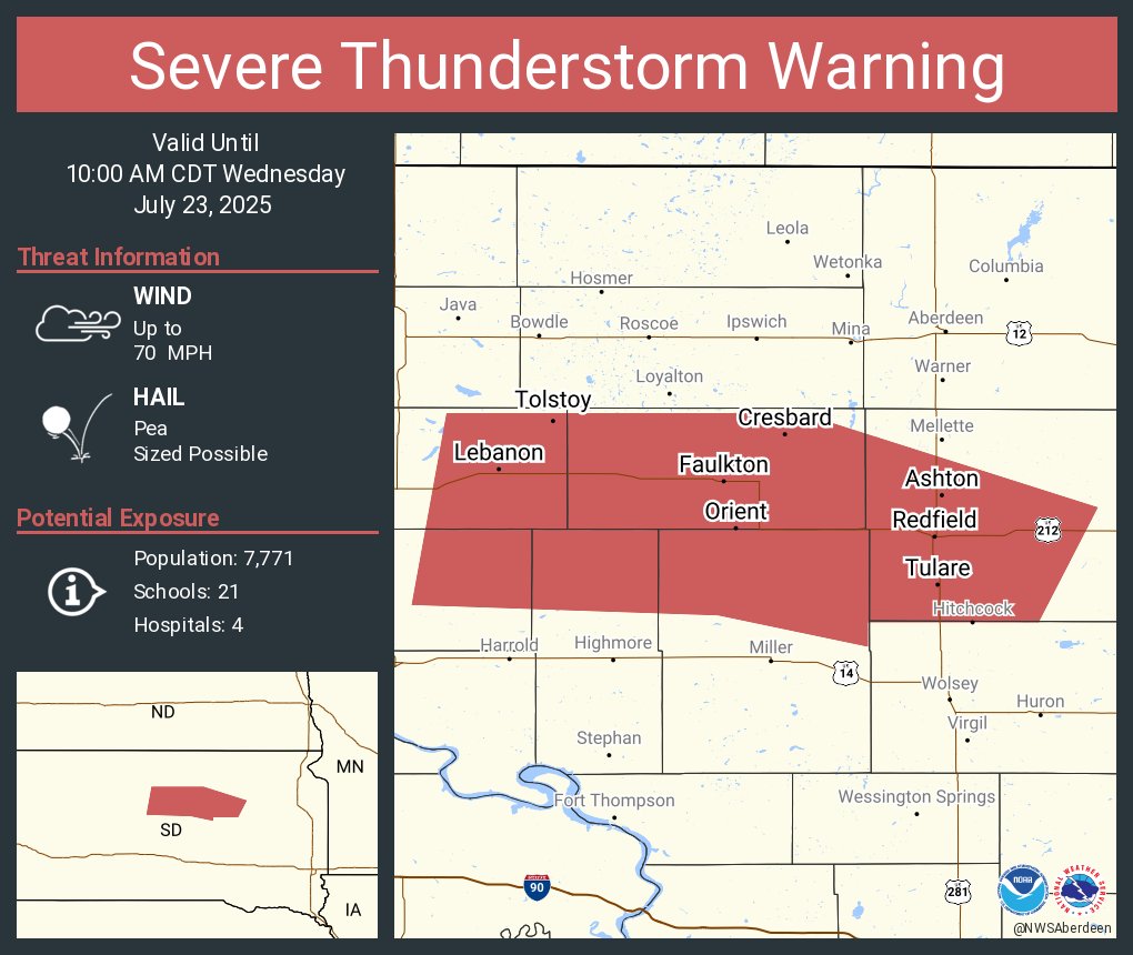
Severe Thunderstorm Warning continues for Redfield SD, Gettysburg SD and Faulkton SD until 10:00 AM CDT. This storm will contain wind gusts to 70 MPH!
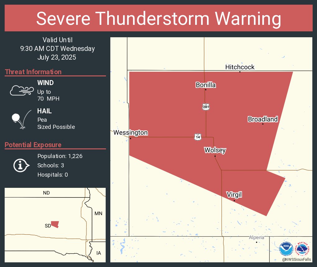
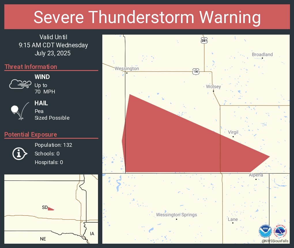
Severe Thunderstorm Warning continues for Wolsey SD, Wessington SD and Hitchcock SD until 9:30 AM CDT. This storm will contain wind gusts to 70 MPH!
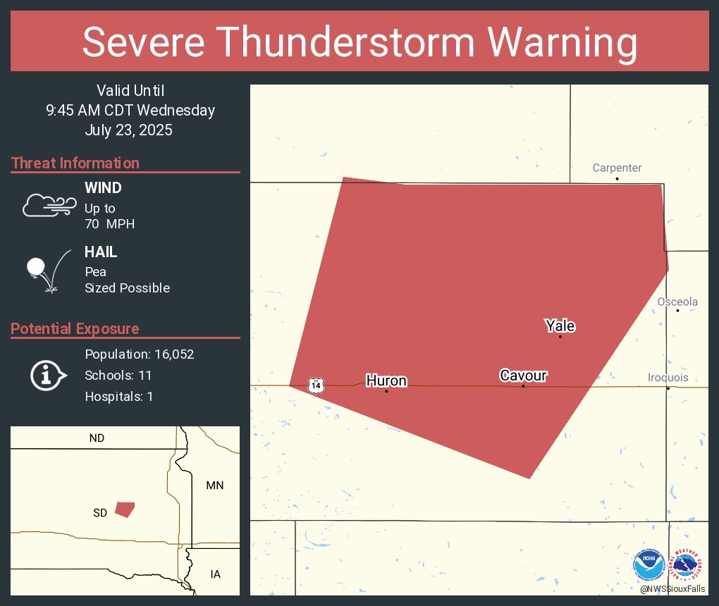
Severe Thunderstorm Warning continues for Huron SD, Cavour SD and Yale SD until 9:45 AM CDT. This storm will contain wind gusts to 70 MPH!
Severe Thunderstorm Warning including Clark SD, Florence SD and Henry SD until 10:00 AM CDT. This storm will contain wind gusts to 70 MPH!
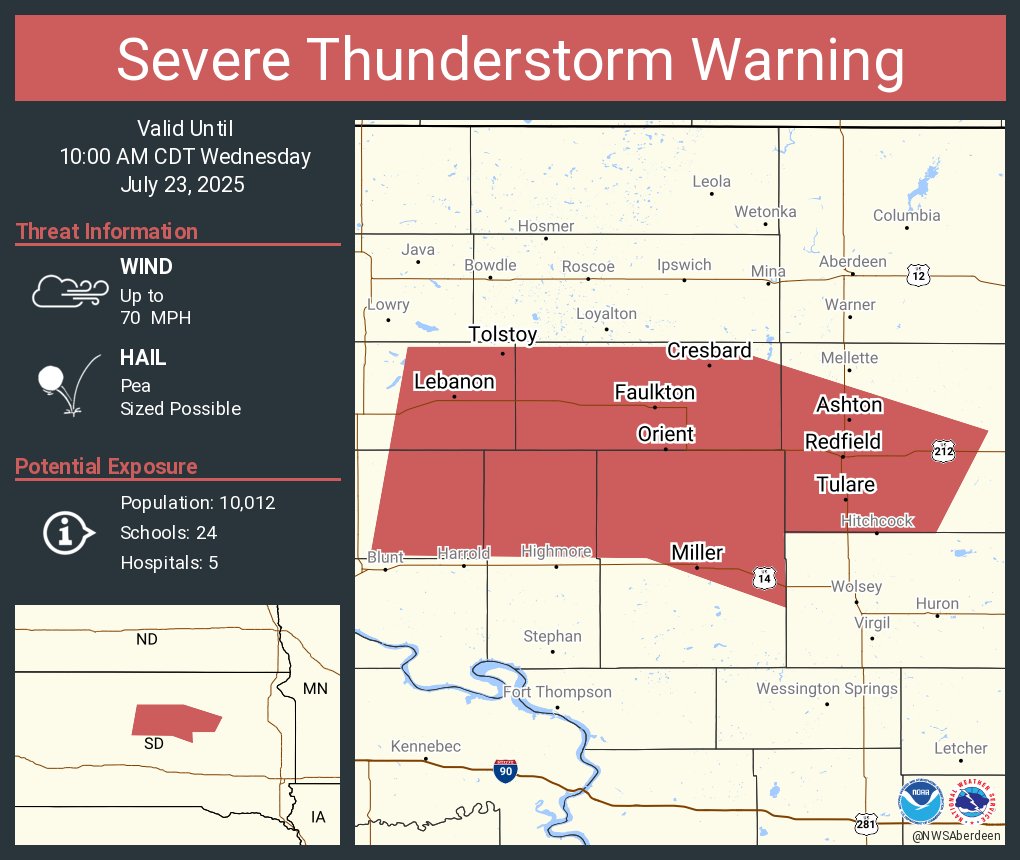
Severe Thunderstorm Warning including Redfield SD, Miller SD and Gettysburg SD until 10:00 AM CDT. This storm will contain wind gusts to 70 MPH!
Severe Thunderstorm Warning continues for Beadle County, SD, Jerauld County, SD until 9:15 AM CDT. This storm will contain wind gusts to 70 MPH!
Severe Thunderstorm Warning including Huron SD, Cavour SD and Yale SD until 9:45 AM CDT. This storm will contain wind gusts to 70 MPH!

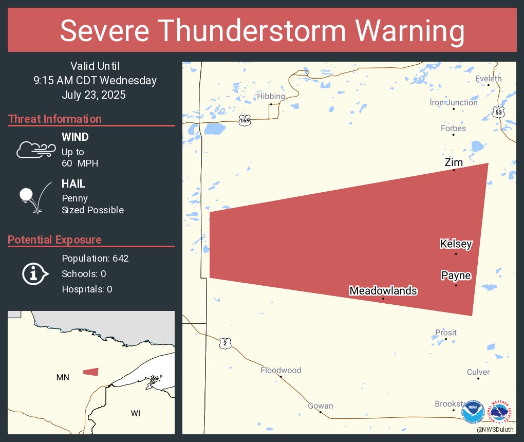
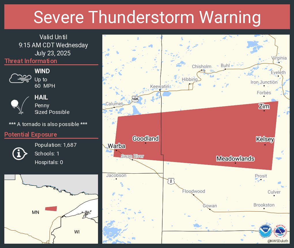
Severe Thunderstorm Warning continues for Meadowlands MN, Zim MN and Kelsey MN until 9:15 AM CDT
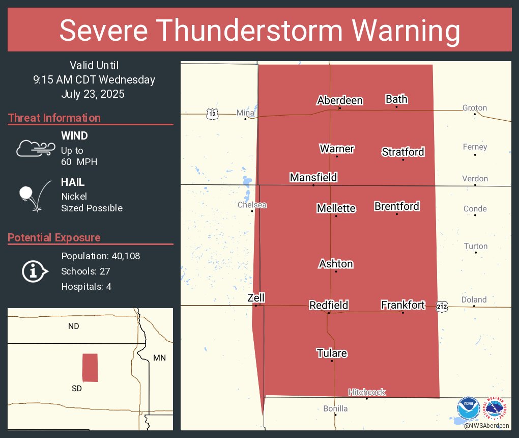
Severe Thunderstorm Warning continues for Aberdeen SD, Redfield SD and Warner SD until 9:15 AM CDT
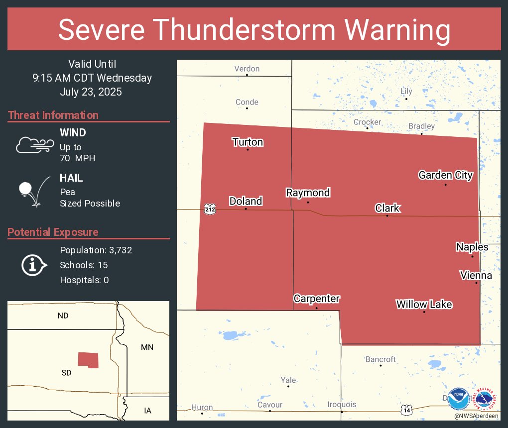
Severe Thunderstorm Warning continues for Clark SD, Willow Lake SD and Doland SD until 9:15 AM CDT. This storm will contain wind gusts to 70 MPH!
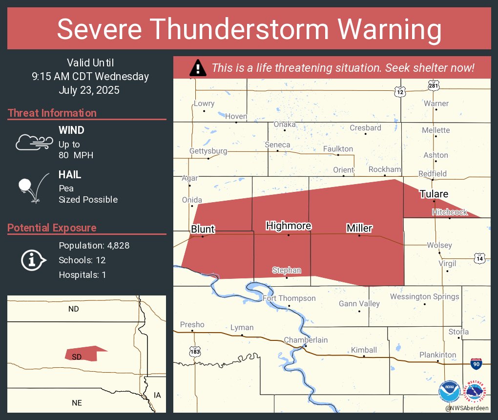
Severe Thunderstorm Warning continues for Miller SD, Highmore SD and Blunt SD until 9:15 AM CDT. This destructive storm will contain wind gusts to 80 MPH!

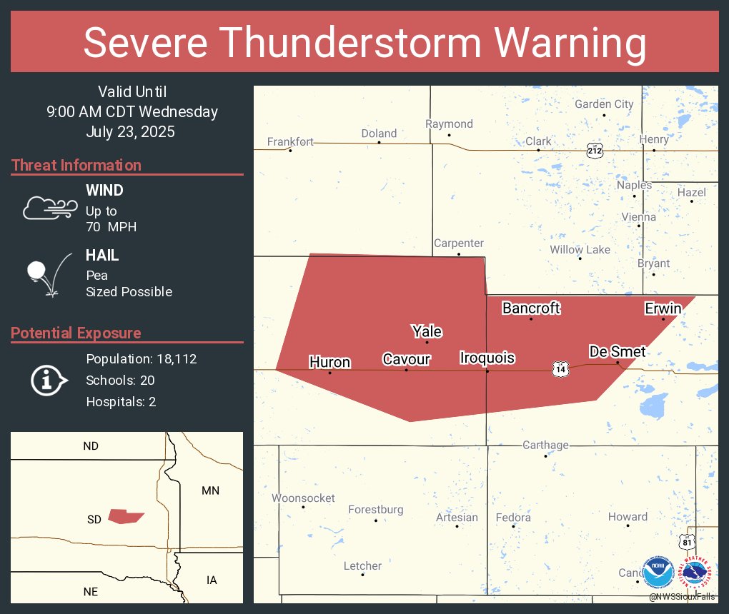
Severe Thunderstorm Warning continues for Huron SD, De Smet SD and Iroquois SD until 9:00 AM CDT. This storm will contain wind gusts to 70 MPH!
Severe Thunderstorm Warning continues for Warba MN, Meadowlands MN and Payne MN until 9:15 AM CDT
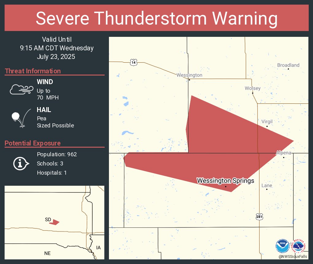
Severe Thunderstorm Warning continues for Wessington Springs SD until 9:15 AM CDT. This storm will contain wind gusts to 70 MPH!
Severe Thunderstorm Warning continues for Miller SD, Highmore SD and Blunt SD until 9:15 AM CDT. This destructive storm will contain wind gusts to 80 MPH!