Logan Giles
@LoganGilesWx
Climatologist I Fairfield and Salisbury grad I Currently recovering from CIDP https://logangileswx.substack.com/
This is the moment I’ve been waiting for a very long time. Finally having the ability to walk unsupported like everyone else. Months of treatment, physical therapy, confidence, and pure will power have lead to this moment. Could not be here without incredible support.
Throwing it back to a style used decades ago. Mountains rising up to the heavens with peaceful alpine lake below
Straight outta 1974.
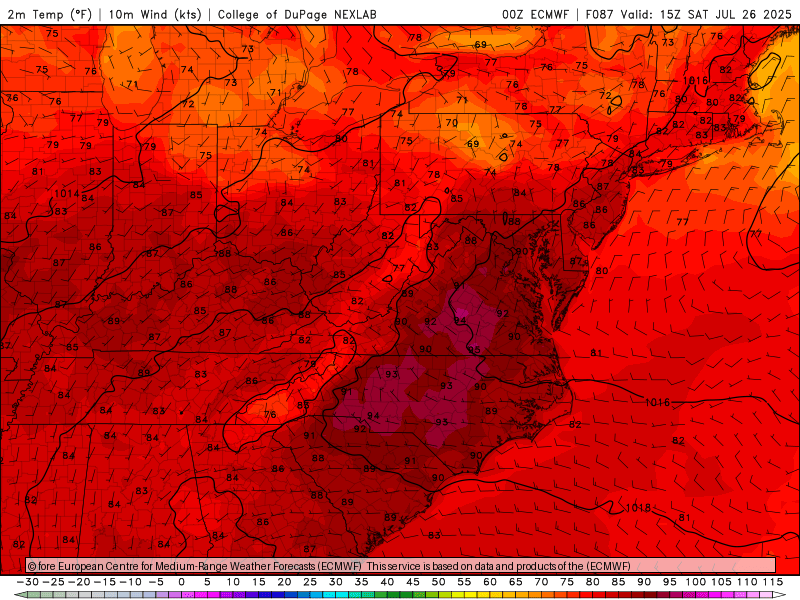
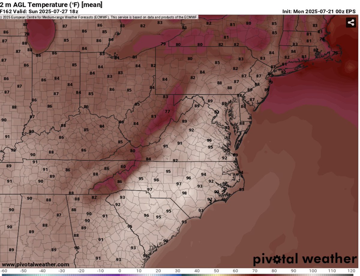
Heat returns soon with storms, but there is a light at the end of the tunnel logangileswx.substack.com/p/july-23-2025
Storm chances this weekend, with Saturday being the day to watch. Isolated storms during the afternoon, with main show in the evening. Cold front and strong shortwave will help move heavy rain in the evening. Heaviest appears to be in the Northeast, but Mid-Atlantic will get some
[1/x] A couple of quick thoughts about the flooding on Sat., 7/19. #MdWx #EMGTwitter -Worst flash flood of my career. Watching 4 waterways simultaneously surge several feet in just minutes was unreal. -Tremendous work by @NWS_BaltWash to push watches & warnings so quickly.
Check out this graph of Saturday’s flash flood from one of Montgomery County’s flood sensors. The water in Sligo Creek rising 100 inches in half an hour followed by another spike 30 mins after that. I’ll have more on @7NewsDC at 4&5
Here is your @Nationals forecast logangileswx.substack.com/p/washington-n…
It's disappointing major weather media groups that exist off NOAA/NWS data have been deafeningly silent about federal staffing hits and proposed cuts to NOAA. No letters of support. No news reporting on their detrimental effects to forecasting. Just glaring editorial omission. 🧵
An updated Day 3-7 Hazards Outlook has been issued. wpc.ncep.noaa.gov/threats/threat…
Here is your @Nationals forecast logangileswx.substack.com/p/washington-n…
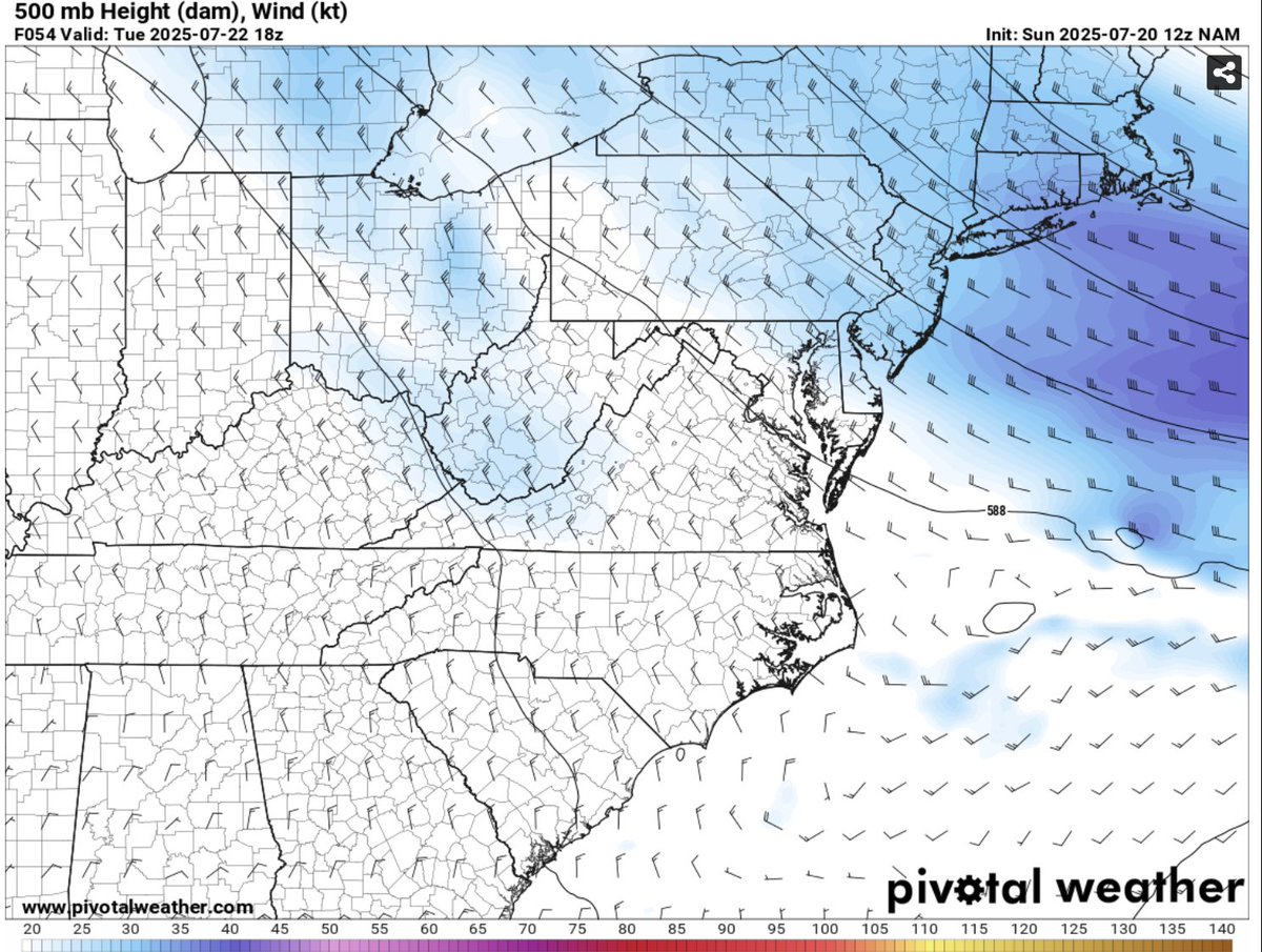
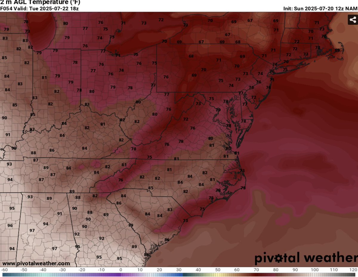
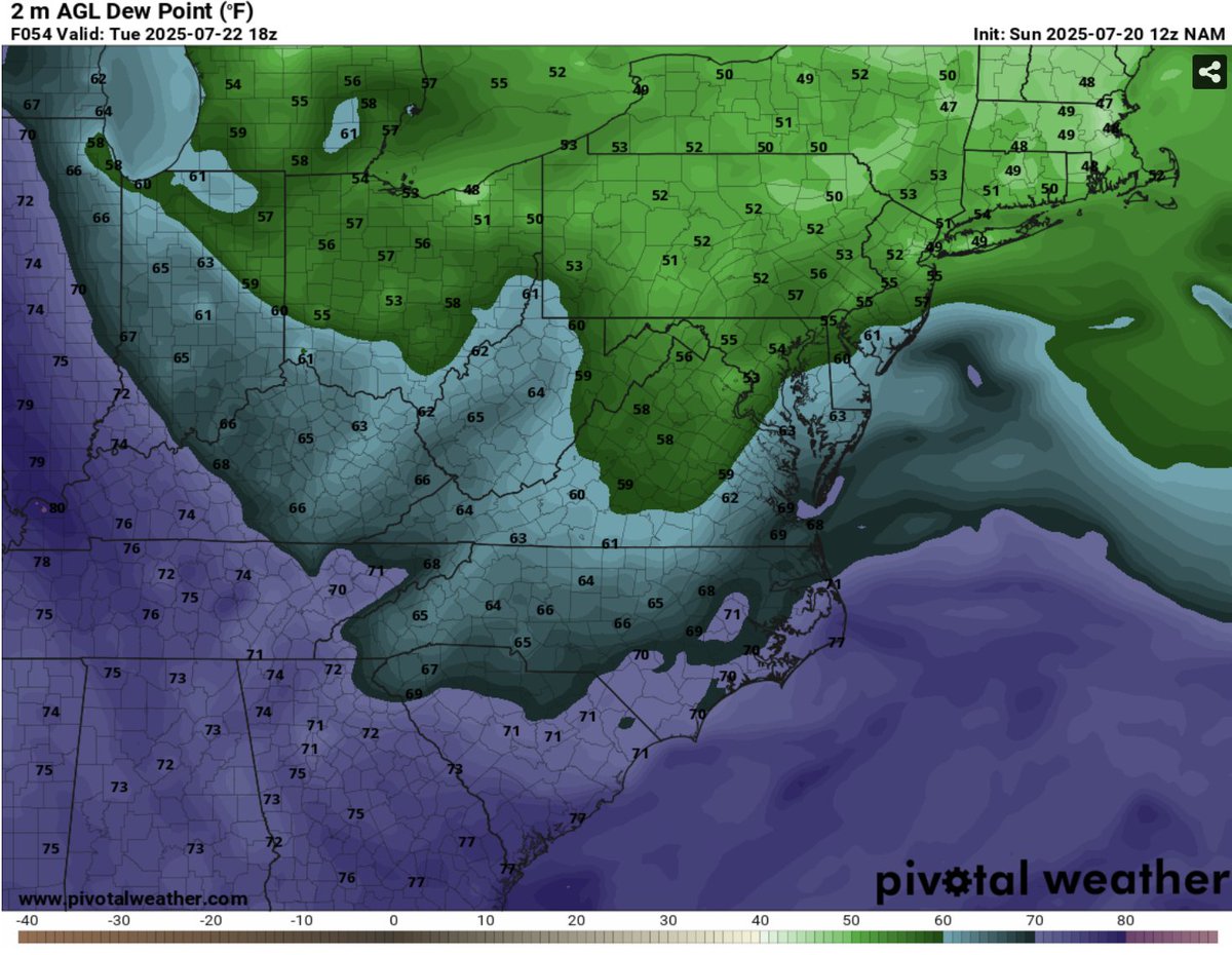
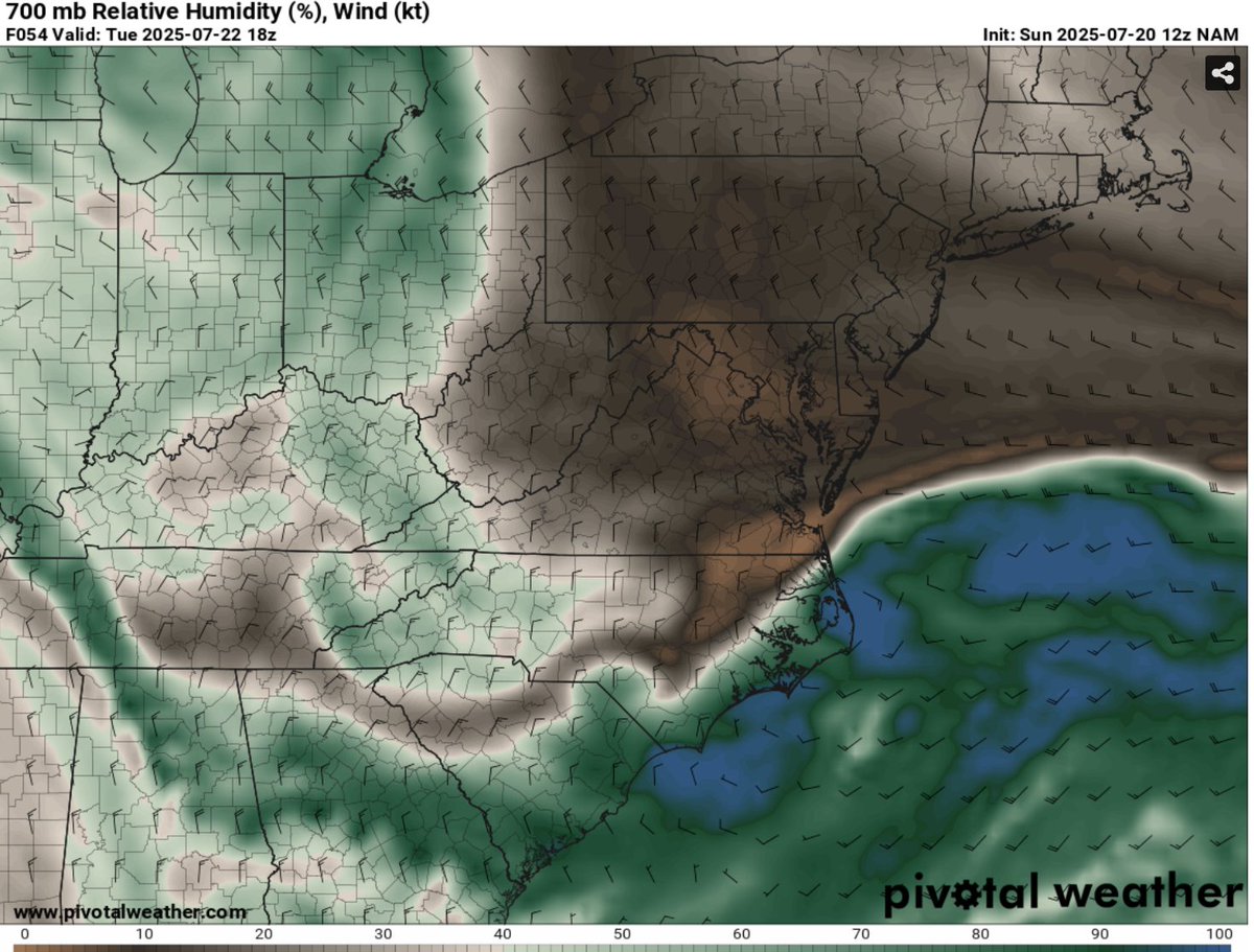
Tolerable next three days before hottest temperatures in a month arrive for the weekend. logangileswx.substack.com/p/july-22-2025
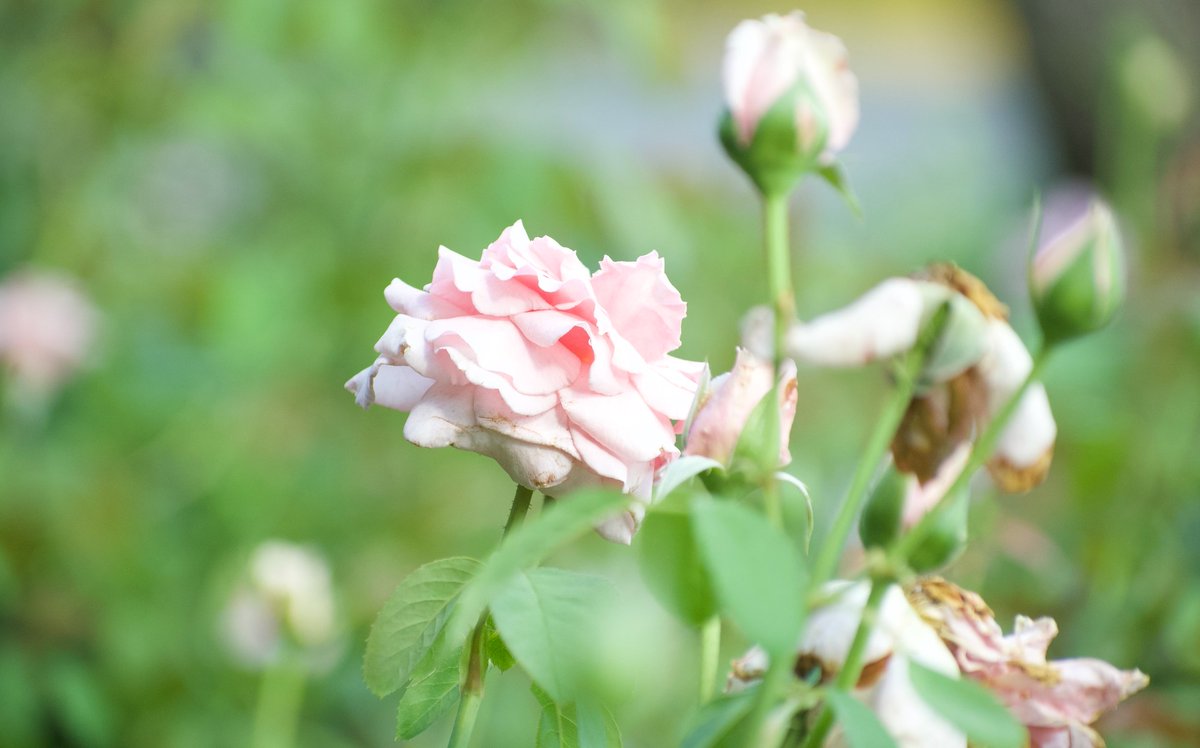
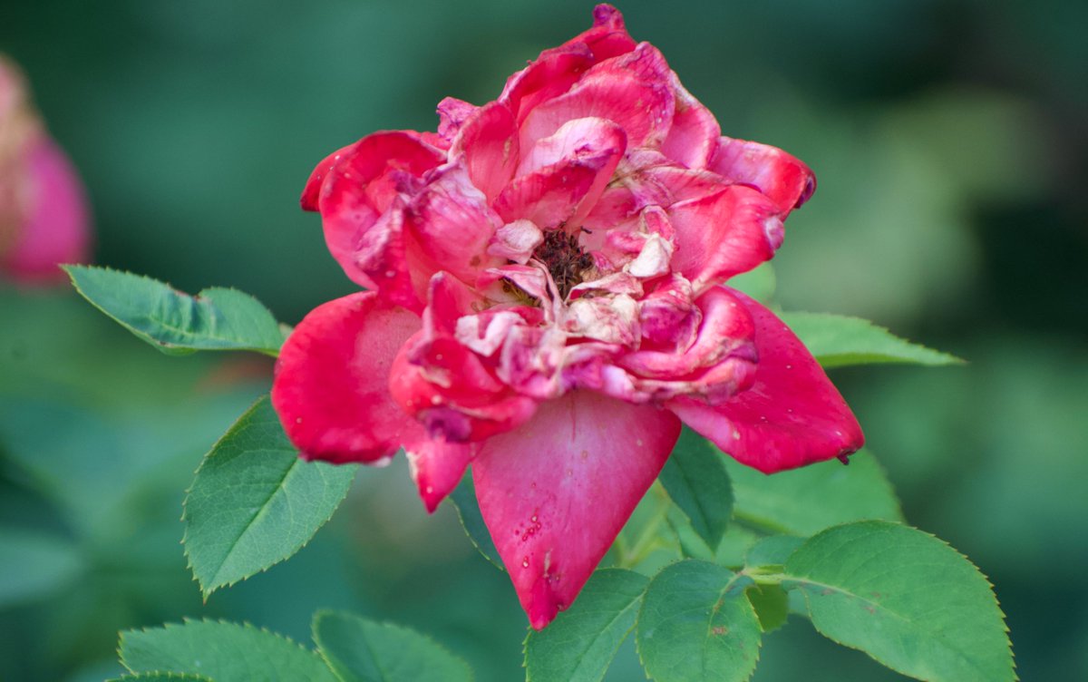
Summer has about a month left, but temperatures don't abide by calendars. In three months, all will be enjoying a crisp fall day with leaves changing. But for now, summer flowers continue their show
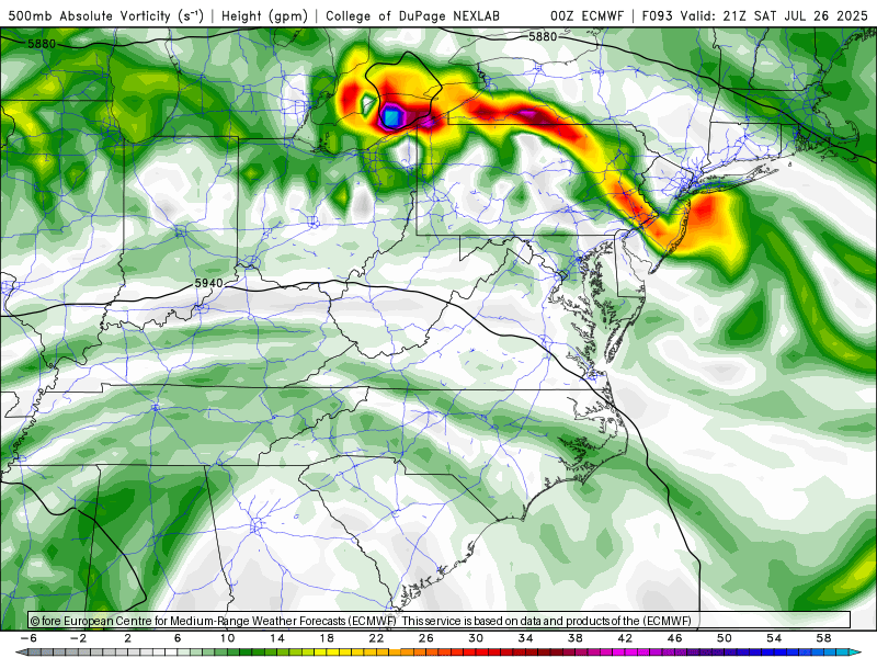
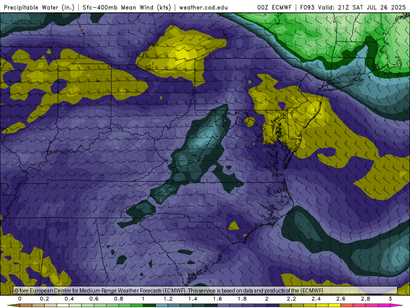
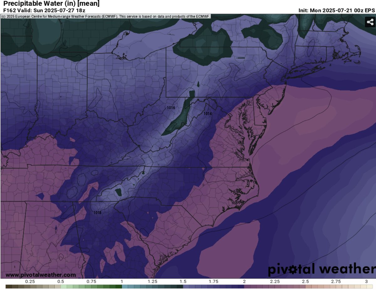
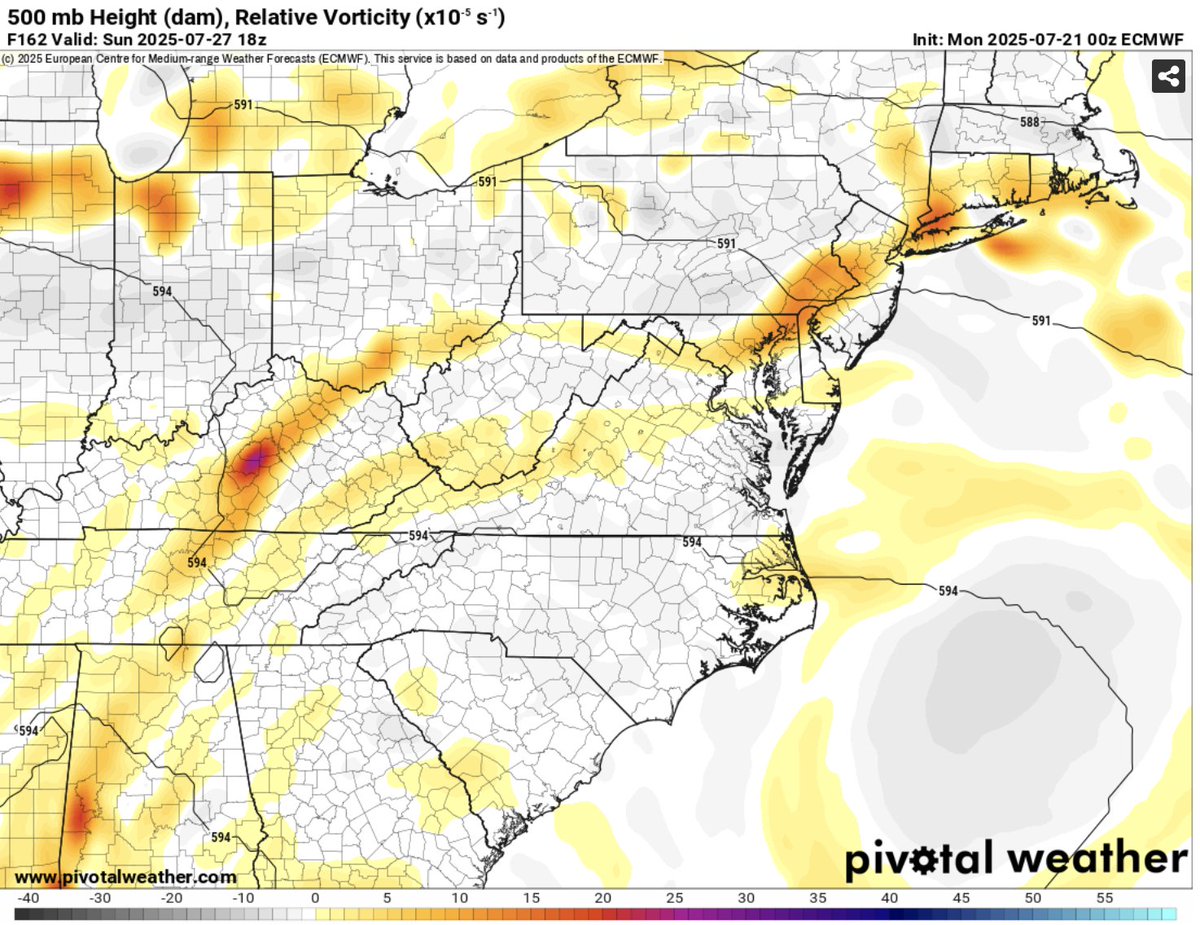
Sunday bears watching for heavy thunderstorms as numerous shortwaves will be in the area. Temperatures will plenty warm and environment looks rather unstable. Ensembles already showing plenty of moisture with PWAT >2.0
First day of brief pattern change before humidity returns logangileswx.substack.com/p/july-21-2025
Here is your @Nationals forecast logangileswx.substack.com/p/washington-n…
Tuesday will be the best day in awhile with northerly flow bringing temperatures to near 80˚F. Dry airmass with low humidity expected