Ethan Rosuck
@EthanRosuckWX
Meteorologist @FOX59 @CBS4Indy ⛈️🌪️❄️ | Formerly: @WIFRTV | Ball State @BSUGeography & @BallStateMedia Alum | North Chicago Suburbs = 🏠
Rain continues today and into Monday as tropical moisture fuels heavy downpours. Totals of 1-3" possible with localized flooding. Humid conditions linger until late Monday. See the graph below on when dew points will start dropping. It'll be NICE relief. #INwx @FOX59

Expect heat index values across the board tomorrow 100-110°. That puts central Indiana under the "Major" heat risk. Through early next week, central Indiana under "major" heat risk each day. Take this heat seriously as it looks to have some staying power. #INwx @FOX59


Wednesday marked the 15th 90° day this season in #Indianapolis. We'll be adding PLENTY more to this graphic in the days ahead. Another hot dome is moving in and puts the entire Hoosier State under its belt Thursday. #INwx @FOX59

An 80° DEW POINT being recorded just after 5PM in #TerreHaute. That high of a dew point is rare for an Indiana summer and is tough for states like Florida to reach at times. The last time #Indianapolis had an 80° dew point was on August 25, 2023. #INwx 🌡️💦 @FOX59

HOT DOME is taking shape. It's MUGGY across most of the Midwest with our western counties seeing the brunt of the humidity today. The 100°+ heat indices extend eastward on Thursday, with a Heat Advisory taking effect for the remainder of the state at that time. #INwx @FOX59🥵 🌡️


And it's only going to be HOTTER and more HUMID from here. #INwx @FOX59
The mild air is in the rearview window as humidity surges through the state Wednesday afternoon. HEAT INDEX has topped 100° in many locations in western Indiana just before 5pm. HOTTEST 112° in Clinton (Vermillion Co.) 109° Terre Haute (Vigo Co) #INwx
Was incredibly grateful I got to see this in person! It’s hard to be a White Sox fan but remembering moments like this make it still worth it. #WhiteSox
𝐉𝐮𝐥𝐲 𝟐𝟑, 𝟐𝟎𝟎𝟗 Mark Buehrle throws the 18th perfect game in MLB history!
Here are some approximate times and towns in the path of this cell. It's moving east at 40 MPH. If your town or county is listed below, keep an eye out. #INwx @FOX59

The cell we've been monitoring has just been turned into a Severe T-Storm WARNING for Tippecanoe County until 10:30 AM. Frequent lightning, thunder, downpours and some gusts near 60 MPH are possible. Stay aware as this cell moves east. #INwx @FOX59

A cluster of storms in Illinois is moving into the NW portions of our viewing area. Winds around 40 MPH are possible in portions of Fountain, Tippecanoe and Warren Counties in addition to frequent thunder, lightning and downpours. #INwx @FOX59

Flood WATCH kicks in today at 1:00 PM. Numerous showers and isolated storms will be around late morning and continue through the day. Downpours and flash flooding are the biggest threats along with an isolated higher wind threat. Remember, turn around, don't drown! #INwx @FOX59

One lone storm in Putnam County just before 8:00 AM Sunday. Otherwise, all is quiet ahead of more rain in Illinois that moves in later this morning. Expect more widespread rain compared to yesterday. Coverage increases later this morning. #INwx @FOX59
Oh the things that happen on weekend mornings lol
When you accidentally combine tortoise with turtle, it comes out sounding like “turd-us.” And I’m so glad I got to discover that on live TV this morning 😂 @FOX59 @SierraHigniteTV @EthanRosuckWX
Dew points in the 60s kick off the next work week but it won't last. Another HOT DOME builds late Tuesday and that's when dew points rise again. They could get 80° in spots. Oppressive humidity + highs in the 90s = heat index over 100° on a widespread basis. #INwx @FOX59 🥵 🌡️


A threat for heavy rain and localized flash floods also exists with today's storms. The latter will especially be the case in areas that received ample 2-5+" rains in recent days. Spots in that range are south of #Indianapolis. #INwx @FOX59

A line of storms in IL/IA will race SE into central Indiana today. Timeframe: 2-8 PM with from west to east. Heaviest rain likely in a 1-2 hr window per spot. Peak coverage ~60% by 4PM. Main threats: damaging winds & localized flooding, especially south of #Indy. #INwx @FOX59 🌩️


Getting FOGGY out there in several hometowns. Conditions are perfect for fog development, especially in areas south of Indianapolis, which have received more recent rains than most. Expect this to gradually mix out as the morning progresses. #INwx @FOX59


Especially next week when the next HOT DOME arrives. I know @SierraHigniteTV knows this reference. 🤣
It's gonna be GOSH DARN hot and humid, says @EthanRosuckWX . @SierraHigniteTV @FOX59 @theWXauthority
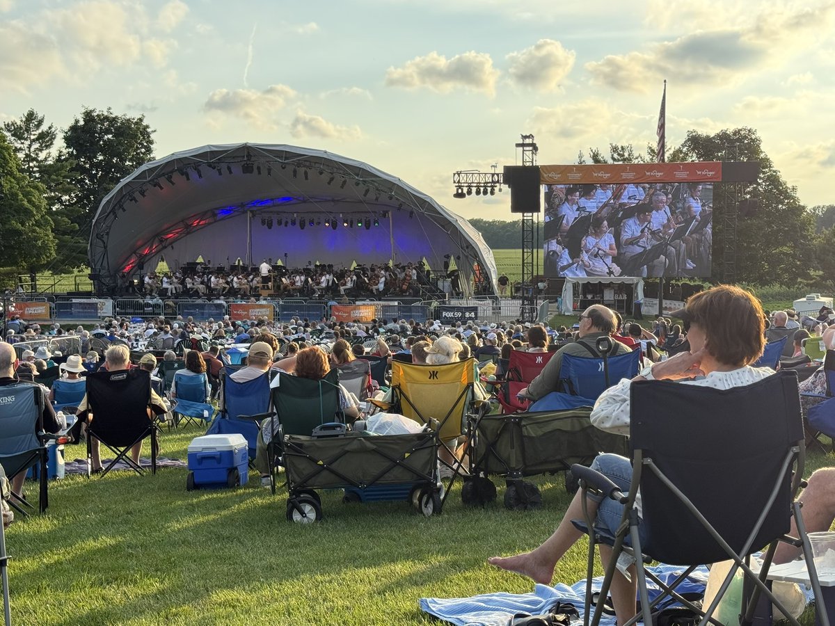
Peep the @FOX59/@CBS4Indy banner on the @Indy_Symphony stage! Enjoy a night of wonderful movie music by John Williams and several other amazing composers. I love movie scores so this is so cool 😂 @ConnerPrairie
Upper 70s (even some 80°) dew point readings expect next week. Mid-July is when we usually see the most humid air, thanks to increased moisture from the Gulf (HOT DOME) and increased moisture from the growing corn. Heat Indices above 100° are likely, too. #INwx @CBS4Indy 🥵 ❗

