Brian Wilkes
@BrianWilkes59wx
Chief Meteorologist FOX 59 Indianapolis
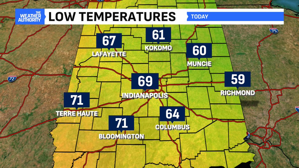
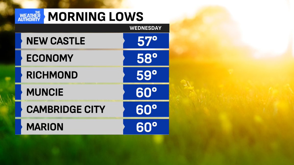
Eastern Indiana once again on the "September side" of lows early Wednesday morning. Coolest lows 57° New Castle (Henry Co) 58° Economy and 59° Richmond (Wayne Co) #Inwx
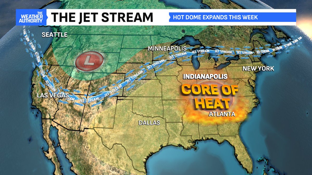
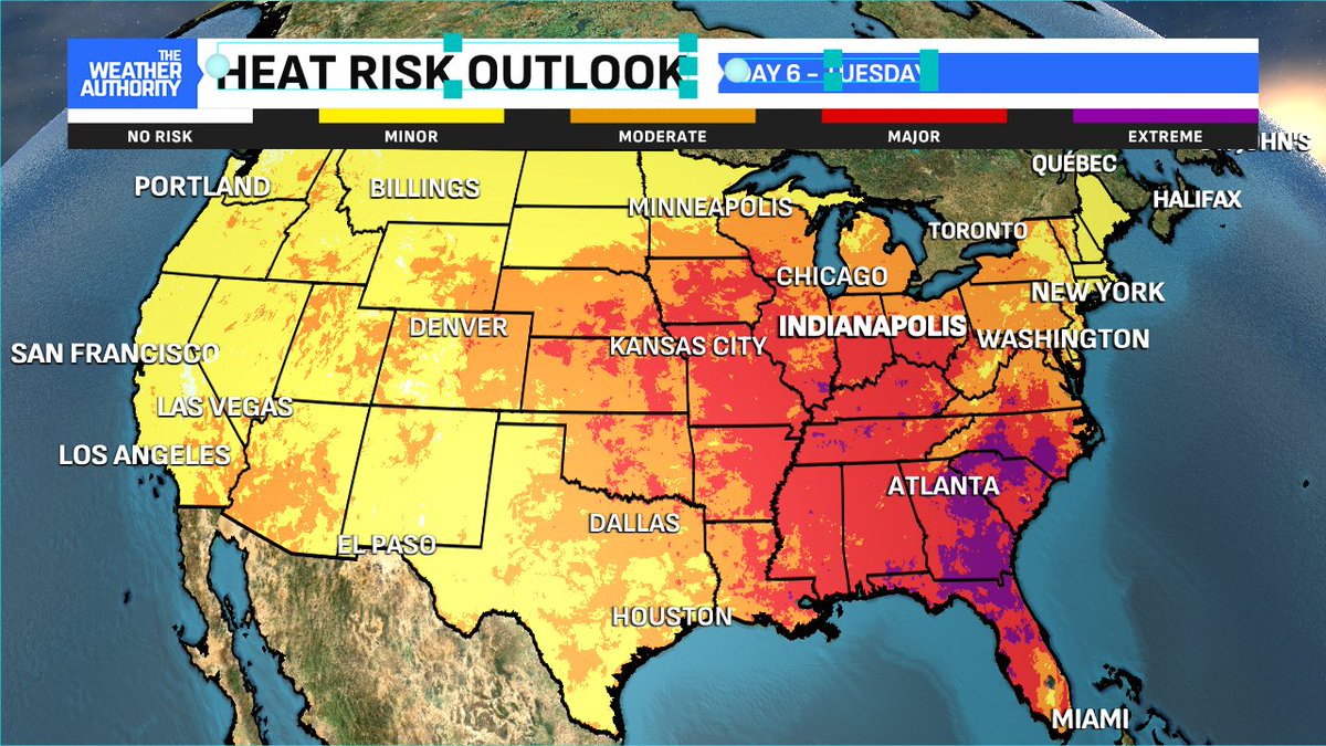
Relief will be a long way off as upper-level high pressure anchors over much of the eastern half of the Nation. Heat risk will remain high or categorized as 'major' each of the next 6 days. Real relief may not arrive until August's open #INwx
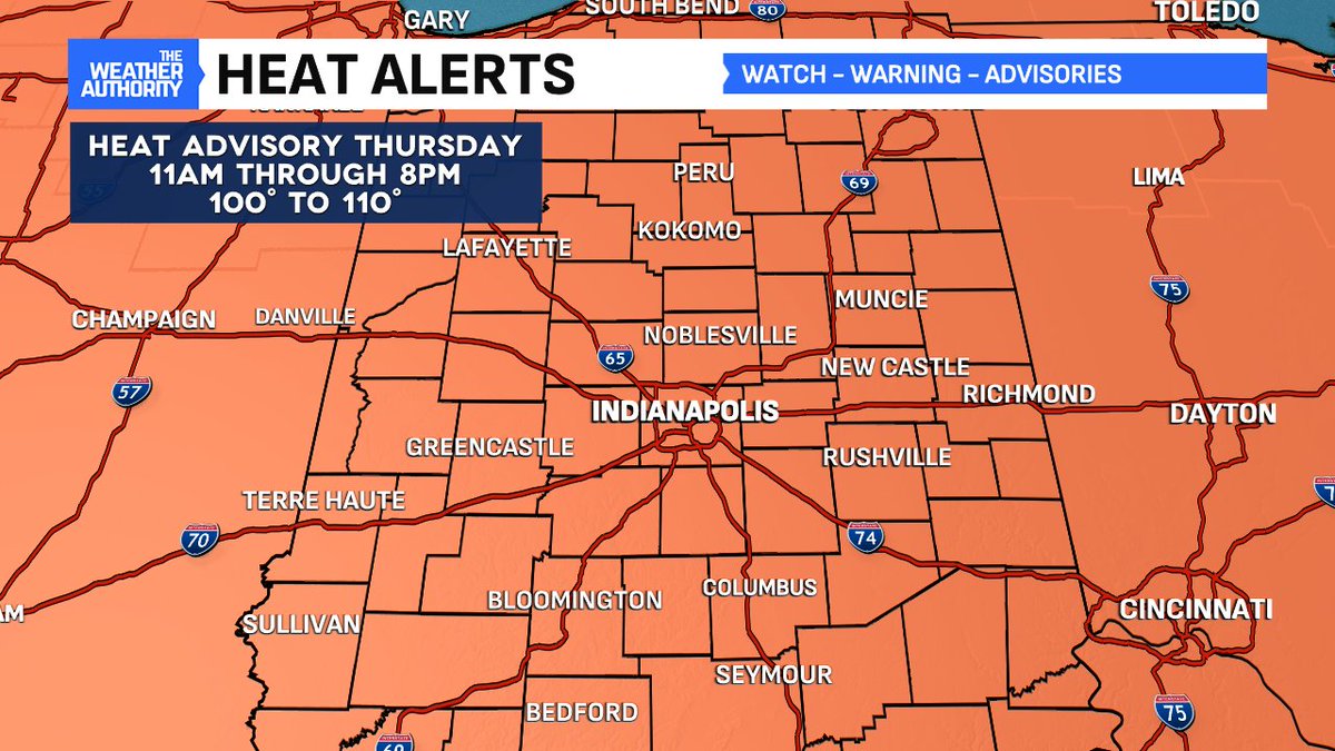
Smothered in high humidity Thursday and air temperatures expected to be even higher - HEAT INDEX of 100° to 110° area wide likely. HEAT ADVISORY issued from 11am to 8pm. #INwx
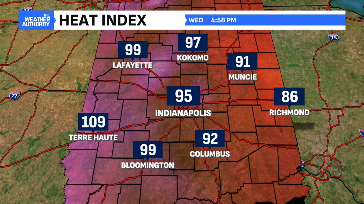
The mild air is in the rearview window as humidity surges through the state Wednesday afternoon. HEAT INDEX has topped 100° in many locations in western Indiana just before 5pm. HOTTEST 112° in Clinton (Vermillion Co.) 109° Terre Haute (Vigo Co) #INwx
It's definitely that time of year. They had a bad stretch in 1934, as reported in this Indiana Times story on July 24th. 112 degrees!
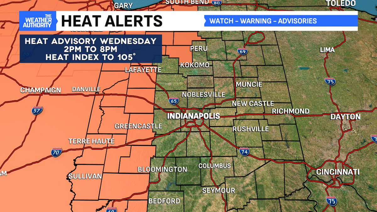
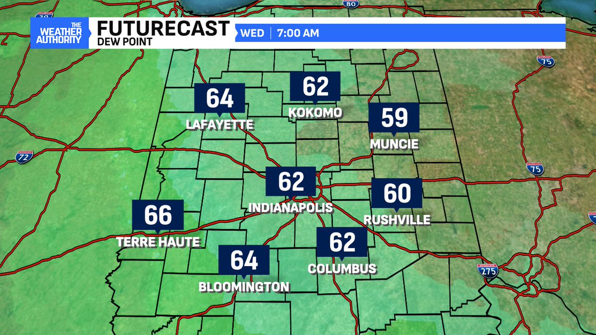
Dew point surges Wednesday afternoon and combined with a surge in temperatures - the HEAT INDEX could top 100° or higher especially in western Indiana. HEAT ADVISORY issued from 2pm to 8pm Wednesday #INwx
Dew point surges Wednesday afternoon and combined with a surge in temperatures - the HEAT INDEX could top 100° or higher especially in western Indiana. HEAT ADVISORY issued from 2pm to 8pm Wednesday #INwx
Tonight will be the COOLEST night in #Indianapolis in over two weeks. This will also be the coolest night for perhaps the next two weeks. Humidity will remain low enough to afford some locations again dip below 60° early Wednesday morning #INwx
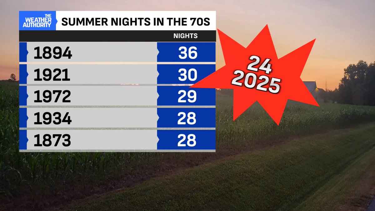
This summer has produced an abundance of WARM nighttime LOWS in years. 24 nights since June 1st have been 70° or warmer. That's the most since summer 2012 and ranks 8th all-time.
Only two nights in the past two weeks have dipped below 70° in #Indianapolis. The dive in humidity allowed outlying locations east for lower below 60°! Coolest 59° Richmond and New Castle #INwx

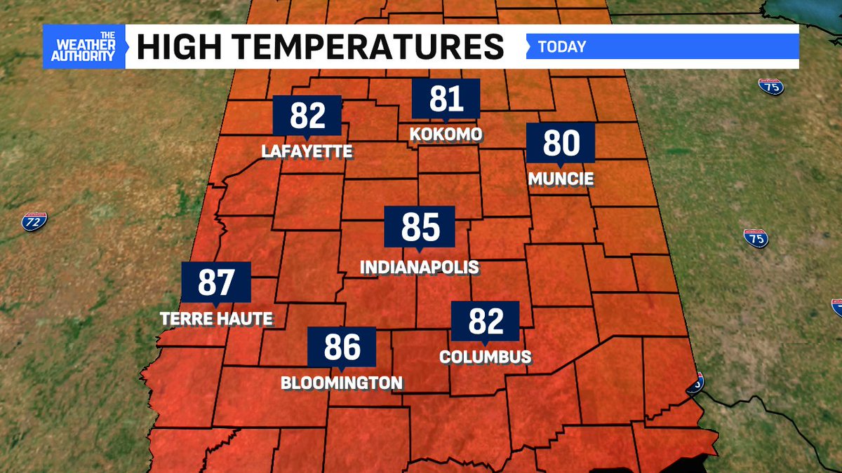
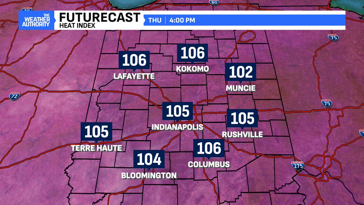
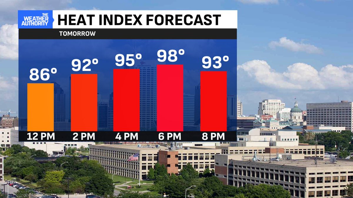
Take advantage of the brief break as the heat will return again this week. Temperatures and humidity will surge again starting Wed. The heat index by Thu afternoon could reach 100° along with the hottest high temp of the season #INwx
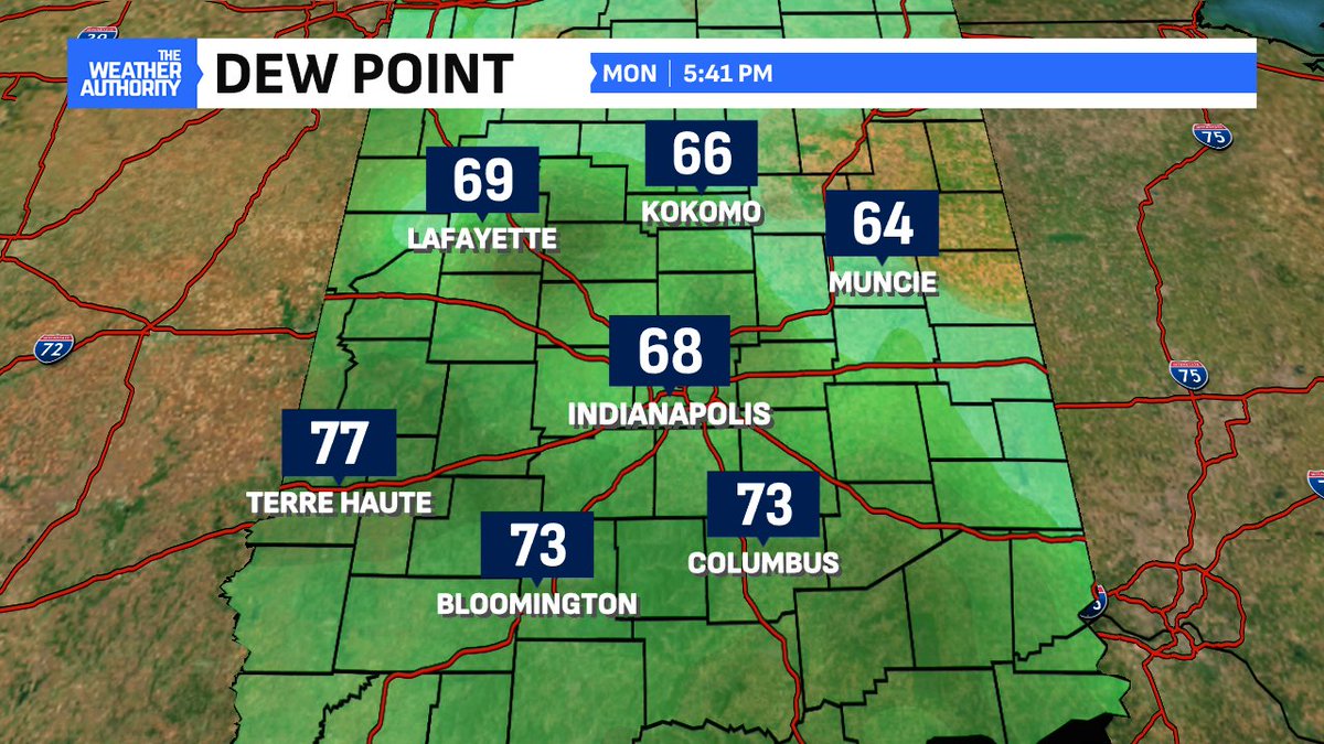
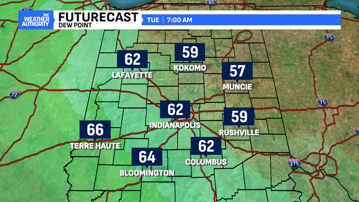
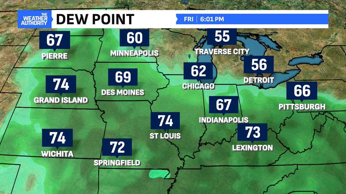
We had not had a day without a 70° (or higher) dew point in two weeks! The humidity has been uninterrupted until now. Drier air arrives overnight on NE winds driving dewpoints down to their lowest levels since July 8th #INwx
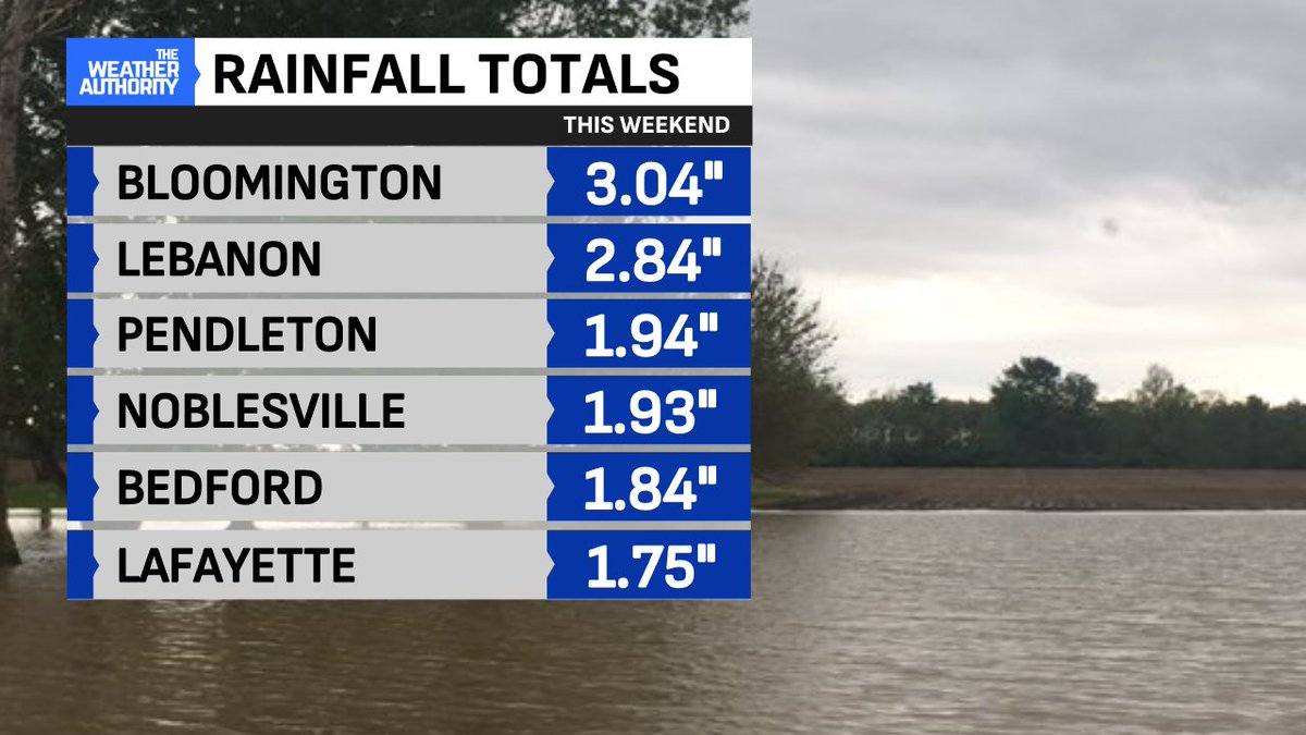
Bypassed again? #Indianapolis had a mere .24" of rainfall officially this weekend while tropical downpours roamed all weekend long. Top totals include over 3" south end of Bloomington, 2.84" Lebanon, 1.04" Pendleton #INwx

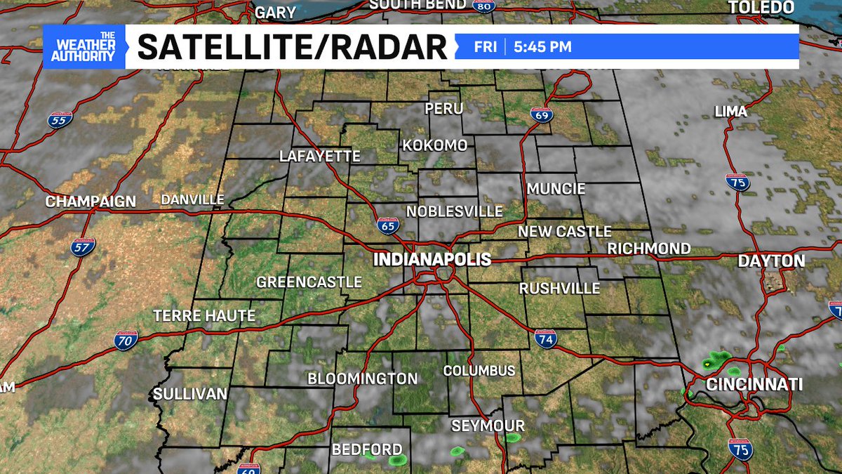
WEATHER ALERT: Severe Thunderstorm Warning for Monroe County in IN until 9:30pm EDT. @Fox59 #INWX
WEATHER ALERT: Severe Thunderstorm Watch for Bartholomew, Brown, and Monroe County in IN until 1:00am EDT. @Fox59 #INWX
WEATHER ALERT: Severe Thunderstorm Warning for Tippecanoe County in IN until 10:30am EDT. @Fox59 #INWX
WEATHER ALERT: Flood Watch for Tippecanoe County in IN until 8:00pm EDT Monday. @Fox59 #INWX
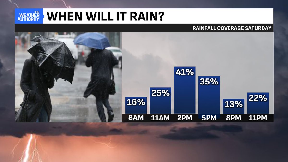
Most likely time to get under a downpour or storm is 2pm thru 5pm Saturday. Peak coverage rises to 40% during peak heating hours of the day. SUNDAY is the better of the two days this weekend - with spotty storm chances mainly late day #INwx
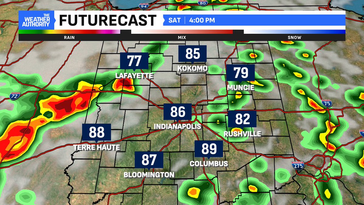
Front is further south late day but migrates north overnight. Renewed downpours could arrive as early as sunrise. Humidity will remains high overnight. More organized rain chance will return Saturday afternoon. #INwx

First afternoon in a long while that is rain-free area wide. Coincides with the COOLEST afternoon in nearly two weeks. Only two days this July have been under 87° - today and July 7th (81°) #INwx