
Disasters Charter
@DisastersChart
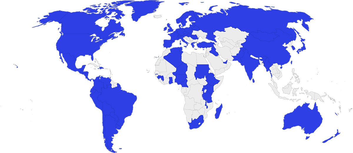
Satellite data to support disaster response worldwide
The Charter has been activated to provide satellite data following Tropical Cyclone #Wipha. We have been activated for the storm's impact to: - Laos 🇱🇦: bit.ly/4f9B1FQ - Vietnam 🇻🇳: bit.ly/4m8Nv2w - The Philippines 🇵🇭: bit.ly/45iEDlm
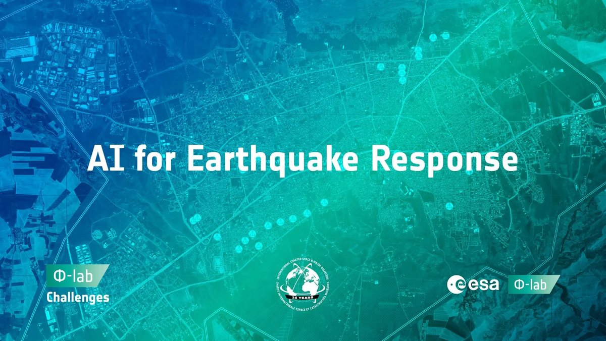
The AI for Earthquake Response challenge is now open: bit.ly/4lEuLZ4 The challenge is open until 29 September, so please join us in developing innovative methods for disaster response.

We are working with ESA's Φ-lab on a new challenge to generate machine learning models that can rapidly identify post-earthquake damage in Earth observation data: ai4eo.eu/portfolio/ai-f… Join us in developing new innovations with the AI for Earthquake Response challenge.
🚨 Tracking 2024 #Hurricanes: @UNOSAT's Emergency Mapping Team in Action: When Hurricane Beryl hit the Caribbean, our experts quickly activated the Space Charter, delivering 8 products with crucial satellite data to guide swift response. ➡️unosat.org/products
🚨In 2024, our Emergency Mapping team responded to 65 natural disaster-related activations, delivering 450+ geospatial products for crisis response. One activation, requested by @UNmigration, followed a storm surge in the Republic of the Marshall Islands. unosat.org/products
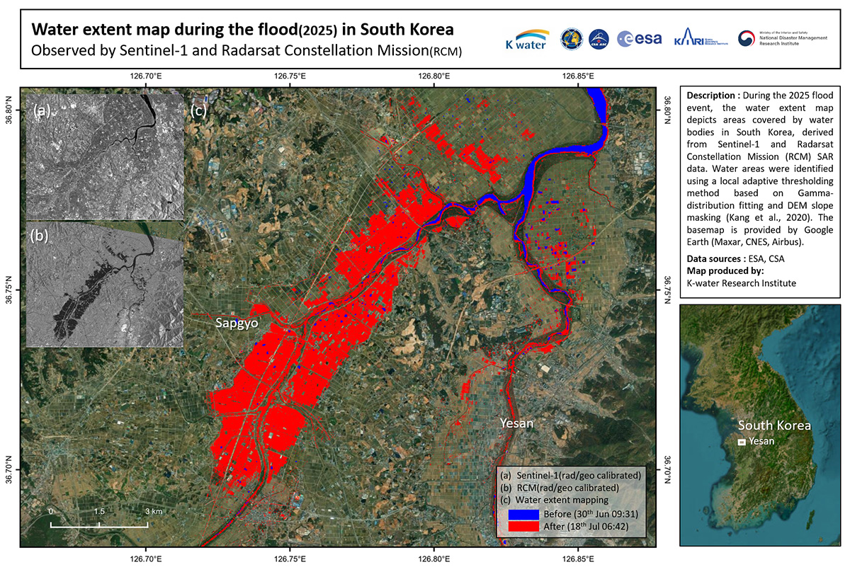
The Charter has been activated to provide satellite data over the flood in South Korea: bit.ly/3IFK9Wj Our first map uses radar data from the #RCMSatellites and #Sentinel1 to estimate the extent of flooding at Yesan and Sapgyo.
The Charter has been activated to provide satellite data over the 6.3 magnitude earthquake in Colombia: bit.ly/3FQRXUj
Our latest 25th anniversary article is available. In this article we share stories from end users who have benefited from Charter data during disasters: bit.ly/4mJYmkS

The Charter has been activated to provide satellite data over a flood in Kazakhstan: bit.ly/4j80qAS
The Charter has been activated to provide satellite data over the forest fire in Kazakhstan: bit.ly/4lm8y29
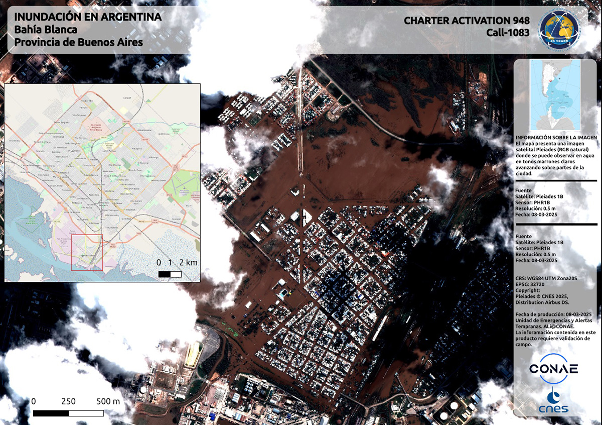
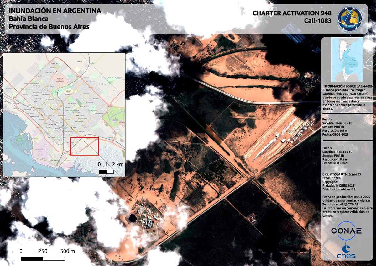
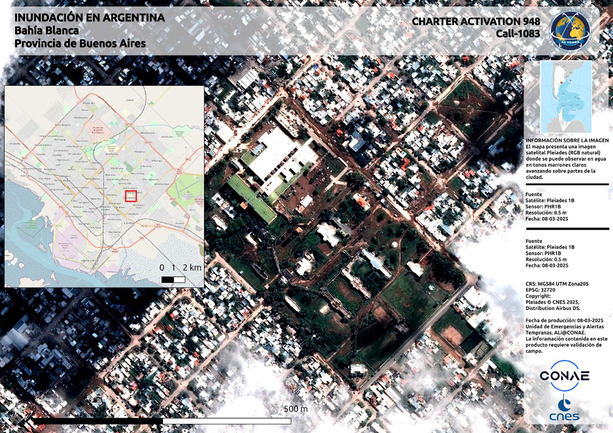
The Charter has been activated to provide satellite data over a flood in Argentina: bit.ly/4iera22 Our first maps of the disaster look at areas affected by the flood at Bahía Blanca.

The Charter has been activated to provide satellite data over a fire at Al-Asabi’a in Libya: bit.ly/4iHsev1
The Charter has been activated to provide satellite data over a flood in Peru: bit.ly/3FuFi8M
🌪️Tracking 2024 Disaster Response: In the face of Cyclone Remal, @UNOSAT activated Flood AI & delivered 23 crucial analyses to support #Bangladesh’s #flood response. 🔹 Flood Extent: 43,000 km² 🔹 Affected Population: 34M 🔹 Buildings at Risk: 180K ➡️unosat.org/products
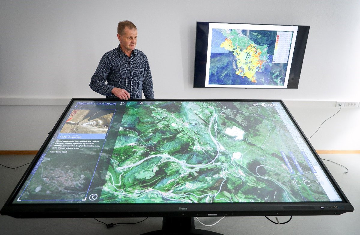
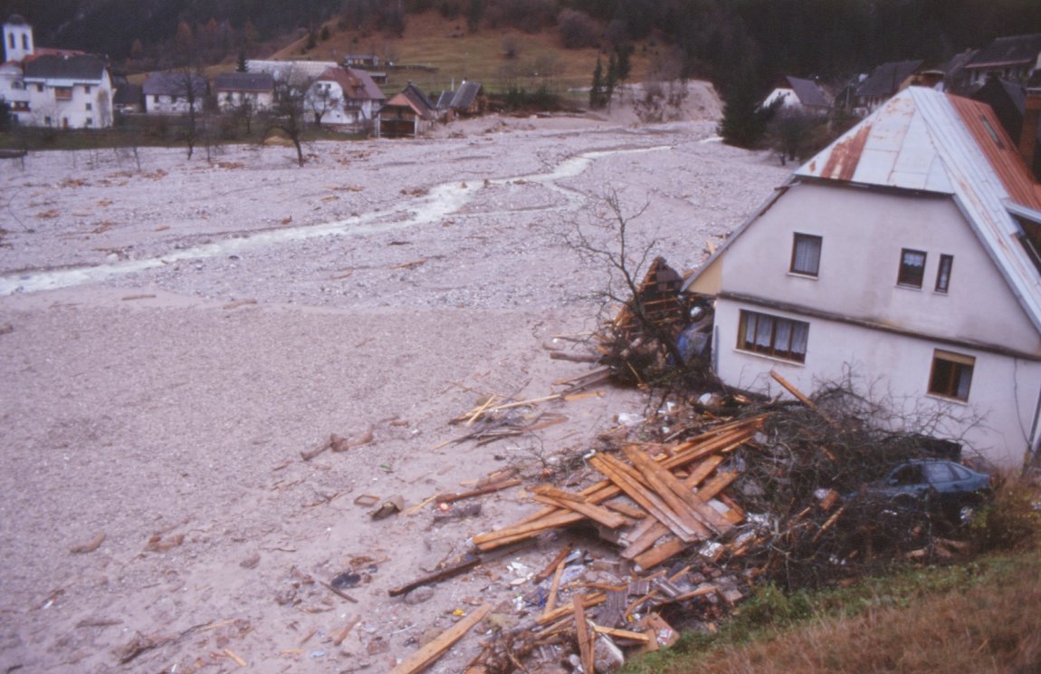
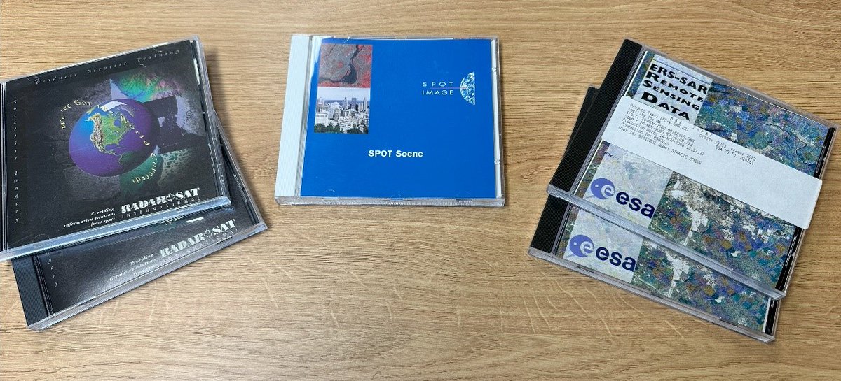
In case you missed it, we published an interview in our first 25th anniversary article with the Project Manager of the Charter's very first activation in 2000: bit.ly/3EAMr7a The interview provides insight into how the Charter has evolved since those early days.
Read our latest article on the 25th anniversary of the Charter: bit.ly/4hTvJ1I In this article we look at the starting point for an activation, when Authorized Users submit a request for help from the Charter.

Take a trip back to the beginning in our first 25th anniversary article, looking back on how the Charter was formed and how it has evolved over the past 25 years: bit.ly/3EAMr7a
We will publish monthly articles with stories about the Charter, we recently released a new version of our website, and exhibitions and presentations about the Charter will take place at conferences such as the Living Planet Symposium #LPS25 and Paris Air Show #PAS25
2025 marks the 25th anniversary of the Charter. Join us as we take the opportunity throughout the year to commemorate this milestone achievement of supporting disaster monitoring for a quarter of a century.
The Charter has been activated to provide satellite data over #StormEowyn's expected impact to the United Kingdom: bit.ly/3C9WHTf The storm is particularly expected to affect Scotland tomorrow.