Meteorologist Jack Drake
@Danbury_WX
Danbury Weather Guy. Local meteorologist. Will randomly start talking about clouds. WCSU 👨🏻🎓 - Entegris 👨🏼🔬. Why is the Exit 8 traffic so bad?
AURORA ongoing now - as seen through the phone in Litchfield County. Faint Northern Lights will likely come and go through the night. 📷 Scott Whalen

Embedded supercell transitioning into the shoreline shelf cloud. Rotation aloft is great to see in a timelapse! Vernon, CT is evening #ctwx @ryanhanrahan @RachelFrank_CT @Danbury_WX @MikeSliferWX @Eweather13 @DHTheWeatherNut
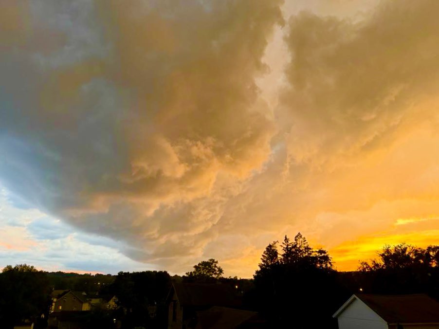
Some pretty epic shots from the sunset storms across Greater Danbury.


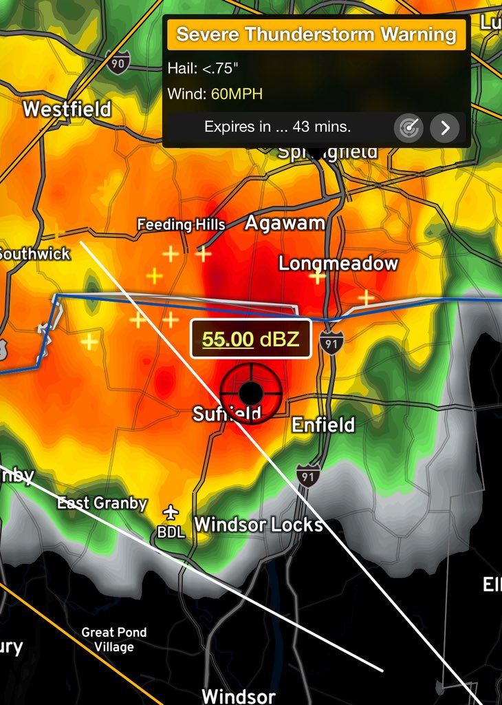
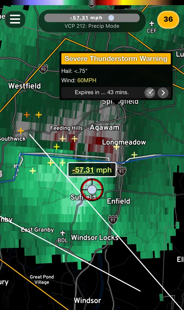
Big storms headed into Northern CT. Heads up Enfield points ESE.
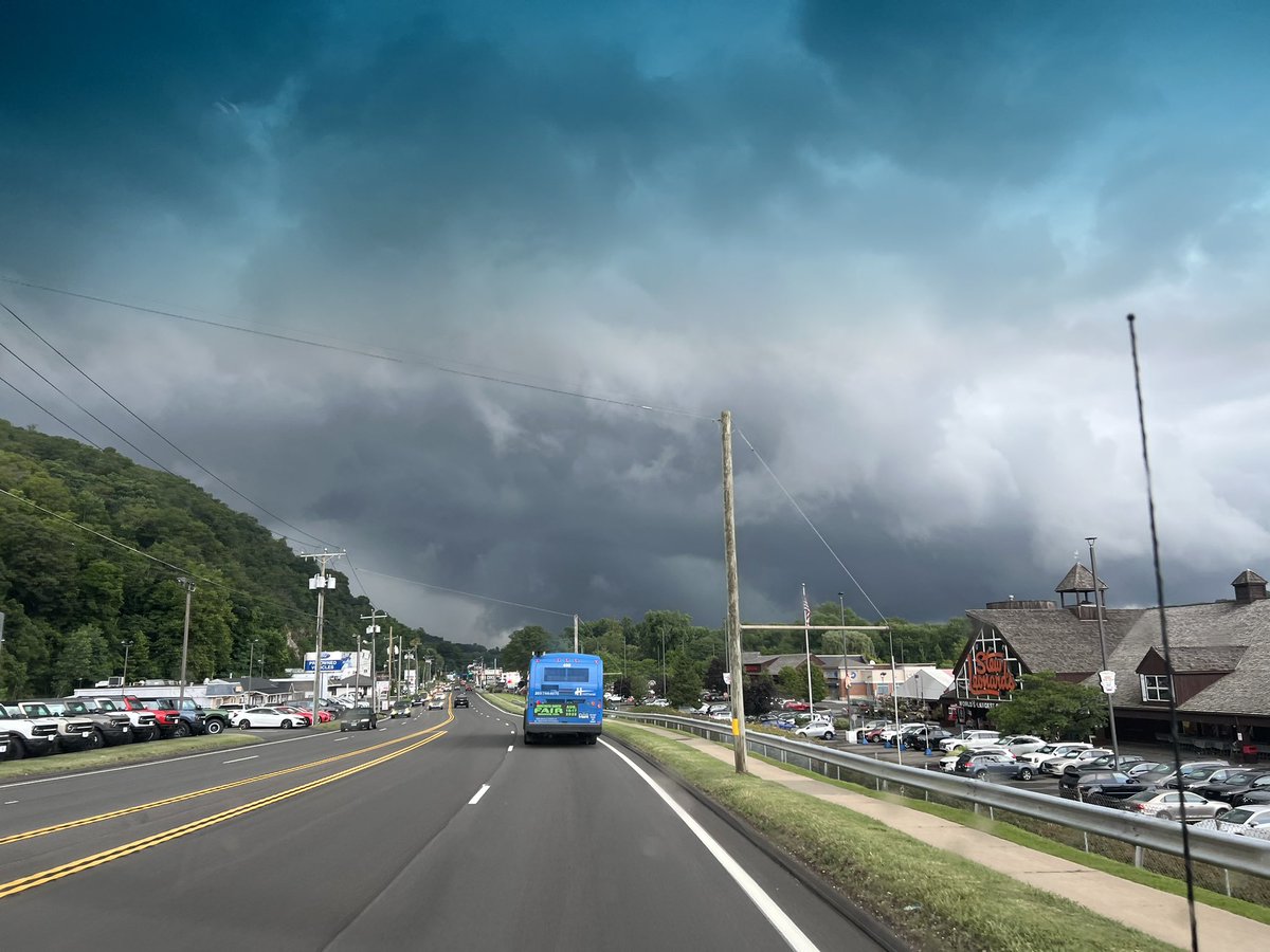
Cold front is coming through dry tonight… just some cool clouds as seen from Danbury. You should notice a drop in humidity tonight and temperatures tomorrow! 📸 Ashley Thibodeau


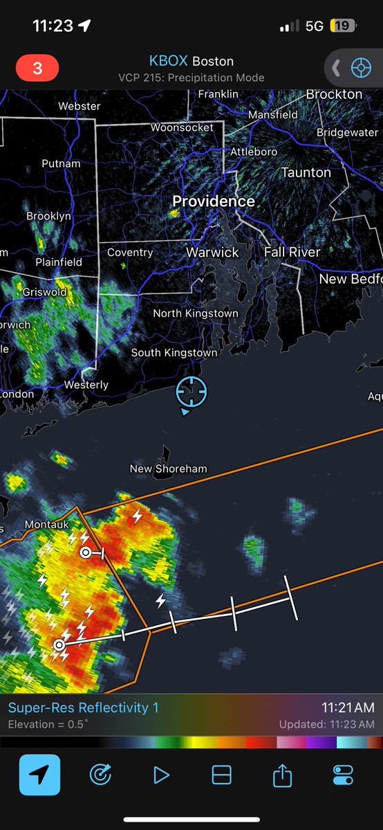
I’ve escaped to Narragansett for a few days. Had to try to get a glimpse of this strong storm offshore though. 😂

PTWC: "A tsunami has been confirmed and some impacts are expected" after 7.3 earthquake near Alaska
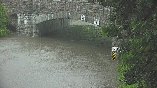
If you’re attempting to head into NYC tonight “Fuhgeddaboudit” there is serious flooding on Bronx River Parkway and 287 - many main routes in are closed.

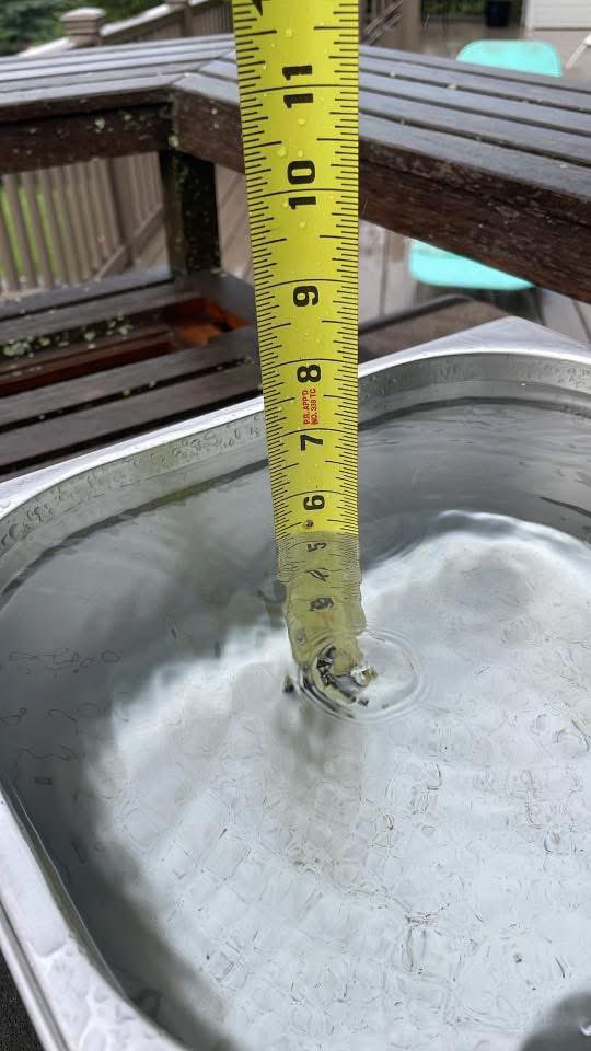
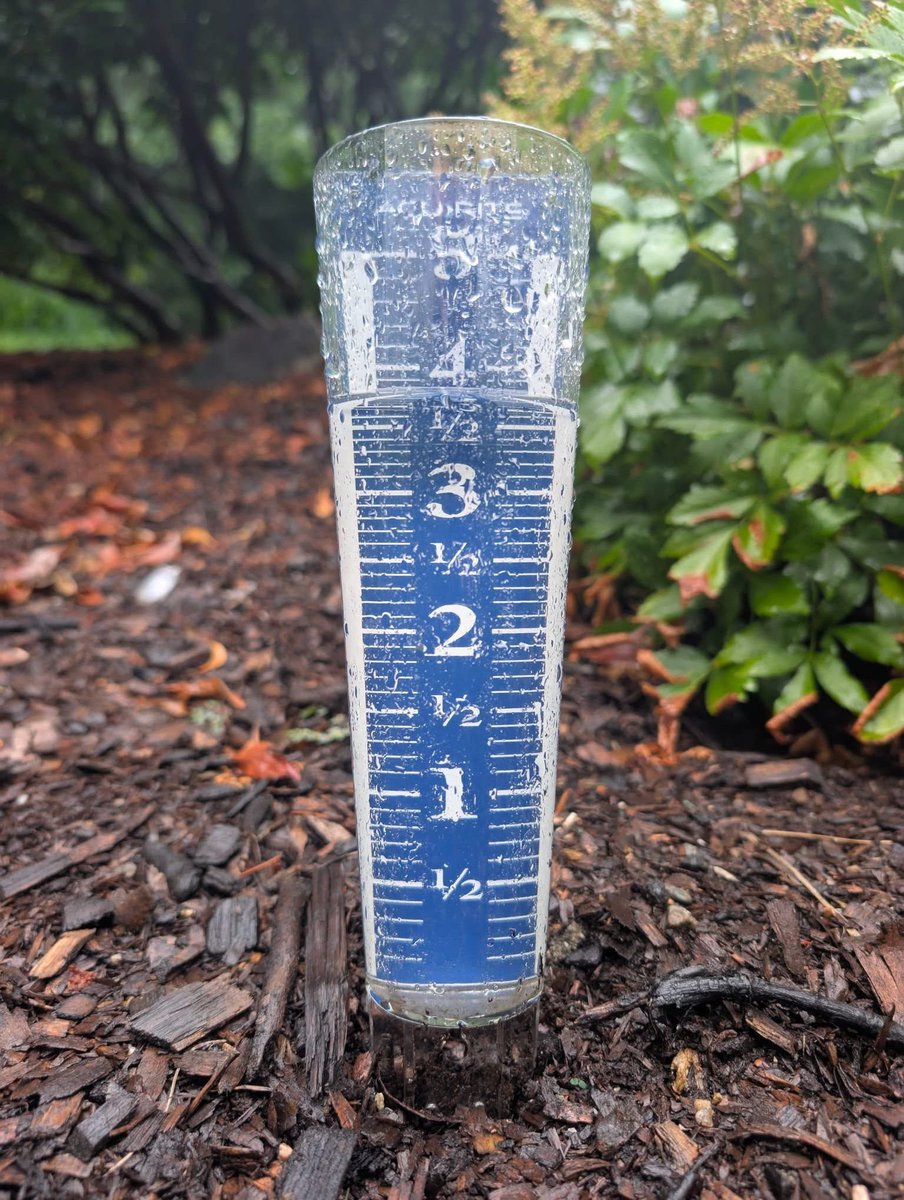
Looks at these rainfall totals from today! Left is from Brian Coyman in New Fairfield and right is from Mike Switser in Newtown!
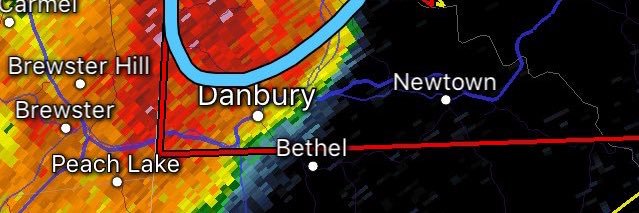
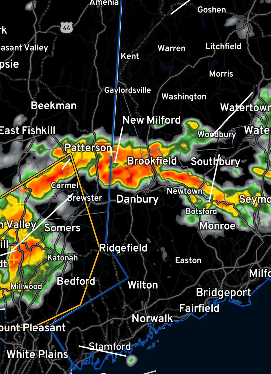
We’ve got issues in Northern Fairfield County right now torrential rainfall is being reported with these storms! FLASH FLOOD WARNING in effect.
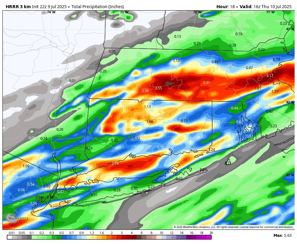
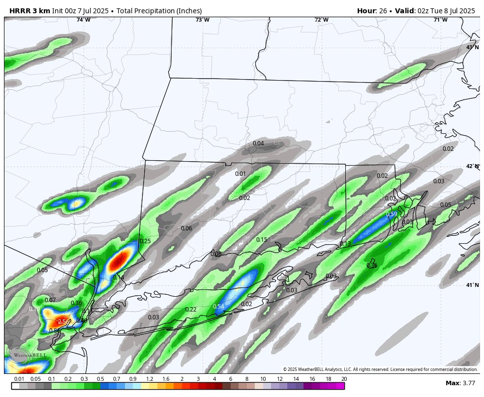
Maps are a little bit hard to follow but basically we get scattered downpours over the next 24 hours. Localized areas could see heavy rain.

Weird day today - it was very tropical with partly sunny skies but a few notable downpours. Actually ended up with 0.33” here in Stony Hill. We look for more showers and storms late tomorrow afternoon and evening. A few of the storms could be severe. Stay tuned for updates.

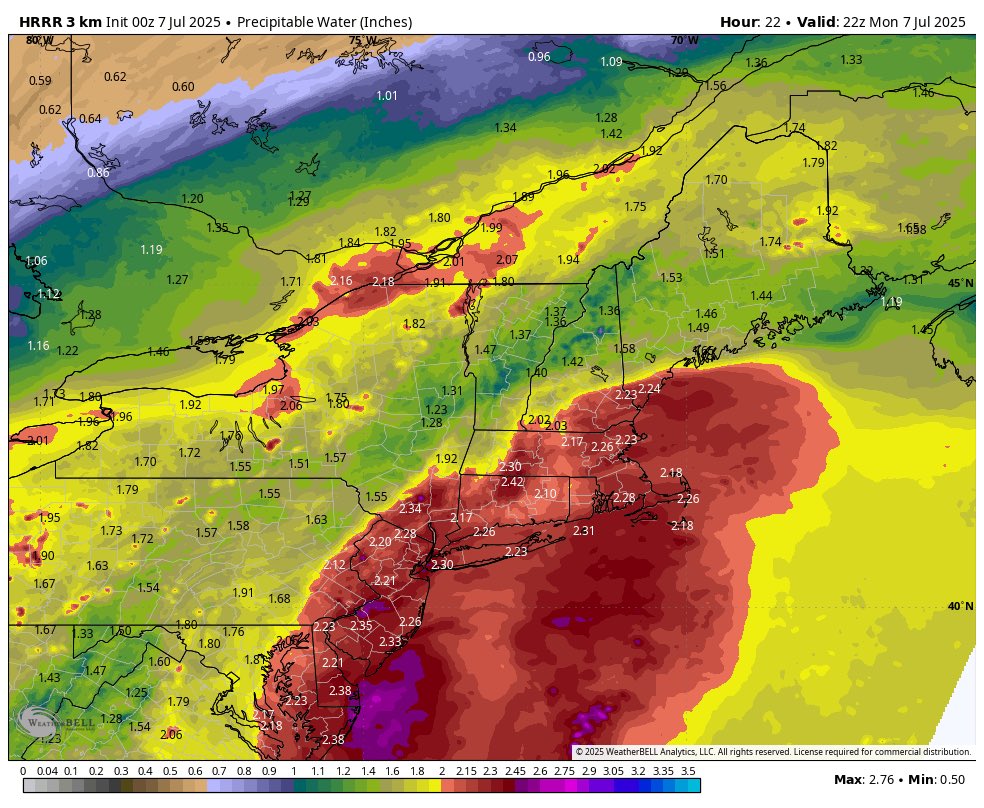
There will be scattered showers and downpours around tomorrow morning through much of the day. These will be enhanced a bit from an uptick in moisture from Tropical Depression #Chantal. This can be seen on the bottom right with the red “moisture blob”. Timing 8AM to 4PM.
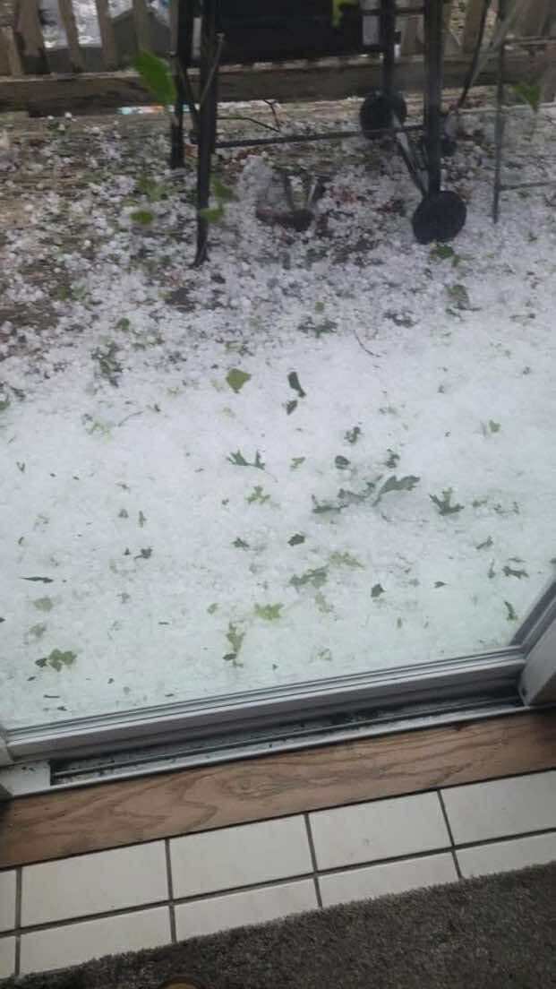
It’s July 3rd and cars slid off the road due to “icing” conditions in NE CT. This was hail accumulation on the roads! 📸 Alicen Groh


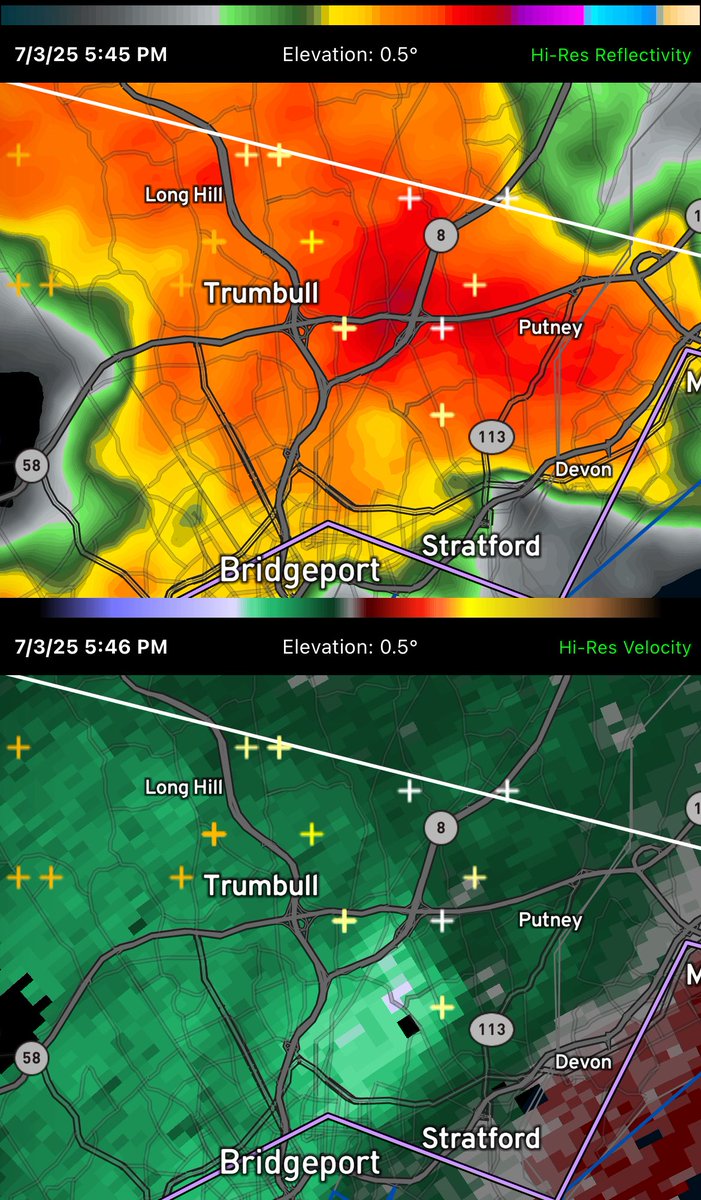
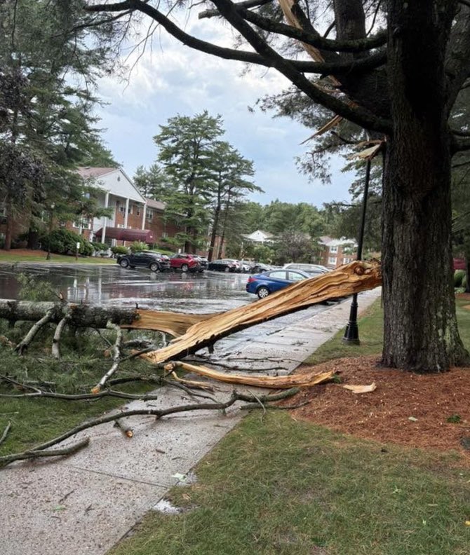
The path from Trumbull to Milford got hit hard by a microburst. Lots of tree damage reported.

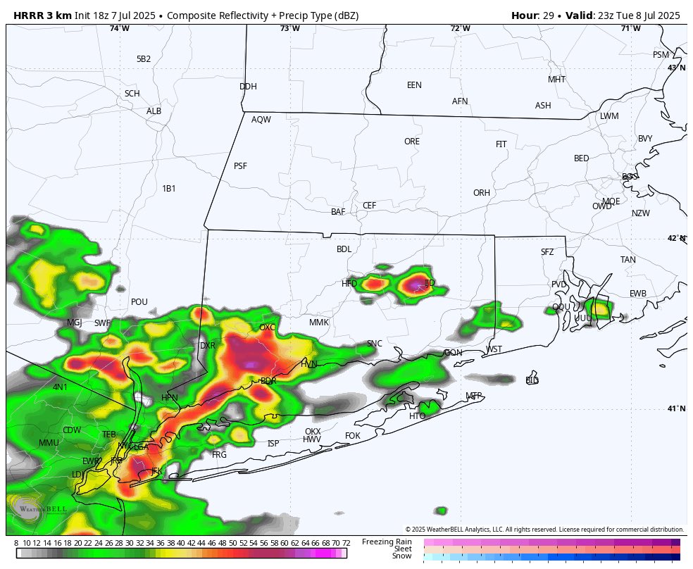
The most impressive storm of the summer season just passed Norfolk, complete with hail. @NWSAlbany no reports of power outages yet or any damage.