Bunting Labs 🗺
@BuntingLabs
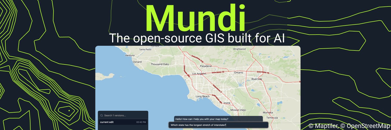
we build AI for gis. try Mundi, our open-source GIS built for AI we also trained the AI Vectorizer, AI Georeferencer, and made Kue, an LLM for QGIS
🗺️ Our AI #GIS assistant Kue can now handle multi-step reasoning! You can ask it to do two geoprocessing steps and it will break it down and run them sequentially. If you want to try it out go to the QGIS manage and install plugins window and search for Kue!
We’re launching Mundi, the first open-source web GIS built for AI. After years of training geospatial AI models, we decided now is the moment to build the GIS software of the next decade. After the AI Vectorizer, Georeferencer, and Kue (our LLM agent inside QGIS), we realized…
OpenAI's latest model, GPT-4.1, is now live in #QGIS through the Kue plugin with all new chats! Every time a new model is released we evaluate it internally, and 4.1 was so strong we decided to upgrade all users for better performance
The @BuntingLabs QGIS vectorizer great, you click a few points along your raster line and it finishes it for you. This would’ve saved me years in grad school, digitizing is no fun
Along with some major updates to Kue (coming soon 👀), we've been building a major update to our AI aerial/satellite imagery georeferencer! Check it out here, we'll be making it publicly available very soon
Met Kue kan je nu ook prompts geven in het Nederlands! #QGIS #GeoAI👇🏼
To make Kue—our AI GIS assistant—more user friendly we've translated it into 21 new languages! Now, Kue uses your QGIS' preferences to determine which language to work with you in. If you want to try it out, download the Kue plugin in #QGIS 🗺️
To make Kue—our AI GIS assistant—more user friendly we've translated it into 21 new languages! Now, Kue uses your QGIS' preferences to determine which language to work with you in. If you want to try it out, download the Kue plugin in #QGIS 🗺️
In QGIS it's hard to get geoprocessing right the first time, if it's even possible to do it in just one step. Now, Kue can learn from its own mistakes and plan multiple steps ahead. This makes questions that need multiple difficult geoprocessing algorithms possible to be…
New Video: Exploring the Kue plugin: an #AI Chatbot for #QGIS by @BuntingLabs 🌍✨ Simplify geoprocessing tasks with AI. Highlights: installation, base maps, styling, analyses & more. 🔔 Subscribe for more! #QGIS #AI #GeoAI #GIS youtu.be/hQJ1SuyyvT8
You can now add #OpenStreetMap data to your QGIS project with AI! With Kue v 1.7, you can ask for any OSM feature in an area and it will add it as a new vector layer complete with the metedata as attributes In 1.7 you can also ask for SQL and geoprocessing in the same prompt
🗺️ How LLMs will change #GIS: working with GIS will become something easily accessible to anyone who wants to get started Instead of needing to know the specifics of geoprocessing, SQL, and different styling options, you can just explain what you want Kue to do
Can AI complete a college-level Iowa State GIS homework assignment? 🤯 @MichaelEBunting puts Kue, our new QGIS plugin, to the test 👀
Kue was my tool for day 13 of the #30DayMapChallenge. I wanted to visualize which california parks I'd see only one type of bunting in. Kue helped me run geoprocessing and find the right datasets on my computer!
Today we're launching Kue, an AI assistant inside QGIS. Kue can edit your project by styling layers, filtering with SQL, run any geoprocessing algorithm, and search both the internet and your hard drive for datasets:
The AI Georeferencer in QGIS is now publicly available 1. Aerial imagery georeferences to satellite near the QGIS map canvas 2. The full georeferencer reads coordinates, buildings, streets, PLSS, cities, and other features humans use Rotated aerial image support is coming soon
Our AI legal description plotter has three new tools for verifying accuracy! Now, you can see the created geometry, distance to close, the geometry on a web map, and—most importantly—all of the text the AI read and the corresponding survey calls
Digitalizar automáticamente curvas de nivel o ríos y polígonos en QGIS, usando Inteligencia Artificial @BuntingLabs
Our #QGIS AI Land Description digitizer lets you map legal descriptions in under 20 seconds! Just click on your point of beginning, upload your document, and our AI takes care of the rest.
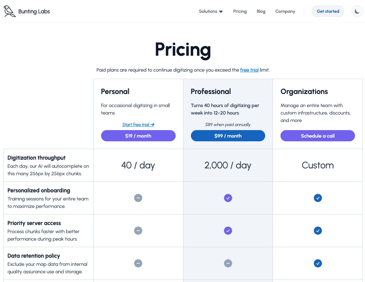
We've created a less expensive Personal tier of 40 chunks per day at $19/month for people who only do occasional digitizing! This is equivalent to about 30 minutes of manual digitization per day. If you have any questions, send us a DM
What if LLMs could digitize your survey boundaries for you? Well, they can, and it's in our next AI vectorizer version 😎