Aaron Sperschneider
@AaronStormchase
B.S. Meteorology🌪️⛈️ Studying the masters in Bonn, Germany 📚🤓 Storm chaser at Sturmjäger NRW: https://www.instagram.com/sturmjaegernrw
That was an amazing chase day on Saturday! Check out the time lapse of the meso dumping downpours right next to it!


INSIDE a tornado southwest of Elstow, Saskatchewan on Sunday! #skstorm
It's a bit strange that the Royal Meteorological Society mistakes a dust devil for a tornado. And the description of a funnel cloud is also unfavorable.

English subtitles are now available! Take a look into the most amazing chase we've ever had in Germany: youtu.be/q1b4AXaw5e8?si…
The new chase video is ready! It was an absolutely amazing day with a beautiful tornado in Bavaria, Germany and a perfect example of @CameronJNixon|s nudger theory (also mentioned the paper in the video). I'll add English subtitles in the next few days: youtu.be/q1b4AXaw5e8?si…

Good things come to those who wait 🤩 #F1 #BritishGP @HulkHulkenberg
Scientists: “climate change is going to cause more deadly natural disasters” People: “stfu, hoax” Natural disaster: *happens* Scientists: “climate change partially contributed to the intensity of this disaster” People: “this is not the time to politicize a tragedy”
[1/X] Immer das gleiche. Der #DWD hat beim #Sturm gar nichts verschlafen, es scheitert nur wie so oft an der richtigen Kommunikation der Lage, v.a. auch durch Presse & Medien. Hier mal ein Auszug aus der synop. Übersicht von gestern früh, in der Berlin sogar direkt erwähnt wird:
Tote und Verletzte und keine Warnung. Die Bundesbehörde DWD (388 Mio. € Etat) verschläft den Sturm in Berlin/Brandenburg – die Warnung kommt erst, als alles vorbei ist. Kommentar des Wetterdiensts: „Mehr konnten wir nicht machen.“
On June 23rd 2016 a rather unassuming day would spawn the second widest #tornado in recorded history while also being the best EF5 contender since the 2013 Moore EF5. #wxhistory #wxtwitter A damage analysis thread 🧵
Just wow! 🌪️😍 Look at the speed of the drone with 250-280 km/h (70-78 m/s, 155-175 mph) matching more or less the rotational velocity of the tornado!
Inside the EF3+ Spiritwood, ND wedge tornado near peak intensity from our research drone!
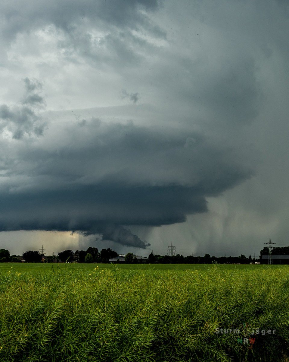
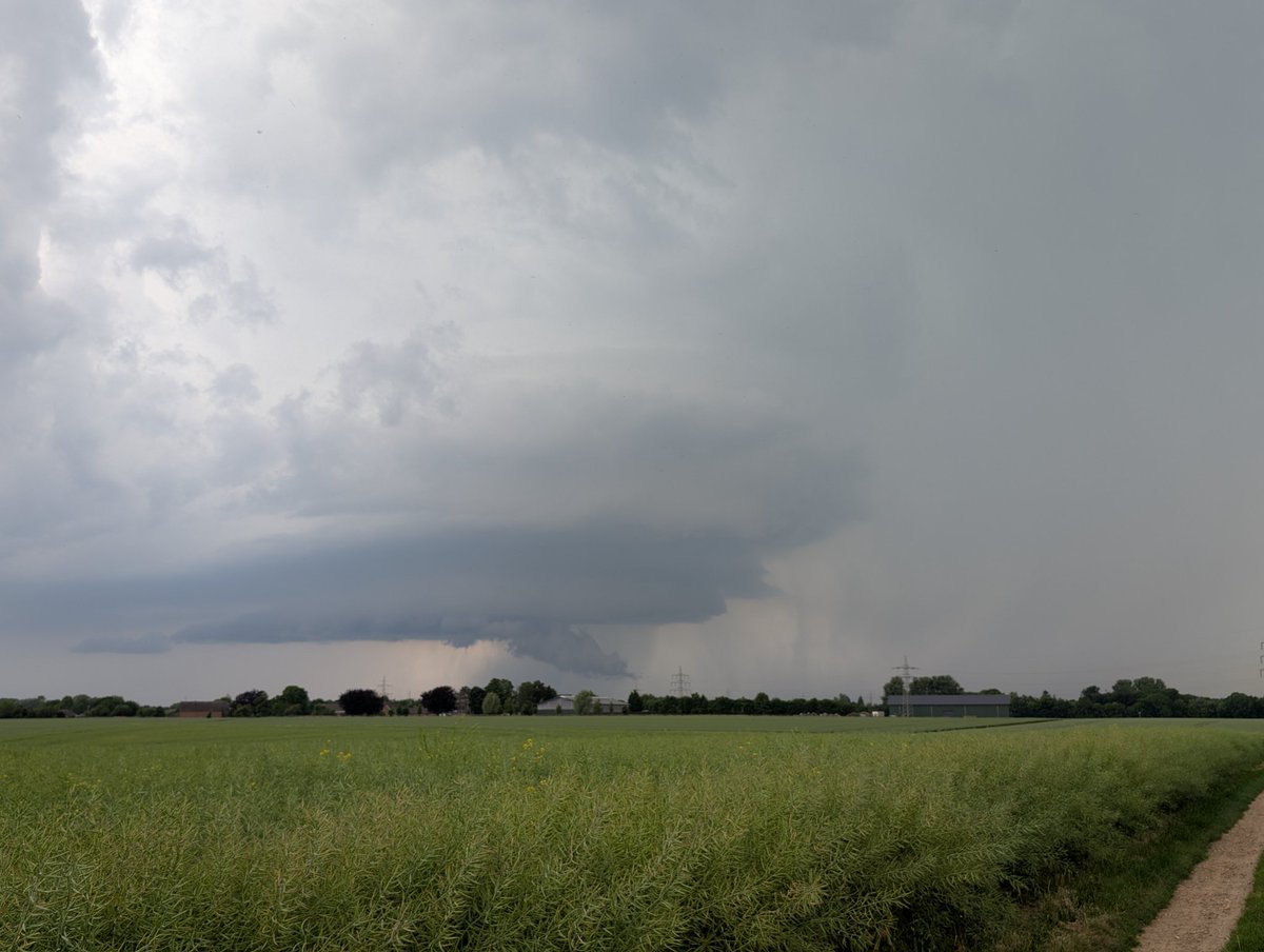
Nice well organized storm SW of Cologne 40 min ago.

Every single cell of my body wants to jump into the car and drive to N France tomorrow - but I can‘t. Models simulate the setup of the year (for this latitude); it’s rare to have 3000 MLCAPE overlap with such sufficient 0-6 km DLS this far north. Destructive storms possible.
Our research drone collected data through tornadogenesis near Morton, TX yesterday, including this subvortex early in its life.
Along the path of the Greenfield EF4 tornado, a narrow corridor of winds exceeding 300 mph was scanned between SE 3rd St and SE Linn St. Shown here is a DOW7 radar scan from that time, along with drone footage from Live Storms Media. Officially, this area was rated high-end EF3.


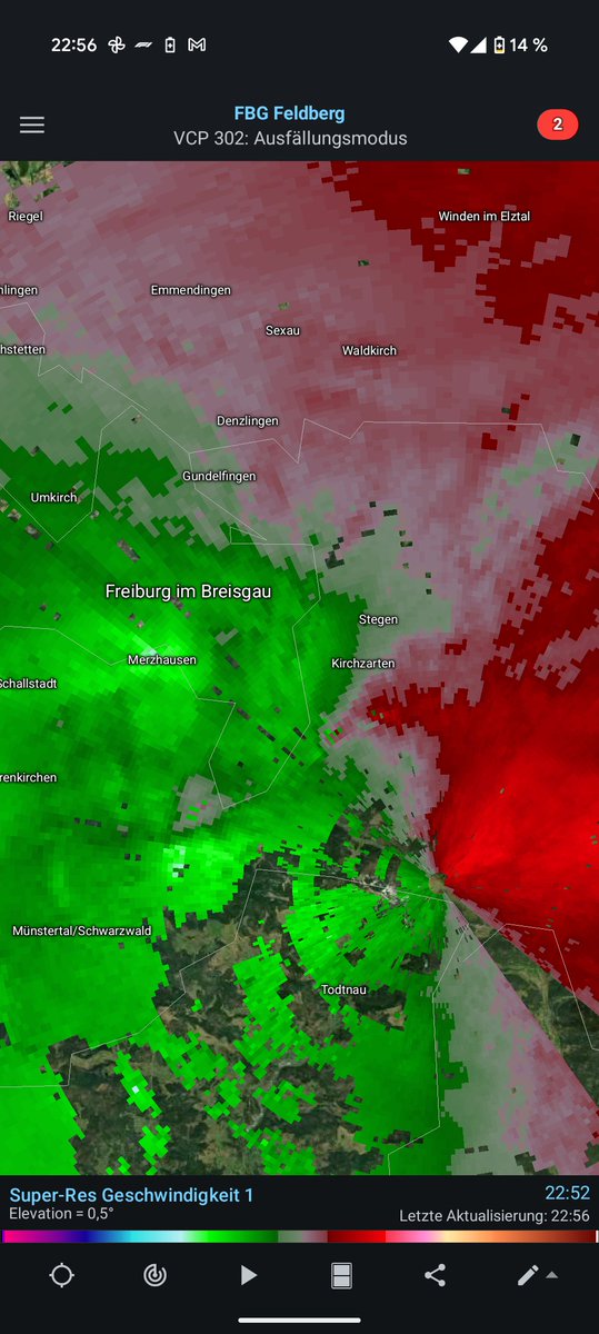
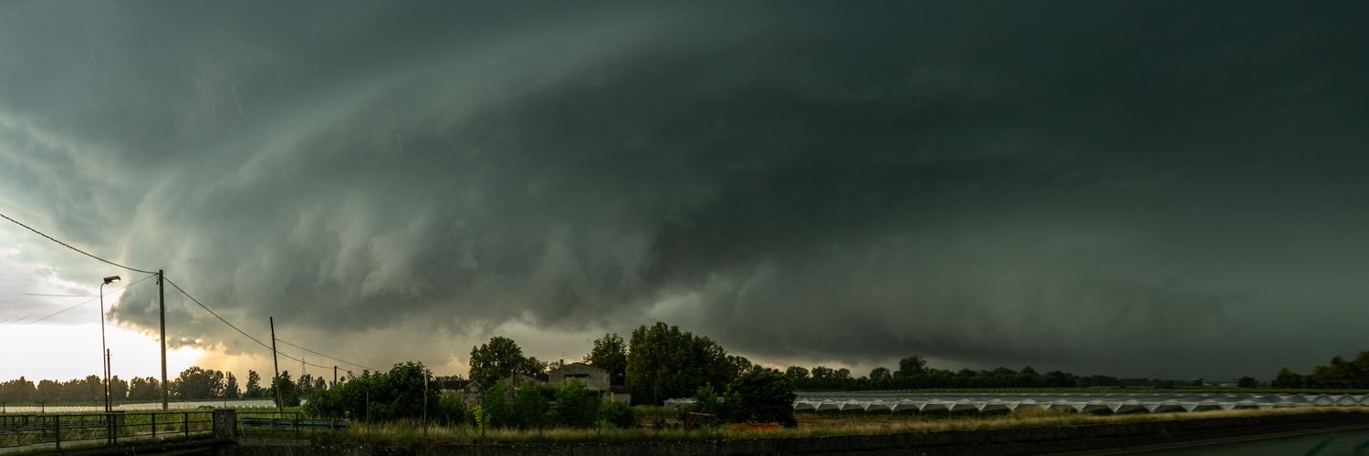
Beautiful mesocyclone near Mönchengladbach right now!

And the next chase today 😃 All images taken west and north of Bonn, Germany. Strong outflow broke large branches off of trees.


