Leo | DEwx
@GerWeather
Tracking and chasing severe weather worldwide with focus on Germany. Also conducting on-site tornado damage surveys for http://torkud.de
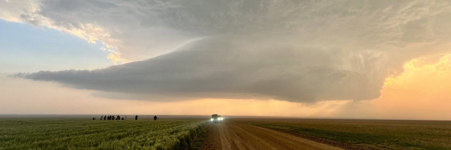
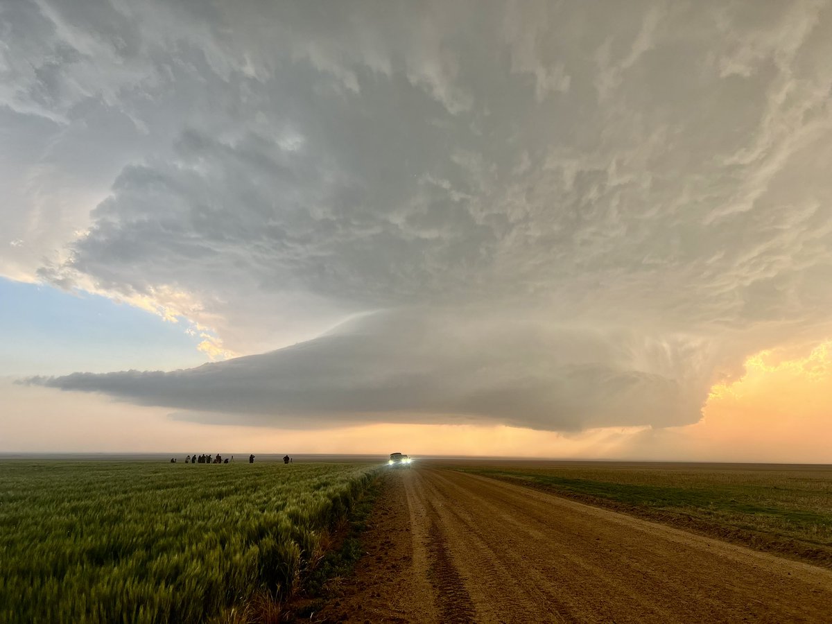
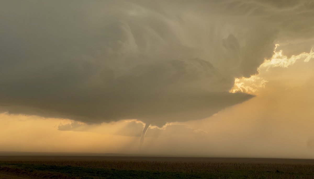
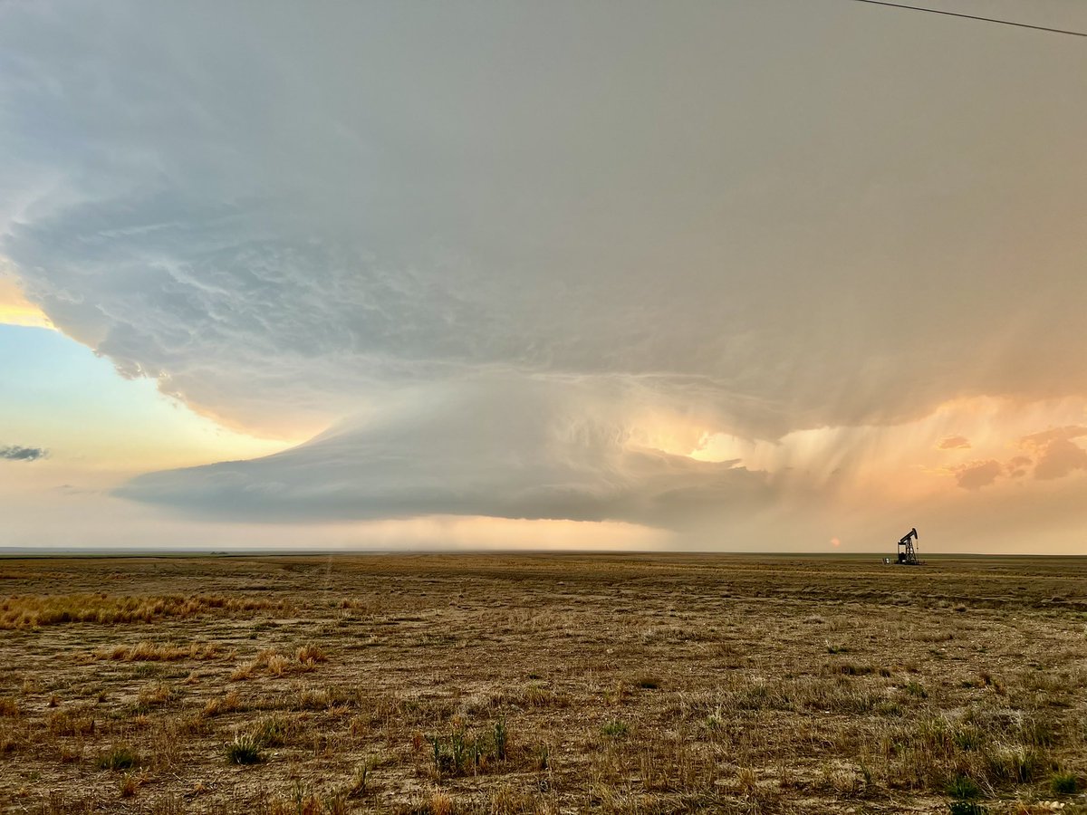
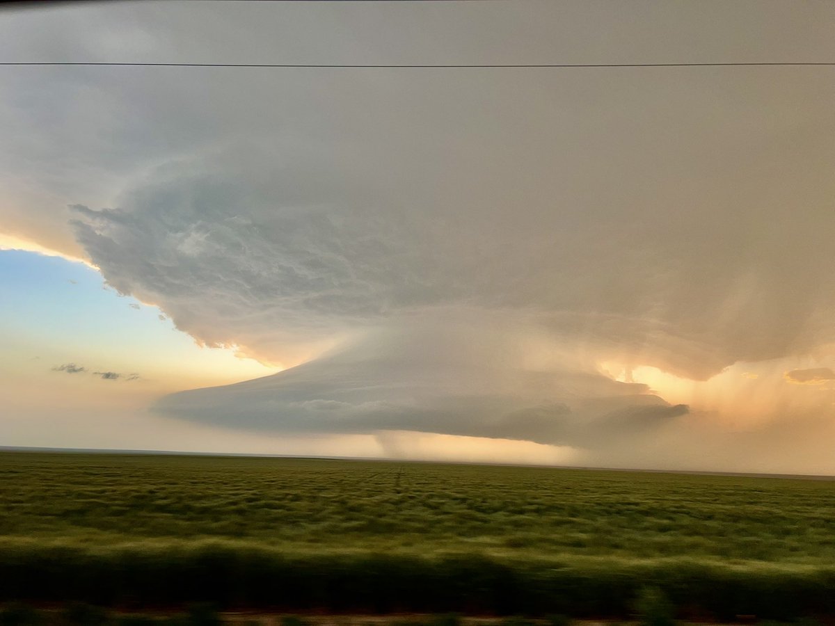
A few snapshots from my phone of the Kit Carson #COwx supercell and its tornado on May 23, 2025. This was my first ever time seeing a tornado. Starting to feel a little nostalgic when looking at these photos
Education is so important
This morning, I took a Pic of a cloud I have only seen in other posts. This was not normal. It was a flat-head mushroom cloud. Again, definitely not normal.
Violent orage sur la #RN7 dans l’Allier à hauteur de Langy. @Meteovilles
Something I‘ve noticed in the weather community is that many say they were scared of thunderstorms as children. This fear eventually turned into fascination. But I need some actual data on this, so; were you scared of thunderstorms as a kid? #wxtwitter
SOTY in China today, near Xi Ujimqin Banner, Inner Mongolia.
Neuer Outlook: 2% Risiko am Montag, 14-07-2025 Weitere Informationen: torkud.de/outlooks/
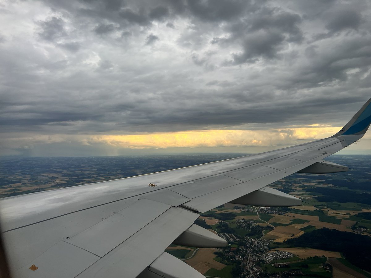
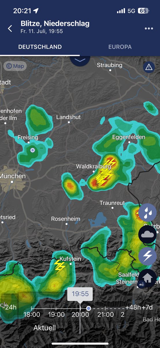
Blick auf die Gewitter bei Waldkraiburg vorhin während dem Anflug auf München.
Does anyone have any contacts in the Hill Country that need supplies? All of the churches have full voicemail boxes and now I have 14 gallons of hand sanitizer and 13 tarps that I was planning to run down there tomorrow
I really wonder what people in the middle ages thought when some of them stumbled upon a violent tornadic scar like this just by chance. Like that must have happened at least a few times.. #wxtwitter
Drone footage reveals the scale of destruction in rural Kentucky after a deadly tornado in May flattened thousands of trees and claimed 19 lives.
Just. Wow. As we went over Mexico and the U.S. this morning, I caught this sprite. Sprites are TLEs or Transient Luminous Events, that happen above the clouds and are triggered by intense electrical activity in the thunderstorms below. We have a great view above the clouds, so…
The most severe heatwave of the summer is peaking next week, with temperatures approaching 40°C (104°F) in W Germany. Honestly, with the current weather pattern and SST anomalies in the MedSea, I could imagine a run at the German all time record over the course of this summer.
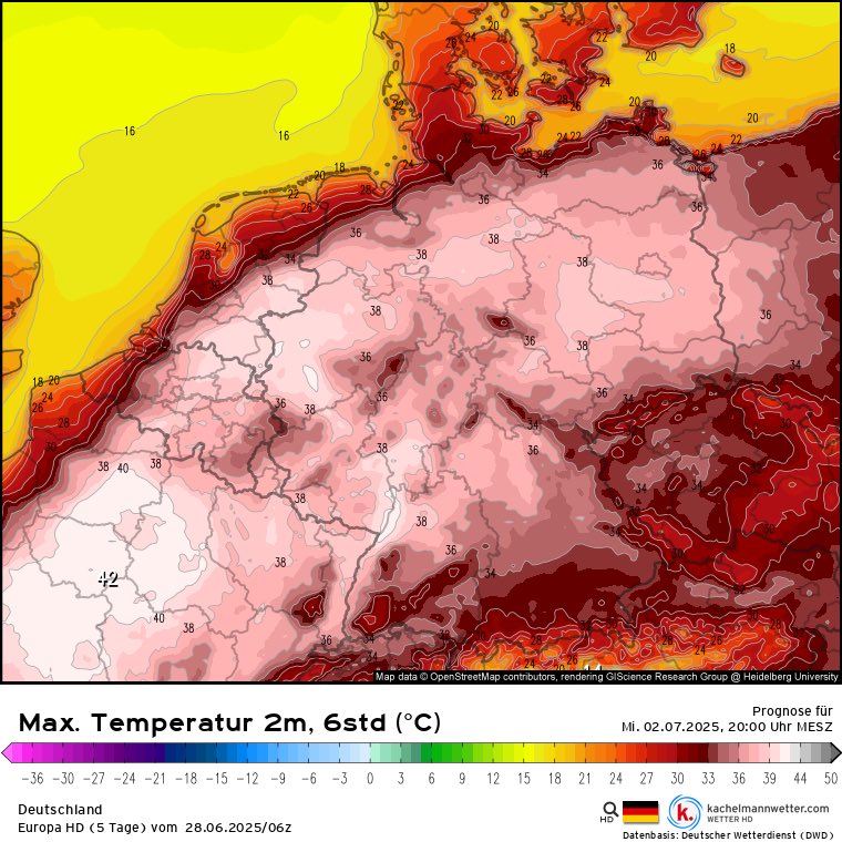
40 Grad werden immer nördlicher in Europa immer häufiger. Hier nächsten Mittwoch. Die nächsten Jahre wird auch irgendwann ein Heat Dome mit vielen Tagen 40+ kommen. Davon muss man wohl ausgehen. Und Deutschland hat keine klimatisierten Pflegeheime und Krankenhäuser.
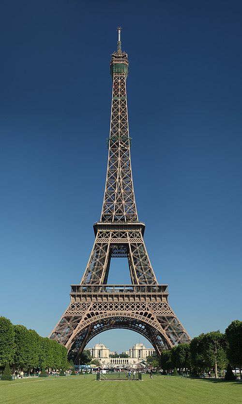
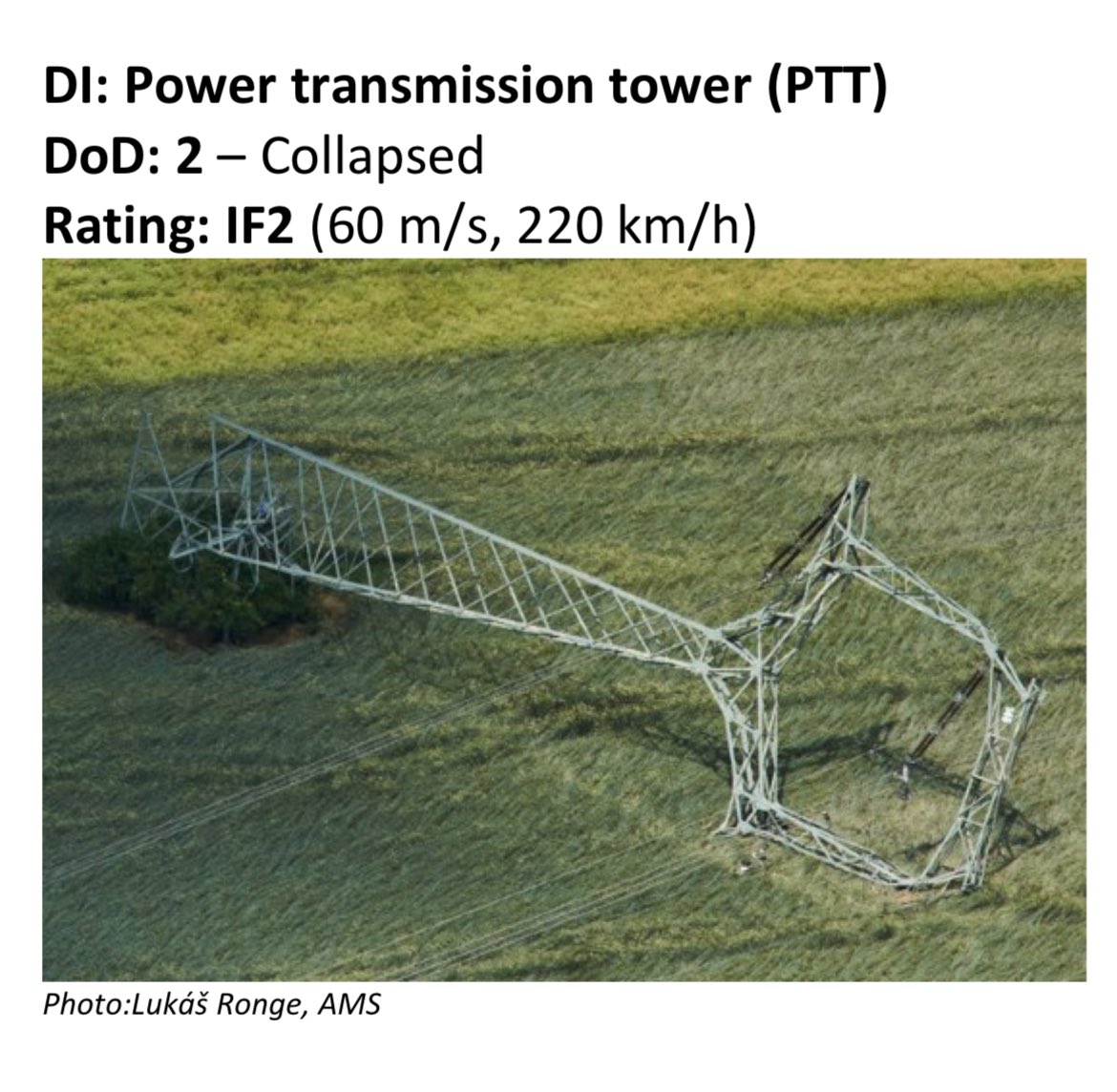
Fun fact: The Eiffel Tower being slabbed by a tornado would only yield an IF2 rating.
A very strong supercell is currently approaching the Poznań vicinity. This storm is likely produce large hail and severe wind gusts. The Poznań radar VWP also suggests that kinematics would support a tornado threat but based on modellign thermos do less so. #EUwx
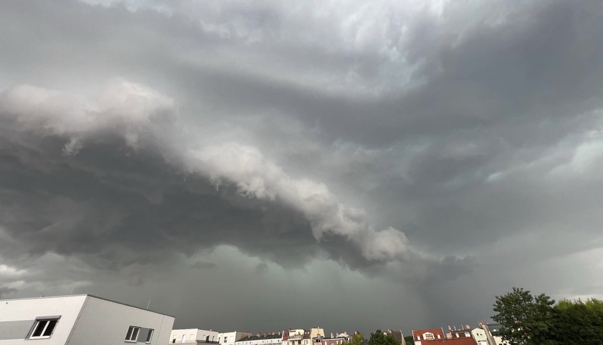
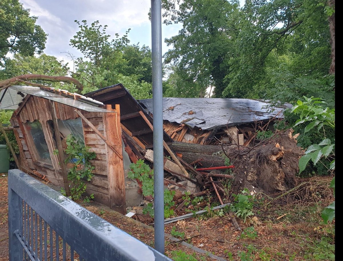
A sight you‘d expect to see over Munich rather than the greater Berlin area; two right-moving supercells and a trailing MCS causing widespread travel disruptions throughout the city. Many reports of fallen trees and other damage. Pictures from the DWD app
Débarquement du #Derecho sur le #PuydeDôme le 25 Juin en début de soirée. Un arcus massif et progressant à une vitesse impressionnante sur le paysage. Merci à la clôture qui a récupéré ma casquette 50 mètres plus loin !
Hier ist ein Video aus Staufenberg in Hessen, aufgenommen von einem Bekannten, welches das Gewitter gegen 13:20 Uhr zeigt. Es kam zu Schäden an der Vegetation. @Kachelmannwettr
So if you will, I was actually hit by the remnants of a derecho around 4:30 this morning lol. It stopped producing severe winds shortly after moving into Germany. Strongest gust occured in Tholey, Saarland at 96 km/h. Here it was just a bit gusty.
Derecho du 25 juin 2025 Plus de 58 rafales convectives > 90 km/h relevées sur près de 700 km ce 25 juin. Le derecho qui a frappé la France a généré des rafales jusqu'à plus de 130 km/h entre Midi-Pyrénées et Lorraine. Bilan de l'épisode : keraunos.org/actualites/fil…
Derecho du 25 juin 2025 Plus de 58 rafales convectives > 90 km/h relevées sur près de 700 km ce 25 juin. Le derecho qui a frappé la France a généré des rafales jusqu'à plus de 130 km/h entre Midi-Pyrénées et Lorraine. Bilan de l'épisode : keraunos.org/actualites/fil…