
Wherobots
@wherobots
The spatial intelligence cloud, by the original creators of @ApacheSedona
Check out the latest article from @BigDataWireNews featuring us and @ApacheSedona! It covers the origins of Sedona, early adopters like @Amazon Last Mile and the @OvertureMaps Foundation, and the challenges that we're helping to solve. bit.ly/3H3rBPp

New integration: Dekart now supports Wherobots as a spatial SQL engine! ⚡ Run fast spatial queries from S3 🗺️ Visualize instantly—no ETL, no GIS lock-in 🔗 Share the results of your geospatial analysis as a live map 👉 Get started here: bit.ly/44SYdmT
📍Learn to work with @Foursquare's continuously updated POI dataset using Wherobots in this new tutorial blog post. Includes complete code examples and visualization techniques. bit.ly/44Uox15
Working with spatial joins, GeoAI on satellite imagery or map matching? Join us for a hands-on session on how to make this process scalable, fast, and cost-efficient. 📈⚡💰 For more details: bit.ly/4kZJUnx

🚨 New Chapter Alert! The latest chapter of Cloud Native Geospatial Analytics with Apache Sedona, published by O'Reilly, explores how to use Sedona with today’s most popular cloud providers. Learn how Sedona fits into your cloud stack: bit.ly/3GaDQJB

Wherobots is thrilled to announce that we have achieved our SOC 2 Type II attestation in accordance with American Institute of Certified Public Accountants (AICPA) standards for SOC for Service Organizations (SSAE 18). Read more here: bit.ly/4nahmck

Open map data just got easier to use. Explore Overture Maps Foundation datasets right in the Wherobots Spatial Catalog, and see how simple it is to build powerful visualizations with them. bit.ly/43R8GA8
👋 We’re ready for Day 2 at the Data+AI Summit! Come say hi to us at booth E407 in the Dev Tools section and talk geospatial with us. Don’t forget our Iceberg meetup is happening tonight with PuppyGraph and CARTO! Details and location: bit.ly/45TdAh7


We’re looking forward to an amazing week at the Data+AI Summit! Come visit us at booth ✨ E407 to learn how Wherobots supports spatial ETL and AI with Databricks. Be sure to ask about our demos on Sedona + Databricks and how Wherobots fits in. bit.ly/3FT94ER

🧊 Join us next week for an Iceberg Meetup in San Francisco! Hear from speakers at PuppyGraph, CARTO, and Wherobots. It’ll be a fun evening of networking, drinks, and light bites. RSVP here: bit.ly/3HmuMkY

We’re excited to be at the upcoming #DataAISummit! Find us at Booth E406 in the Dev Tools and DS section. Join us Wednesday evening for the Iceberg Meetup, and don’t miss our talk on Iceberg Geo on Thursday. For more details: bit.ly/3SYfS6X

It’s easier than ever to work with geospatial data, with Iceberg and Parquet now offering powerful solutions for both geospatial experts and non-spatial professionals. Join this session with industry leaders from Foursquare, Databricks, Planet, and Wherobots as they discuss the…

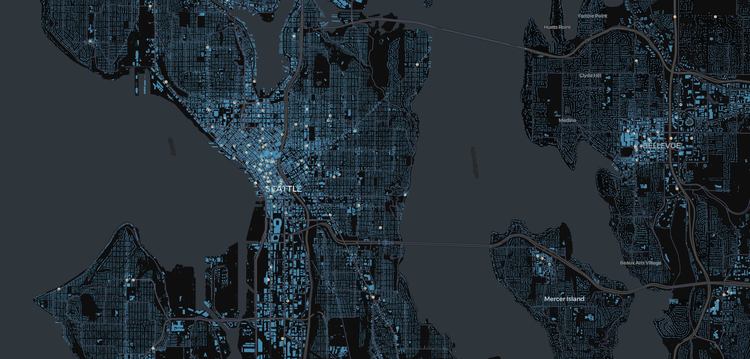
TOMORROW 5/1: Join us for a live session where we'll introduce a new Isochrones Dataset—a powerful, open-source layer that maps reachable areas based on time and transport mode, built on the Overture Maps POI Dataset. We’ll walk through a hands-on example of geospatial weighted…

We're excited to join the cloud-native geospatial community at the CNG Conference! Catch our sessions on Raster Inference, Iceberg GEO, STAC MLM, and more. Find session details and connect with the team here: bit.ly/4jXxn2R

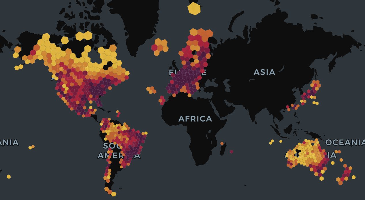
WherobotsAI Raster Inference now supports Meta’s Segment Anything 2 (SAM2) model! You can now perform object detection and feature segmentation at scale on terabytes of satellite imagery—just by describing what you’re looking for in plain text. 🔍 Read more about…

Welcome to the April edition of the Spatial Intelligence Newsletter! This month, we’re covering the benefits of using Apache Iceberg, spatial joins, cloud-native geospatial, and new product updates like isochrones to help you make better location-based decisions. What does it all…
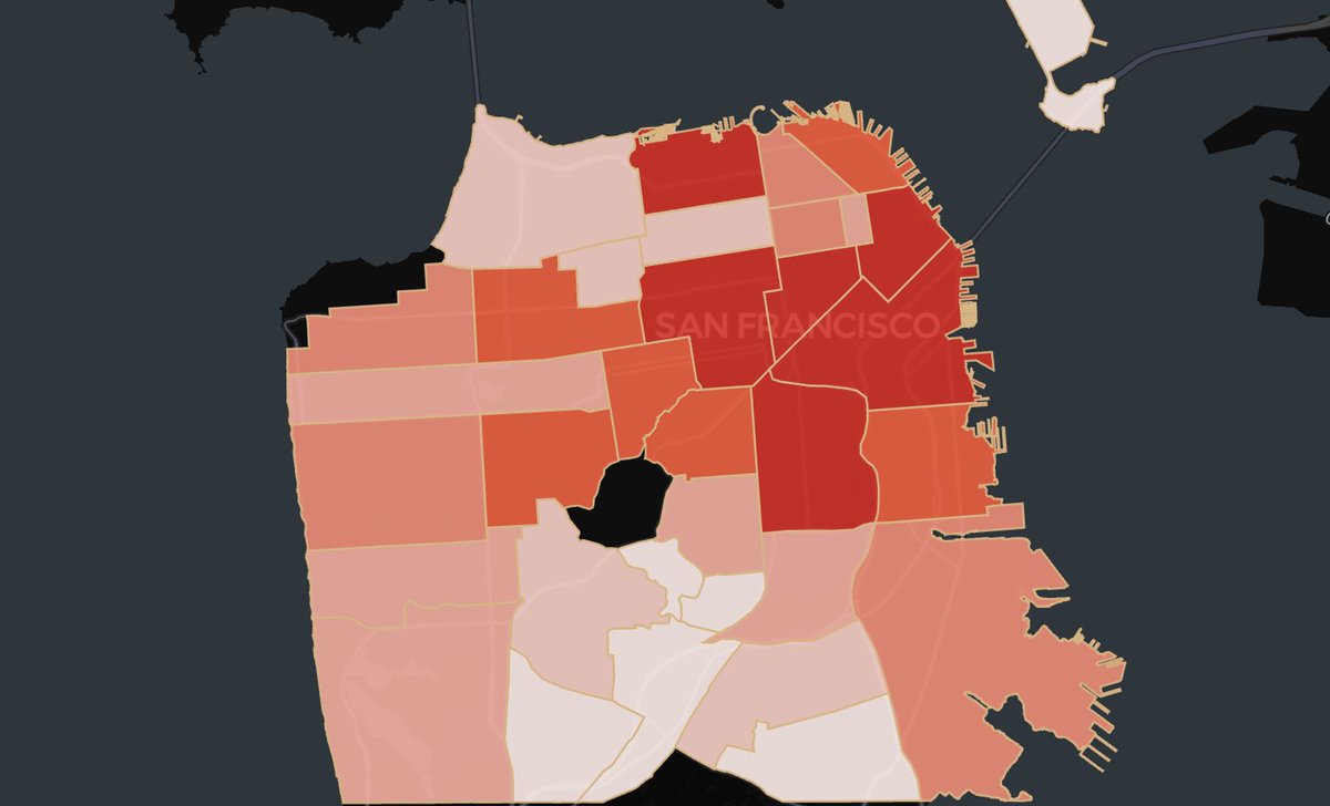
Zonal statistics is one of the most powerful ways to combine raster and vector data—but once you try to scale beyond a few polygons, most tools start to struggle. Join us for a live session where we’ll show how Wherobots make large-scale zonal stats simple, fast, and scalable for…

💡 Did you know that using GeoPandas along with Wherobots and Apache Sedona can provide powerful, efficient analysis, especially for large datasets? Whether you're scaling to massive datasets or diving into detailed analysis, this blog shows how these tools ✨work better…
🚀 Wherobots is now available in the AWS Europe (Ireland) region! If you’re working with geospatial data in the EU, this means faster performance, lower costs, and full data residency compliance—all in a cloud-native environment built for spatial intelligence. Read more:…
This month, we're covering the benefits of using Apache Iceberg, spatial joins, cloud-native geospatial, and new product updates like isochrones to help you make better location-based decisions. What does it all mean, and how can it help you increase data productivity? Check it…