Mike's Weather Page
@tropicalupdate
MWP was born in 2004. Posting about Tropics, Weather, & more. The Daily Brew 9:19am EST weekdays. http://YouTube.com/@MikesWeatherPage. [email protected]
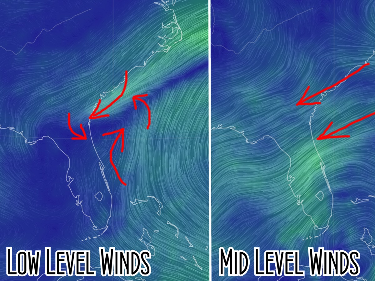
Seeing the Tropics from current winds is neat. Lower level winds (left) shows the basic idea of 'low pressure' formation. Winds race up from the south to meet frontal line winds from the NE. If shear relaxes we sometimes get development from this lower level 'spinnage'. Current…
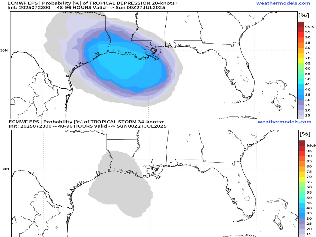
Latest EURO ensemble blend on this weeks Gulf juice. TD chances top. TS chances bottom. Similar situation as last week. Low pressure area sliding west from old front. Land proximity and time two of the hurdles to overcome. Most models not showing development. But always keeping a…
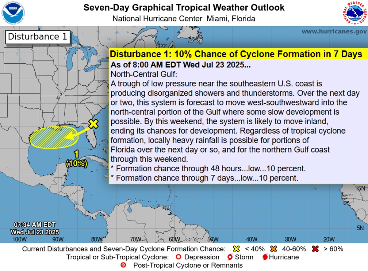
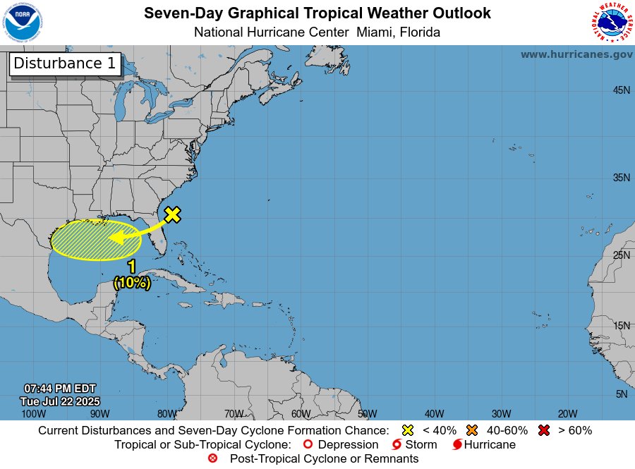
Wednesday AM NHC Tropical Update. Yellow spot remains at 10%. Models not showing much development. Few ensembles farther west and if stays over water give it a maybe. Rain for Florida then westerward into the weekend. Upping chances. But not likely a washout for most.…
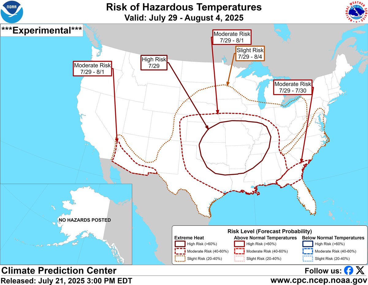
Big heat still on radar today Tuesday. Lower Florida getting a little break as rains return helping... some. Middle US feeling it. Heat Index 110+ for some. spaghettimodels.com

Rainfall totals through Saturday AM. Nothing too 'big' have been showing. Any isolated pockets could be more. All from low pressure area NHC has marked at 10% chance to develop this week. spaghettimodels.com

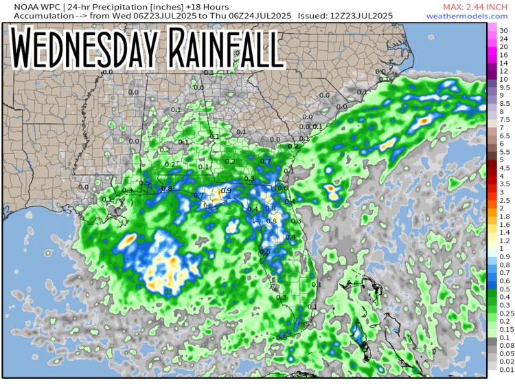
Wednesday rainfall expected here for the SE. Juice working west. Upper Gulf western Gulf gets some towards the end of the week. www.spaghettimodels.colm
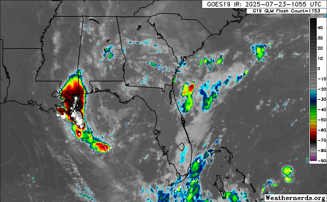
Wednesday AM morning satellite. Similar setup as last week with area sliding through Florida then westward this week. NHC marking the area to watch. spaghettimodels.com
Tuesday PM 07/22 Tropical Update: New spot to watch heading into the Gulf. #hurricaneseason #tropicalupdate #gulf #mikesweatherpage
It's 100 degree Heat Index. But I don't care. Firepit. Good music. Crickets. Gators grunting. Cold beer. My happy place is so simple. Cheers.
Tuesday night NHC Tropical Update. Low pressure sliding into the Gulf now being watched. Chances at 10%. Juicy rains regardless as it heads west this week. spaghettimodels.com
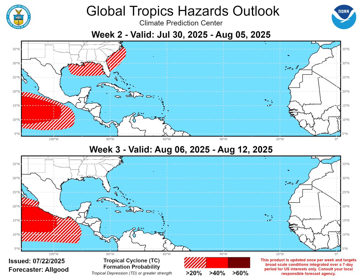
Long-range tropics watching. New NOAA weekly Global Tropics map updated today. Showing low chances Gulf/Atlantic early August. Take with a grain of salt. And save me some for the Margarita rim. spaghettimodels.com
I remember when I was a kid. Bradenton. Seeing storm clouds brewing off to the east. Dark and mean looking. It was our sign. Dinner soon. Time to ride our bikes back home. We would eat. It would rain. We would then go back out and play until dusk. I still remember the cooler…
Guess what? More hotter heat coming towards the end of July start of August. It's summer yes. Just extra summer coming.
Tuesday's 07/22/25 "Daily Brew": x.com/i/broadcasts/1…
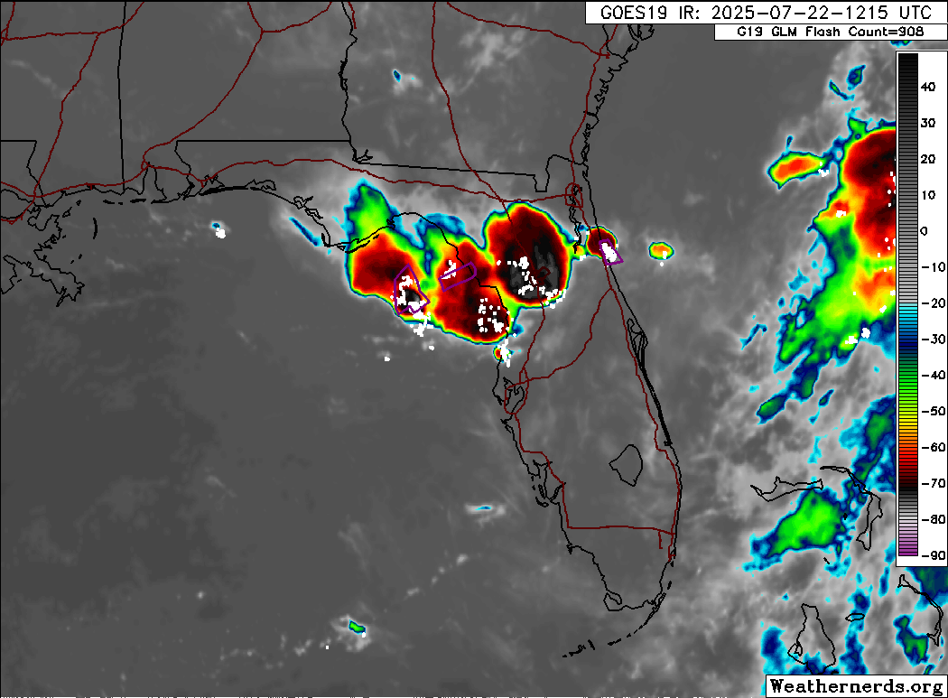
Storms bubbling up big time this Tuesday AM. Flash Flood Warnings currently. Almost 5 inches north of Ocala already. Might be seeing more of these random bursts of convection the next couple days. spaghettimodels.com
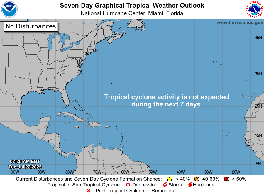
Poof. Invest 94 is gone. Nothing else is on the NHC radar this Tuesday AM. spaghettimodels.com
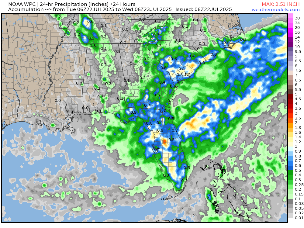
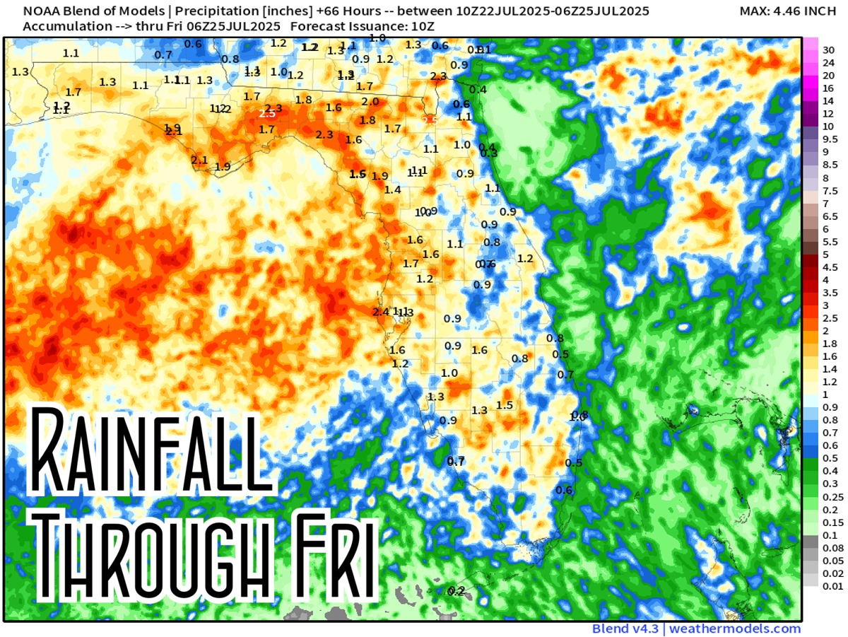
Florida rainfall is on the increase the next several days. Totals through Thursday here. Moisture in the air coming in from the Atlantic will flow westward across the Gulf. This is a blend of models map so idea is strong. Who gets exactly what is always a mystery.…
Rainy pattern returns. Totals here for today Tuesday expected with more widespread coverage across the SE. Similar tomorrow. Juice sliding in from the Atlantic heading westbound through the week. spaghettimodels.com