Mountain Weather
@the_MWIS
The Mountain Weather Information Service provides forecasts for 10 mountain areas across the UK to aid mountain safety: http://mwis.org.uk
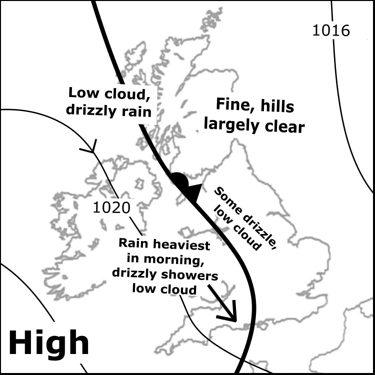
Tue 29/7: A relatively weak front over western areas brings low cloud and drizzle, some steadier rain for Wales in morning. Central & E Highlands generally fine & dry, clear hills, though low cloud tending to encroach further E later. Light winds Scot, breezier Eng & esp Wales.
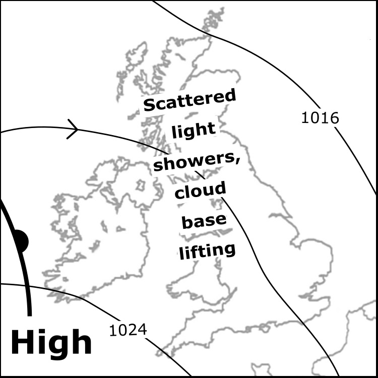
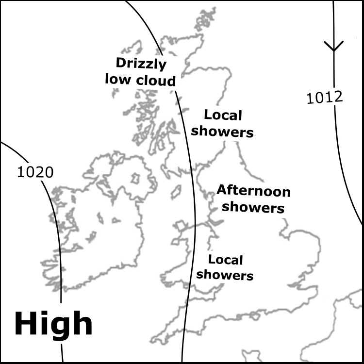
Monday 28/7: Cloud across higher slopes particularly in the west in the morning, some drizzly patches. Local light showers passing eastwards, but widely often dry. Cloud lifting above many summits, though may linger over western tops. Feeling cool in a fresh W-NW'ly breeze.
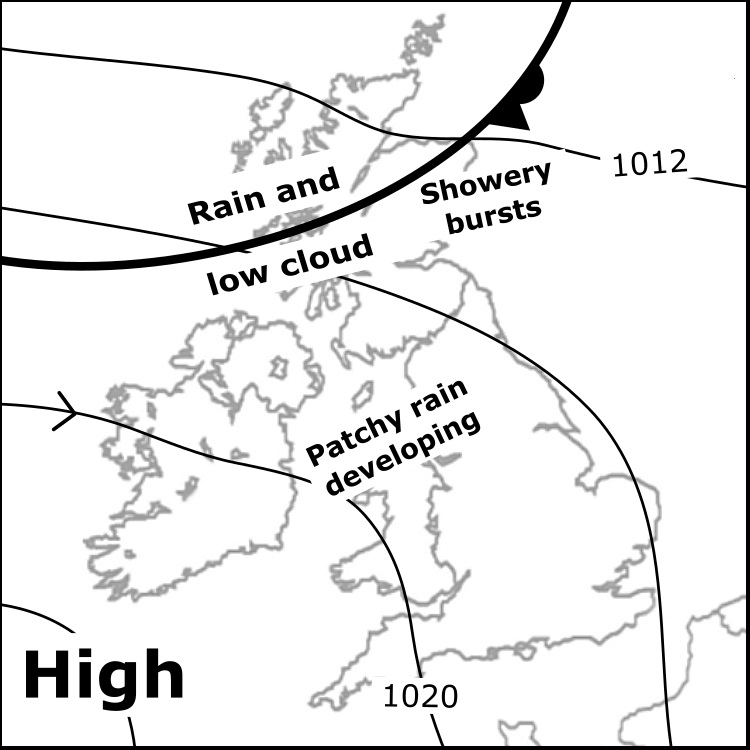
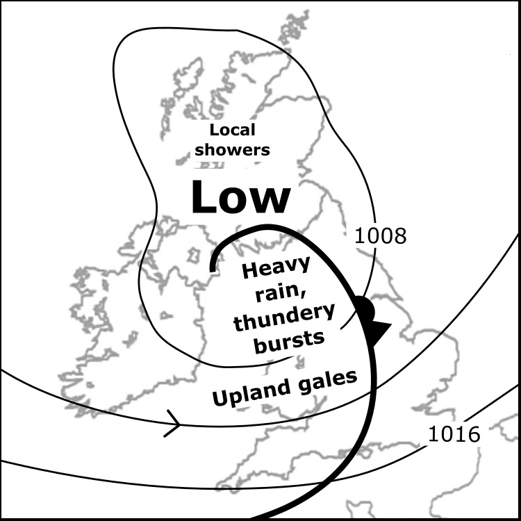
Sun 27/7: Rain & low cloud most persistent W Scot morning, showery rain extending east, some local heavy bursts. Patchy rain or local showery rain at times Eng & Wales but often dry, cloud covering tops mostly in west. Moderate to fresh breezes, feeling rather cool on high tops.
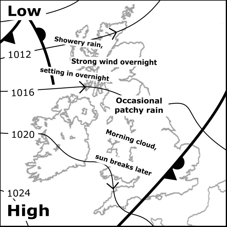
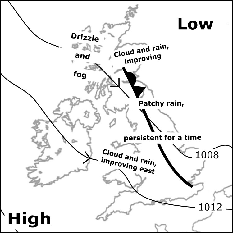
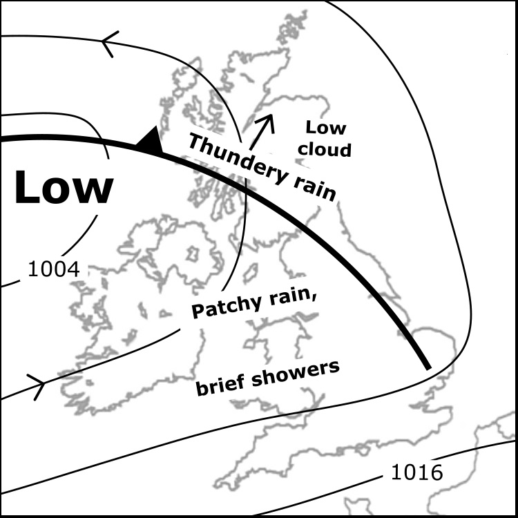
Sat 26/7: Showery rain and fog over W Scotland, rain setting in into night; clearer and drier east. Very strong overnight winds. Morning fog/patchy rain for N England, improving with cloud lifting off Pennines. Morning cloud in Wales will clear summits; NW Wales last to clear.
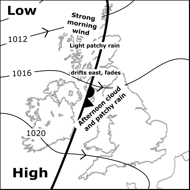
Fri 25/7: Cloud and patchy rain in W Scotland clears east, easing; far E Scotland substantially dry and clear. Patchy cloud over English and Welsh summits in the morning, deteriorating with patchy rain through afternoon. E Wales and S Pennines substantially dry and free of cloud.
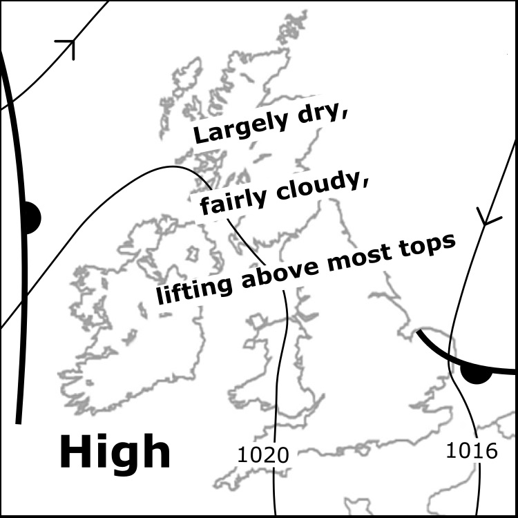
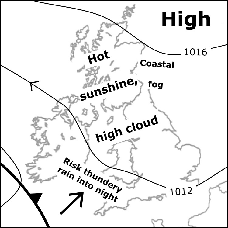
Thu 24/7: A ridge of high pressure brings a largely dry day. Areas of cloud across the hills in the morning with local pockets of drizzle, lifting toward then above many higher slopes, sunshine breaking through at times, best in west afternoon. Light winds.
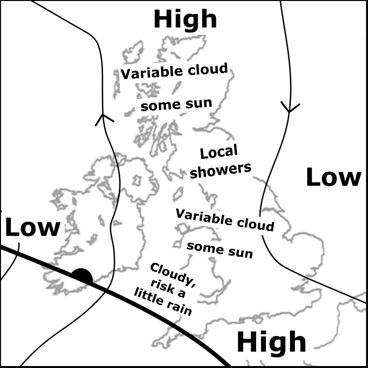
Wed 23/7: Cloud most persistent over hills toward NW Scotland, some drizzle. Varied cloud over hills elsewhere tending to rise, breaks to many tops into afternoon; patches may linger N Wales tops. Local showers forming in the afternoon. Moderate NW'ly breezes, feeling quite cool.
Tues 22/7: Drizzly and dull W Scotland, rain and cloud increasingly breaking E, some breaks to tops. Patchy rain and morning fog across England and Wales too, fog tending to lift; most tops likely remain in cloud. Cloud/drizzle will linger on west slopes of Lakeland and Wales.
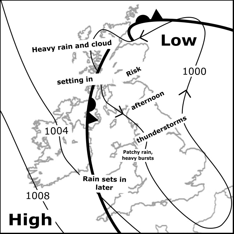
Mon 21/7: Morning rain drifts west across Scotland , setting in over West Highlands afternoon, locally heavy. Showery from central Highlands south down the Pennines, becoming locally heavy/thundery. Patchier showers for Lakeland and Wales, rain setting in later S and W Wales.
Sun 20/7: Areas of rain and thundery showers rotating slowly around a broad zone of low pressure. The most persistent heavy rain focused on northeast Scotland. Lowest cloud in east. Largely dry for several hours in northern England. Variable winds, gusty in places. Fairly warm.
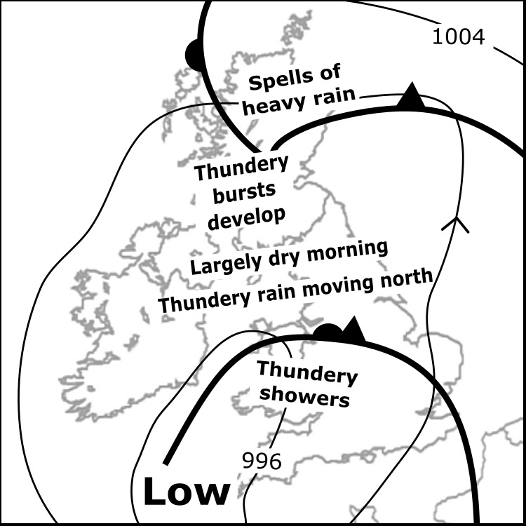
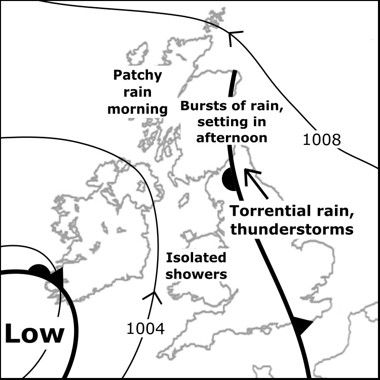
Sat 19/7: Early rain nr W coast but Highlands largely dry morning. Into afternoon, bursts rain become extensive heavy rain. Prolonged heavy rain moves N over England; intense downpours/thunderstorms, focused Pennines. A few showers Wales but often dry. Fairly warm, locally gusty.
Fri 18/7: A front passing eastwards brings patchy rain, some scattered brief heavy showers follow in Scotland. Thunderstorms form east of the Pennines in afternoon. Fairly warm and humid, southerly breezes, strongest in NW Scotland. Cloud base rising, some breaks forming to tops.
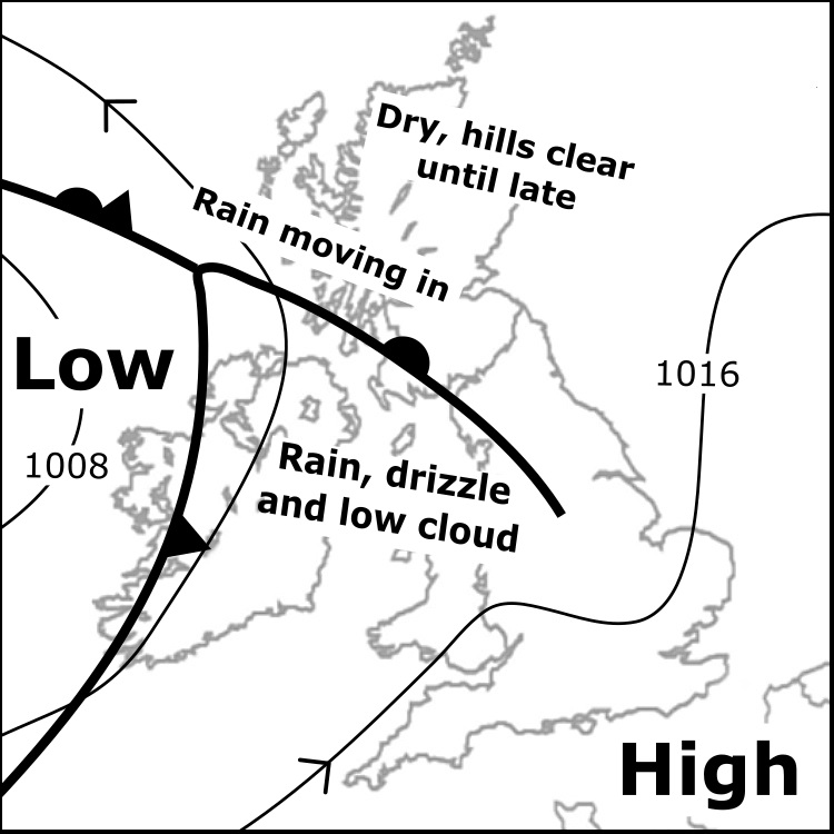
Thu 17/7: Patchy rain/drizzle extends across western regions, cloud lowering to blanket hills. Local heavier bursts of rain forming afternoon, most persistent W Scotland later. Further E&NE, dry with some sun, then cloud thickens afternoon, later a little rain. Breeze increasing.
Wed 16/7: Fine much of the day for many areas, cloud covering some hill slopes in morning, tending to lift above many summits. A little patchy rain mostly southern Scotland and northern England in the morning, tending to fade. Isolated showers into afternoon. Mostly light winds.
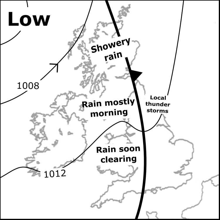
Tue 15/7: Heavy and persistent rain England, Wales & S Scotland, breaking up into thundery showers into afternoon. Windy too, gale force over Welsh mountains. Some rain reaches north of the central belt, but most of the Highlands stays dry, cloud rising, light winds. Much cooler.
Mon 14/7: Heavy rain and thunderstorms increasingly affect the Highlands; northern areas largely dry until late. Bursts of rain over N England in morning, locally turn thundery, moving into Borders. Local showery bursts for Wales & S Pennines. Gusty winds. Fresher air arriving.
Sun 13/7: Very warm on mountains from overnight, soon feeling hot in morning sun. Valleys approaching 30C again, though mostly slightly less hot than Saturday. A veil of high cloud tends to weaken the sun. Local gusty E-SE'ly. Generally dry, later chance of very isolated showers.
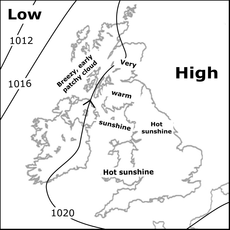
Saturday 12th July: Hot everywhere, rising to 30C in valleys widely by early afternoon, slightly cooler easternmost areas. Unbroken sunshine dawn til dusk. Light winds, though breezier west coast of Scotland, particularly on islands. Very dry ground conditions - high fire risk.
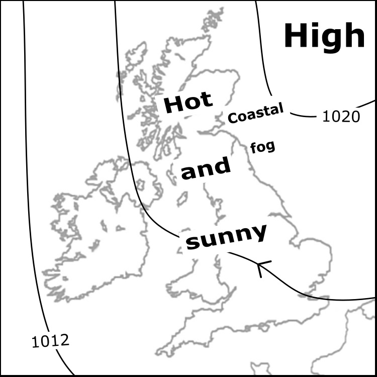


Fri 11/7: Sunny and very warm most areas with light wind - risk of sunburn and dehydration. Warm temperatures will persist overnight. Temperatures nearer the middle teens on Scotland's west coast in the breeze, some early patchy cloud onto Skye and coastal slopes southward.
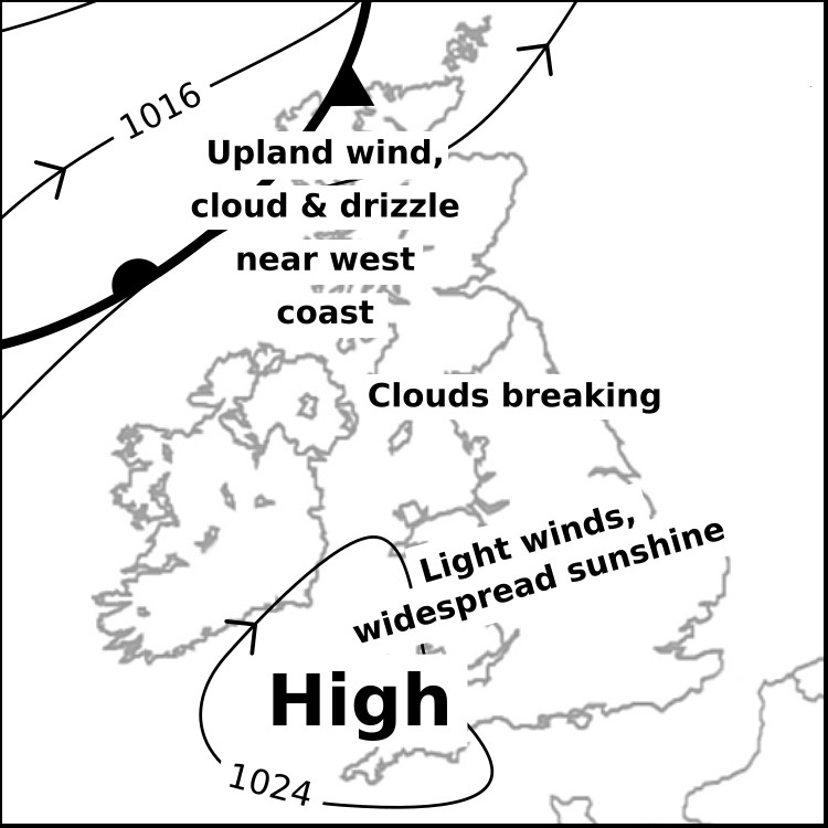
Thur 10/7 Scotland: Persistent low cloud, drizzle & upland wind nr W coast. Better inland with higher cloud; breaking almost competently E of the A9. England & Wales: Fine day with light wind. Soon little cloud in many places but lingering in W parts of the Lakes and N. Pennines.