🔴All India Weather
@pkusrain
📙 Lead by Dr. Pradeep who is a Climate Scientist with Phd, M-Tech in Meteorology from IISc | Views: Personal and Educational | Follow IMD for official Alert |
We'd love your feedback! Are our weather updates useful to you?
Heavy Rainfall over Bihar and east UP with continue for next 12-24 hours. Reduction expected from 29 evening or night..
Parts of Bihar, East UP and north Bengal will continue to experience moderate to heavy showers for next 36 hours. Conditions will remain favorable for rainfall over these regions for next 2 weeks.
Monsoon trough shifting northwards. Rainfall activities will increase over north India: UP, Bihar, Uttrakhand, Punjab, Haryana, Delhi NCR, Himachal and northeast India during next 4 Days.. stay safe
Surprising development: The depression has reduced its size and weakened into a Low-Pressure System (LPS). Currently, it has reduced its size and increased vorticity, which may trigger heavy rain over Northwest Madhya Pradesh, Southwest Uttar Pradesh, and South Rajasthan in the…
Intense rainfall continue over parts of West Madhya Pradesh. Stay safe
From July 28/29 onwards, the monsoon trough is expected to shift over the Indo-Gangetic plains. This will increase rainfall activity over Uttarakhand, East Punjab, North Haryana, Himachal Pradesh, Uttar Pradesh, Bihar, and Northeast India. Some places in Bihar and North Uttar…

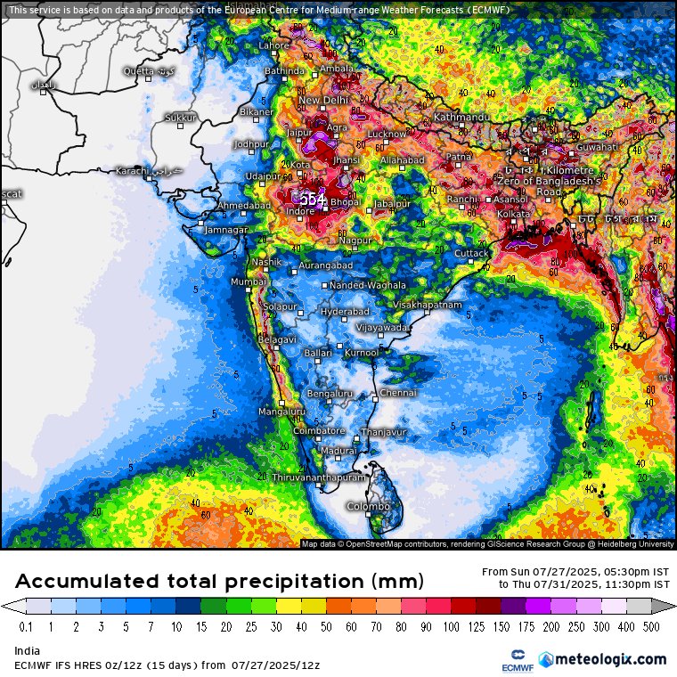
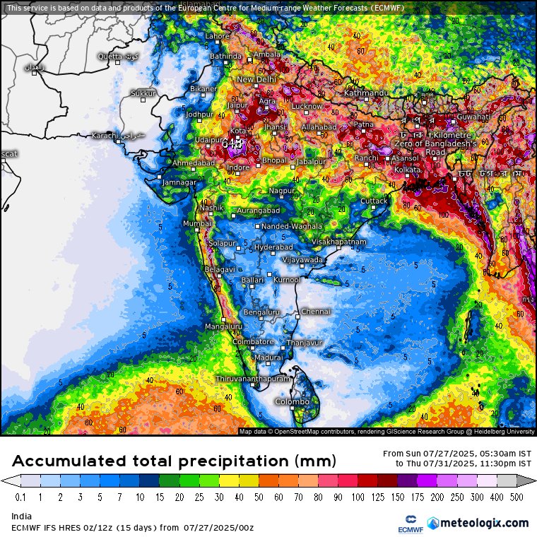
ECMWF model total rainfall forecast during 28 July to 5 August.
Depression has changed its path and weakened significantly. It may continue to bring moderate to heavy showers over south Rajasthan and northwest Madhya Pradesh. Rest of central India will receive only light to moderate showers.
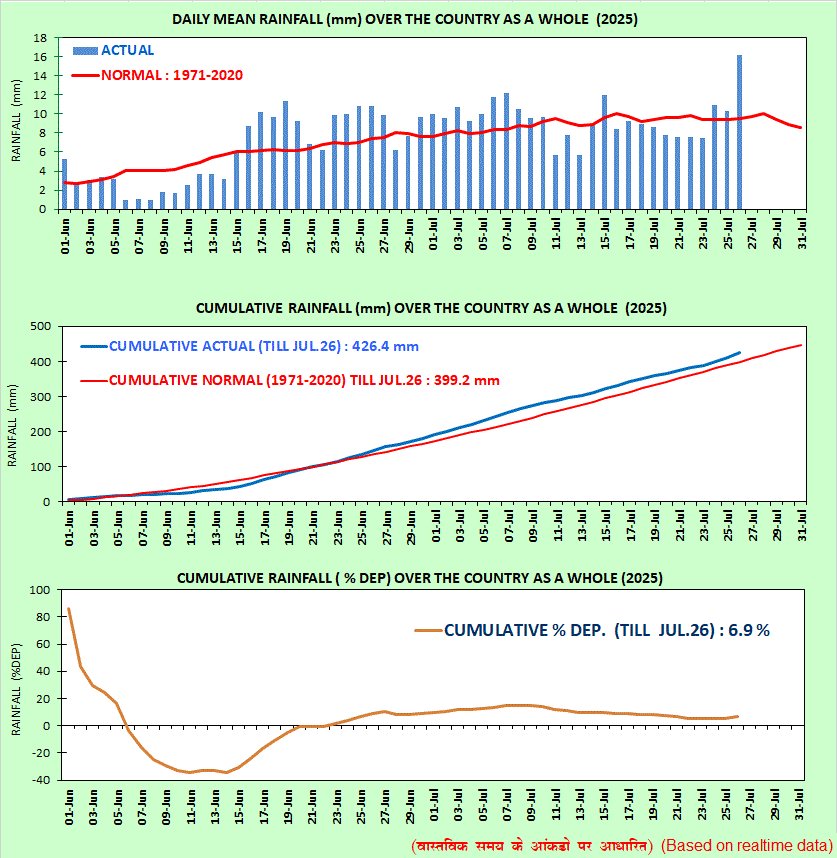
Historic monsoon rainfall recorded in last 24 hours ending 8:30 am today. All India average rainfall was 16-17 mm which is the highest single day recorded rainfall so far this season. Image: IMD
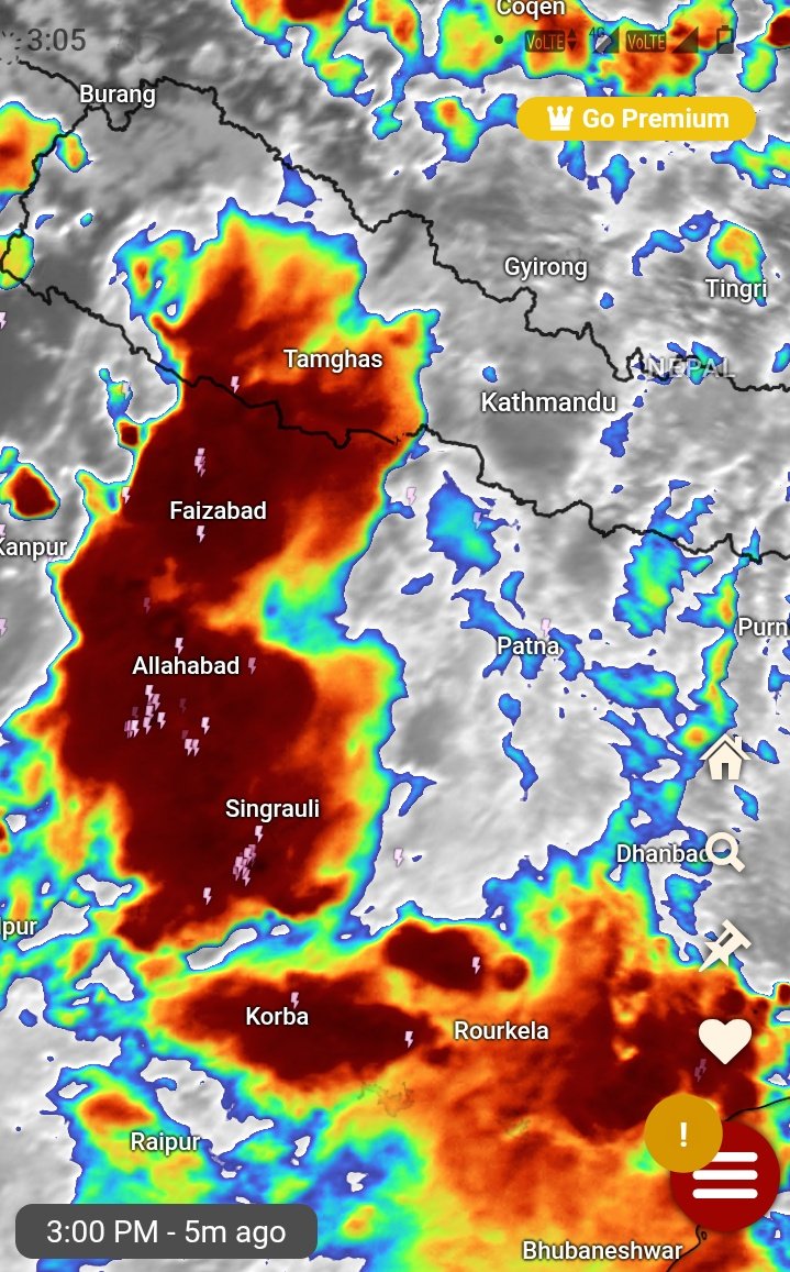
🥹Look at this. Depression triggering massive rainfall over south Chattisgarh, Telangana, Maharashtra and parts of east Madhya Pradesh. It is also triggering thunderstorms over Rajasthan and west coast
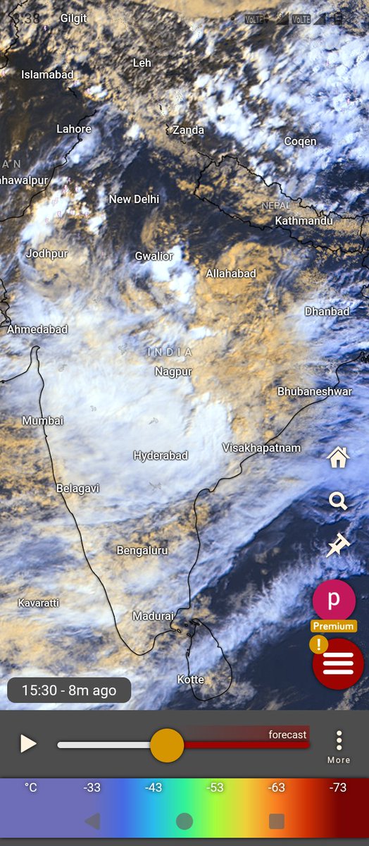
Depression moving westwards rapidly. Currently situated over north Chattisgarh. This will cross MP in next 36-48 hours.
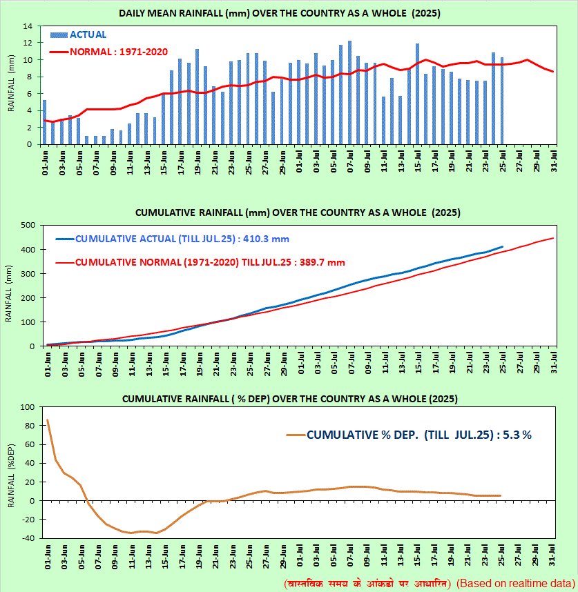
Remember we are currently in peak monsoon days climatologically. From August rainfall gradually starts to decline. Image: IMD.
Thunderstorm now affecting parts of south Haryana, east Rajasthan
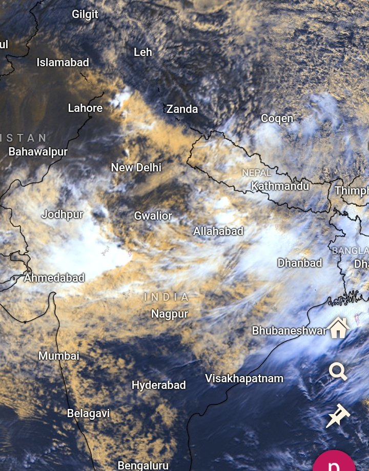
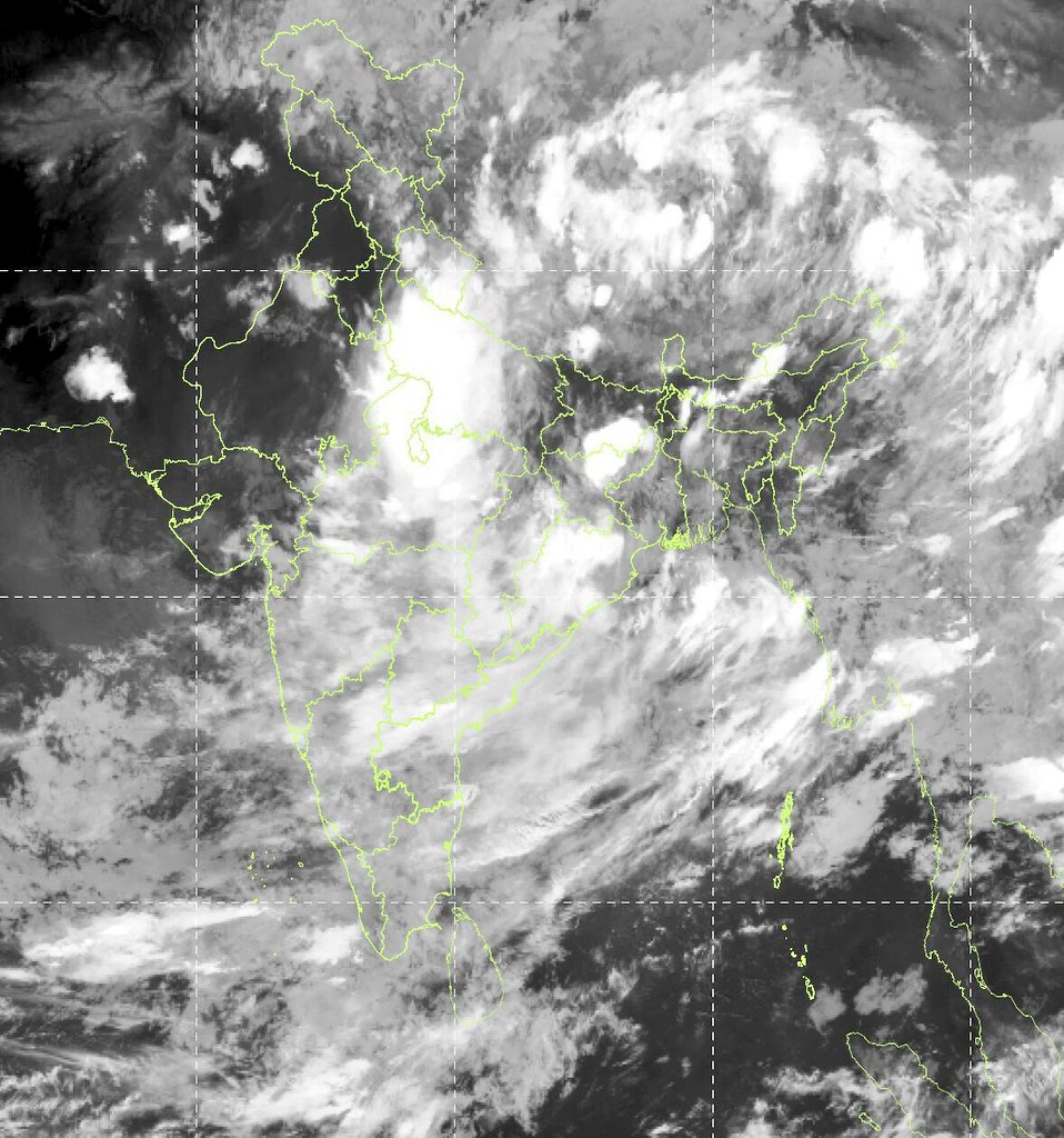
A great monsoon day. Massive clouds across various parts of India.
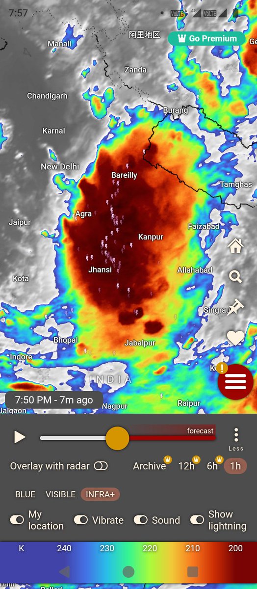
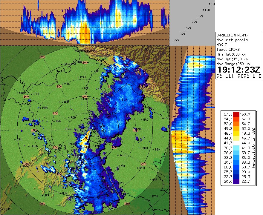
Very severe thunderstorm affecting Western and central parts of Uttarpradesh.