
Owen Basselman
@owenbasselmanwx
Meteorologist @ktivnews | MSU Meteorology ‘24 | OH➡️MS➡️IA
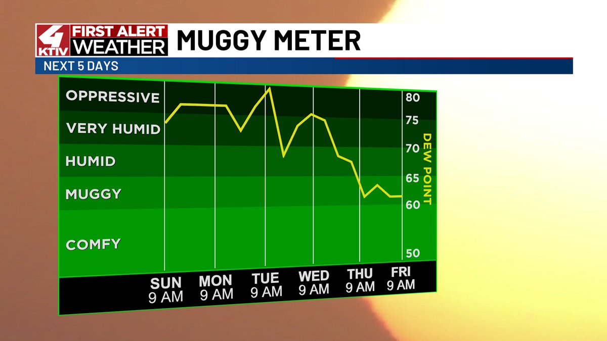
This is awful! Dew point is 81° and it feels like 112°! #IAwx

Ready for a break from the summer heat? Just wait a few days! A drop in temperatures and humidity comes on Wednesday! (This cannot come soon enough😆) #IAwx #NEwx #SDwx
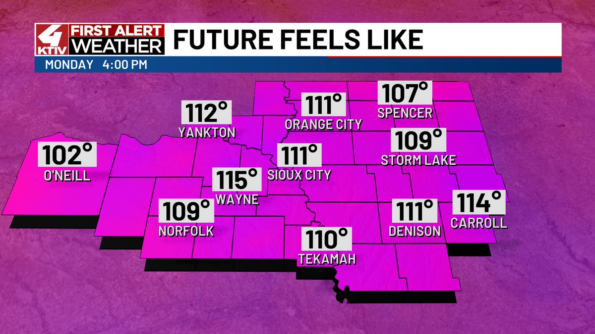
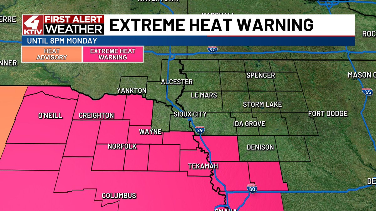
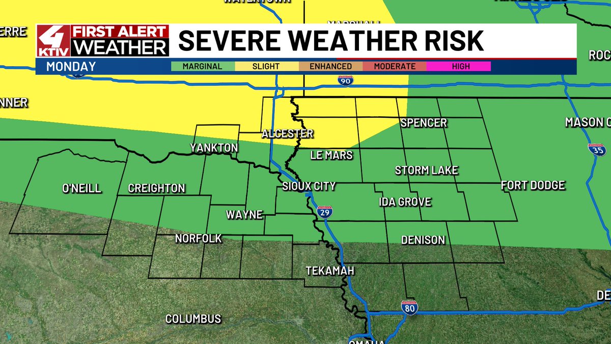
MONDAY: Heat index values could near 115°. I expect a heat alert will be issued for NW Iowa. A stray storm is possible in the afternoon, but a higher chance comes between 10pm-3am. Damaging wind gusts and a quick tornado are the main threats overnight. #IAwx #NEwx #SDwx
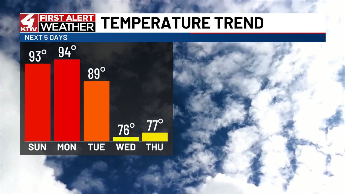
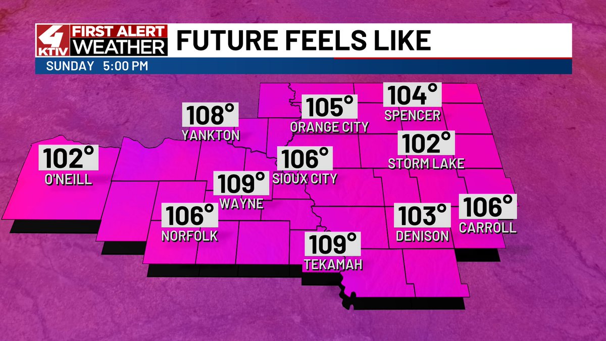
SUNDAY: We'll end the weekend with a scorcher as feels like temperatures range from 100°-110°. This heat and humidity will give way to a chance for isolated storms between 10pm and 3am tonight. A couple storms could be strong or severe with 60mph wind gusts. #IAwx #NEwx #SDwx
Thunderstorms are possible Sunday night and Monday night. There is a low chance a couple storms could become strong or severe. The main threat will be wind gusts near 60mph. #IAwx #NEwx #SDwx


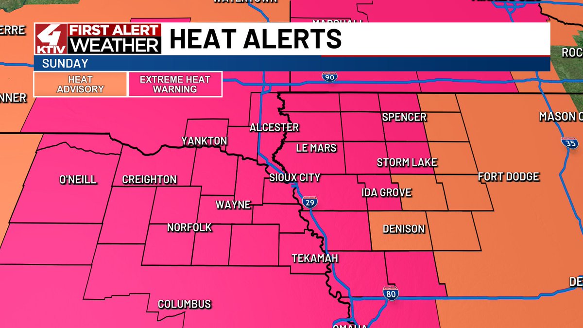
Heat alerts have been issued for Saturday, Sunday and Monday. Feels like temperatures will range from 95°-105° on Saturday and 100°-110° on Sunday and Monday. Monday's Extreme Heat Watch will soon be expanded to include more of northwest Iowa. #IAwx #NEwx #SDwx


It is a foggy morning in Siouxland. A Dense Fog Advisory is in effect until 9am. Use caution while driving in low visibility. #IAwx #NEwx #SDwx


Feels like temperatures will approach 110° on Sunday. This will be dangerous heat! Take precautions if you are spending extended periods of time outside. #IAwx #NEwx #SDwx


RAGBRAI set up is underway in Orange City! The expo is tomorrow and the ride begins on Sunday!🌷🚴🏻


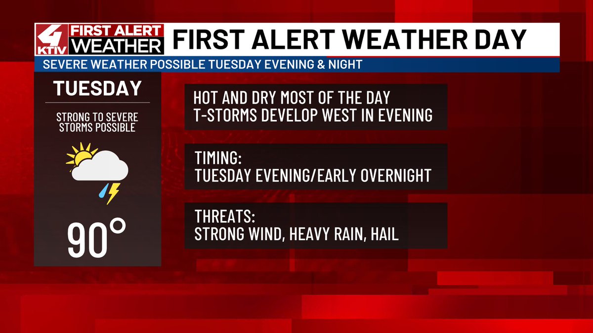
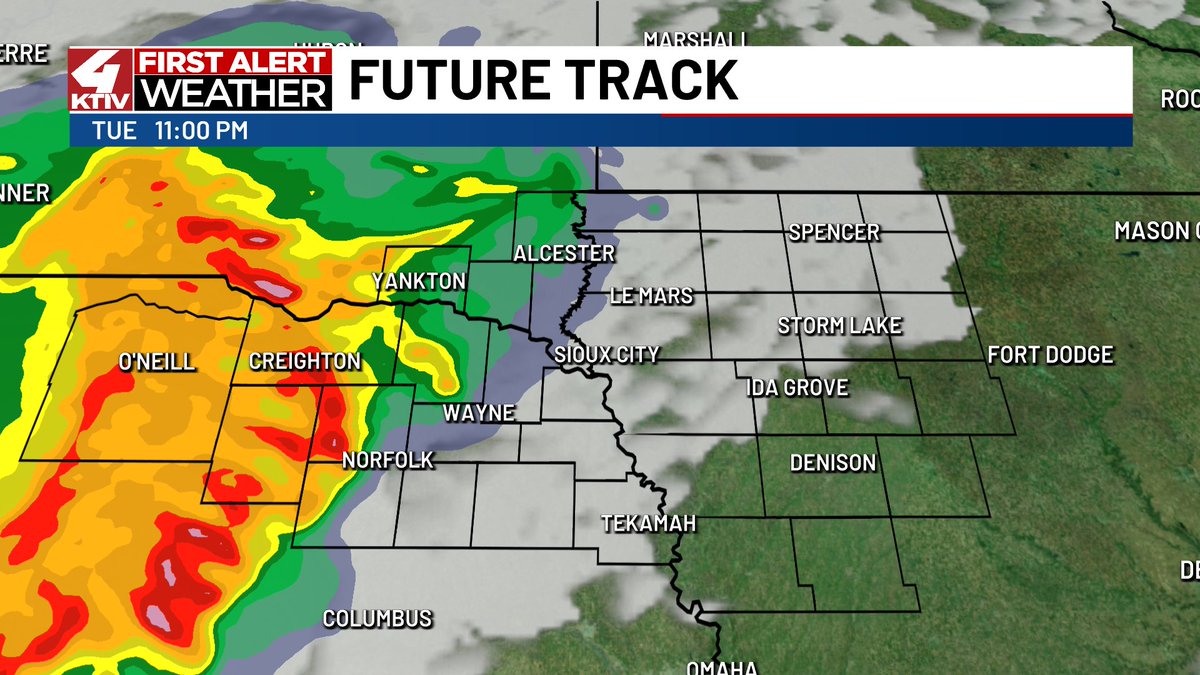
TUESDAY: A line of storms will move into western Siouxland around sunset. It could contain strong wind gusts, heavy rain and hail. The line will weaken as it moves east; the severe weather threat is lower in northwest Iowa. #IAwx #NEwx #SDwx
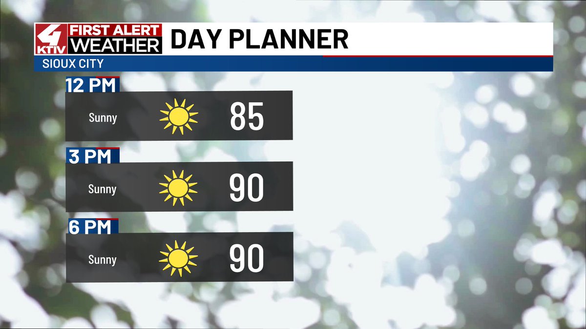
After pleasant weather over the weekend, summer heat will return today. Highs will top out near 90 with a feels like temperature in the mid-90s. #IAwx #NEwx #SDwx
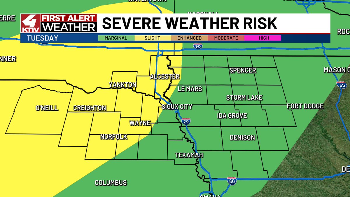
TUESDAY: Our next chance for widespread rain and storms comes Tuesday evening/night. A Level 1/5 Marginal Risk of severe weather clips northwestern Siouxland. The bigger focus might end up being the potential for heavy rain. #IAwx #NEwx #SDwx

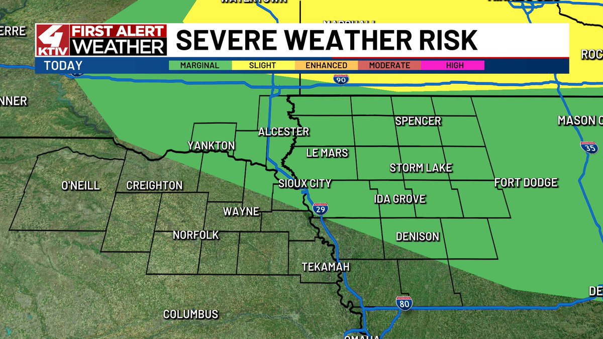
SUNDAY: A few storms are possible this evening between 5pm-10pm. There is a chance they bring strong winds and small hail but the risk for severe weather is low. #IAwx #NEwx #SDwx

I hope you got out and enjoyed the break from summer heat and humidity yesterday! It was the coolest day since June 9th! #IAwx #NEwx #SDwx

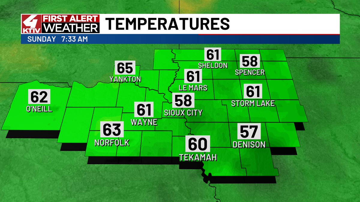
Temperatures are cool and comfortable to begin our Sunday! Highs will be near today's average of 85 with a little more humidity. #IAwx #NEwx #SDwx

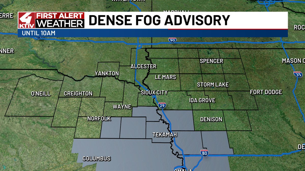
A Dense Fog Advisory has been issued for southern Siouxland until 10am. Visibility could drop to a half mile or less. #IAwx #NEwx
Here's everything you need to know about Saturday's forecast! Get out and enjoy the nice weather! #IAwx #NEwx #SDwx