Kyle Walker
@kyle_e_walker
Demographics | Geospatial | Data Science | Open Source Workshops: http://walker-data.com/workshops.html Book: http://walker-data.com/census-r
Last week’s workshop series on modern web mapping with #rstats went great! We covered 3D basemaps, custom map design, fast filtering in Shiny, story maps, and more. If you missed out, I’ve made the workshop recordings and in-depth tutorials available: walkerdata.gumroad.com/l/modern-mappi…


Two weeks ago, I gave a workshop on high-performance mapping apps with #rstats and Shiny. Shiny is *awesome* for web mapping apps... but can be slow when deployed if you aren't careful. Here are three strategies that have saved my projects:
I'm excited to reveal my brand-new digital book: Mapping the World with R: Your Journey from Beginner to Data Cartographer. After years of coding, teaching, and sharing insights on my YouTube channel, I've compiled a comprehensive guide that demystifies spatial data…
On the blog: building an AI-powered location explorer with Shiny and Claude Intrigued by apps you’ve seen that bridge GIS and LLMs? You can build them yourselves in #rstats! Read the post: walker-data.com/posts/ai-locat…
A dynamic, interactive heatmap over a 3D globe? It’s all possible with @mapbox and #rstats. Learn how: walker-data.com/mapgl/articles…
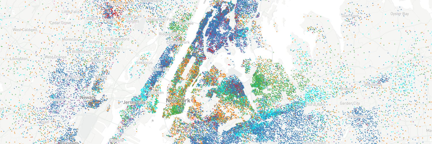
I rave about @protomaps' PMTiles as a transformative technology. Here's an example: 📊 All 8 million+ US Census blocks; 🗺️ Visualized in 3D with MapLibre (via #rstats); 💻 Locally on my laptop - and the fan is running nice and cool. Writing up a blog post, I'll teach you how!
Our #rstats Shiny dev is so much happier now that he's discovered the {mapgl} package! (Sorry, had to!) While you're at it, check out mapgl: walker-data.com/mapgl/

In the latest version of the #rstats {mapgl} package you can export features from the draw control as GeoJSON. The video shows how you can edit features, export your edits, then open up in QGIS! Learn about this & much more in my latest workshops: walkerdata.gumroad.com/l/modern-mappi…
One of many use-cases for the new @MapTiler geocoder support in #rstats mapgl: Makes it easy to explore / teach about the odd shapes of Texas cities!


