Kairo Kiitsak
@kairokiitsak
Weather forecaster in Estonian Environment Agency. I love weather and nature photography. VOP @essl_ecss. Board member of the Estonian Meteorological Society.
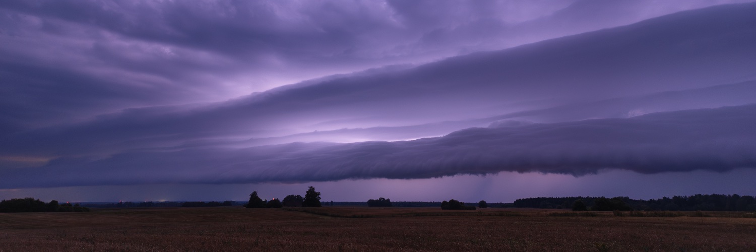
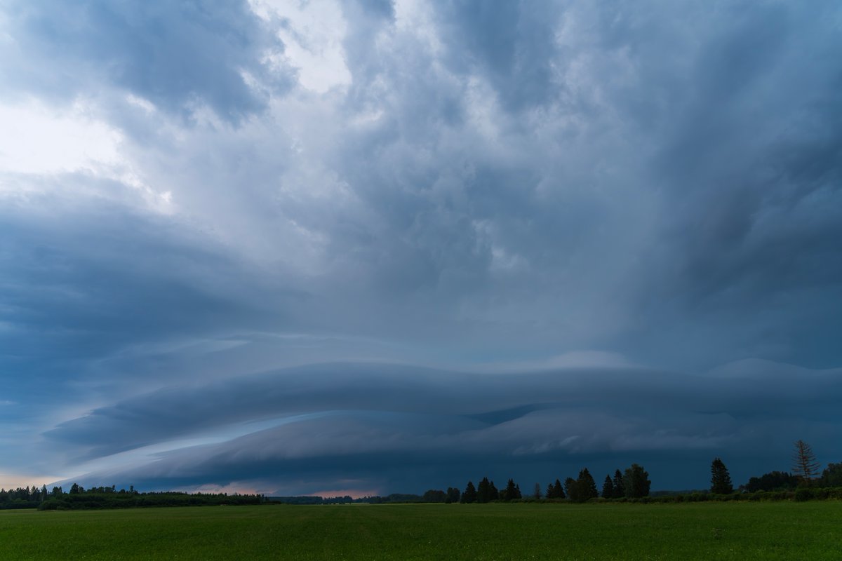
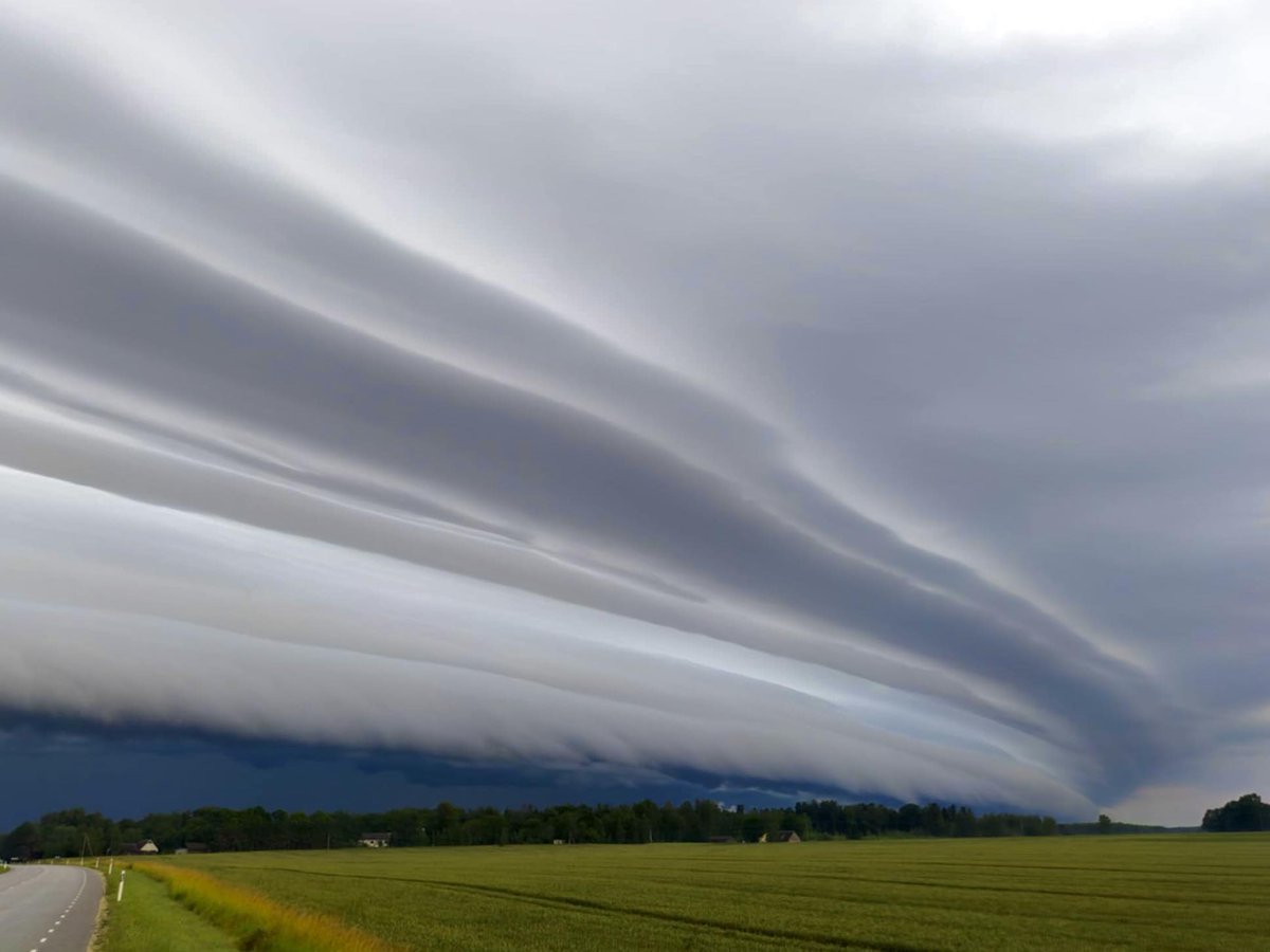
Shelf cloud in western Estonia today 16.07.2025. Photo: Hanna-Maria Tamm
Last few days been very convective in Estonia. Photos from yesterday´s chase 15.07.2025.


Possible supercell SE of Narva, moving W,NW, just like yesterday.

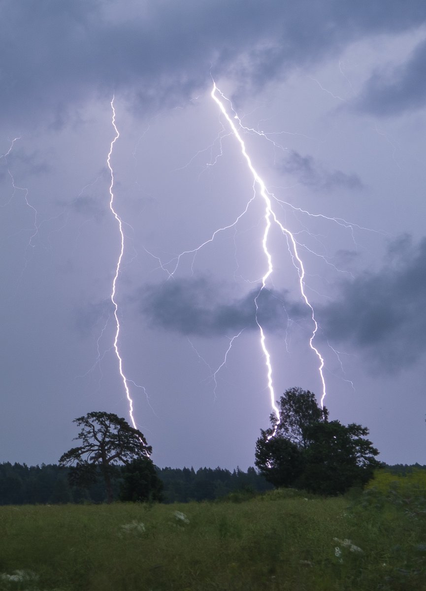
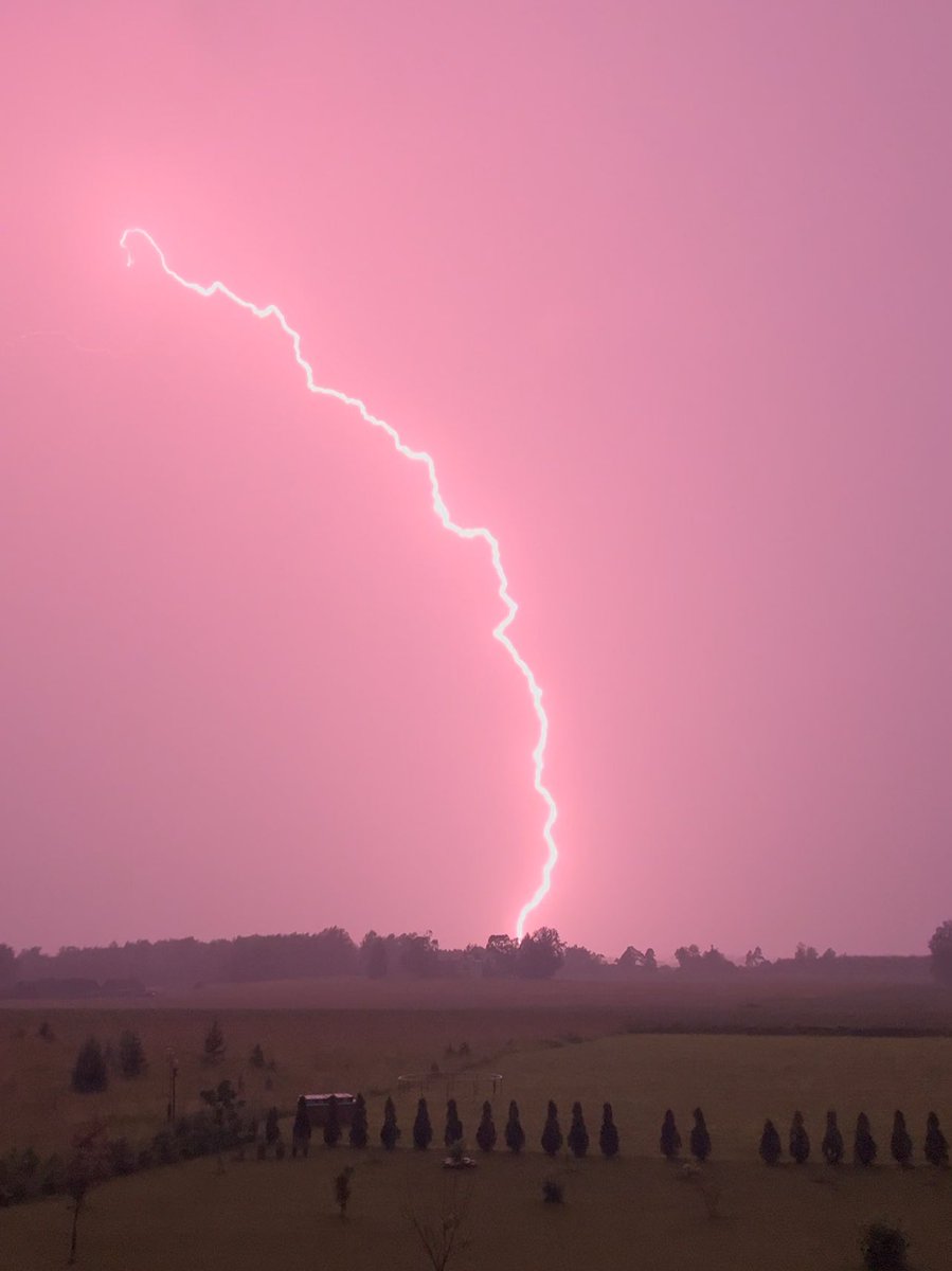
Cloud-to-ground lightning bolt near Karivärava 13.07.2025.
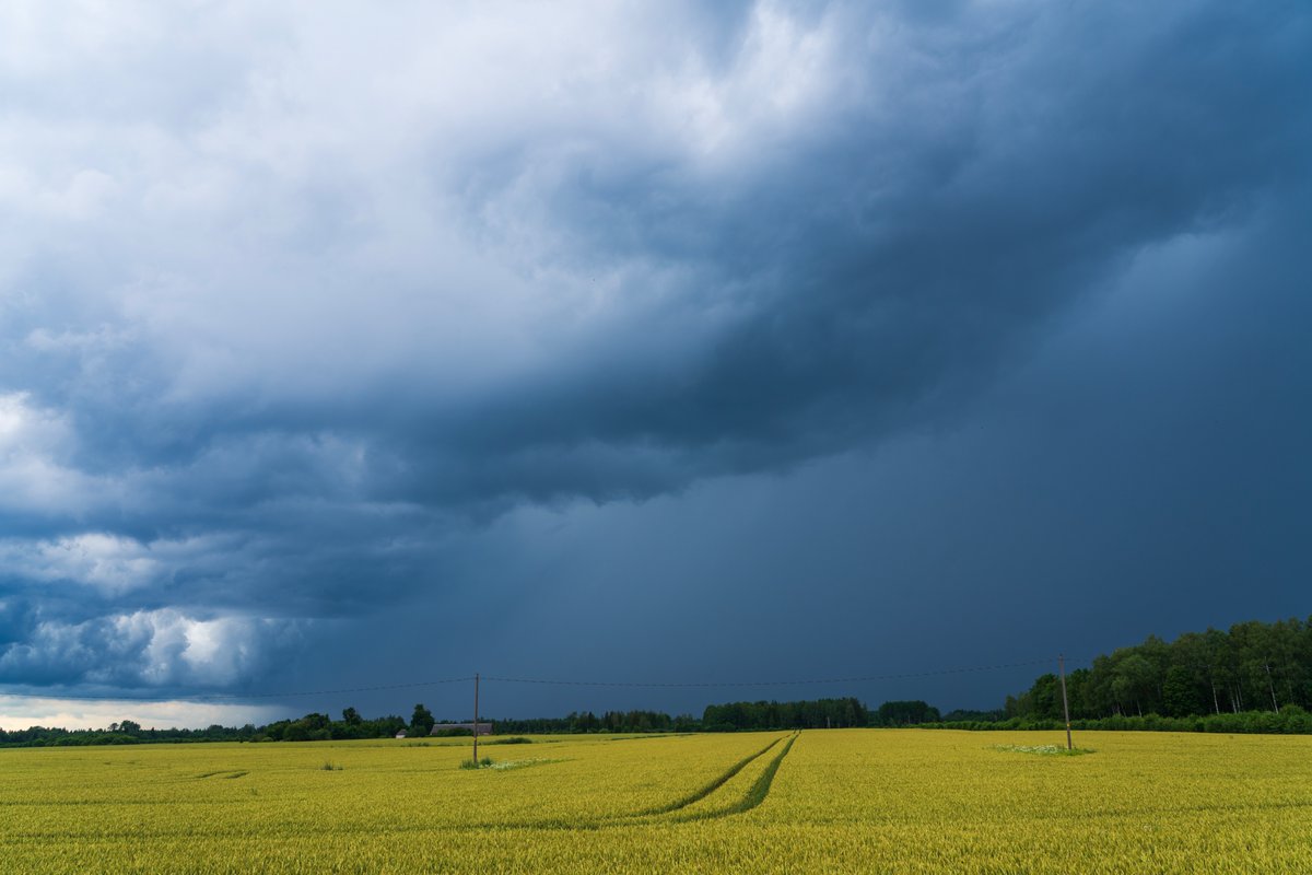
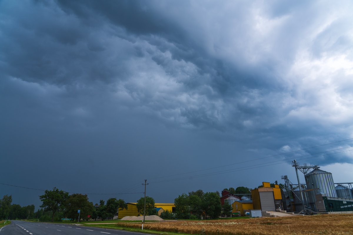
We just got hit by another storm in NE Estonia this evening 13.07.2025.
I was tracking this supercell east of Rakvere, #Estonia 13.07.2025.

Mesoscale convective vortex over SE Estonia 13.07.2025. Animation: @meteologix
New day, new storms. The atmosphere remains very warm and humid making it quite unstable and favorable for intense thunderstorms. Those can produce severe wind gusts, heavy rain and locally large hail.
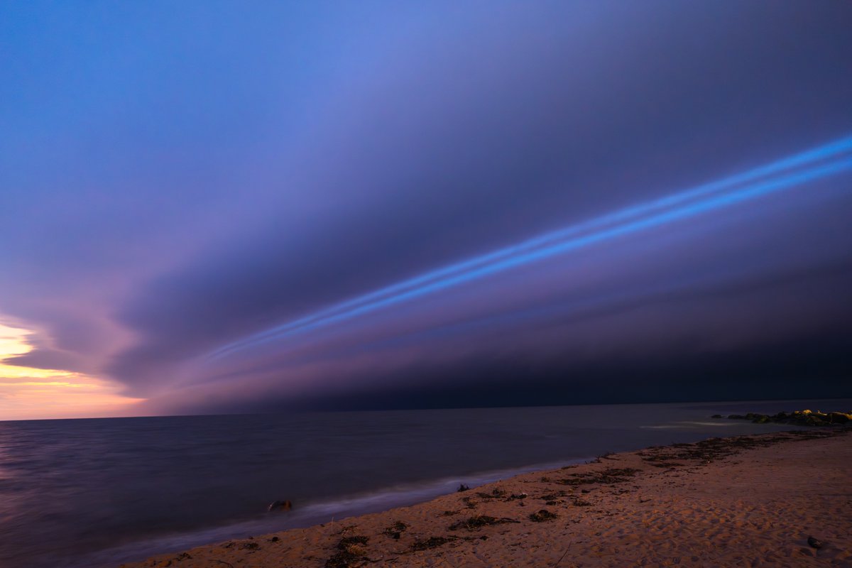
Huge shelf cloud was moving over the Gulf of Finland last night, photo is captured from NE Estonia 13.07.2025.
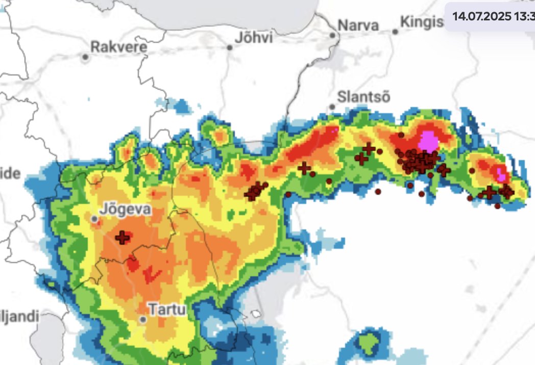
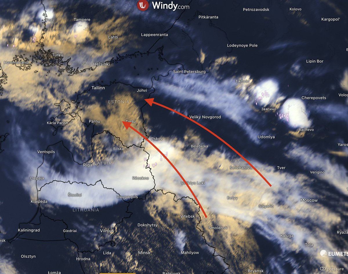
Severe thunderstorms over W-Russia, moving towards St. Petersburg and NE Estonia.
Arrived to eastern Estonia. At 7 PM it is +24C with dew point almost +22C. Crazy humid, almost nothing to breath!


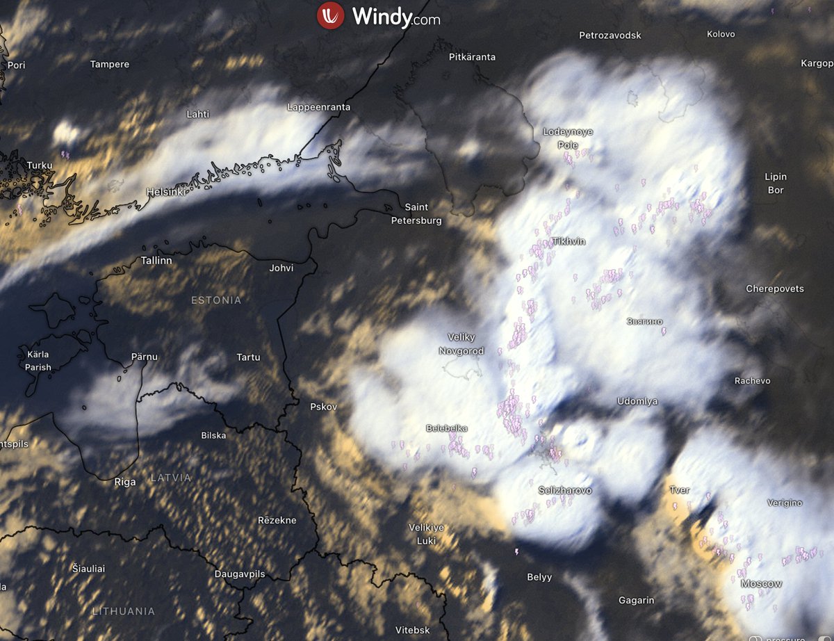
MTG-LI detected flashes 11.-12.07.2025. Data: @eumetsat (animation by Sven-Erik Enno)
Severe storms over #Estonia with overshooting tops visible yesterday 11.07.2025.

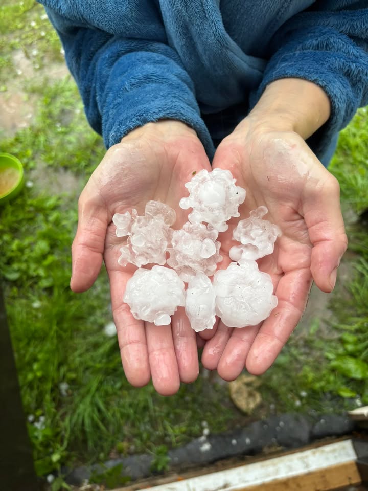
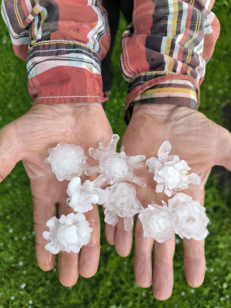
Large hail (3-6 cm in diameter) in S-Estonia yesterday evening 11.07.2025. Photos: Aivo Kook and Gerda Alliksoo
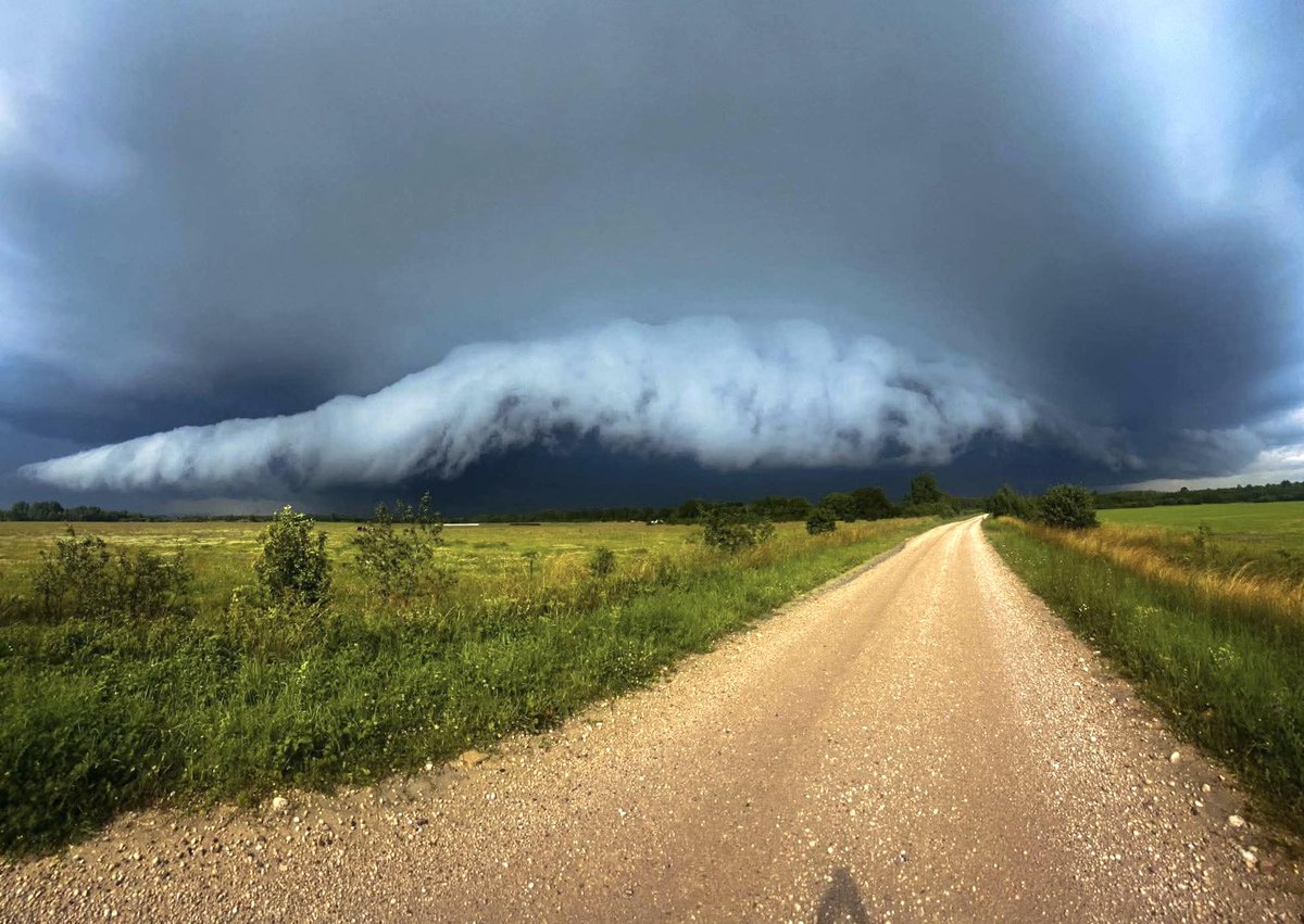
Massive shelf cloud this morning in Melliste, #Estonia 12.07.2025. Photo: Eero Hermann
Saw 3 roll clouds yesterday 11.07.2025 in NW-Estonia.
