Jesse Walker
@jessewalkerWTWO
Chief Meteorologist @wtwonews | CBM & NWA | Country Music Fan | Handy Man | Runner | Life-long Hoosier Instagram: http://instagram.com/jwalker681/
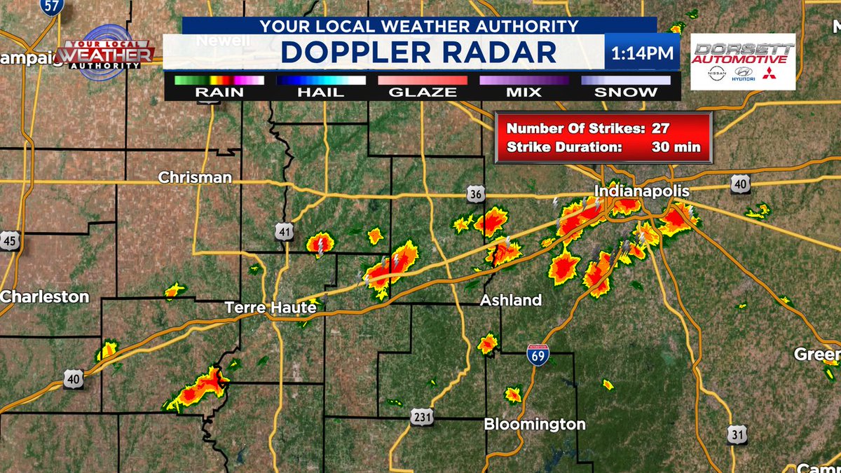
Current weather alerts. Pink = SEVERE T-STORM WATCH. Orange = SEVERE T-STORM WARNING. Plus a FLASH FLOOD WARNING for northern Sullivan and SW Vigo counties

A Flash Flood Warning is in effect for Champaign, Piatt counties until 7/26 9:45PM CDT
A Severe Thunderstorm Warning is in effect for Champaign, Piatt counties until 7/26 6:30PM CDT

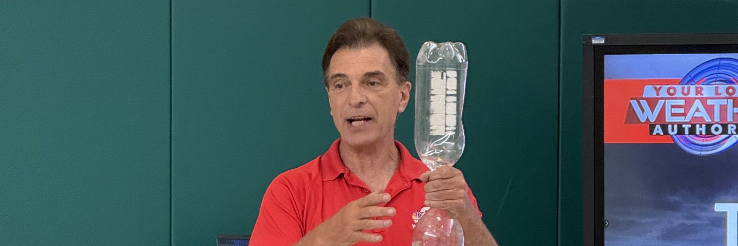
Ever wondered how much water is in just 1" of rain? It's actually a huge amount.

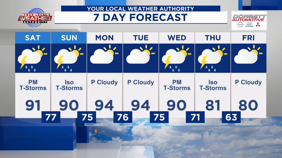
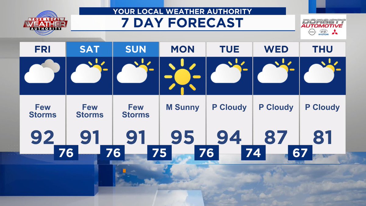
HEAT INDEX has been extended through Saturday evening. This may get extended through the middle of next week.

Heat wave continues for the next week but signs are showing a change by the end of next week. Here's the GFS model forecast for heat index for next Tue and next Fri. If this model is correct, we could see a drop in the heat index by 50 degrees!


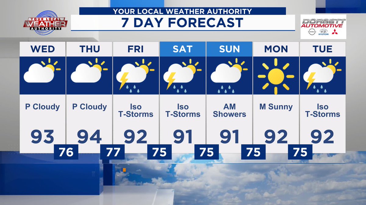
It's going to be hot and humid for the next several days but signs are pointing to cooler weather later next week. The first week of August looks cooler than normal!

All I can say is wow! Melinda King took this picture of a tornado warned storm as it was moving into NW Effingham County Sunday evening. No tornadoes came from it but we were watching rotation with it on radar.

EXTREME HEAT WATCH has been issued for all of our IL counties for Wed. - Thu. Heat index could hit 110 - 115 those two days. This watch may get extended into Indiana as we get closer.

Dew points forecast to be higher here than in FL by the middle of the week! The moisture making these high dew points will come from 1) all the recent rain and it will start to evaporate and 2) Corn sweat or technically called "Evapotranspiration" (more on this later today).


A Flash Flood Warning is in effect for Effingham, Shelby counties until 7/21 4:00AM CDT
A Severe Thunderstorm Warning is in effect for Lawrence, Martin, Daviess, Greene, Monroe counties until 7/20 9:30PM EDT

A Severe Thunderstorm Warning is in effect for Greene, Sullivan counties until 7/20 8:45PM EDT

A Severe Thunderstorm Warning is in effect for Knox, Daviess, Greene, Sullivan counties until 7/20 9:00PM EDT

Rotation showing up on radar in NW Effingham County and moving SE. This is why there is a TORNADO WARNING for NW Effingham County
