ICEYE
@iceye_global
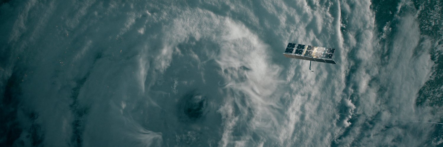
We own and operate the world's largest SAR satellite constellation, delivering unmatched persistent monitoring capabilities for any location on Earth 🛰️
ICEYE is excited to announce Dwell Precise, the industry’s highest fidelity 25 cm product. The increased resolution will allow our customers to identify objects and features on the Earth’s surface with far greater clarity than before. Read more: hubs.li/Q02RC_G80.


ICEYE supported the government of Rio Grande do Sul, Brazil in mapping flood-impacted areas, enabling fast, targeted humanitarian aid for vulnerable families. Learn how ICEYE Flood Solutions helped deploy critical relief in record time: hubs.li/Q03wCFrG0 #DefesaCivil

CSI images are made by coloring the backscatter received for different sub-apertures and combining it into a single product. Learn more about Dwell modes: hubs.li/Q03yrKkr0


The two images shown here are examples of GTR collection imagery over an air base. The obvious question is: "Why do the helicopters look so different?" Read more: hubs.li/Q03ybd7P0

ICEYE was honored to welcome @Esri Founder & President Jack Dangermond at the ICEYE booth during #ESRIUC2025. During the conference, we showcased Flood Rapid Impact and real-world uses of our Flood and Wildfire Insights, sparking discussions on supporting disaster-prone regions.

Hurricane season is here — are you ready to respond faster? Join ICEYE & @eigenrisk on July 23 for a live webinar on using real-time satellite intelligence to stay ahead of wind and flood impacts before, during, and after landfall. Secure your spot now: hubs.li/Q03x_MKM0

Task ICEYE SAR satellites and collect intel over your areas of interest. Build situational awareness to inform future access. Learn more at hubs.li/Q03xcZ070.
Join ICEYE’s Stephanie Wan at the Juvare Asia Pacific User Conference on 29 July for an engaging presentation on how ICEYE is transforming disaster response in the Asia Pacific Region. If you are interested in attending, register your interest by emailing [email protected]

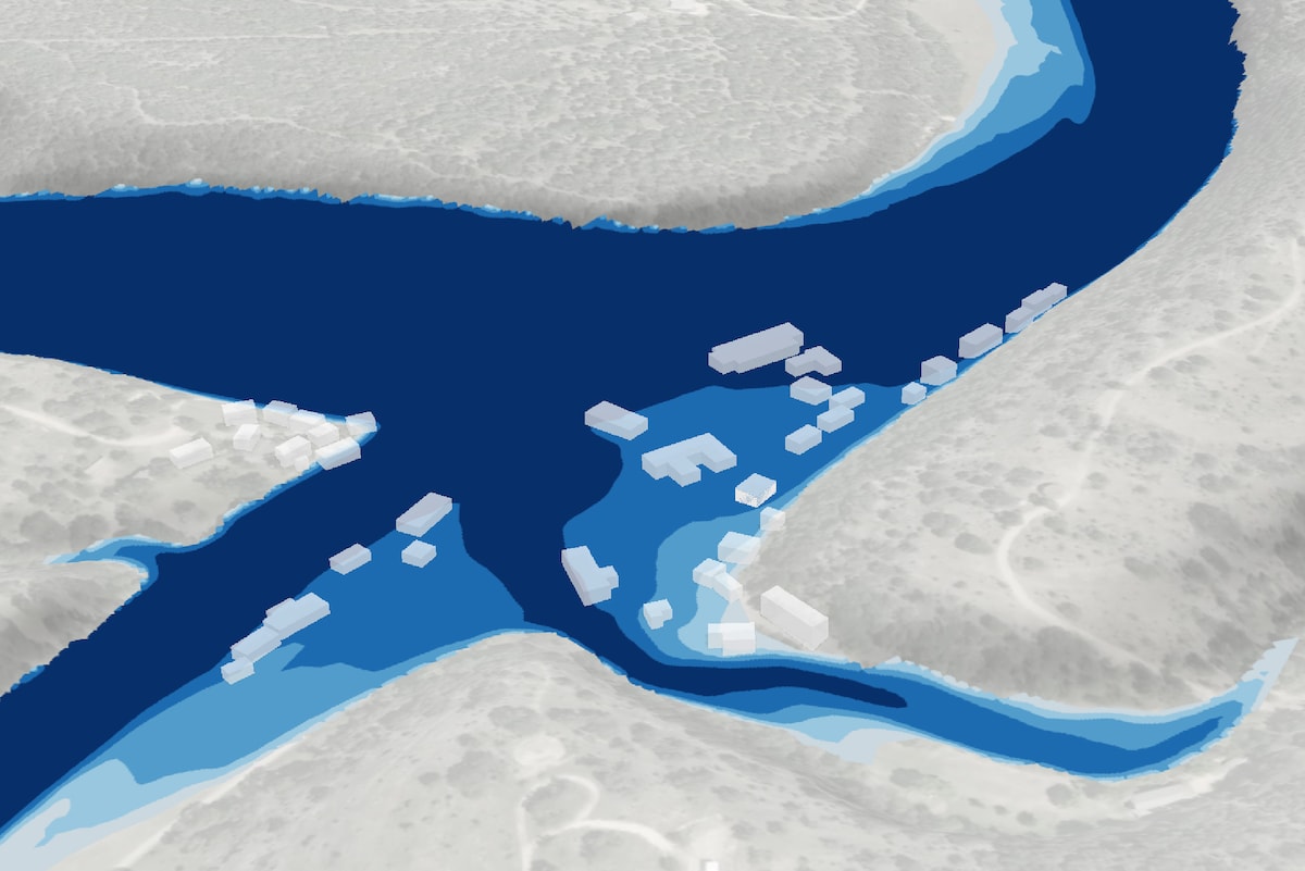
ICEYE shared flood data with the @washingtonpost, showing flood extent and depth at Camp Mystic and along the South Guadalupe River. The story highlights how the camp’s charm also left it exposed to record flooding. Read more: washingtonpost.com/nation/interac….
In this 3-minute video, learn how ICEYE’s #Hurricane Solution helps insurers: • Detect wind damage • See flood extent/depth • Get impact data within 24h of landfall/flood peak Watch now: hubs.li/Q03xq_Ry0 #HurricaneResponse #ClaimsTriage

The ICEYE team continuously tests image collecting, and in one of their tests, they explored how many images could be collected in one pass. Read more about the test: hubs.li/Q03xcYKp0

Introducing ICEYE’s Flood Rapid Impact (FRI) - near real-time #FloodMonitoring with 6-12 hour updates to help responders, insurers, bankers, utility and energy companies, act faster and in the first few hours of a flood event. hubs.li/Q03x19mw0

Dwell Precise gives you the ability to recognize objects in a single image with its game-changing 25 cm resolution. Learn more: hubs.li/Q03w0Sr_0.


