GEOSAT
@geosat_sat
Operation and exploitation of Earth Observation satellites to deliver Very High-Resolution imagery and value-added services.
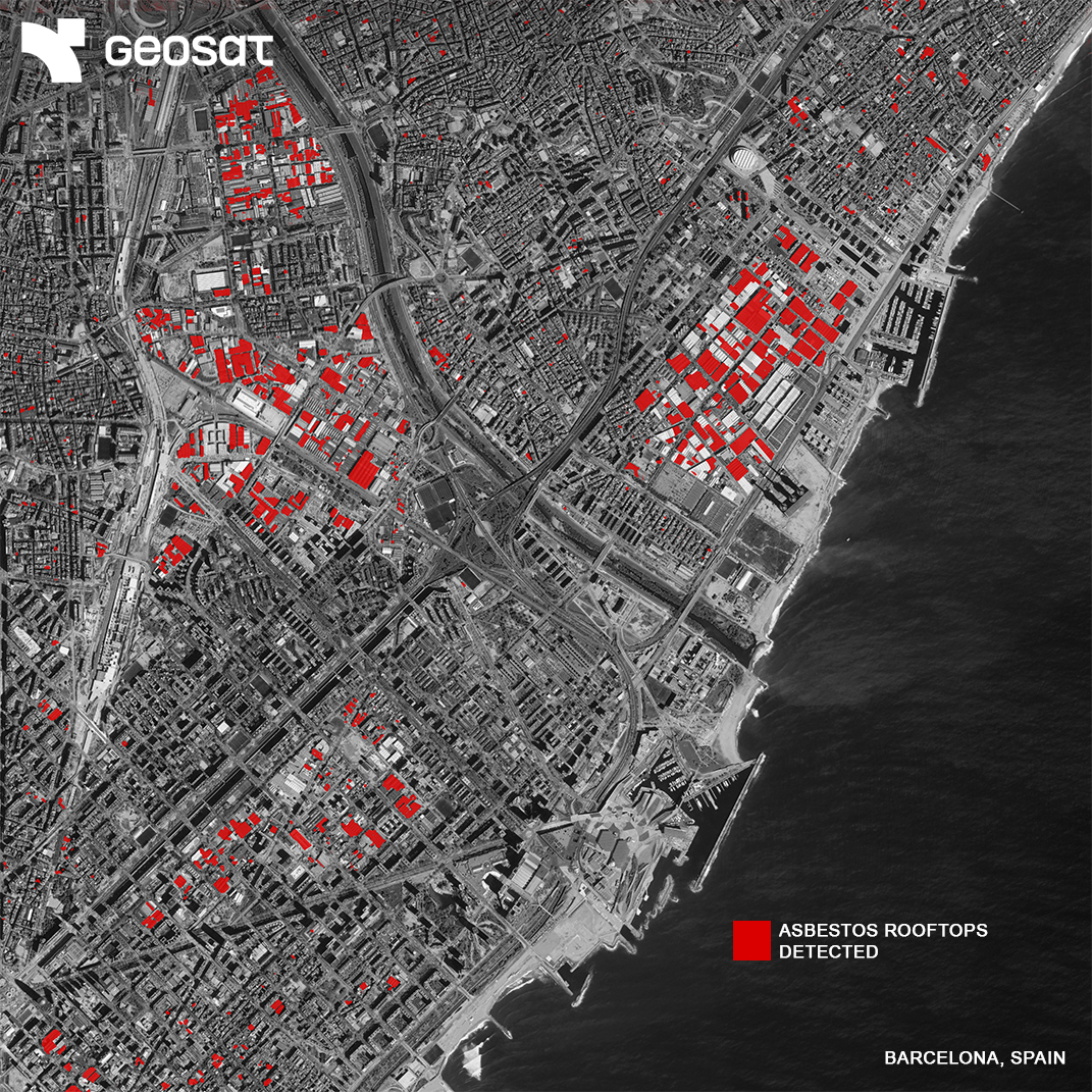
Did you know 2,000+ rooftops in Barcelona still contain asbestos, one of Spain’s highest concentrations? With VHR satellite imagery, these surfaces can be detected from space, helping meet EU removal targets by 2032. Geospatial intelligence for safer, healthier cities. 🛰️

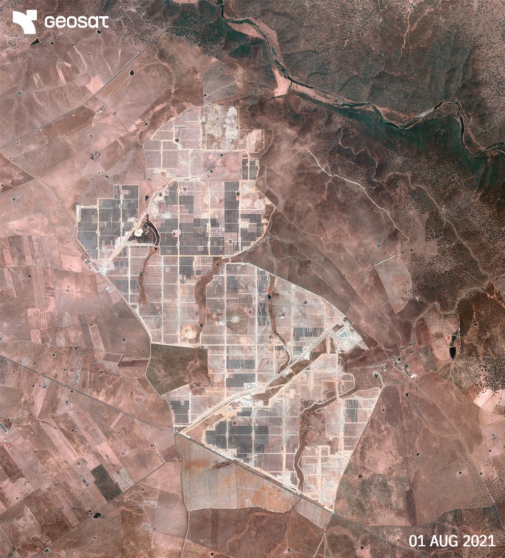
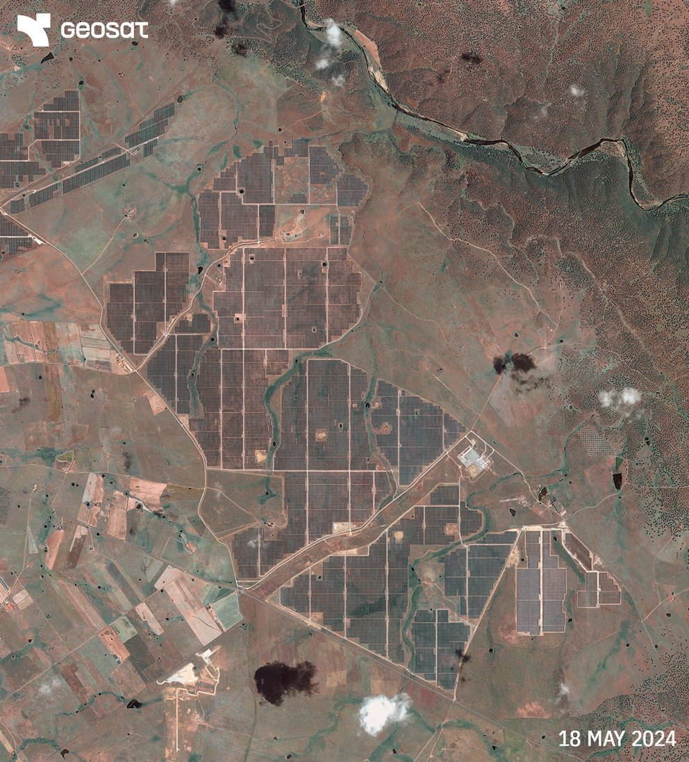
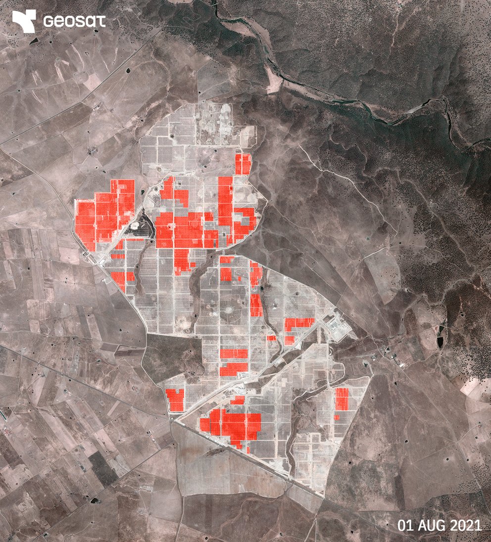
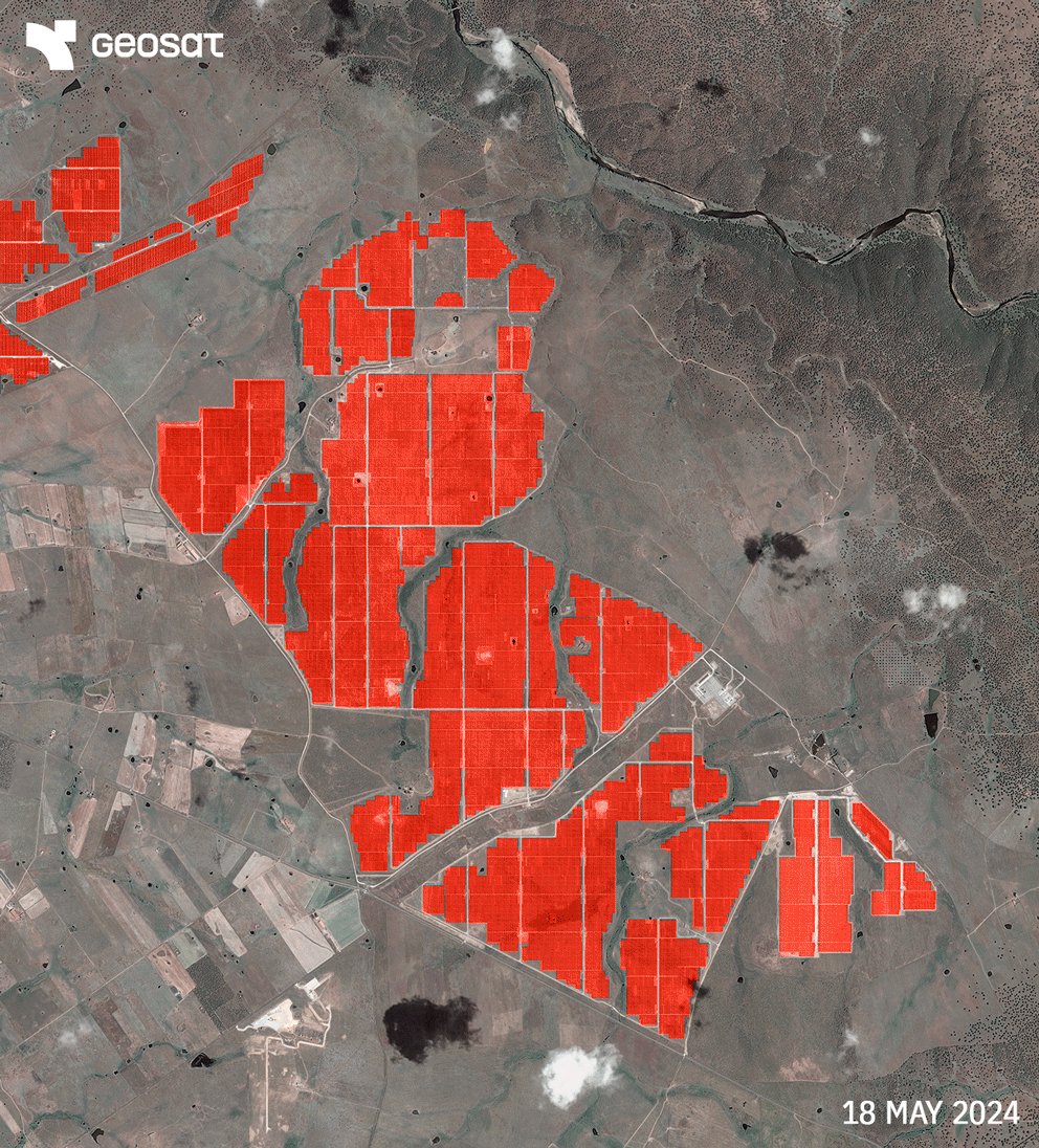
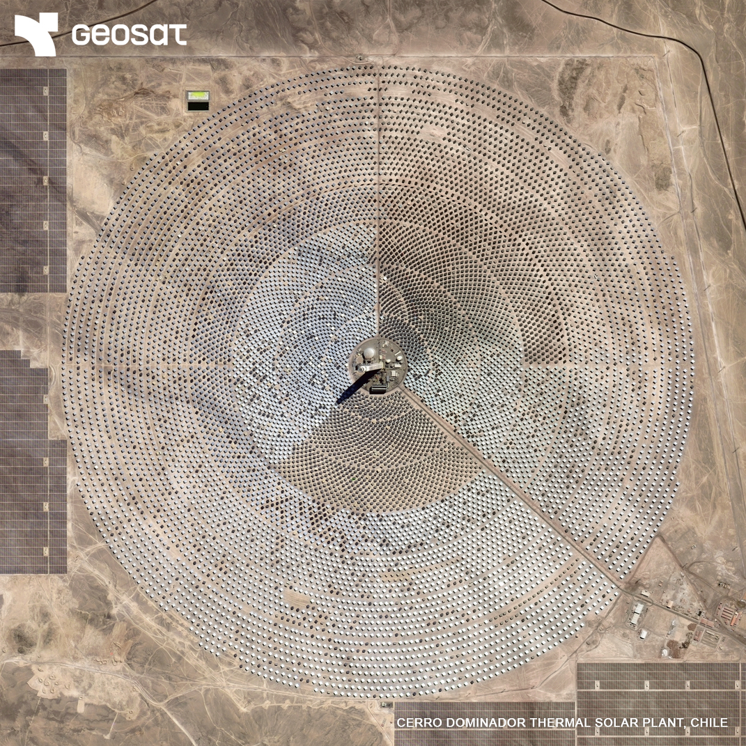
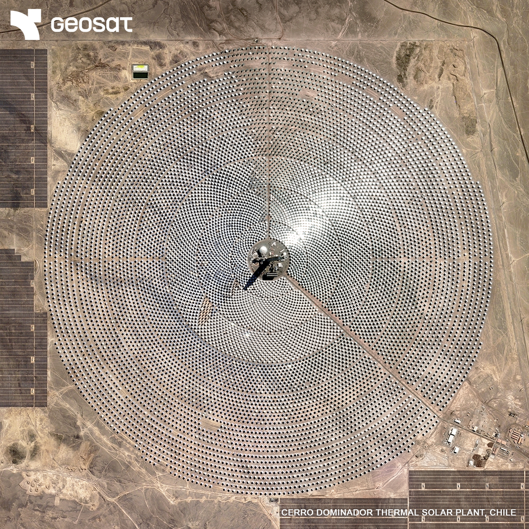
Cerro Dominador, next-gen solar power seen from space. Discover how Latin America's first thermal solar plant stores energy and how optical satellites monitor it remotely, supporting smarter decisions for risk, investment and operations. 📖 Read more ow.ly/vwEL50WtPaE
🚀 Latest view of SpaceX’s LC-39A at @NASAKennedy Visible progress on the Starship launch pad since May. 🛰️ Captured mid-July 2025.
🔄 One month later here’s how things have changed. We’ve revisited SpaceX’s LC-39A and Roberts Road sites at @NASAKennedy. 🚀 New construction progress is clearly visible in both areas. 🛰️ Satellite imagery update, mid-May 2025. Tracking development as it happens.
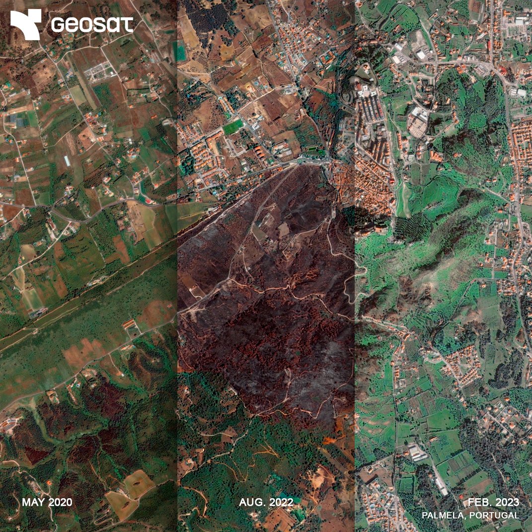
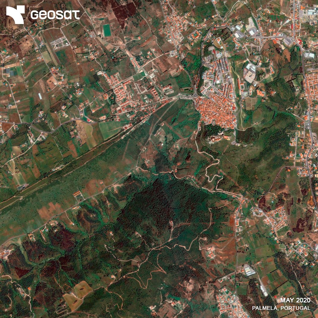
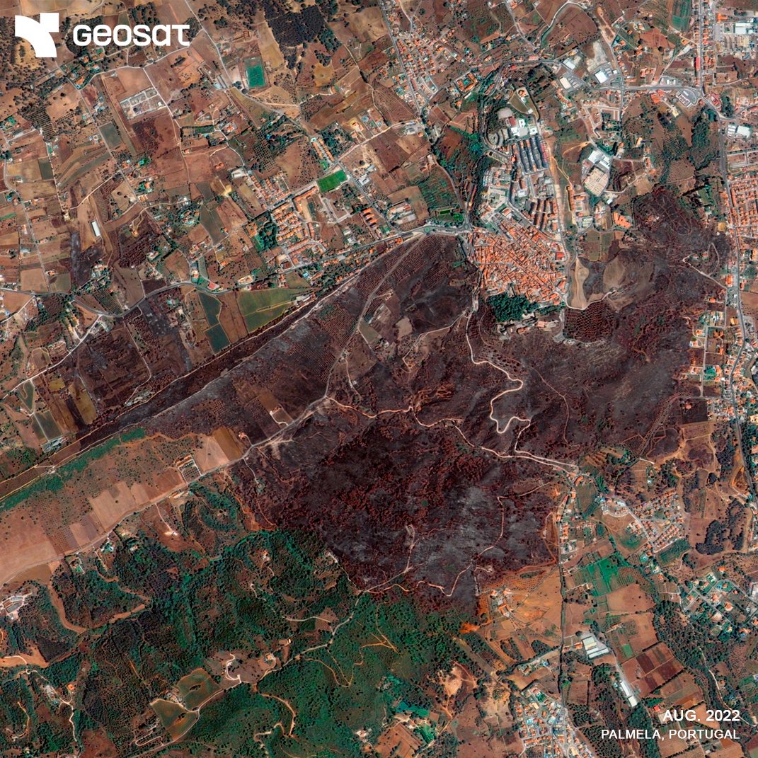
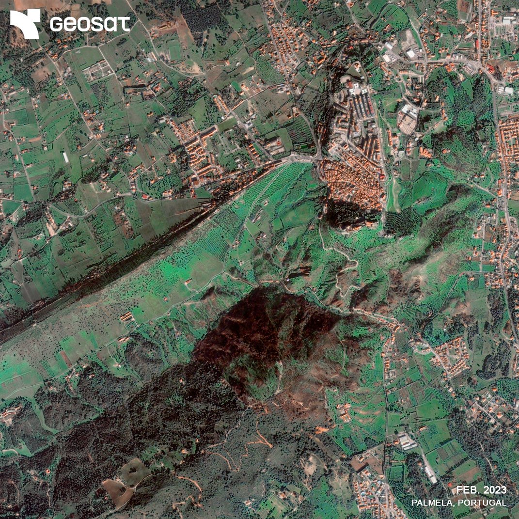
🔥 See the before, during & after of a wildfire, from space. With VHR imagery, 10+ years of archive & delivery from just 15 min after capture, satellite data can help insurers, risk managers & authorities assess damage, track recovery & act fast, without being on-site.
🛰️ The world is changing. So is the way we see it. Discover how GEOSAT helps view the planet with greater precision and purpose. 🔗 geosat.space
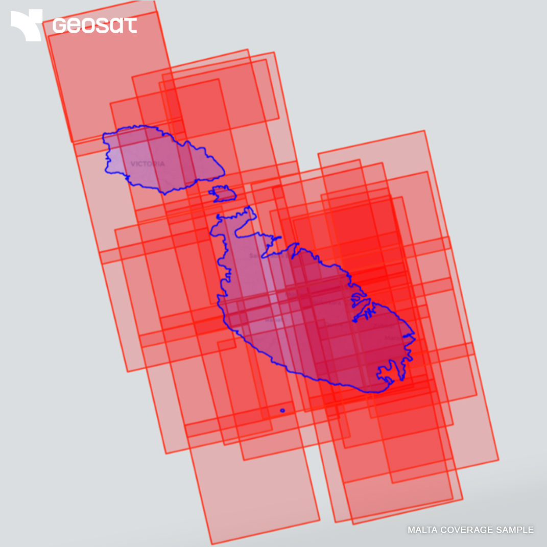
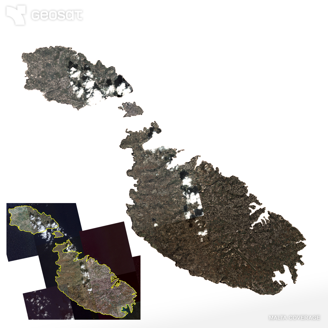
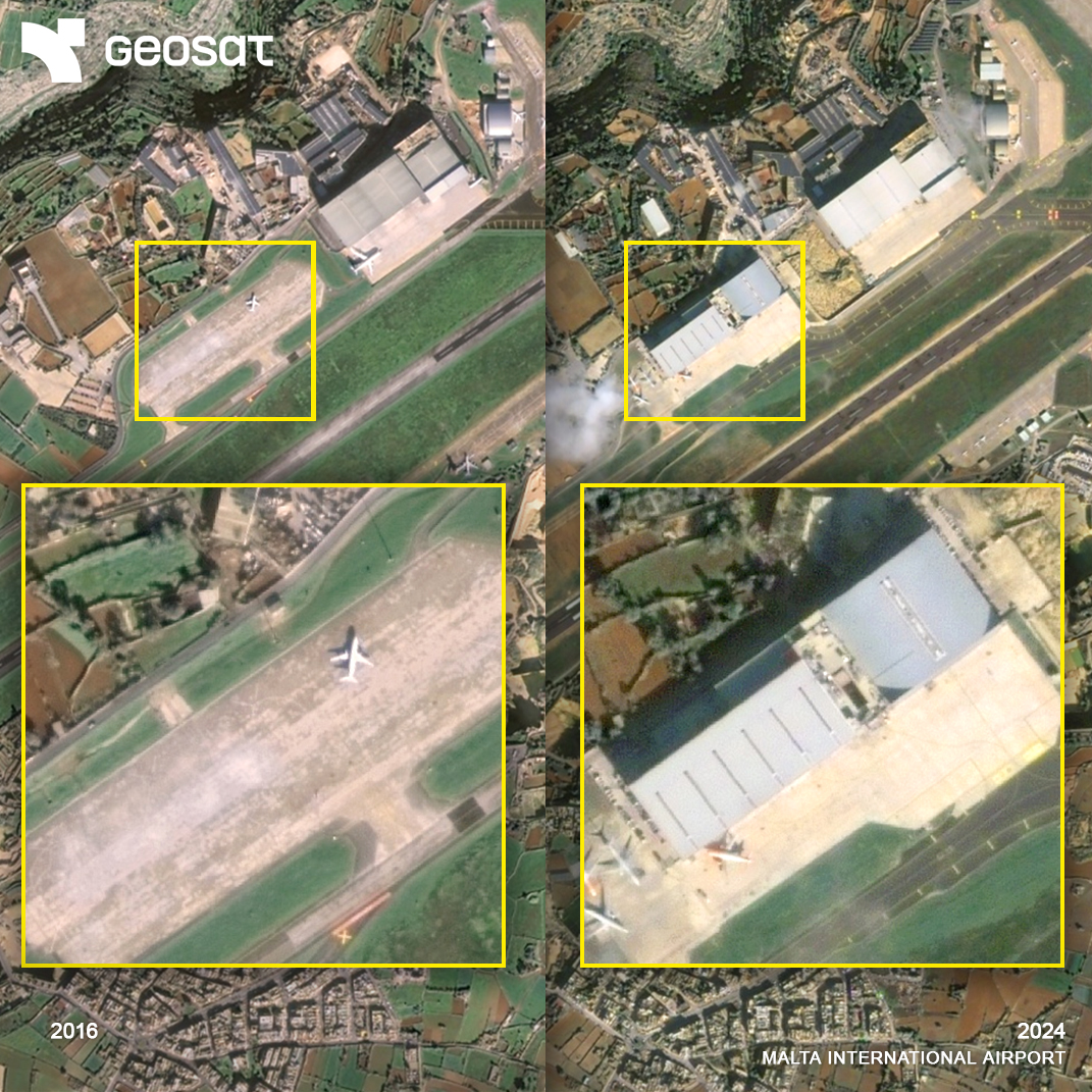
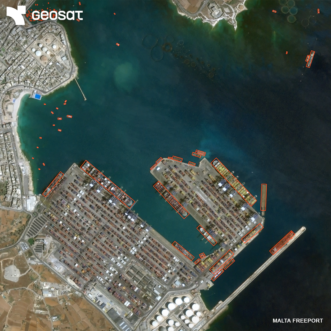
Asset monitoring from space. GEOSAT’s VHR imagery and analytics enable reliable monitoring of critical assets across regions like Malta, from infrastructure to vessels, aircraft, and roads. Actionable insights for security and planning. 🛰️ Your eyes on site.
In September 2024, Vienna faced historic floods as the Danube rose dramatically. Key infrastructure like the Donauinsel protected the city. Now, Vienna is evolving into a “sponge city,” expanding green, permeable spaces. GEOSAT satellites track this climate adaptation.
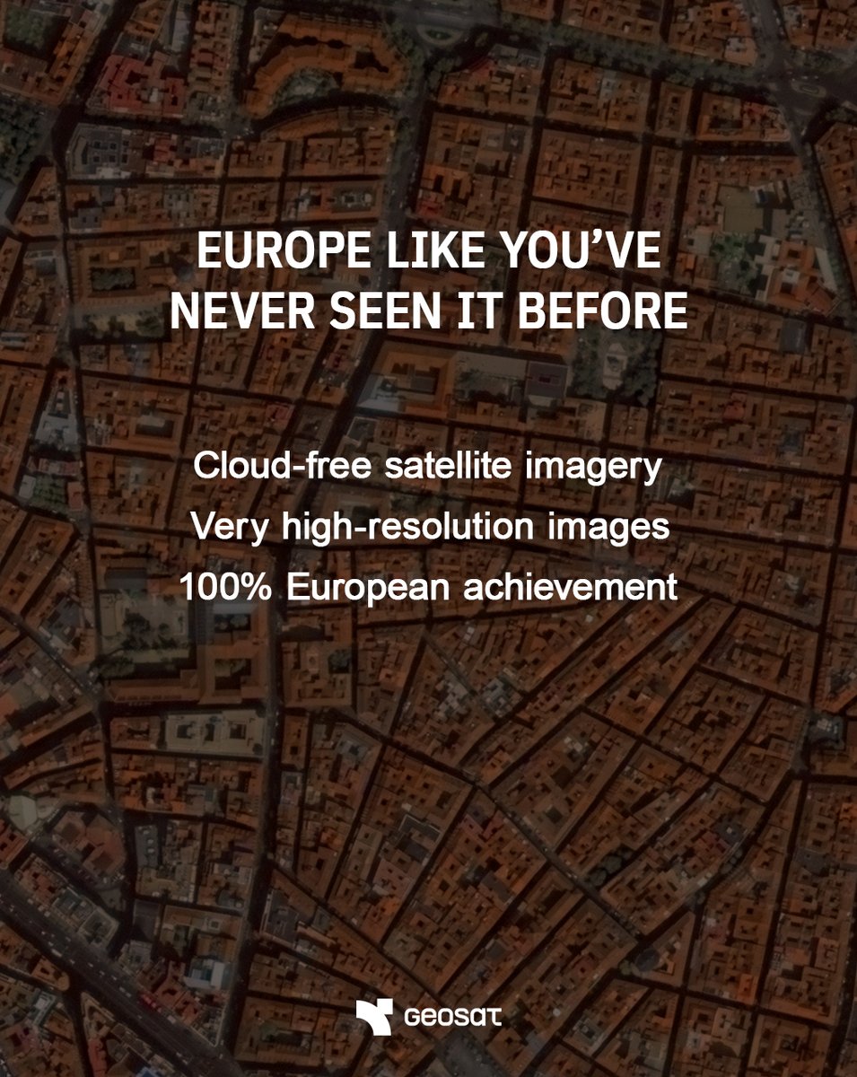
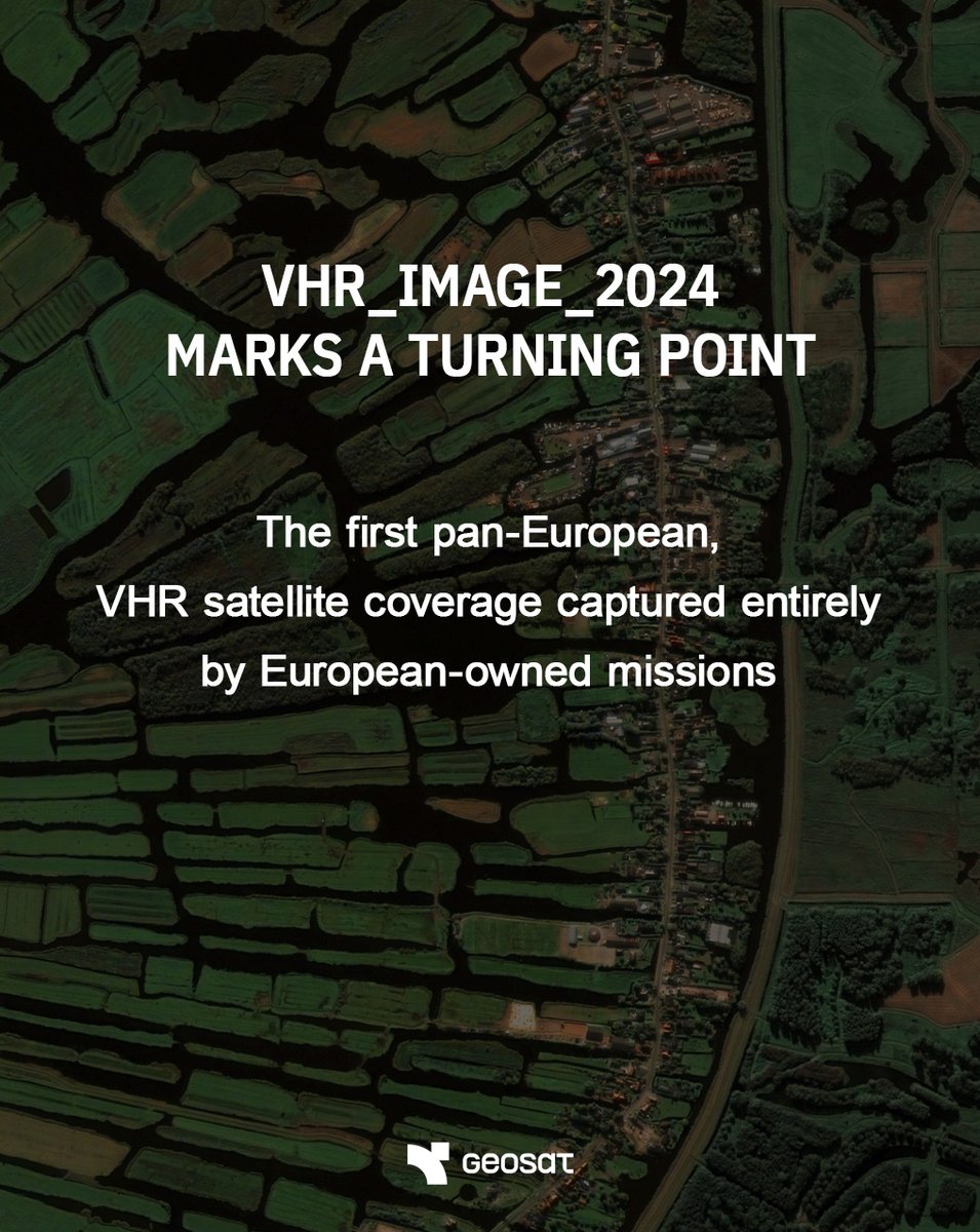
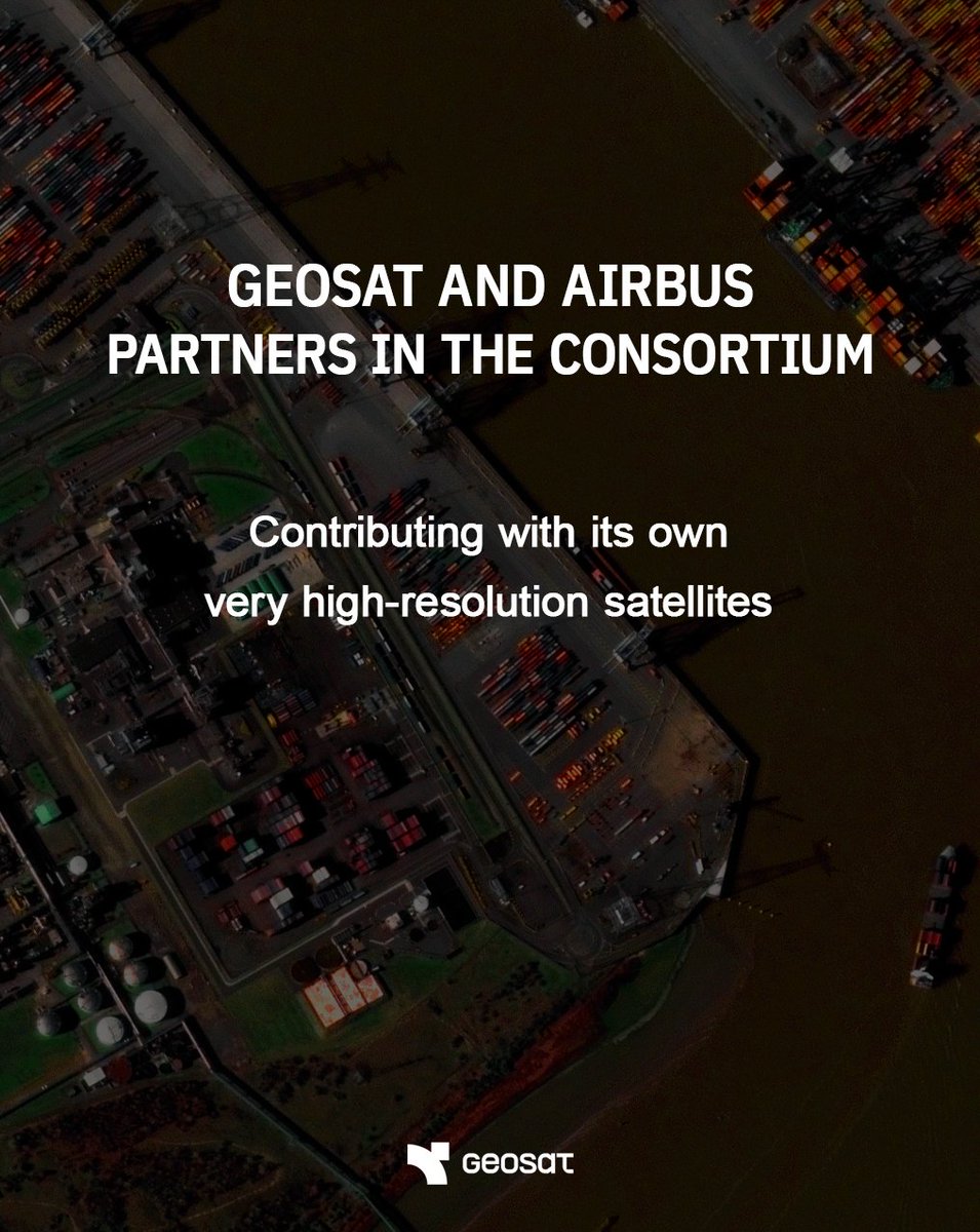
The “truly European coverage” of Europe! 🇪🇺🛰️ @geosat_sat & @AirbusSpace deliver fresh VHR satellite imagery over Europe under the #Copernicus programme, supporting land, urban & environmental monitoring. Bringing space to people. 🔗 geosat.space/blog/optical-v…

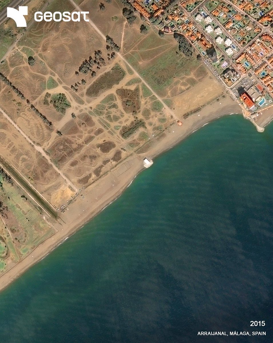
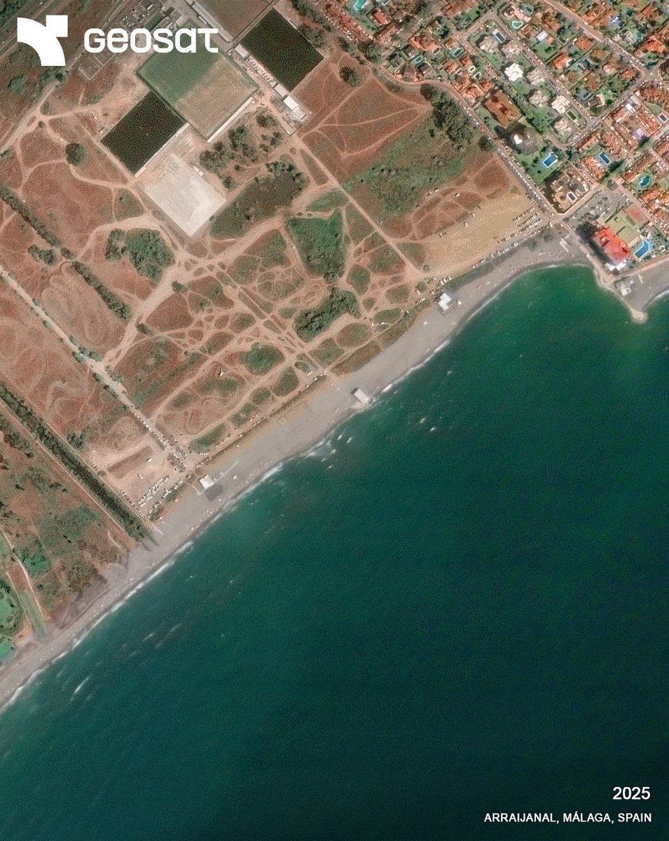
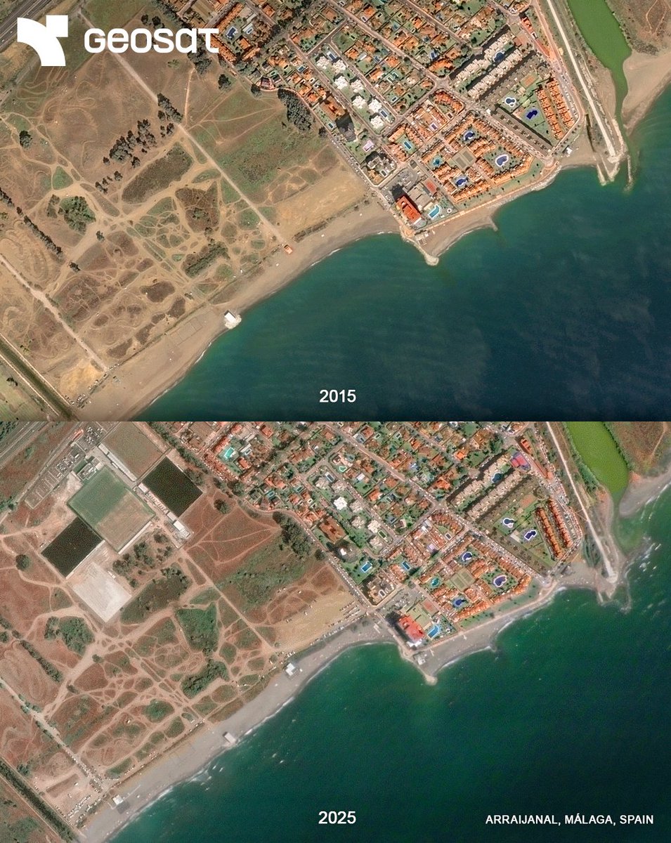
🌊 Coastal retreat in Arraijanal (Málaga) has reached up to 45 m, per Spain’s Ministry for Ecological Transition. Sand loss since 2018 is linked to storms, urban growth, and sediment disruption. Our VHR imagery can help track coastal change over time to guide informed action
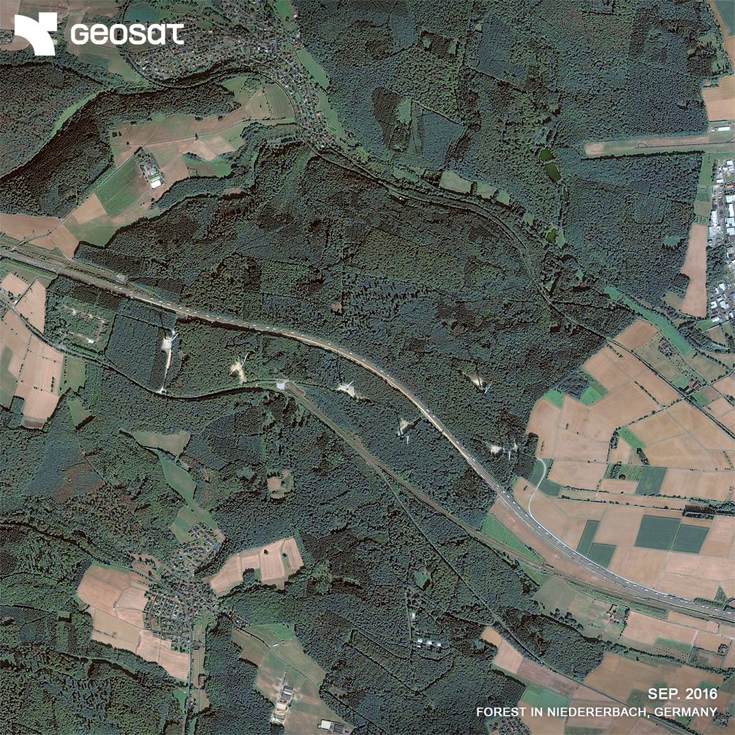
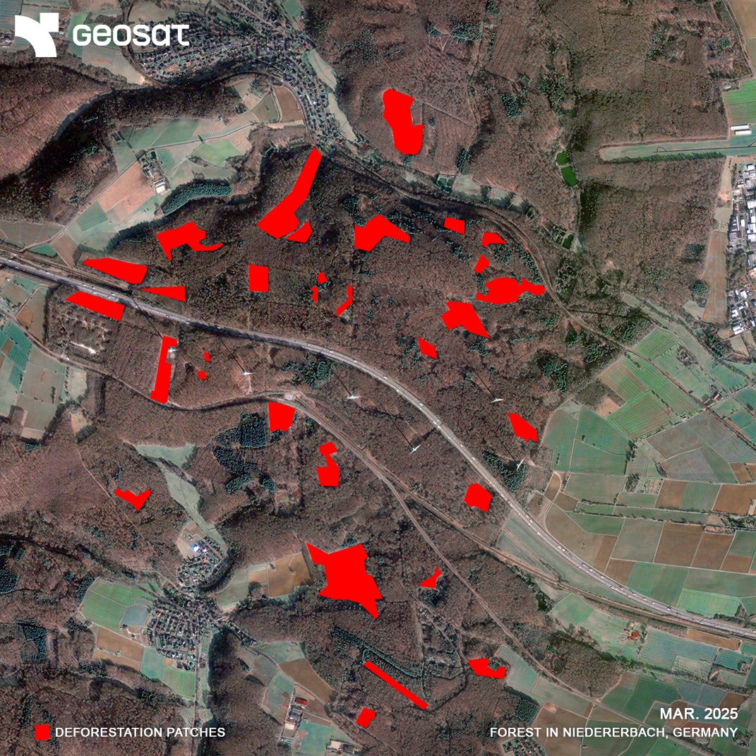
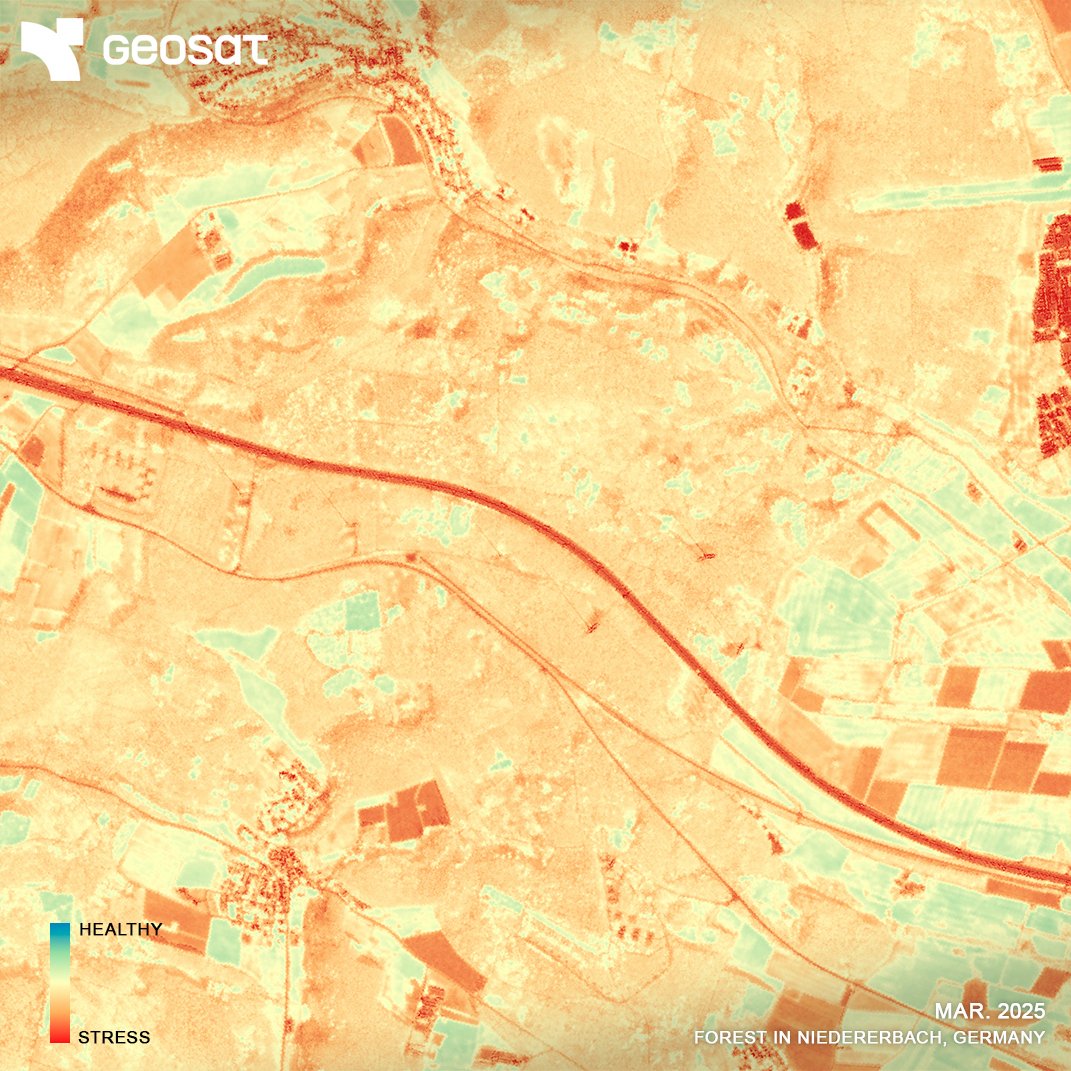
Deforestation Analysis in Germany Using GEOSAT VHR satellite imagery and NDVI analysis, we identified significant forest loss in the Niedererbach region over the past decade (2016–2025). A local case reflecting a global trend. Read more here: geosat.space/blog/deforesta…

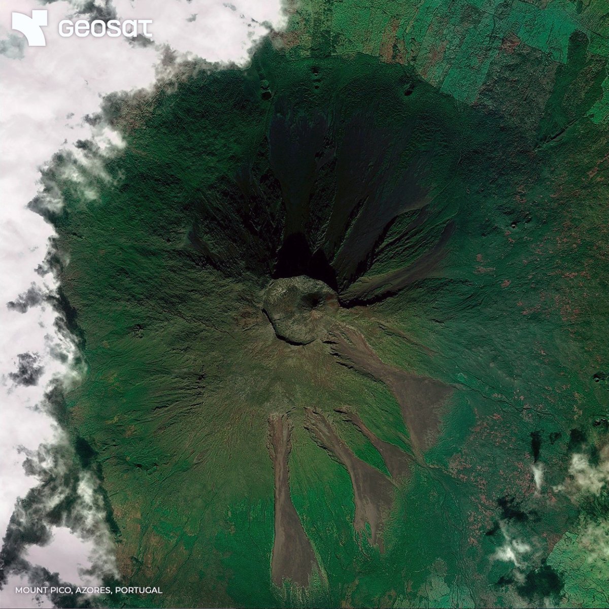
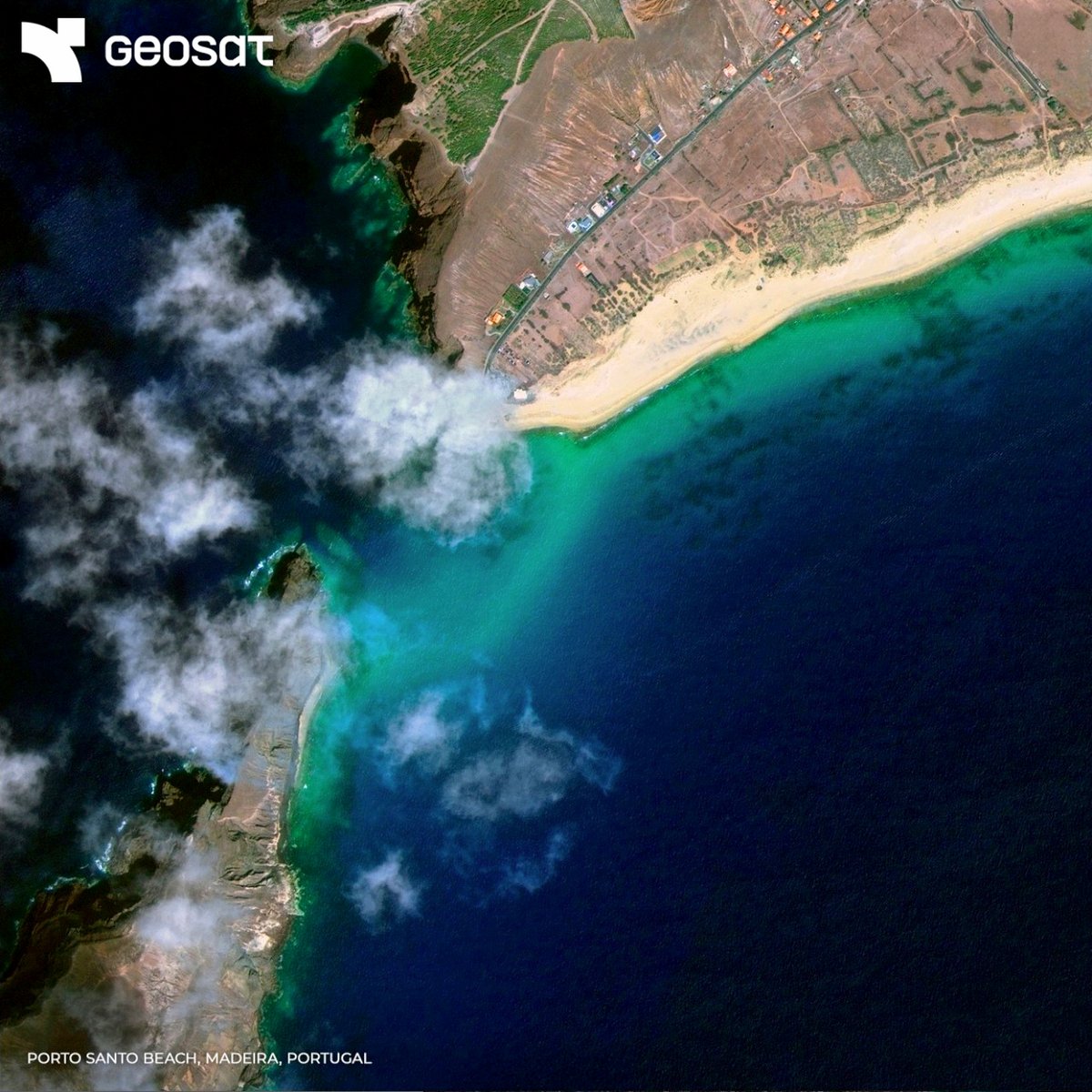
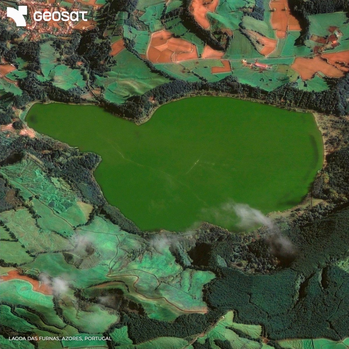
Today we celebrate #PortugalDay. A tribute to Portuguese culture, history, and the legacy of Luís de Camões, author of The Lusíadas, the first literary epic about the country. To mark the occasion, enjoy these stunning satellite views, a celebration of Portugal from space. 🌍✨

🌍 Today is #WorldEnvironmentDay and the Earth spells our name! At GEOSAT, we use over a decade of satellite data to monitor change and support decisions for a more sustainable future. To protect the Earth, we must first see it, clearly.
GEOSAT operates its own constellation of satellites to deliver Very High-Resolution imagery and actionable insights for a changing world, supported by a global ground station network, 24/7 support, and simple access.
🔄 One month later here’s how things have changed. We’ve revisited SpaceX’s LC-39A and Roberts Road sites at @NASAKennedy. 🚀 New construction progress is clearly visible in both areas. 🛰️ Satellite imagery update, mid-May 2025. Tracking development as it happens.
🚧 We’re monitoring construction progress at @SpaceX's LC-39A and Roberts Road in @NASAKennedy Work is underway at 39A for a future Starship launch pad, while Roberts Road is being prepared for a new factory and launch control facilities. 🛰️ Tracking key developments.
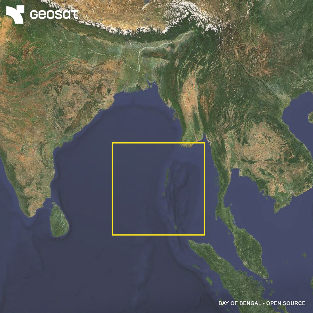
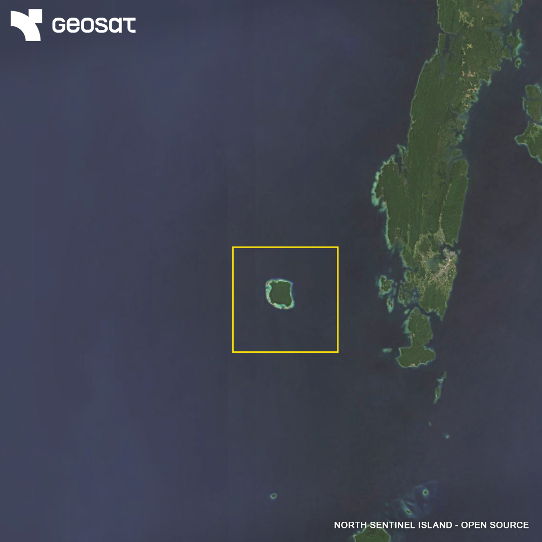
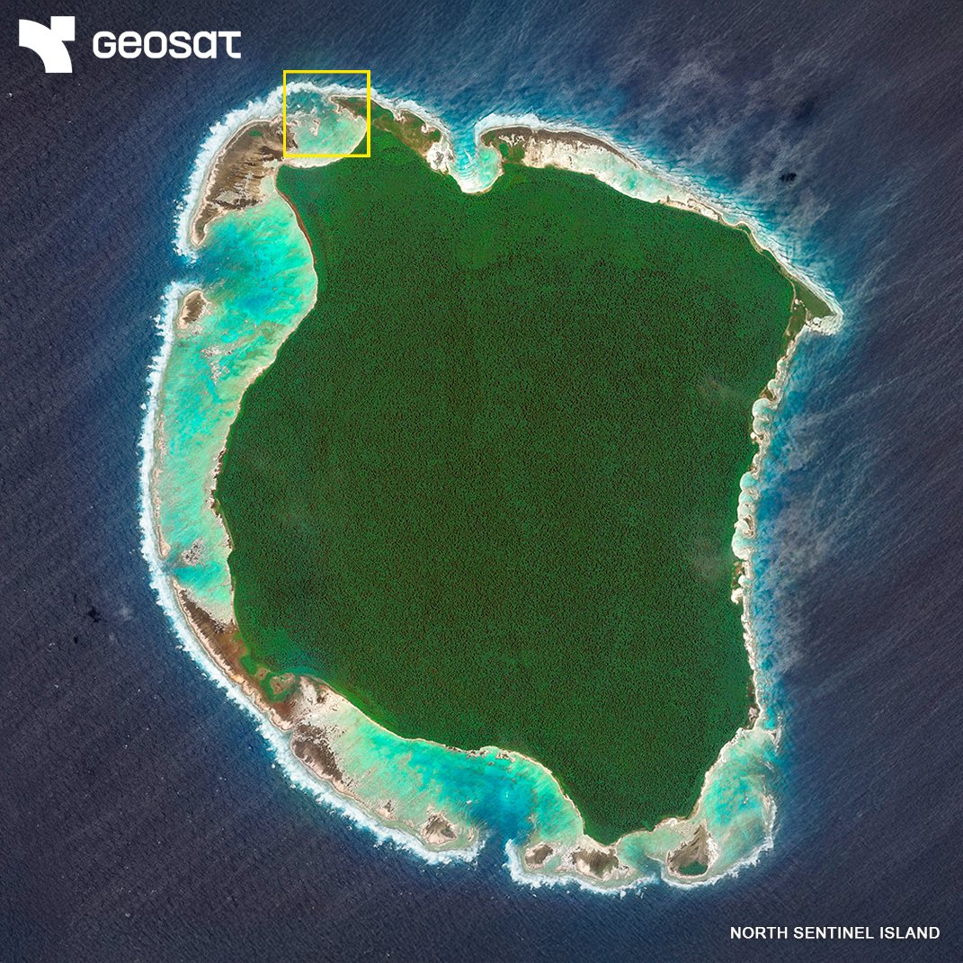
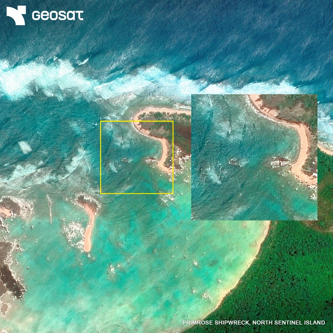
🌍 It looks like just another island. But North Sentinel hides an uncontacted tribe — and the rusting wreck of a ship that changed their story. 🛰️ See it from space. Discover the story of the Primrose. 🔗 geosat.space/blog/the-myste…
From forests to coastlines, GEOSAT helps monitor and protect our changing environment with very high-resolution satellite imagery. Learn more: geosat.space/markets/enviro…


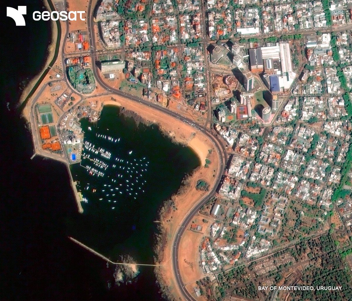
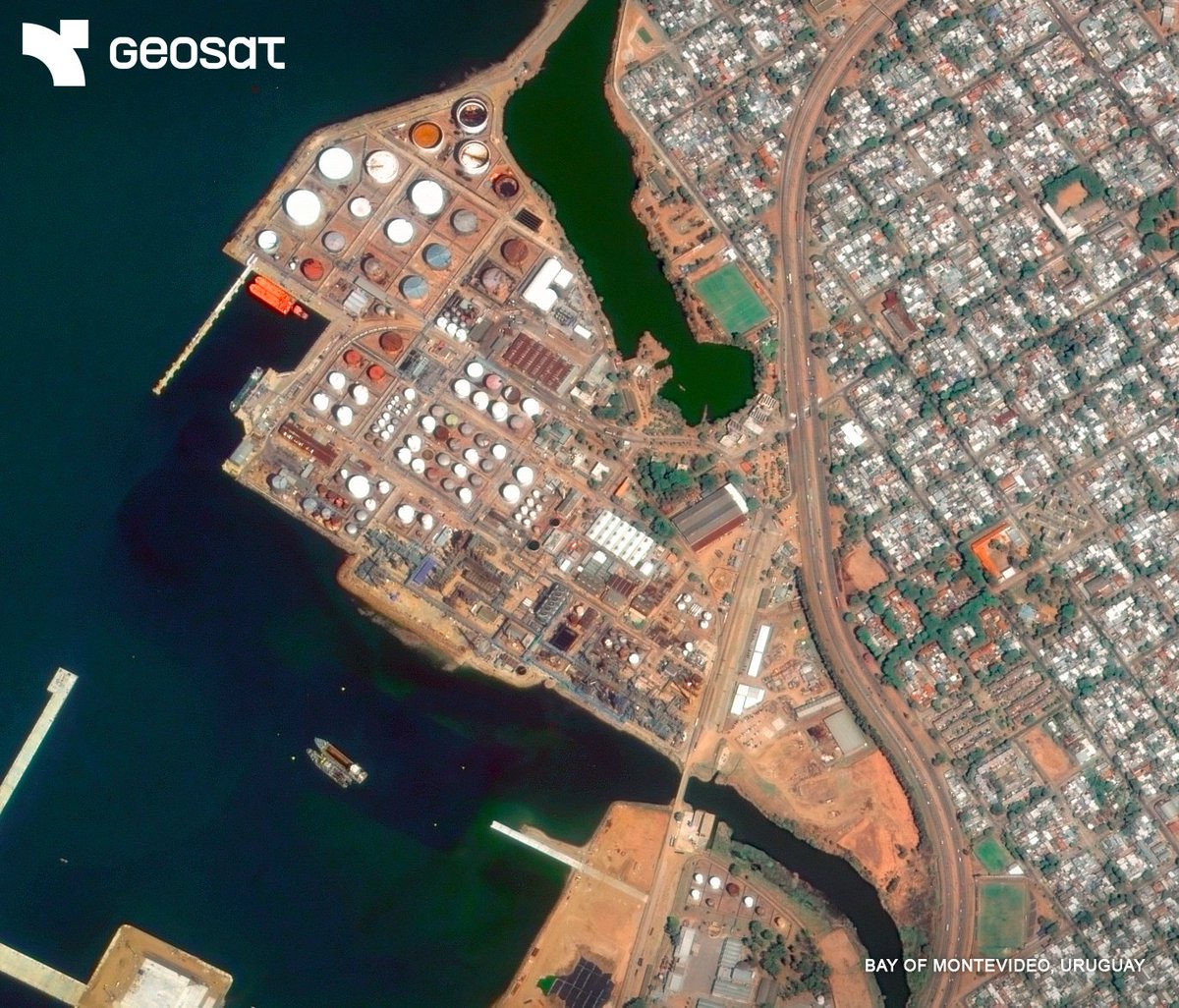
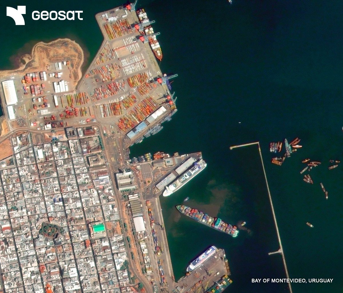
GEOSAT's very high-resolution imagery offers a 12 km wide swath, enabling you to: ✅ Monitor wide areas in a single pass ✅ Detect fine details with precision ✅ Track changes across ports, cities, and natural landscapes The Bay of Montevideo, all in one shot.
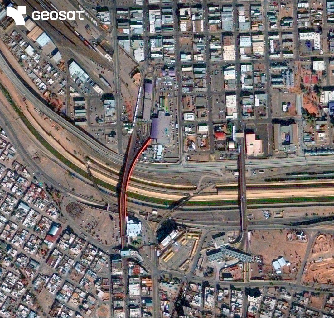
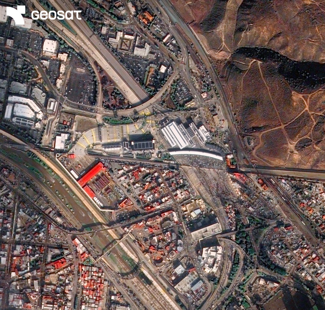
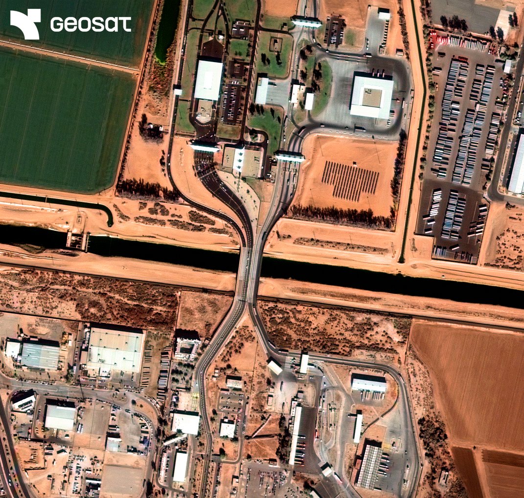
Understanding border dynamics requires perspective. With very high-resolution satellite imagery, GEOSAT supports quasi real-time monitoring and analysis across critical areas. Our data can contribute to informed decision-making in security and infrastructure. #Security
The @GeospatialM kicks off today! The GEOSAT team is already at booth H23 — ready to connect and showcase our Earth Observation solutions. Come say hi! 👋
🌍 GEOSAT will be at @GeospatialM in Madrid, April 22–25, as a proud sponsor! Showcasing how our end-to-end EO capabilities—from satellites to insights—enable smarter, faster decisions across sectors. 📍 Meet us at booth H23! #GWF2025
We can monitor large-scale solar projects via advanced satellite imagery — from site selection to ongoing operations. Our services: 🛰 Remote supervision 🔍 Change detection 🛠 Works verification 📊 Quasi real-time progress reporting 💡 Learn more 👉 bit.ly/3RbkLcc