Capital Weather Gang
@capitalweather
D.C.-area and worldwide weather news from the Washington Post | contact: [email protected]
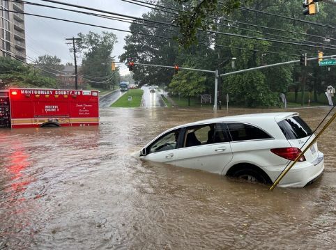
Areas near Washington, D.C. were the latest to be hit by dangerous flooding on Saturday. The long-term trend of atmospheric moisture above the region is not its friend — having risen by 12 percent in four decades — tipping the odds toward more events like this. @capitalweather
Video clip of a vehicle stranded in floodwaters along East-West Highway in Silver Spring earlier. Follow the latest flooding coverage at cwg.live Video taken by Dave Dildine
The Anacostia was overtopping the boat dock and at the Bladensburg Waterfront’s edge around sunset after today’s flash flood upstream in Silver Spring and Takoma Park. Vids 2 & 3 are 1/2 mile upstream at the Northeast Branch and Northwest Branch. @capitalweather
Ahhhh -- drier air filtering in. It'll become more noticeably pleasant into the night. Dew points, a measure of humidity, shown here. Details and forecast update at cwg.live.
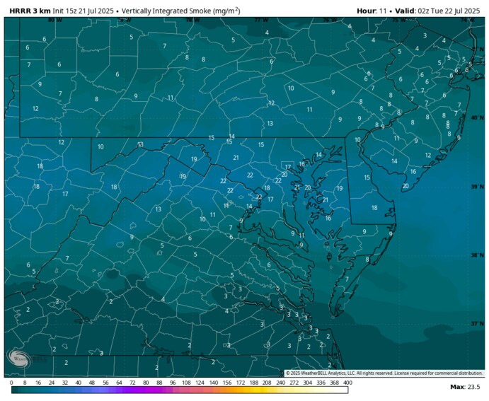
In the category of "it's always something," we could see a touch of haze from wildfire smoke in the DC area Monday afternoon into Tuesday. But it doesn't look like too much of an impact on air quality. More at cwg.live
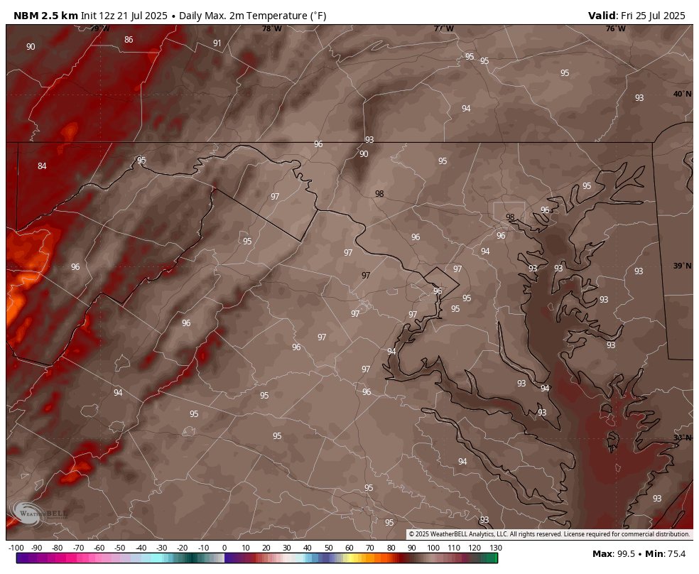
🌡️ Enjoy the break while it lasts — BRUTAL heat-humidity combo is coming. Highs Fri & Sat 95-100 w/ heat indexes near 105. Likely our hottest stretch since late June. 🥵 Storm chances return this weekend too. Full details at cwg.live Pictured: Forecast highs Fri
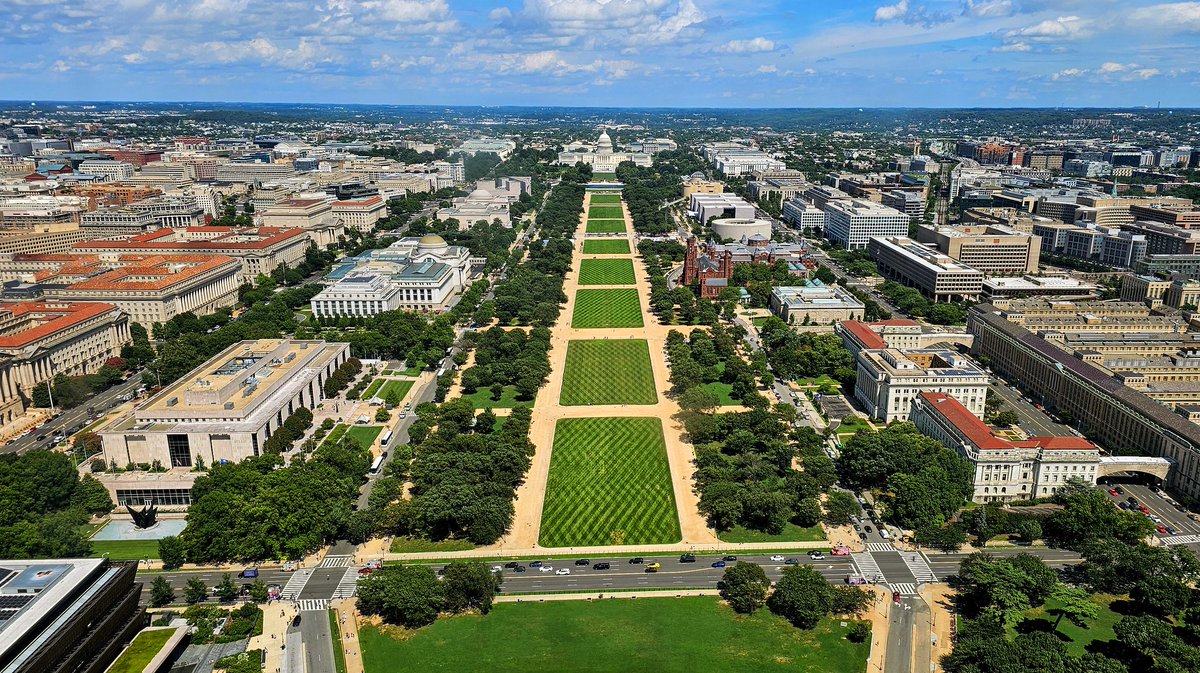
A 9 out of 10 kind of Monday in D.C.! ☀️ Low humidity, tons of sun, and highs in the 80s — what’s not to like? Even better? Tomorrow might be the nicest day in a month. 😎 Full forecast: cwg.live Photo by angela n.
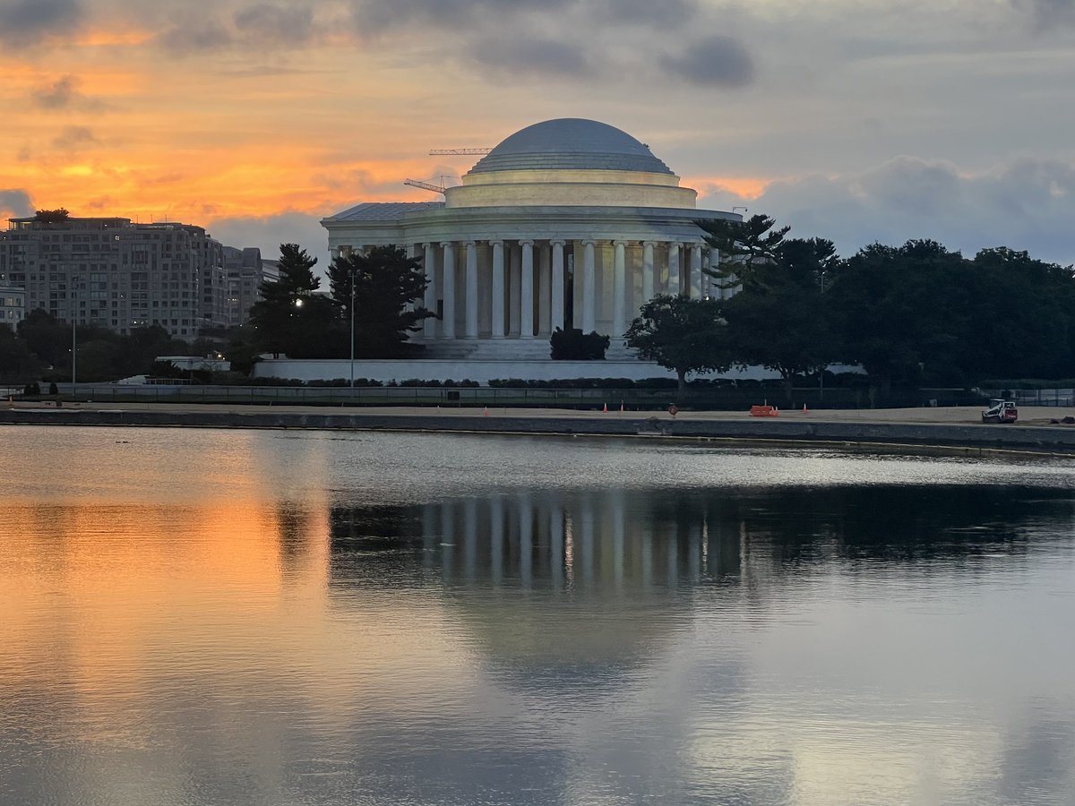
#Sunrise on Monday over the Potomac River in #DC! @capitalweather @KaitlynMcGrath
#Sunrise over #DMV to kick off the week @capitalweather @StormHour @ThePhotoHour @dcstormchaser @PoPville
@capitalweather Another gem from this morning. Photo taken in Pasadena, Md.
GM the beautiful sunrise from @Reagan_Airport @TuckerFox5 @Conthescene @MikeTFox5 @MatthewCappucci @TaylorGrenda @gwenfox5dc @caitlinrothfox5 @JenDelgadoFOX @accuweather @weatherchannel @capitalweather
@capitalweather Tonight’s calm Sunset after a week of evening thunderstorms. Photo taken at BWI Airport.
Sunday Sunset Q&A: Subdued heat, humidity, and rain chances until late week x.com/i/broadcasts/1…
Nicer CWG.Live forecast coming this week but we're watching radar for one last evening before low rain chances arrive. 8:29 p.m. tonight we'll chat here and on the blog about serious heat and humidity pausing, too! Photo by Jeannie in D.C.
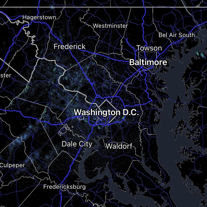
A quiet radar picture at the moment! Will it stay that way? A few pop-up storms still possible today. They should be isolated, so many spots could end up dry. On the other hand, any storm that develops could have strong winds. More at cwg.live
1/ Our new Floods Above series has launched! For our first installment, @sarahkaplan48 @kcrowebasspro @NaemaAhmed and @BenNollWeather unpack why those hit hardest by Hurricane Helene and the July 4 Texas floods were so vulnerable. #climate washingtonpost.com/climate-enviro…
The flood watch ahead of yesterday's deluge was DC's 16th so far this year. ‼️DC has had more flood watches than any other major city!!!
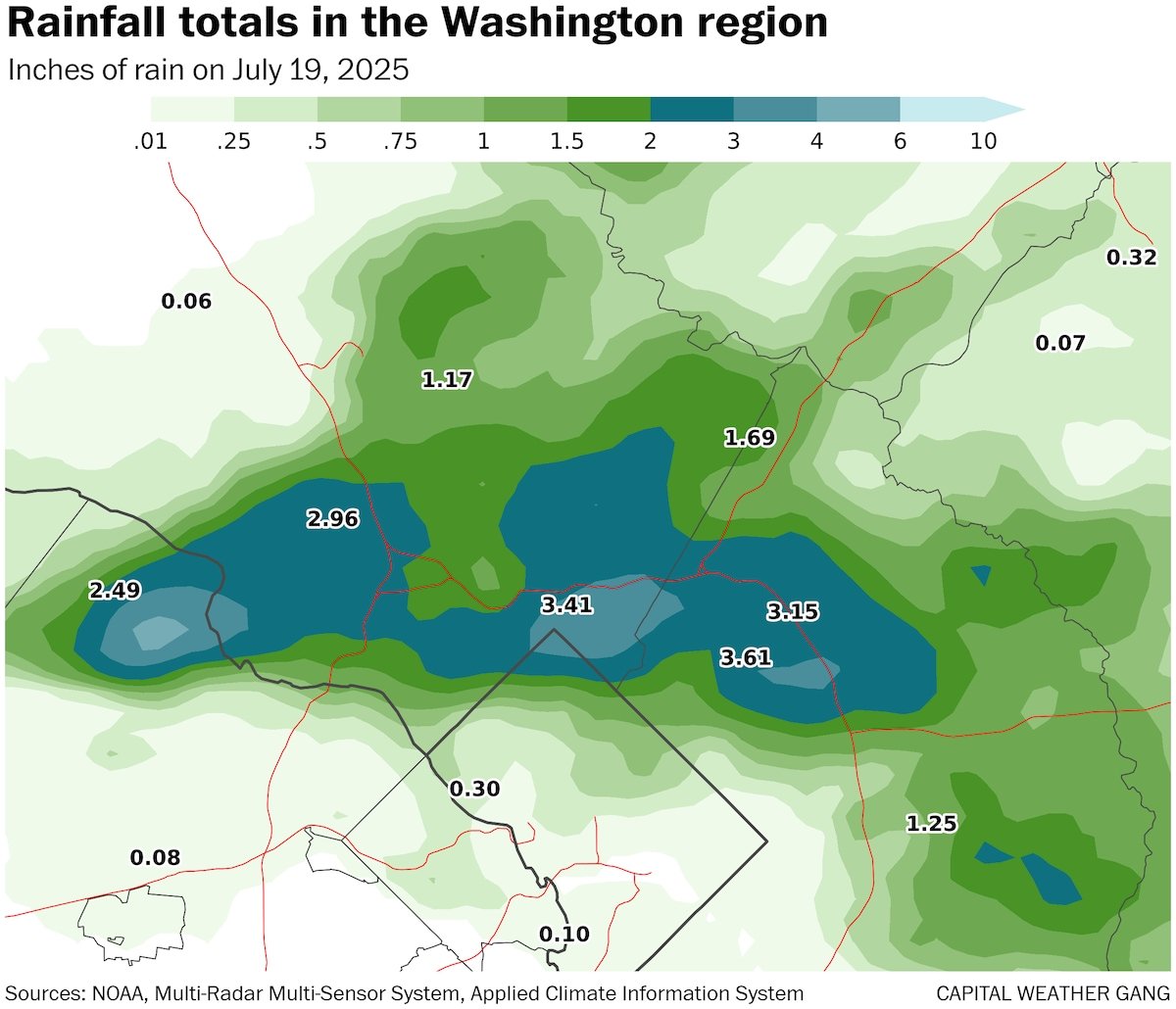
Last night’s rains were staggering in the northern D.C. area: 🌧️ Up to 5.5" in Great Falls & Silver Spring 🌊 Sligo Creek rose 10 feet in 30 minutes 🚨 Dozens of water rescues ⚡ Fueled by near-record moisture Our full recap: washingtonpost.com/weather/2025/0…
Last night’s rains were staggering in the northern D.C. area: 🌧️ Up to 5.5" in Great Falls & Silver Spring 🌊 Sligo Creek rose 10 feet in 30 minutes 🚨 Dozens of water rescues ⚡ Fueled by near-record moisture Our full recap: washingtonpost.com/weather/2025/0…
Sunday digit — 5/10: A break from the relentless humidity and rain is on the way, but we’ll have to wait through one more steamy (and maybe stormy) day. Get the full forecast, and full coverage of yesterday's flooding, at cwg.live (Photo of flooding on East-West…