AZ Dept. Forestry and Fire Management
@azstateforestry
Prevention and suppression of wildfire on 22 million acres of State Trust Land and private property outside incorporated areas.
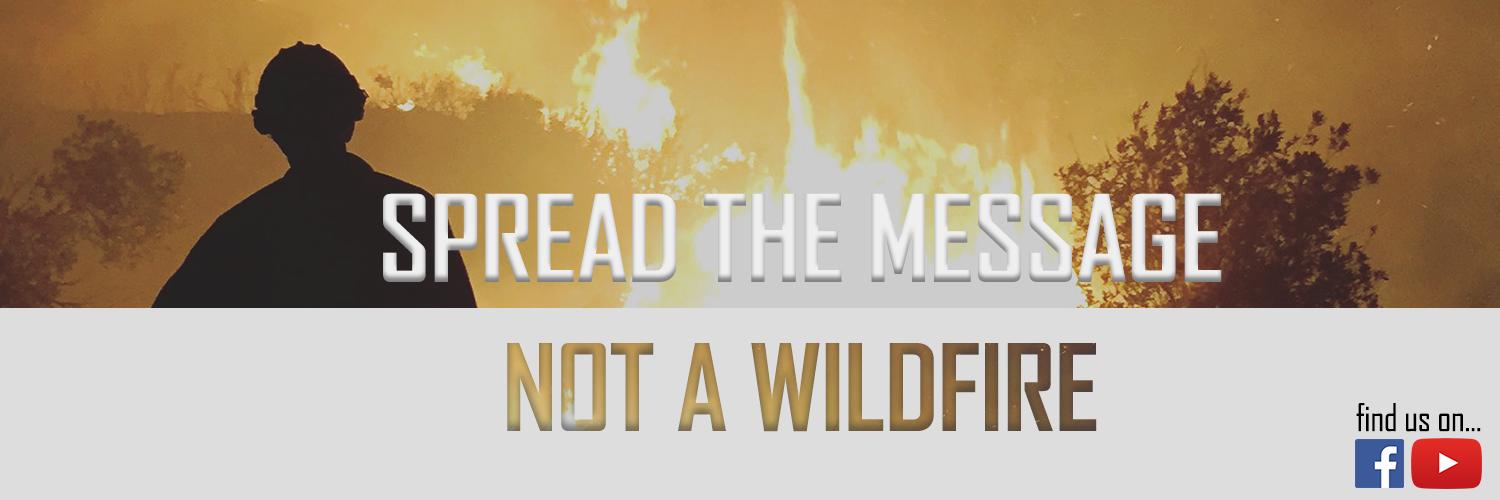
Help us spread the message and not a wildfire! Use caution! Thx @ArizonaDOT 4 helping get the word out! #BeFirewise #WildfirePreventionWeek

Fire restrictions have been lifted in southeast Arizona. For Arizona Forestry that includes State Trust lands w/n Cochise, Graham, Greenlee, Pima, Pinal, & Santa Cruz Counties. However, Stage 2 remain in place on State Trust lands across the rest of the state - w/exception of…

We're excited to continue working with SRP through 2030 to restore forests & watersheds through active forest management! Read the full release here: media.srpnet.com/srp--arizona-d…
Breaking news for Arizona’s forests: We’ve renewed our partnership with @azstateforestry to continue restoration thru 2030. We've restored 35,000 acres since 2020. Next up: 52,000 more acres across AZ forests! Together, we’re reducing wildfire risk and protecting the watersheds.
Forward progress stopped. @BLMAZFire #AZFire #AZForestry
Arizona Forestry responding to #WoodworksFire approx. 15 mi. SW of St. Johns. Fire est 50-80 ac. burning through grass & brush. Local resources currently engaged w/suppression & structure protection to a nearby property. #AZForestry #AZFire #ApacheCounty
Arizona Forestry responding to #WoodworksFire approx. 15 mi. SW of St. Johns. Fire est 50-80 ac. burning through grass & brush. Local resources currently engaged w/suppression & structure protection to a nearby property. #AZForestry #AZFire #ApacheCounty


ASD-Update: #WhiteSageFire about 15 mi SE of Fredonia, AZ. Ground & air resources continue working the fire. Est @ 1K ac & active. Complex Incident Management Team (CIMT) ordered . More: inciweb.wildfire.gov/incident-infor… #AZFire Photo: USFS Kaibab RD
#WhiteSageFire - approx. 15mi. SE of Fredonia. @BLMAZFire jurisdiction. ✔️Inciweb for add'l info: #AZFire #CoconinoCounty
Information on the #WhiteSageFire is available on Inciweb inciweb.wildfire.gov/incident-infor… #AZFire
🔥 #MonarchFire FINAL UPDATE July 4 @ 6:30 pm - All objectives for fire suppression and repair are nearly complete. This has led to containment increasing to 75% while acreage remains at 148 acres. Resources will finish up any remaining work over the weekend but will be available…

Let freedom ring🇺🇸 Happy Fourth of July, Arizona. #AZFire #AZForestry #FourthOfJuly

🚩A Red Flag Warning is in effect for @mohavecounty for Friday, July 4 from 11am to 8pm. Today's critical fire weather allows for new fires to spread rapidly. Visit wildlandfire.az.gov for the current restrictions. Visit weather.gov for more info. #AZFire…

#SteamboatFire FINAL Update July 3 @ 9pm - A small group of firefighters reached the fire today after hiking through steep, rugged terrain. They identified multiple hotspots along the edge and worked to remove heat, limiting spread and building containment line. Forward progress…
The #SteamboatFire is approximately 150 acres and actively burning to the east. Thunderstorm cells off to the west are influencing fire behavior, producing a large smoke column this afternoon and evening. Due to weather concerns and limited access, fire personnel will not engage…
The #JuniperFire is under the command of a Type 3 Incident Management Team. For all future updates, follow @BLMAZFire #AZFire #FireYear2025
PHD - #JuniperFire Update: The Central West Zone Type 3 Incident Management Team has assumed command of the Juniper Fire, 5 mi. W of Black Canyon City. The fire was mapped at 600 acres this morning, and there is currently no containment. More at: inciweb.wildfire.gov/incident-infor… #AZFire
#MonarchFire UPDATE July 3 @ 6:30 pm - Containment increased to 50%. The fire was tested last night by winds from adjacent thunderstorms and firefighter efforts proved successful with no new growth. Size remains at 148 acres. The fire did receive decent moisture overnight. Fire…


🇺🇸Leave the fireworks up to the pros this Fourth of July. 🧨Fireworks are not allowed on state or federal lands at any time of the year. Even with the recent moisture, the weather is expected to once again warm up and dry out. Remember, Stage 2 fire restrictions are in place…

The #SteamboatFire is approximately 150 acres and actively burning to the east. Thunderstorm cells off to the west are influencing fire behavior, producing a large smoke column this afternoon and evening. Due to weather concerns and limited access, fire personnel will not engage…


#MonarchFire Update July 2 @ 6:30pm - Thanks to the hard work of fire resources over the past two days, the fire has reached 30% containment and remains at 148 acres. A fire investigation has been completed with the cause determined to be dragging chains. Pieces of metal and…


🔥 Orchard Fire Update July 2 @ 5:40pm - Acreage is estimated at 65 acres. With @PrescottNF currently in command of the fire, updates will be provided on their account. Follow them and Verde Valley Fire District for future updates. @YavapaiOEM has reduced evacuation levels to…
Resources responding to the #OrchardFire. The fire is burning on a mix of @PrescottNF and Private lands. #AZForestry is supporting Verde Valley Fire District with a type 2 handcrew and miscellaneous overhead from AZDFFM. The fire is estimated at 100 acres. A SET evacuation is…
PDO - #JuniperFire Update: Residents near Horsethief Basin in SET Status x.com/YavapaiOEM/sta…
WILDFIRE WARNING - SET STATUS! Residents near Horse Thief Basin, prepare to leave due to #JuniperFire. Get essentials ready! More info: go.genasys.com/8mx029