Lexie Horvath
@WXwithLex
Meteorologist at @live5news | Virginia Tech alum | ATL
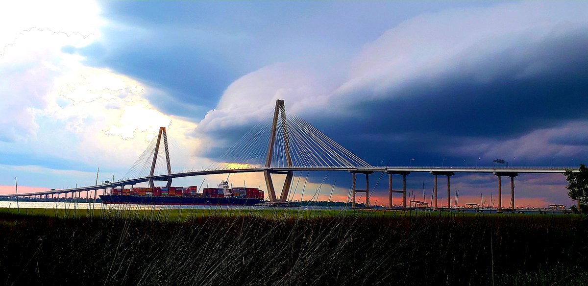
Another summer storm rolling through Charleston! 📷 : Kenneth Macbride
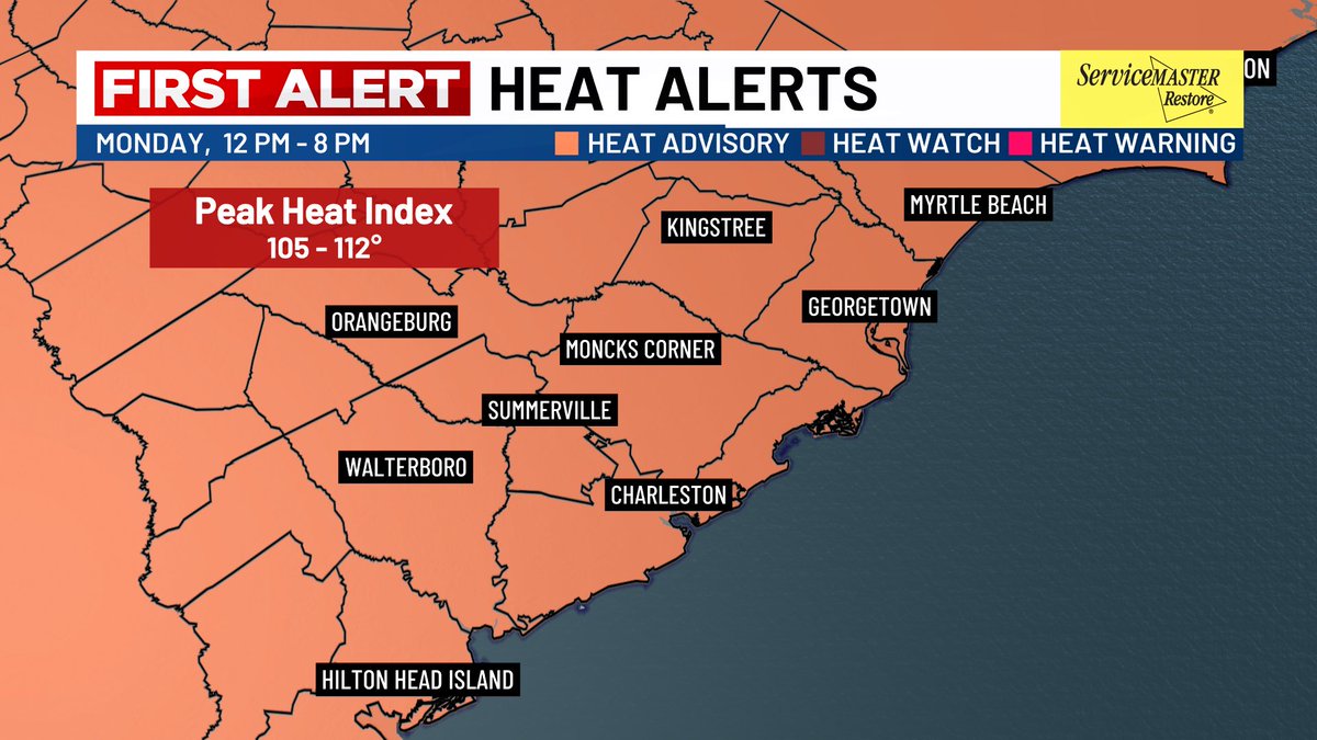
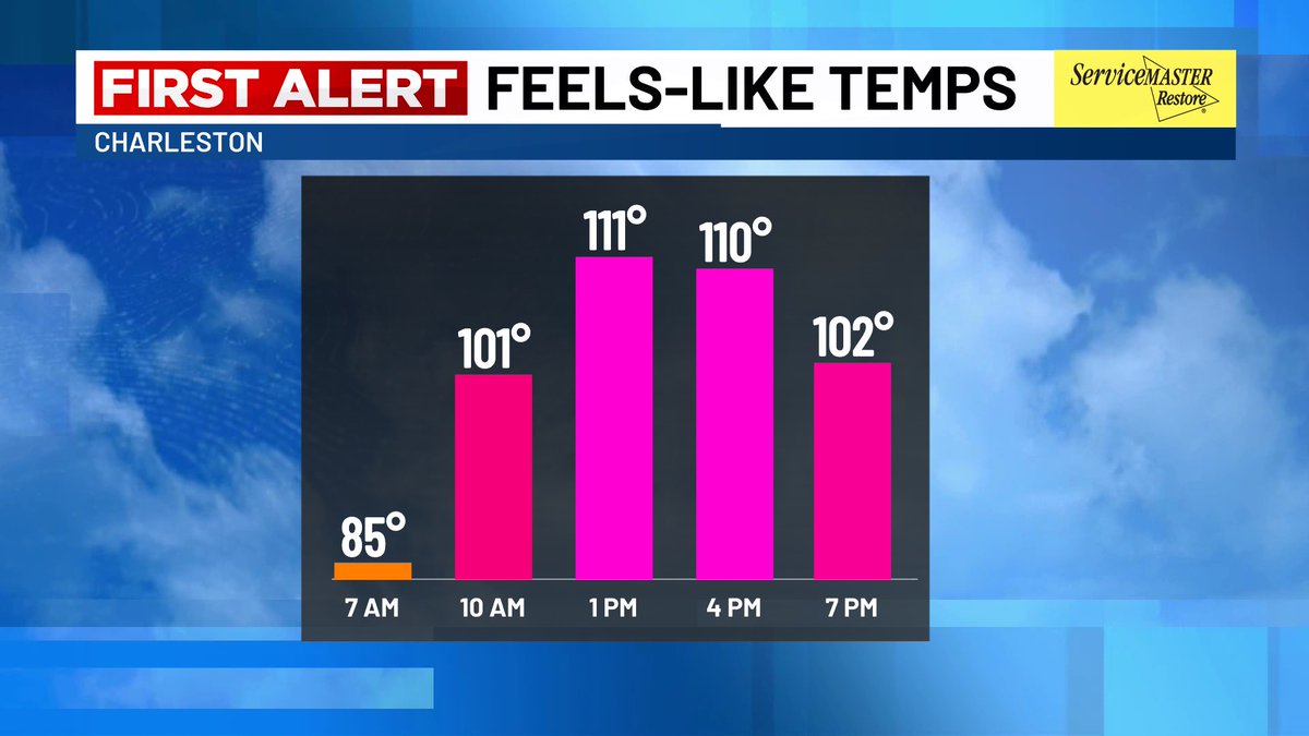
2 words - HOT & HUMID! 🥵🔥 Another Heat Advisory is in effect today from 12PM - 8PM. Highs reaching the mid to upper 90s and low 90s along the coast with heat index values up to 112°. Scattered showers and storms build later today which could provide relief to the heat! #chs
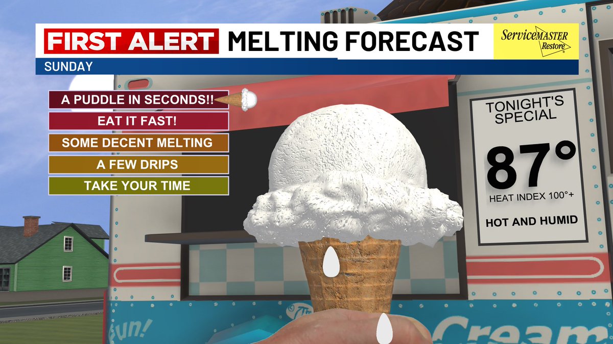
IT’S NATIONAL ICE CREAM DAY!! 🍦 Our Melt Meter is at “A PUDDLE IN SECONDS!!” this evening from the triple digit heat index values! Remember - If you’re out this evening enjoying a sweet treat to cool off…a Heat Advisory remains in effect until 8PM.
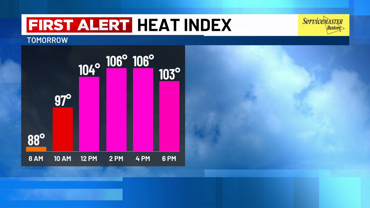
Hot, Hot, Hot! Another HEAT ADVISORY has been issued for Sunday from 11AM - 8PM as feels-like temperatures peak around 105-110°! Take it easy out there !!🥵 #charleston #chswx

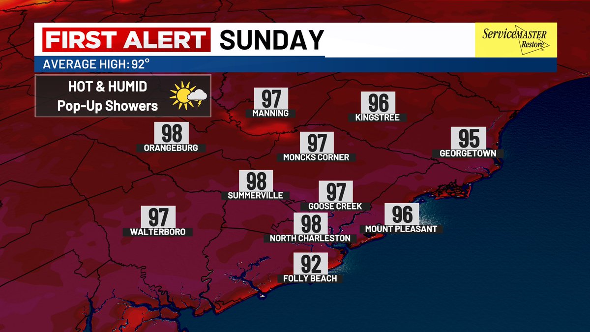
SIZZLING SUNDAY!!! 🔥 Another HOT and HUMID day tomorrow with highs soaring into the mid to upper 90s! Heat Index Values peaking around 105-110°. A stray shower or storm is possible, but most will stay dry. Stay cool, friends!!! #chs #chswx #charleston
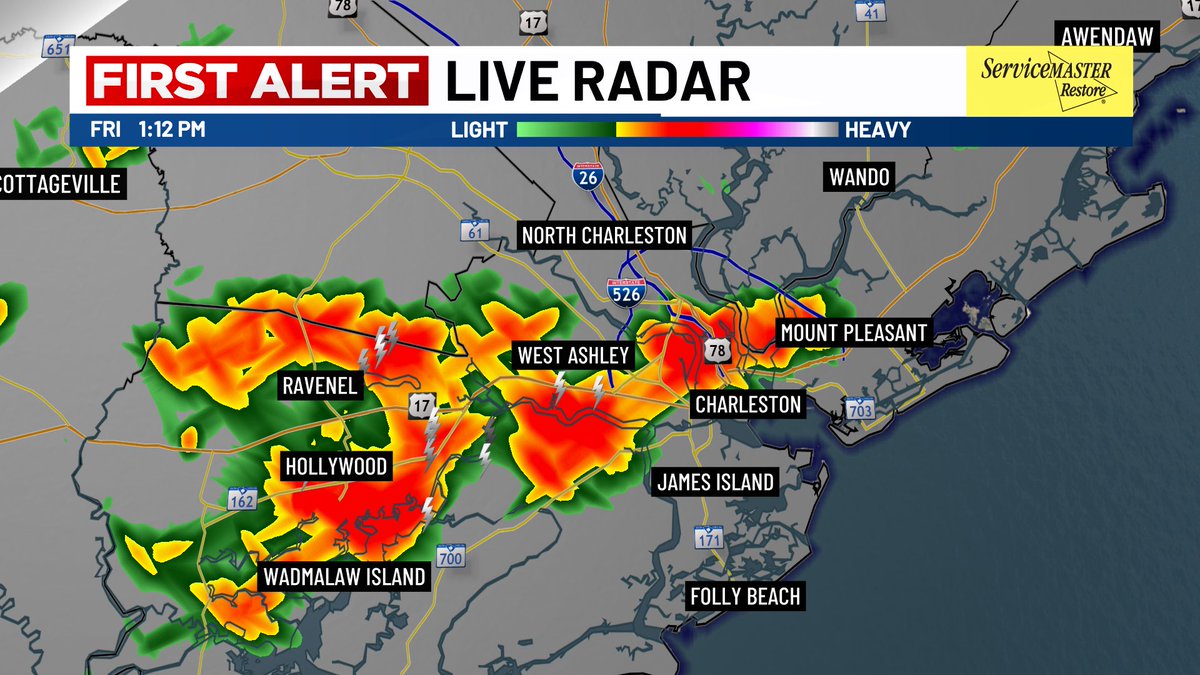
Friday 7/18 Afternoon Radar Update: Showers and thunderstorms storms are building off the sea breeze as it moves further inland. This should provide us with some relief from the heat. Remember - When thunder roars, Head indoors!
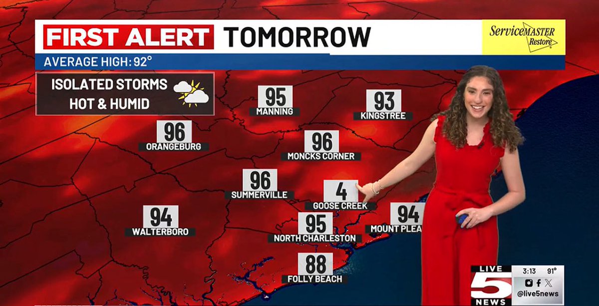
IS IT FRIDAY YET??? 😂😂😂🤦♀️ If you live in Goose Creek - it will NOT be 4° tomorrow…..I meant to put 94° !!
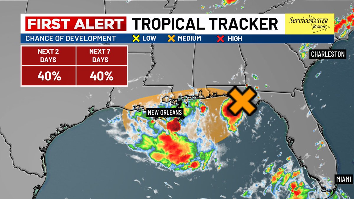
TROPICS UPDATE🌀 Continuing to track INVEST 93L Wednesday afternoon as it remains very disorganized with a 40% chance of development. Right now a big rain producers along the gulf coast as it continues to move west. Development remains possible but not likely.
Clearly running out of ideas to keep the headlines new and fresh 😂😂 Happy Monday and have a great week everyone!!!
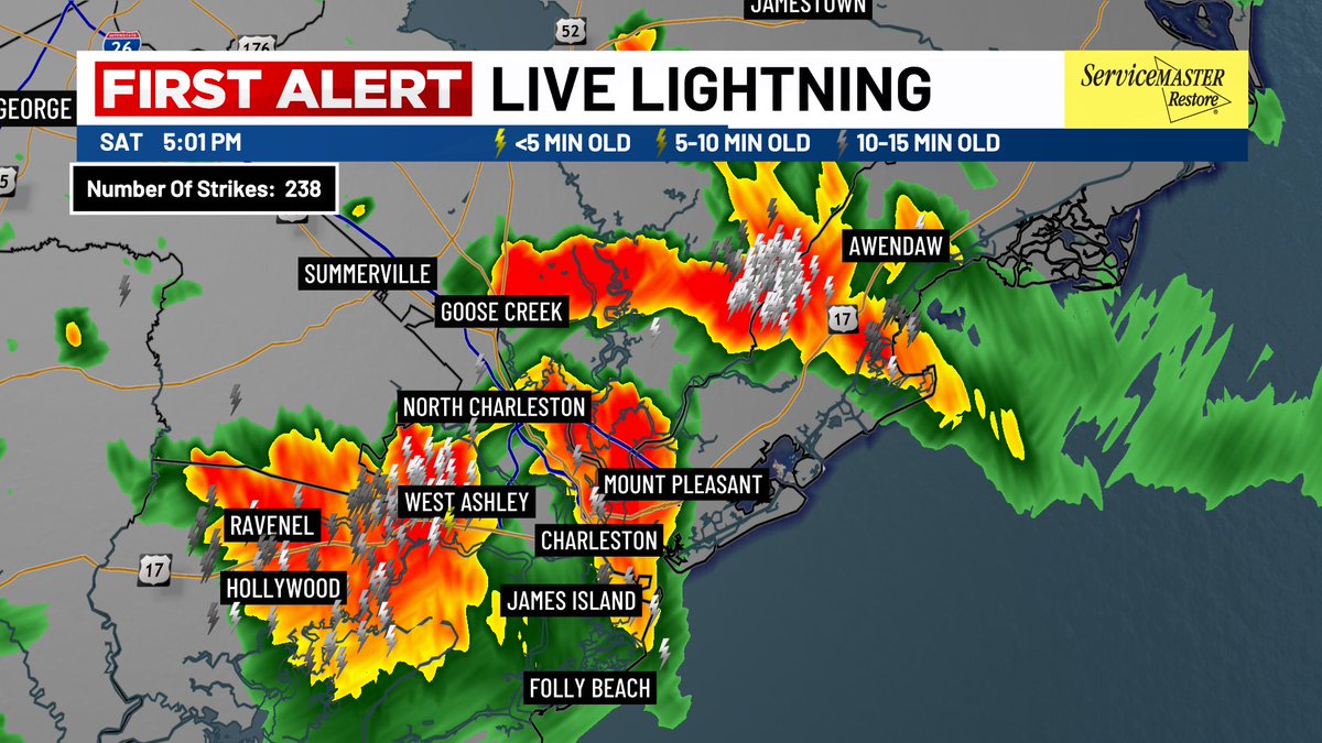
Saturday 7/12 5pm Radar Update - Showers and strong thunderstorms are moving through the Lowcountry. Remember - When thunder roars, Head indoors! #chs #Charleston
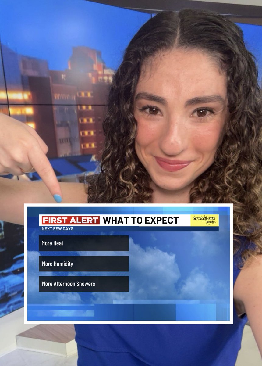
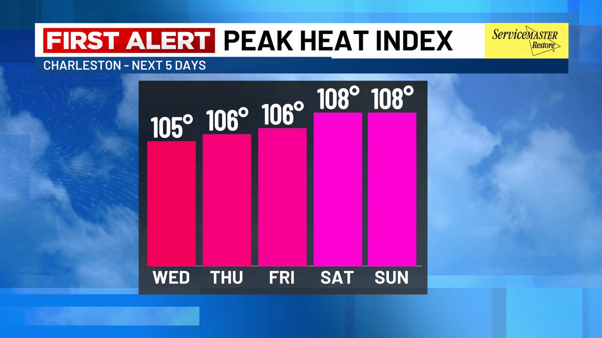
WEEKEND WEATHER - More heat, More humidity and More showers! While there should be plenty of sunshine and dry times this weekend, our summer-like pattern of afternoon showers/storms are expected each day. Highs will top out in the mid 90s with heat index values 105°-110°. #chs

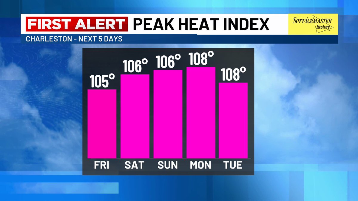
HOT! The next few days are going to feel like some of the hottest days of the year so far in Charleston. 🔥🥵
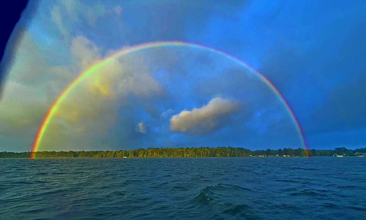
PERFECT RAINBOW !! 🌈 Check out this beautiful picture taken in Moncks Corner today - thank you Hope Port for sharing! Hope everyone had a happy, safe (and dry) 4th of July weekend!
NEW: Tropical Storm #Chantal has developed off the Southeast coast, the 3rd named storm of the 2025 Hurricane Season. This is forecasted to make landfall over our area Sunday morning. Main threats - strong winds up to 40mph, high rip current risks & heavy rainfall at times.

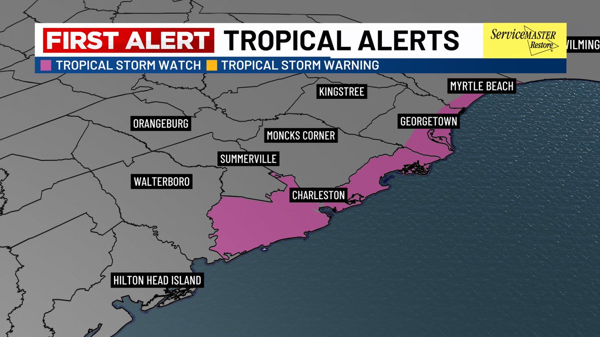
FIRST ALERT: Tropical Storm Three has formed this Friday evening! A Tropical Storm Watch is now in effect through Sunday morning for Charleston and Coastal Georgetown Counties. #charleston

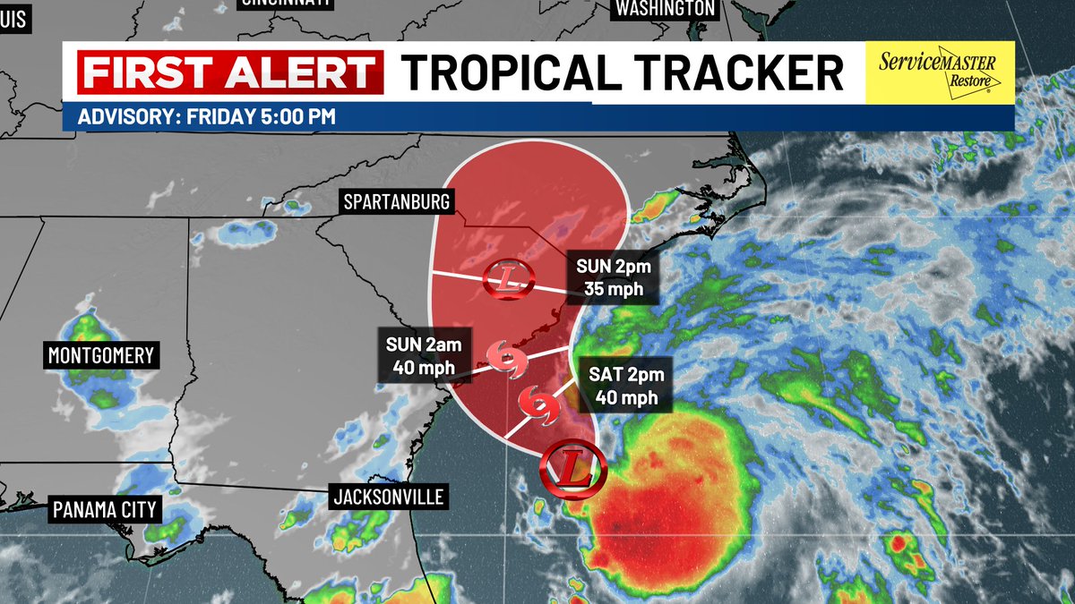
FIRST ALERT: A Tropical Storm Watch is in effect for Charleston and Coastal Georgetown Counties.
NEW: Invest 92L has just been increased to a high chance of development with a 70% chance the next 2 days from the NHC. A short lived tropical depression or storm could form today or Saturday while the system continues to develop possibly towards the Carolina’s.

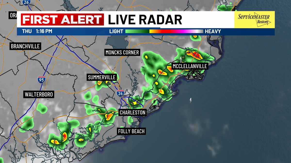
☔️Thursday 7/3 Radar Update - Don’t forget an umbrella if you’re heading out this lunch hour! Scattered showers and storms picking up along the sea breeze this afternoon. #chs #Charleston
GOOOOOOD TUESDAY MORNING! ☕️Who’s up with me?? I’m LIVE this morning at Live 5 News (with my much needed coffee)!
You’re welcome back to the weekends anytime !! 😉😉
The most special Saturday anchoring our evening shows alongside two of my closest friends, @summerhuechtker & @WXwithLex 🩷 If you didn’t catch our trio on-air tonight, watch tomorrow night at 6 and 11!