
Dr. Levi Cowan
@TropicalTidbits
Owner/developer of https://tropicaltidbits.com. PhD in meteorology from FSU. Opinions are mine alone. Follow for expert, factual, no-hype hurricane analysis
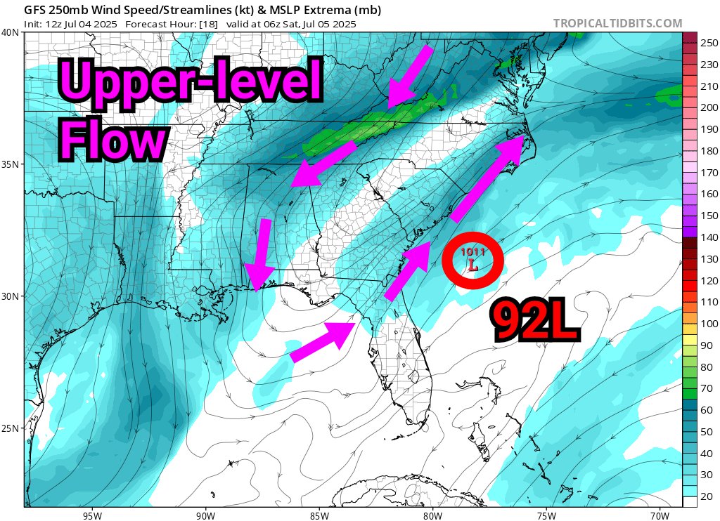
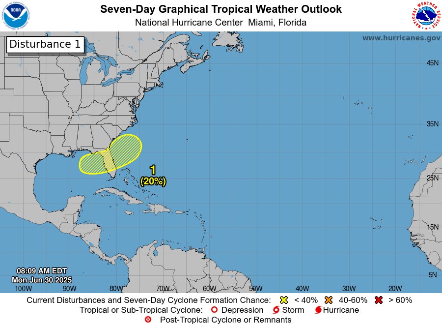
We now have the disturbance offshore of the southeast US coast that was discussed a few days ago. So far, convective cells are intermittent and short-lived, with some large downdrafts observed, indicating thermodynamic conditions are not currently optimal for immediate…
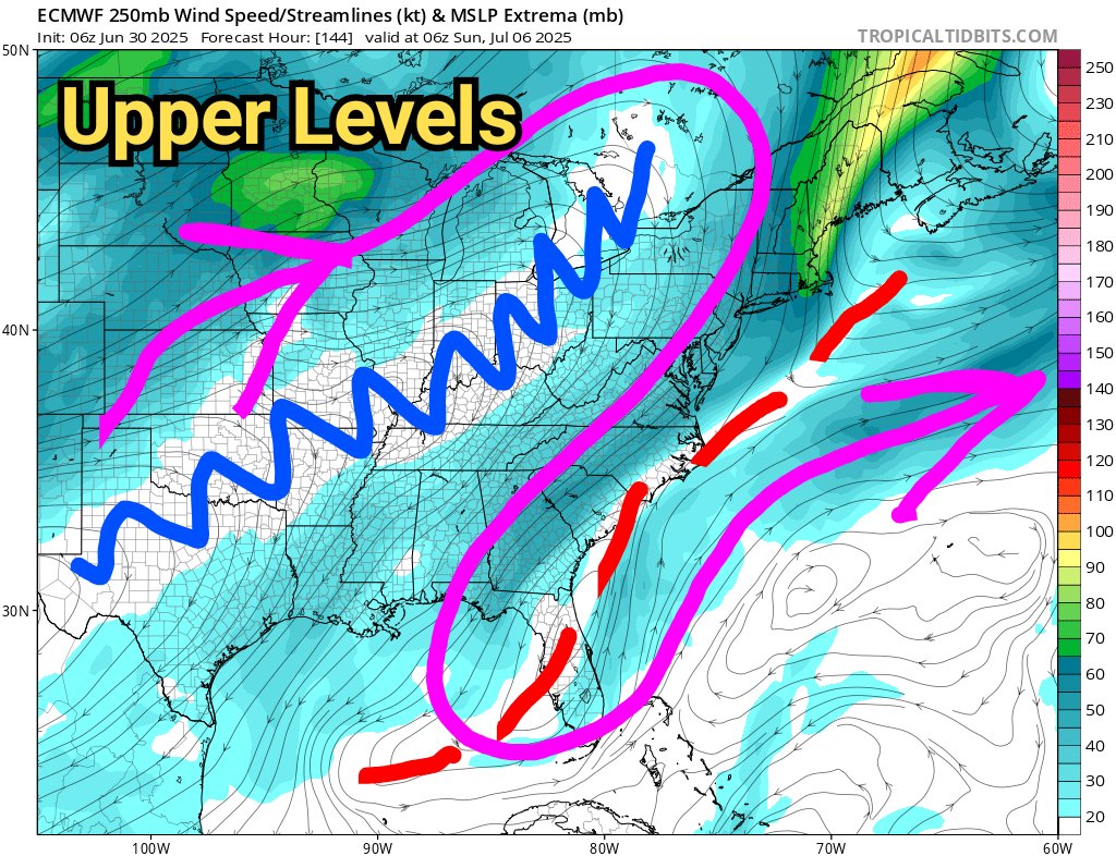
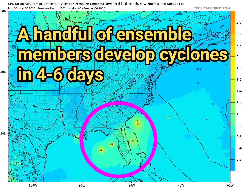
Although the tropical Atlantic is quiet for now, we may need to keep a wary eye out for another "home-grown" storm near the US coastline next week. A subtle low-level trough over the southern US is forecast to move eastward and offshore during this weekend, eventually looping…
Although the tropical Atlantic is quiet for now, we may need to keep a wary eye out for another "home-grown" storm near the US coastline next week. A subtle low-level trough over the southern US is forecast to move eastward and offshore during this weekend, eventually looping…
🌀 New video update below on Tropical Depression Three (#TD3), which has formed off the southeast US coast with max winds 35 mph, and is expected to make landfall in #SouthCarolina early Sunday. 🌀 Vertical wind shear is keeping the storm broad and asymmetric, with most heavy…
🌀 As discussed earlier this week, the trailing end of an old frontal boundary off the southeastern US is providing an opportunity for tropical development. 🌀 A broad circulation is developing east of Jacksonville, and will move up into #SouthCarolina early Sunday. Fortunately,…
One more night-time disruption is currently in progress as the web server gets fully replaced. The website should be back up shortly.
Maintenance has concluded, though it took longer than the hosting company estimated. I cannot guarantee that this fixed the underlying issue causing the website to randomly go down, but fingers crossed 🤞 Apologies again for the interruptions. Hoping this is the last one.
Maintenance has concluded, though it took longer than the hosting company estimated. I cannot guarantee that this fixed the underlying issue causing the website to randomly go down, but fingers crossed 🤞 Apologies again for the interruptions. Hoping this is the last one.
This issue is still plaguing me, and is highly frustrating. I'm working closely with the hosting company to troubleshoot. Another round of maintenance is scheduled for tonight from 12am to approximately 4-6am EDT. I apologize for the continuing intermittent downtime.
Invest #93L's low-level center is inland over northern Florida this morning, as expected. The risk of tropical cyclone formation is tied to the mid-level trough and thunderstorm activity offshore over the Gulf. So far, there is no sign of significant organization, and models have…
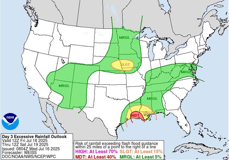
🌀 Tuesday video update on a tropical disturbance (dubbed "Invest 93L") near #Florida that will be monitored for potential development as it crosses into the northern Gulf. 🌀 Regardless of development, heavy rains over central-northern Florida spreading westward along the north…
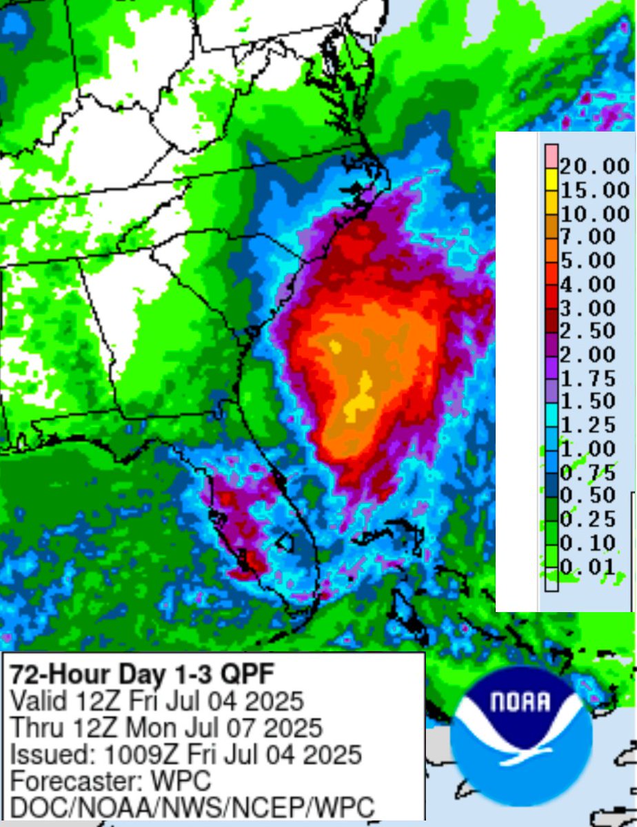
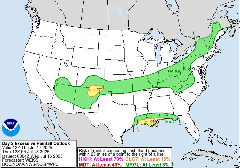
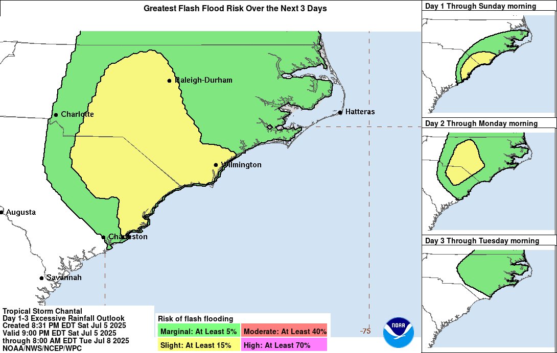
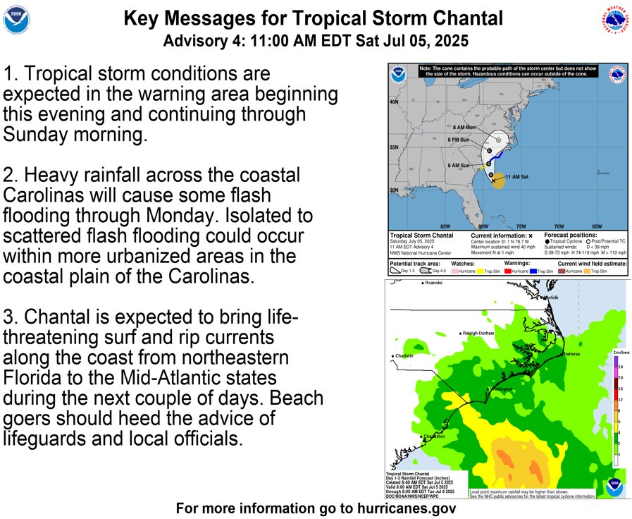
Tropical Storm #Chantal is approaching the eastern #SouthCarolina coastline, expected to make landfall Sunday morning. The heaviest rains are northeast of the storm center and are beginning to impact portions of eastern #NorthCarolina. There is some risk of flash flooding in both…

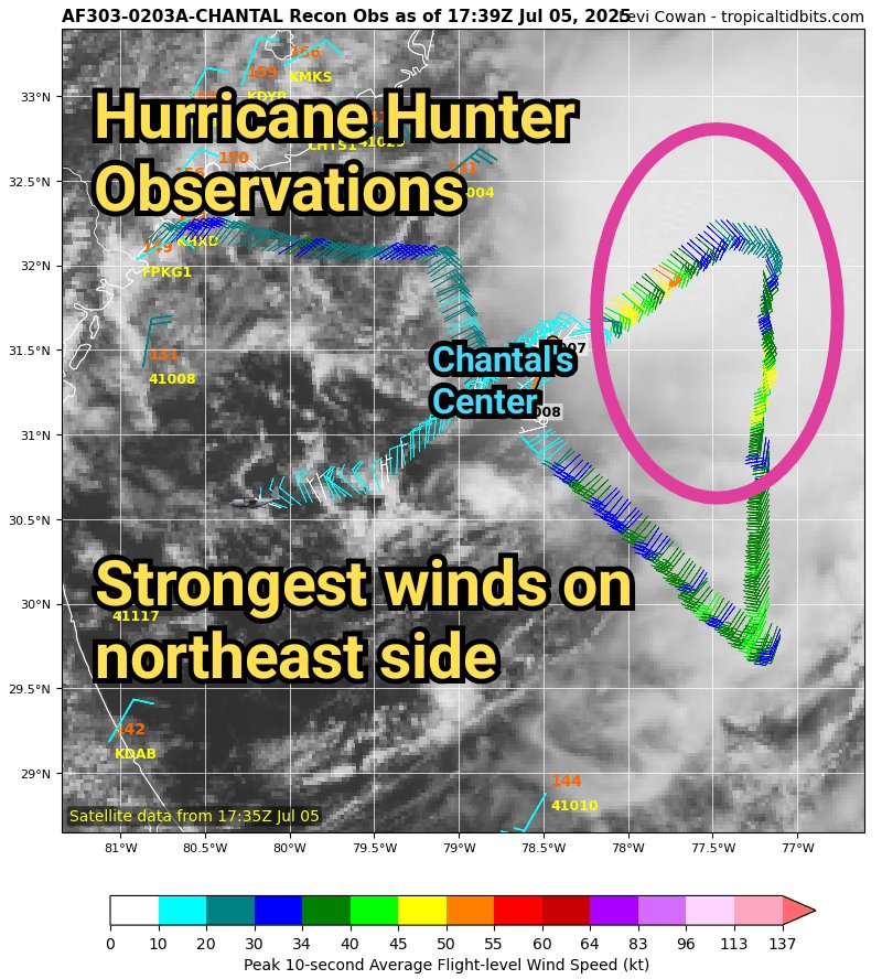
🌀 #TD3 has been upgraded to Tropical Storm #Chantal, as max winds have increased to about 45 mph as measured by @53rdWRS hurricane hunter aircraft. 🌀 These winds, along with the heaviest rains, are confined to the northeast side of Chantal's circulation due to persistent wind…
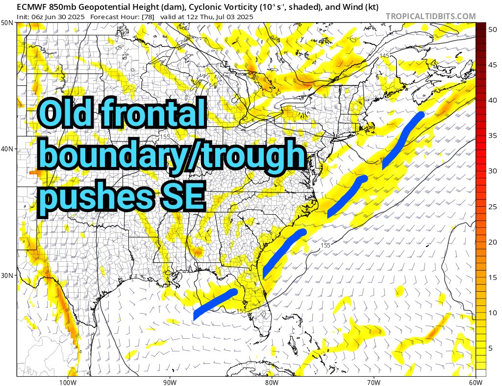
This week, we will be monitoring a weather pattern over the southeastern US that *could* have a chance of spawning a tropical storm near the US coastline. As an old frontal boundary / trough pushes across the coast mid-week, an upper-level ridge "folded over" an upper-level…
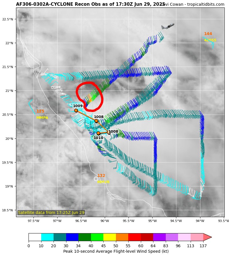
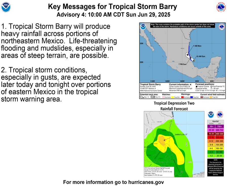
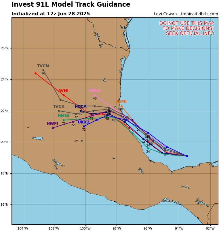
TD2 has become Tropical Storm #Barry. Although the storm remains poorly organized due to a suboptimal environment, a small region of 40-45 mph winds has developed to the NE of the storm's center as measured by @53rdWRS. Barry will make landfall in #Mexico near or south of…
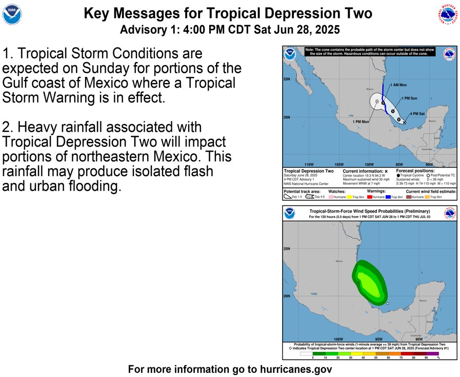
The NHC has initiated advisories on Tropical Depression Two (#TD2), formerly Invest #91L, located in the Bay of Campeche. This will be a short-lived storm, with a track into Tampico, Mexico expected during the next 24-36 hours. Slight intensification into a tropical storm with…
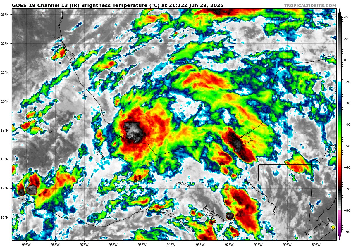
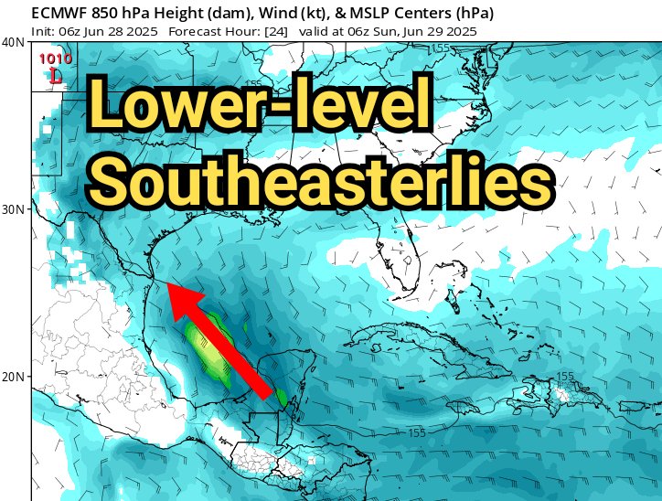
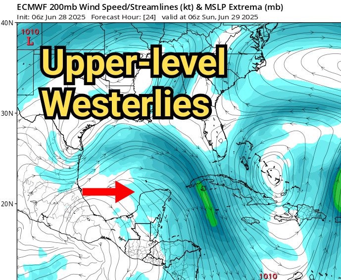
🌀 We're tracking Invest #91L in the Bay of Campeche, as a weak circulation has developed from a tropical wave there. Rotation of the low-level clouds is evident in the satellite loop, with some deep thunderstorm activity on the south side. 🌀 Conditions are not fully optimal…
This issue is still plaguing me, and is highly frustrating. I'm working closely with the hosting company to troubleshoot. Another round of maintenance is scheduled for tonight from 12am to approximately 4-6am EDT. I apologize for the continuing intermittent downtime.
The website had some downtime again this morning, an issue I thought had been fixed by previous hardware replacements last month. Unfortunately, it looks like more sleuthing is required. The site is back up for now - some data will take a while to backfill. I apologize for the…
Tropical Storm #Andrea has formed, the first of the Atlantic season. The National Hurricane Center determined that the area of low pressure in the northern Atlantic became organized enough to be briefly classified as a tropical storm. However, Andrea is already moving into cold…
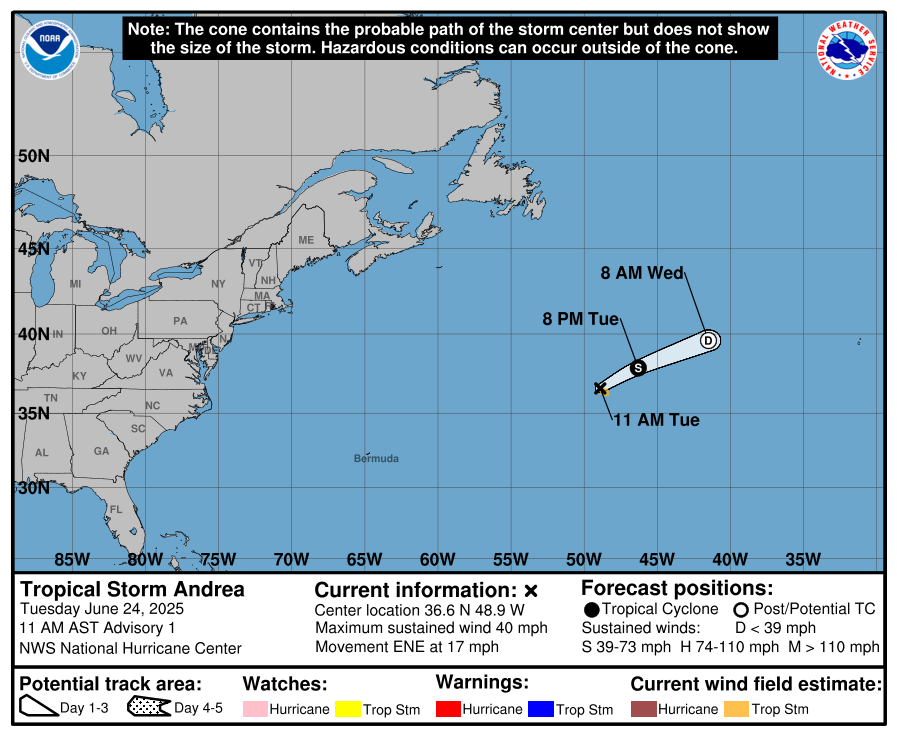
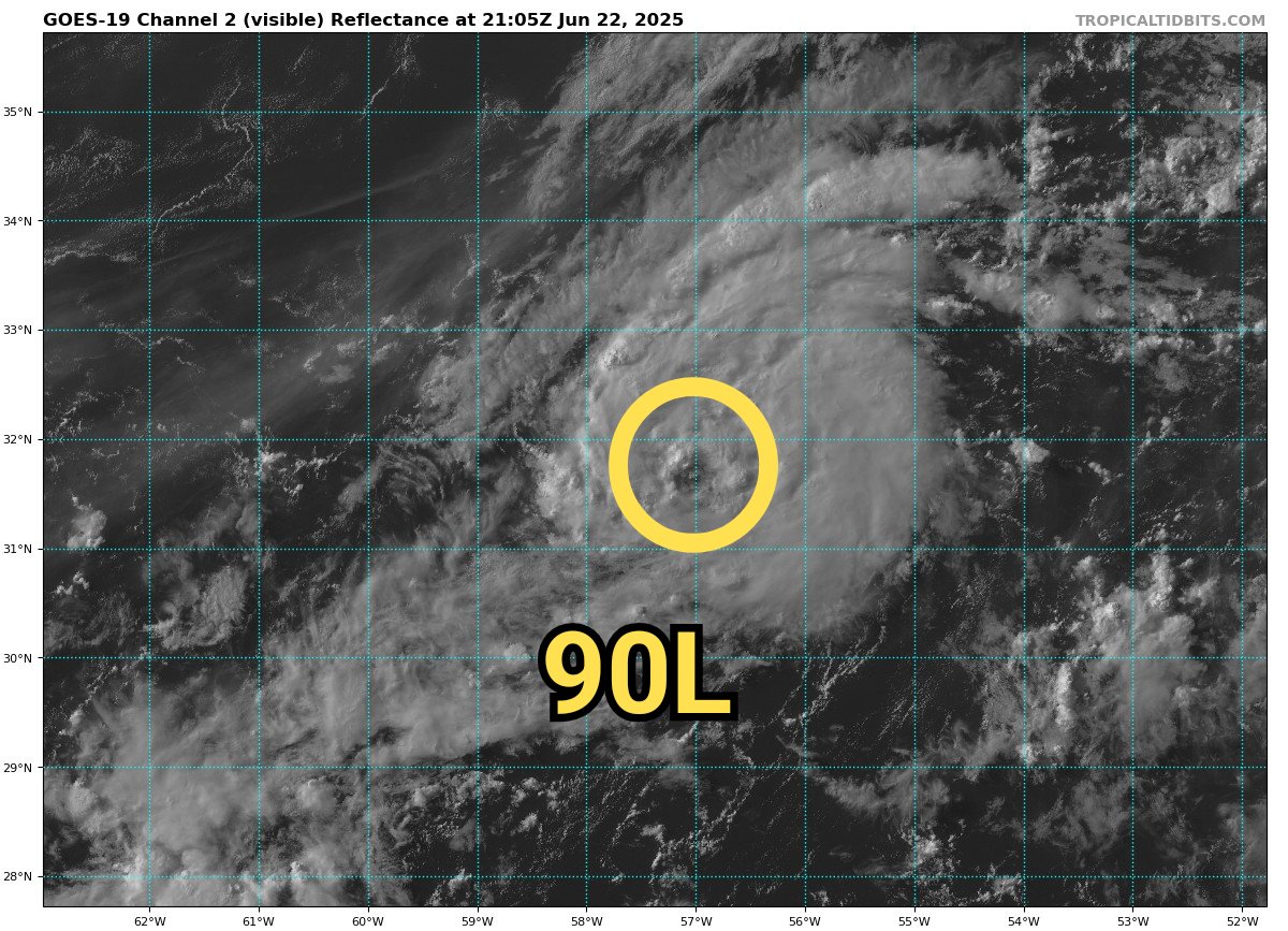
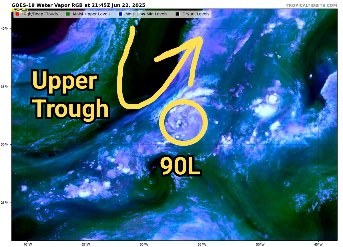
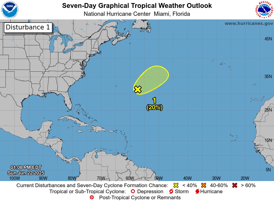
A weak area of low pressure east of Bermuda has been dubbed "Invest 90L", and is being monitored for possible tropical or subtropical development. A brief time window is open for the system to become further organized, but this window will close later on Monday as an upper-level…
The website had some downtime again this morning, an issue I thought had been fixed by previous hardware replacements last month. Unfortunately, it looks like more sleuthing is required. The site is back up for now - some data will take a while to backfill. I apologize for the…
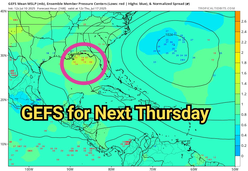
The GFS model is predicting sudden hurricane development in the western Caribbean in 8-10 days. I'll take the under. As my long-time followers know, this model is infamous for over-amplifying tropical thunderstorm complexes. You can see the massive amount of 24-hour rainfall…
At the beginning of the Atlantic hurricane season, an MJO pulse of rising air and enhanced thunderstorm activity is often what brings the first window of potential for tropical storm formation. We have one in sight, currently over the Indian Ocean. This pulse will propagate…