TropicScope
@TropicScope
Tropical Weather Tracker & Fan Not professional by any means, just my personal opinions. Refer to the NHC/JTWC for official information.
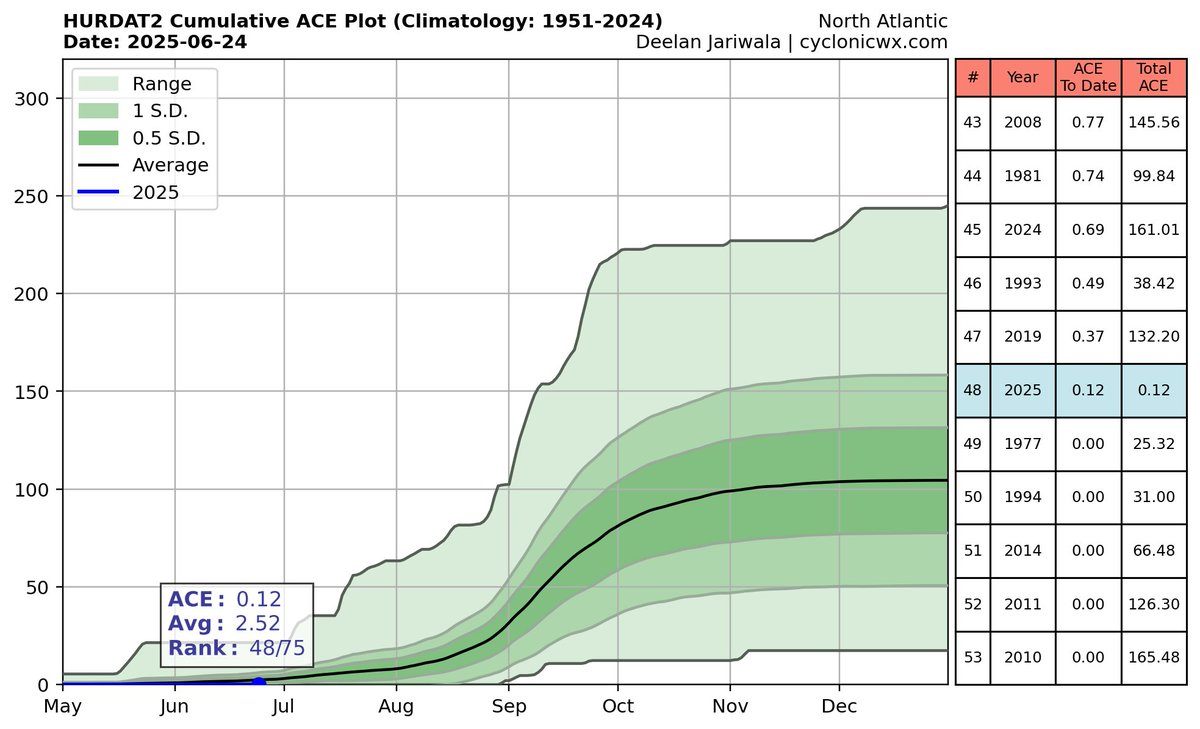
Just because the start of a season is "Quiet" does not mean that the season is a "Bust", Seasons like 2010, 2011 had *0* ACE by this point and still went on to produce deadly storms that churned up 120+ ACE each, Dont let your guard down just because the start seems slow.


Our first MDR system could spin up, a CCKW will pass, helping to open the gates for some development, with ensembles highlighting a wave that could become a tropical storm, Dry air from the SAL will be an issue so the environment is likely marginal. NHC could highlight it!


The initial rapid development of #93L in the Gulf Stream hadn't persisted like I thought it may to keep the system from jumping too far north. As a result, a good portion of the surface spin is located inland over Georgia/Alabama this afternoon. So what's next for it? Well as…
Development of a Tropical wave that will move off of Africa next week is becoming possible, while the NHC is yet to officially tag anything, Determanistic (Long range) runs have shown promise, and Ensemble support has been steady for the last~24 hours. Something to watch #Tropics


That was something.... goodbye happy hour 18z GFS, hello happy hour 18z AIFS
#Comay (Co-May) is likely at typhoon strength and in a initial period of RI. A recent MW pass of the storm reveals a compact inner core taking shape.


Good afternoon everyone. Latest EURO ensembles are below for our newly designated Gulf AOI. This gives us a good idea of when low formation should be expected. EURO expects possible development beginning as early as Friday, so pay attention over these next two days!
#EmongPH is continuing to gradually develop as it churns just west of the Philippians. PAGASA has recently increased their forecast to a typhoon peak before making landfall, RI is very likely given the highly favourable environment!


After being reduced to 10/10, Our AOI in the MDR is now a 20/20 and listed as #94L it has just over a day left with somewhat favourable conditions (does have a SAL issue/breakout to its N), Still skeptical on development but we will see.


As talked about earlier, the support was good enough for the NHC to mark it an AOI with a 0/20 shot for now, It has until the mid part of next week before the conditions become unfavorable for further development, with environmental conditions to become better this weekend.

#93L has been reduced to a low (30/30) chance of formation, its window is very slim and it would need to do a large level of organizing within a 12-24 hour period before making landfall in Louisiana. also no longer think recon will fly into this system tomorrow.

Latest ATCF fix for #93L is in, Winds are now 30kts, pressure 1011mb. Center has continued to track SW and is fully over the water (very warm waters). NHC has held at 40/40 as this thing still has just under a day now (16~ hours) over a decent environment and could become a TD.


In a break from 93L, a Tsunami warning has been issued for Alaska after a 7.3 magnitude earthquake was confirmed to have created a tsunami based on reports from the Tsunami Warning Center
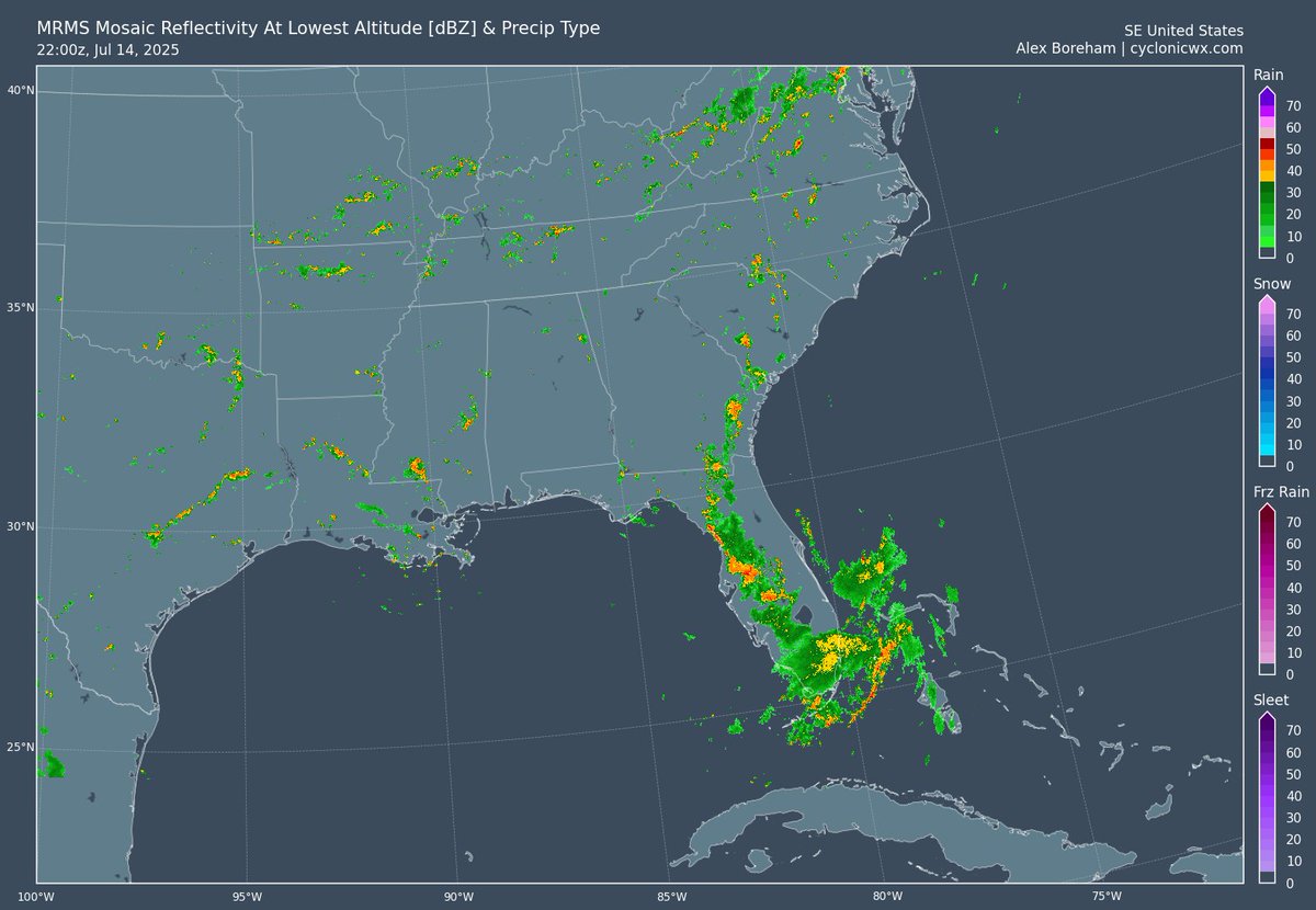
#93L is still struggling, its circulation is still embedded in land, really knocking development odds. A brief TD/TS could still develop if it can get itself over water, but unless something changes, its unlikely we will see anything out of it, Flooding rains will be a problem.

#93L is making its way onto land this afternoon, with a lot of the convection displaced to the S/SW of the center due to some shear that it has encountered. This convection could help to keep it more south and enter the gulf more favourably, a waiting game at this point.

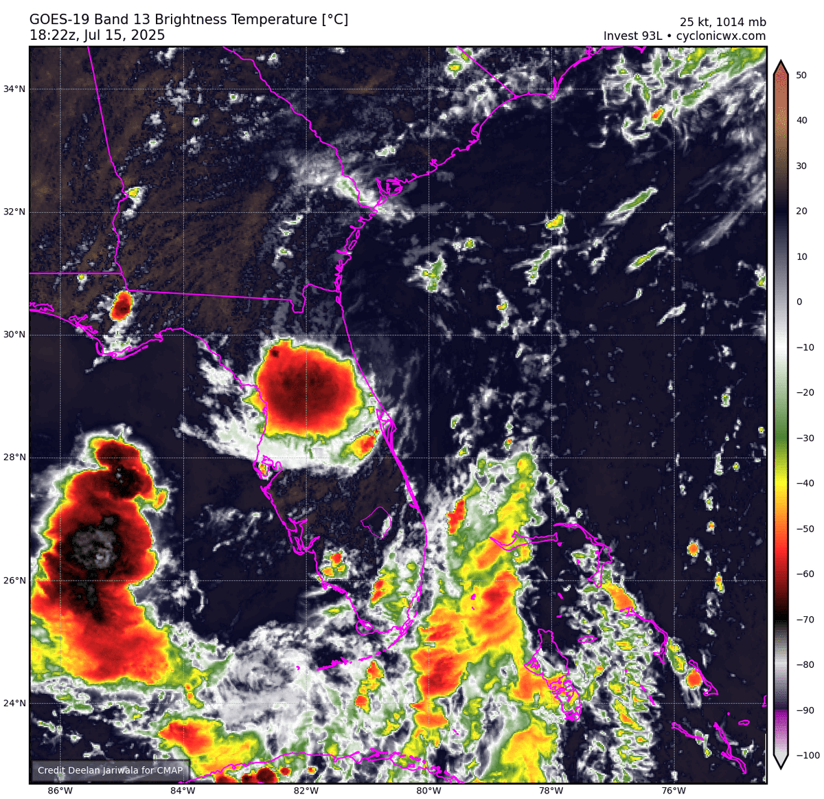
We now have an orange with #93L with development being increased to a 30/40 with disorganized showers/tstorms to the south of the center. conditions appear generally favorable if it stays off of land after crossing florida, recon might fly tomorrow, but depends on timing.
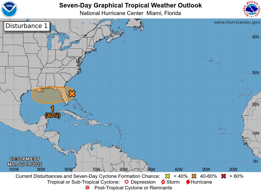
#93L formed earlier today, and looked quite a bit better earlier thanks to the curvature of the coastline and lack of tstm activity that create some cold pools + DMIN starting to get close, 93L still has a cycle of DMAX and could get its act together somewhat before landfall inFL


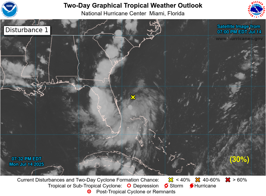
20/30 at 2pm, that's an interesting call.... bit confusing, cone expanded back more east where our current feature is.

Our system that will eventually be listed as #93L is looking quite impressive this morning, with a sharper trough axis becoming visible and good convection just to the S of the formative center. Confused on why this is still 10/30 and not even an invest! #TropicalUpdate