Tom Wachs
@Tom_Wachs
Chief Meteorologist at FOX6 Milwaukee. Dad, Husband and Storm Chaser. Living the Dream!
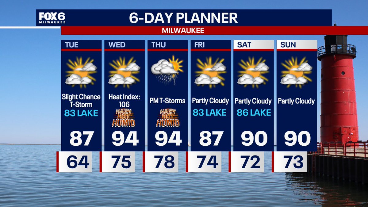
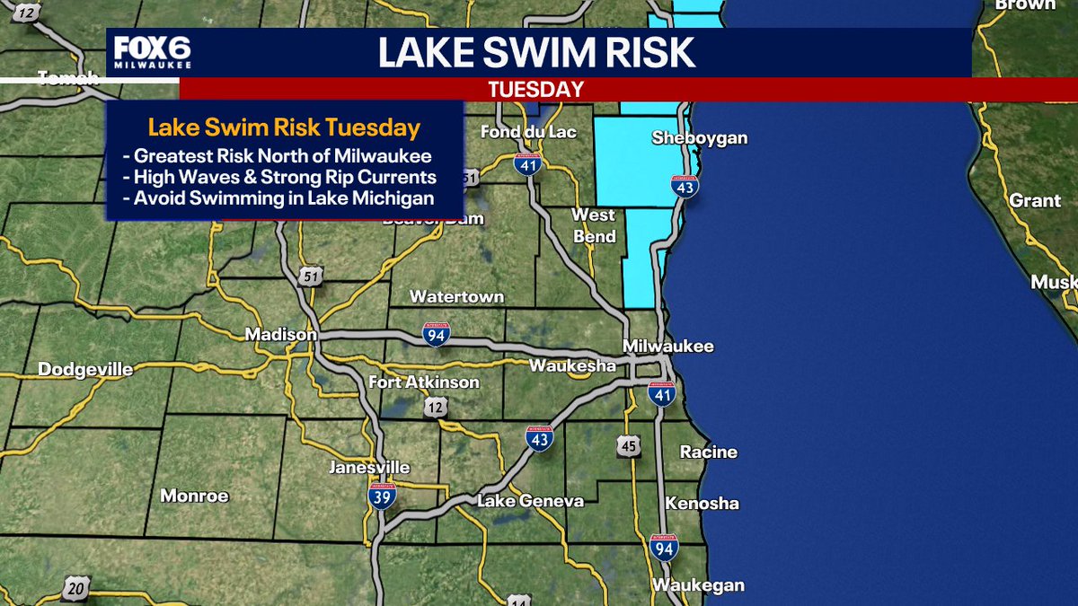
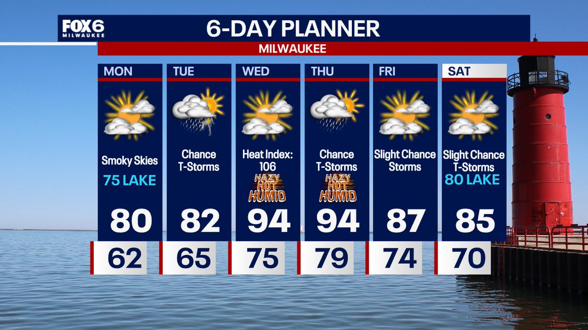
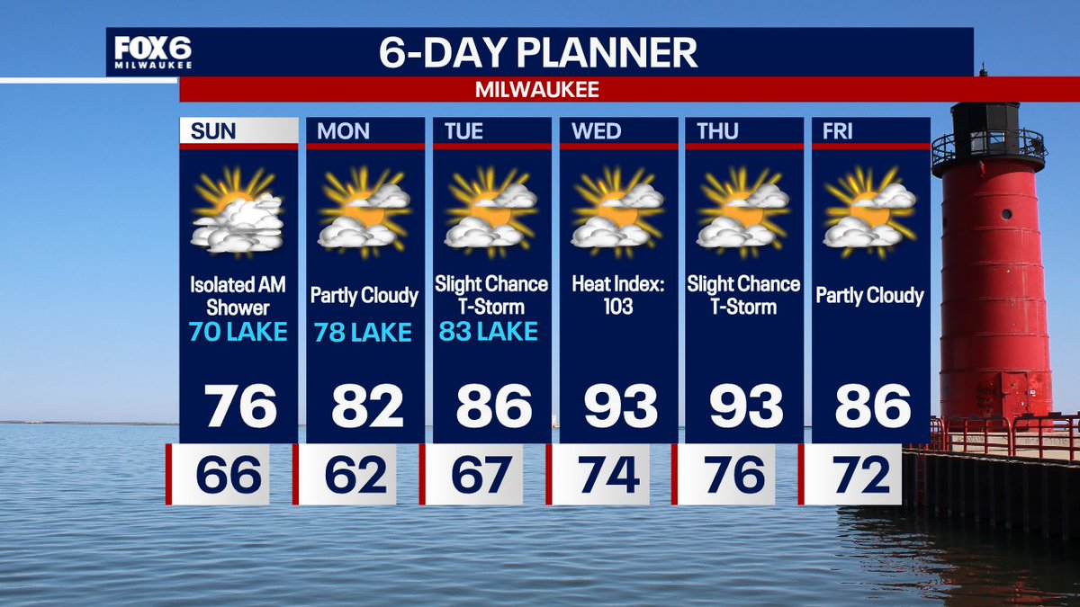
7/21 10:22pm: Warming up on Tuesday with dangerous swimming conditions on Lake Michigan. Please avoid swimming in the lake. Highs in the 80s. An Excessive Heat Watch is in effect Wednesday & Thursday with a heat index around 106. A cold front comes in late in the day Thursday…
Monday Night 7/21 Update: Please avoid swimming in Lake Michigan on Tuesday. While the greatest risk for high waves and strong rip currents will be north of Milwaukee, I would suggest playing it safe across all beaches and swim areas. Please be careful.
Funny behind the scenes moment. I’m battling a 10 day cold/sore throat and feel horrible today. Not a great voice. So my producers cut my time back to help me (they are amazing). Well at 5:58pm one of our news systems crashed. In my ear: “Tom! We are coming to you for a 4 minute…
Weather in less than a minute…sick edition. July 21st. #weather #Milwaukee #Wisconsin
7/21 4:15pm: Get ready for the heat. We will warm into the 80s across the board on Tuesday but the real heat kicks in on Wednesday and Thursday. Peak Heat Index of 106 on Wednesday afternoon and Thursday afternoon.
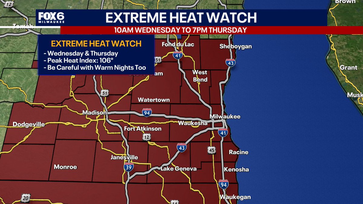
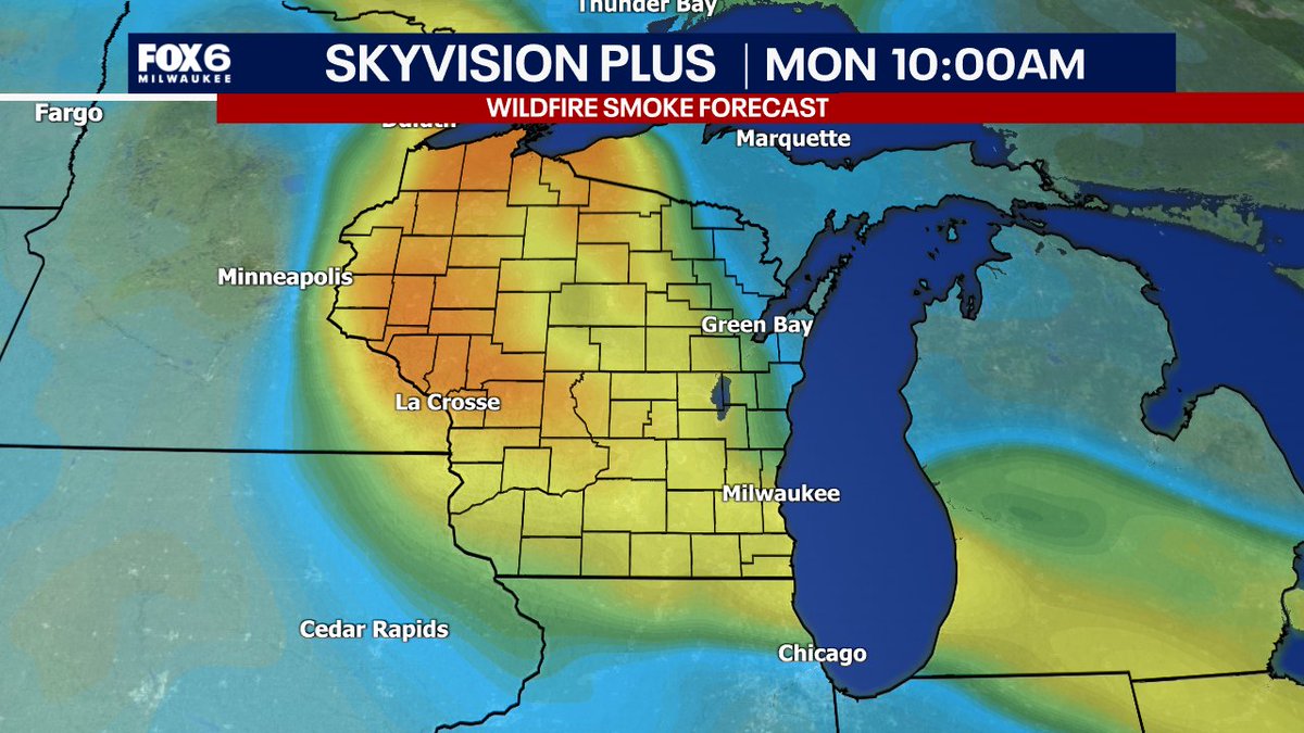
7/20 10:22pm: Smoky skies on Monday with highs in the mid-70s near the lake, around 80 inland. T-Storms are possible on Tuesday afternoon with highs in the low 80s. Intense heat/humidity will return Wednesday and Thursday with a heat index around 106. Cooling down a little late…
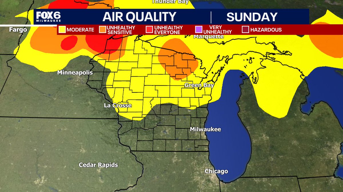
The smoke is back in our skies tonight. It could become surface-based for a time by morning and gradually dissipate at night. Not quite as smoky on Tuesday. High around 80 inland on Monday, mid-70s near the lake.
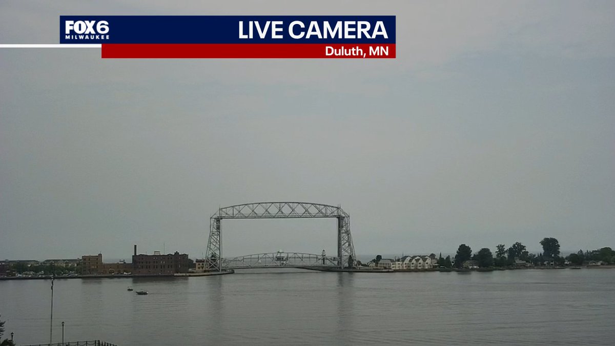
3:12pm Sunday: Smoky skies up in Duluth, MN today. That Canadian wildfire smoke is heading in our direction. Expect smoky skies tonight and again on Monday, possibly in our air as well closer to the surface. Conditions will improve on Tuesday.
7/19 10:24pm: Mostly cloudy, cooler and less humid on Sunday. Highs in the 70s (coolest near lake) with dew points in the mid-60s. Can't rule out an isolated AM shower, but most will stay in IL. Late day clearing is expected. Gradually warming up this week with some serious heat…
Wild! Check this out from Manitowoc this afternoon
More video of Manitowoc funnel/possible tornado. From Crista Koeppel.
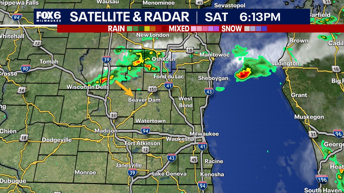
6:13pm: A few t-storms have developed to the northwest of us along a cold front. Nothing too crazy expected, but we could see a t-storm or two this evening as the front comes through. The big story is the Sunday cool down. 70 near the lake, mid-70s inland.
Weather in less than a minute Saturday 7/19. #weather #Milwaukee -#Wisconsin #heat
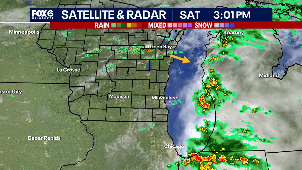
3:01pm Saturday: Skies are clearing out after morning rain. Temperatures are heating into the 80s. A cold front to our northwest will move through this evening. This could bring a few t-storms along with it during the evening as well. Much cooler on Sunday, highs in the 70s.
7/17 10:23pm: Partly cloudy on Friday with highs in the 70s and a dew point around 60. Beautiful day. Scattered t-storms on Saturday, round 1 in the morning (most concentrated) with scattered storms on Saturday afternoon. So NOT an all day rain. Humid with highs around 80. Dry on…
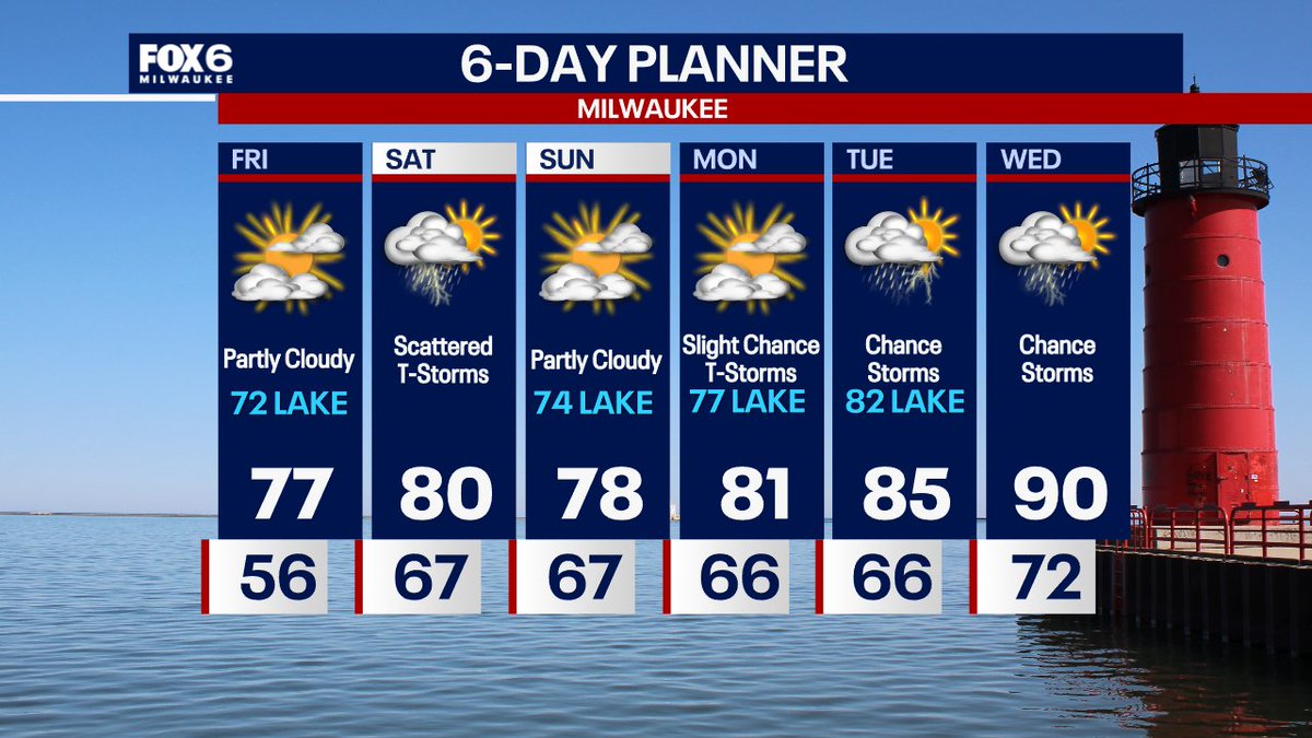
We have a warmer day on the way Friday with highs in the 70s, coolest of the air near the lake. Partly sunny skies are forecast. T-Storms are back in the forecast on Saturday. There is a chance in the morning and another chance for scattered storms in the afternoon, high of 80.