TTWeatherCenter
@TTWeatherCenter
Disseminating information on natural hazards for Trinidad and Tobago and Lesser Antilles
6:00 AM - As Tropical Wave 18 nears the Lesser Antilles, scattered showers and thunderstorms are developing ahead of the wave axis. Currently, an isolated strong thunderstorm is producing heavy rainfall and frequent lightning in the western Gulf of Paria, near Venezuela.…
1:30 PM - Street flooding is ongoing across various areas of northwestern Trinidad, including Port of Spain and Cocorite. Expect traffic delays across the typical flood-prone areas of Port of Spain as waters subside following brief but heavy rainfall. Today’s next high tide is…
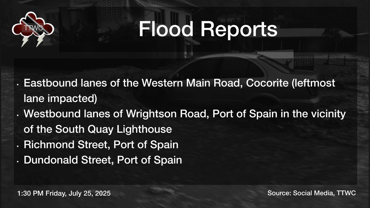
1:20 PM - Street flooding ongoing on lower Dundonald Street, Port of Spain. Expect traffic delays across the typical flood-prone areas of Port of Spain as waters subside following brief but heavy rainfall. Today’s next high tide is at 5:08 PM. ttweathercenter.com/2025/07/23/for…
1:15 PM - Scattered showers continue across mainly southern and western areas of Trinidad, with locally heavy rain and increasingly cloudy skies. Meanwhile, across Tobago, mainly hot and sunny conditions persist, with increasing cloudiness forecast from mid-afternoon due to a…
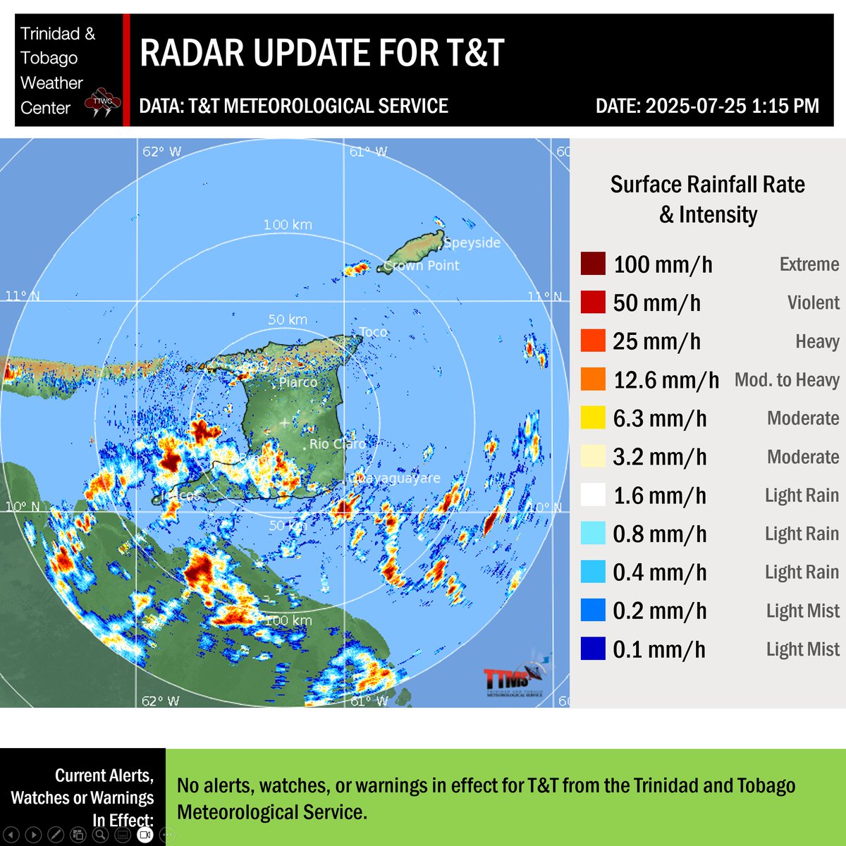
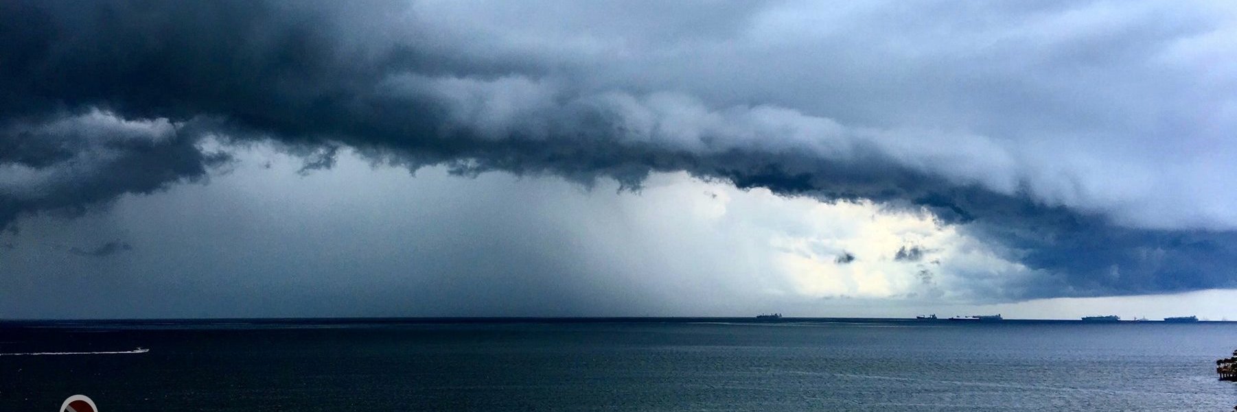
Over the last 15 minutes, between 25 and 50 lightning cloud-to-ground lightning strikes have been detected across southwestern Trinidad as a cluster of thunderstorms moves west into the Gulf of Paria, producing locally heavy to violent rainfall rates and possible gusty winds.…
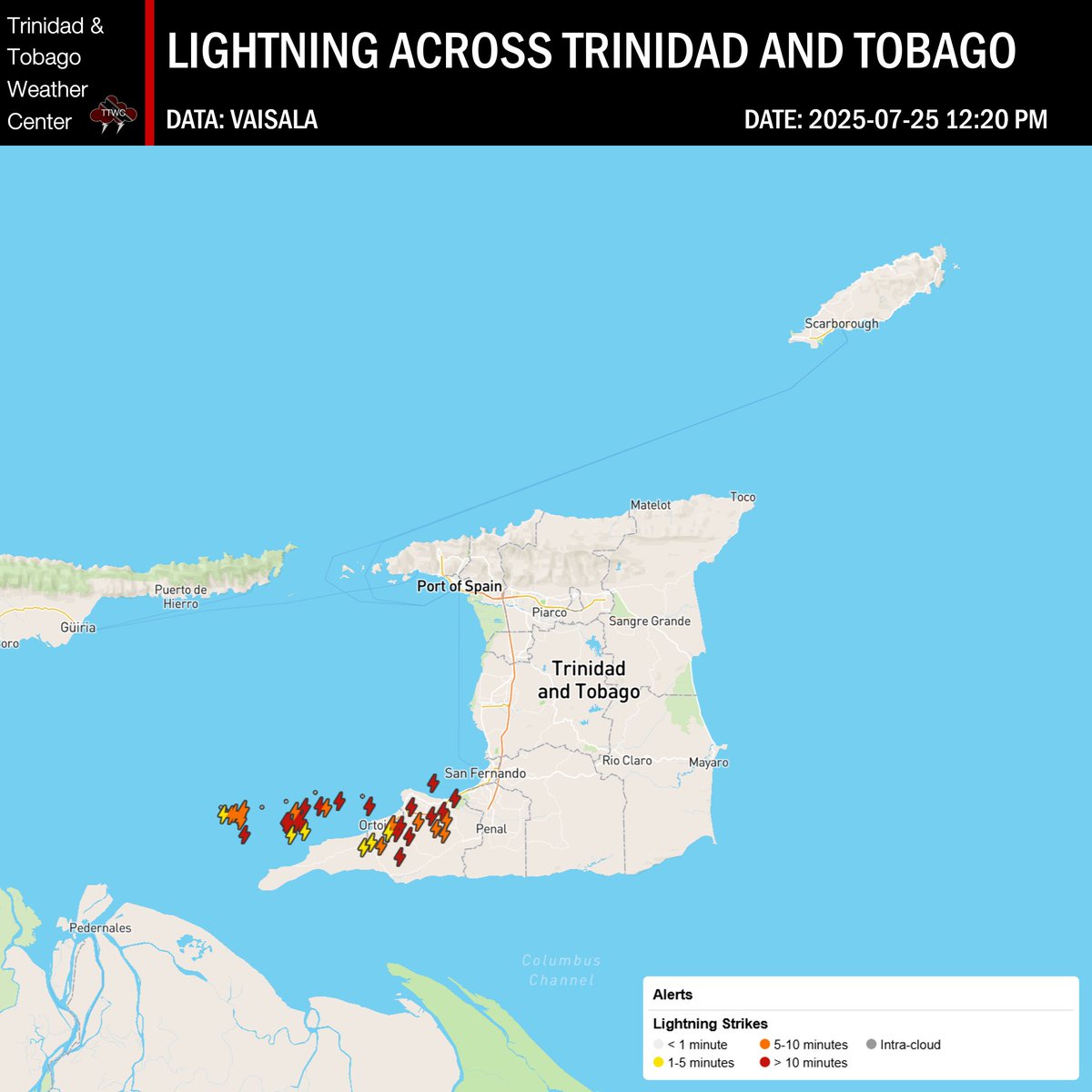
12:10 PM - Violent rainfall rates are being detected across southwestern Trinidad associated with a cluster of thunderstorms. Moderate to heavy rainfall, with pockets of intense rainfall, is ongoing between Moruga and Cedros, primarily falling across the South Oropuche River…
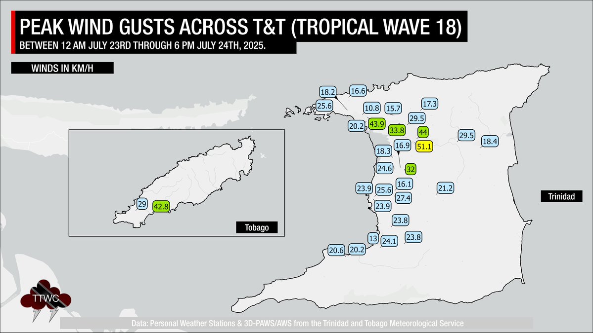
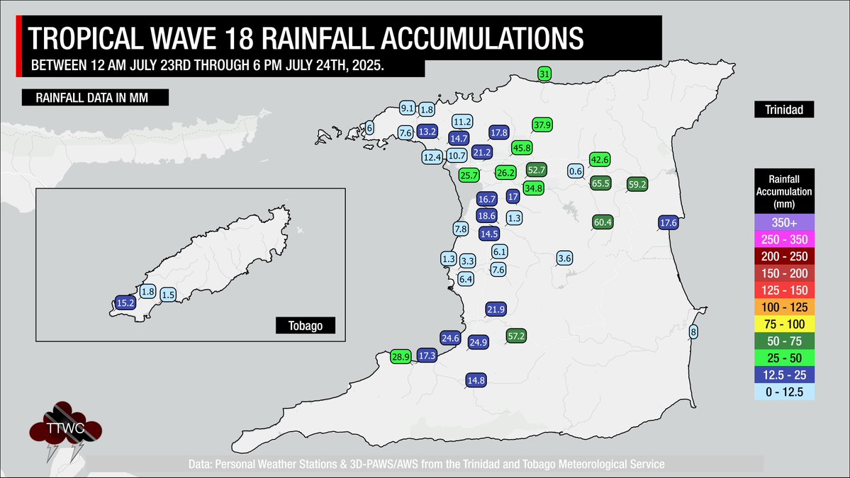
Over the last 36 hours, as Tropical Wave 18 moved across T&T, locally heavy rainfall and gusty winds have occurred. Localized street flooding was reported along the East-West Corridor on Wednesday, and at various areas in northeastern Trinidad on Thursday. Fallen trees were…
For 2025 to date, the National Hurricane Center has analyzed 20 tropical waves between Trinidad and Tobago and the African West Coast. Of these, one dissipated before reaching T&T, 17 have now moved across the Lesser Antilles, and two are forecast to move across the region on…
12:00 AM (midnight) - Isolated to scattered showers and isolated thunderstorms, producing moderate to locally heavy rainfall, are moving across mainly central and southern Trinidad. This activity is forecast to continue through the early morning, increasing in coverage across…
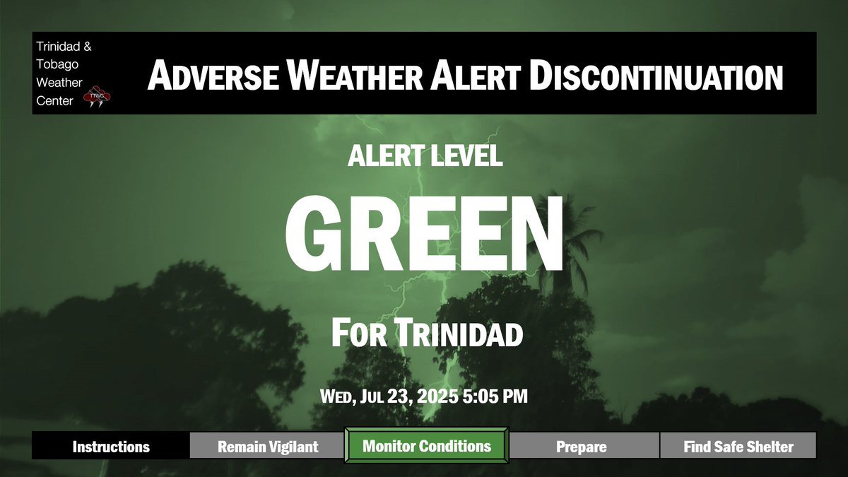
5:15 PM - Isolated, but locally heavy, showers are moving across Trinidad associated with instability and moisture from #TropicalWave18 that continues to move across the Lesser Antilles. Although the Adverse Weather Alert has been discontinued, the TTMS advises that locally…

Although the Adverse Weather Alert for Trinidad has been discontinued as of 5:05 PM today, more showers and thunderstorms are forecast for T&T on Thursday. Locally heavy rainfall may still bring street/flash flooding, accompanied by gusty winds exceeding 45 KM/H.…
11:30 AM - Following isolated and short-lived mid-morning cloudiness, showers and thunderstorms across Trinidad, which produced wind gusts to 45/kmh, conditions are becoming sunny again with temperatures rising once more. Warm temperatures, light winds from the southeast, and…
An Adverse Weather Alert is in effect for Trinidad due to the high potential for isolated heavy showers and thunderstorms through 6:00 PM Wednesday. Details: ttweathercenter.com/2025/07/23/adv…

Typically, the wind across Trinidad and Tobago moves from east to west. However, on Wednesday, these winds are likely to shift from the south/southeast to the north/northwest, resulting in larger-than-usual waves along the Gulf of Paria coastlines. ttweathercenter.com/2025/07/23/sea…

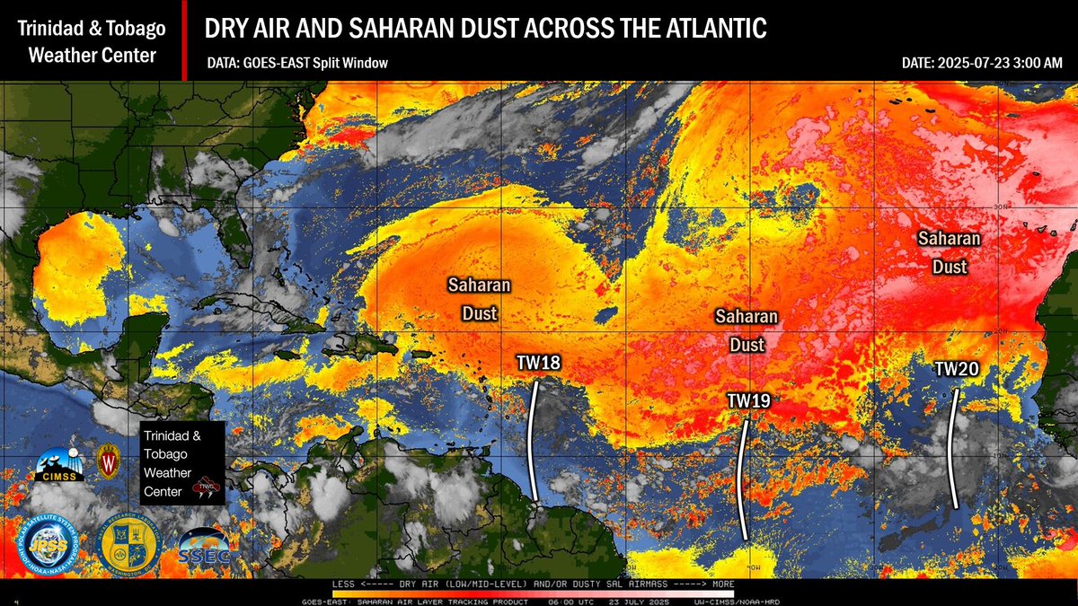
Over the next seven days, Saharan Dust surges are forecast to trail tropical waves, with the first, short-lived surge forecast to move across T&T from early Thursday, trailing Tropical Wave 18. ttweathercenter.com/2025/07/23/sho…
The first of three tropical waves forecast to move across Trinidad and Tobago and the Lesser Antilles over the next five days is expected to pass today, with periods of heavy rainfall and gusty winds likely, mainly north of T&T. Today's main hazards will be slow-moving showers…
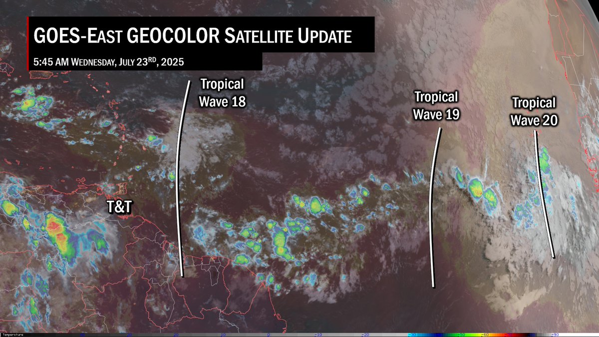
The National Hurricane Center is monitoring Tropical Wave 18, 1,775 kilometers east of T&T, for development. At this time, development chances remain low with no islands, including T&T, under any tropical storm threat, watch, or warning. This wave is forecast to move across the…
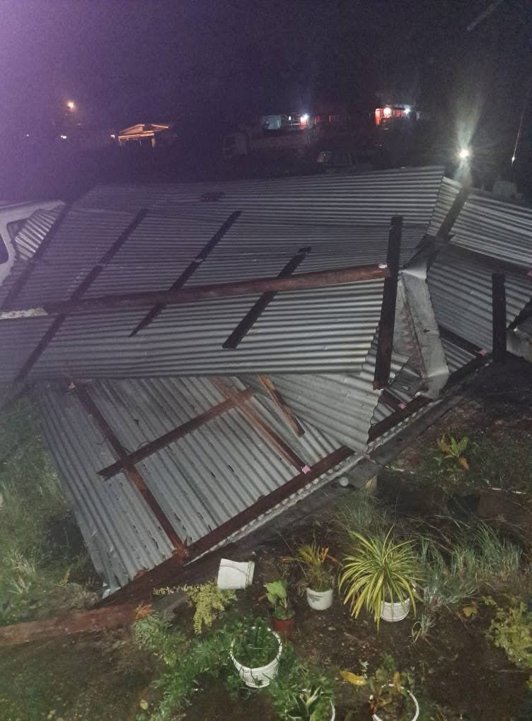
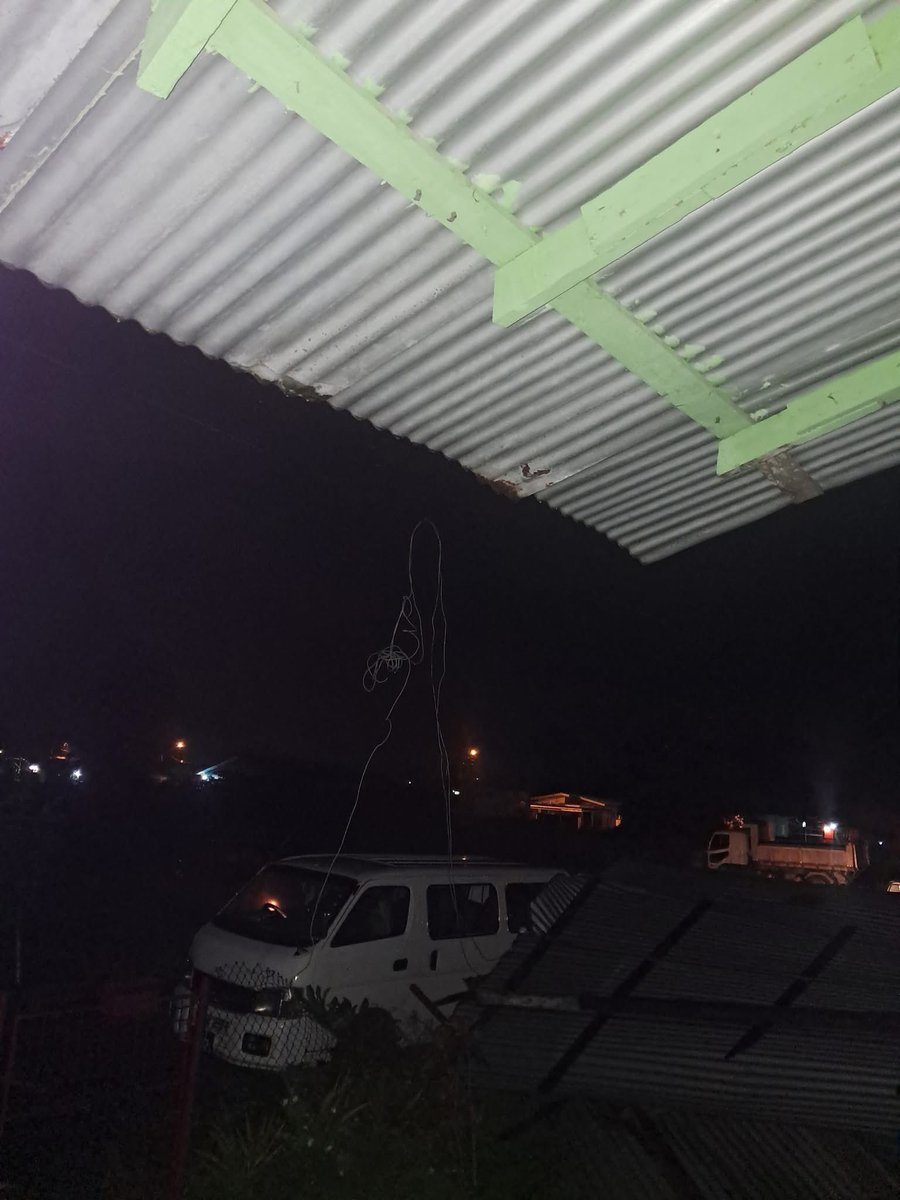
Another report of a roof blown off a home at Rampersad Trace, Vega de Oropouche, northeastern Trinidad, damaging a car in an adjacent property. Wind gusts between 50 km/h and 65 km/h have been observed, leading to sporadic reports of fallen trees, power outages and roof damage…
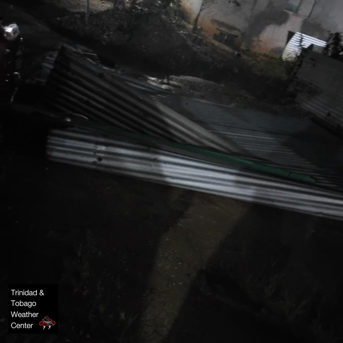

10:30 PM - A roof has blown off a home, landing an in adjacent property at Jacelon Trace, Vega de Oropouche, northeastern Trinidad following strong winds. 📸: Jenelle Wallace Wind gusts between 50 km/h and 65 km/h have been observed, leading to sporadic reports of fallen…