Steve Templeton
@SteveTempleton
Chief Meteorologist #KMOV #STL. Love active wx, it's when my job is most important. Love BBQ & most of all family. Two kids keep me smiling & tired
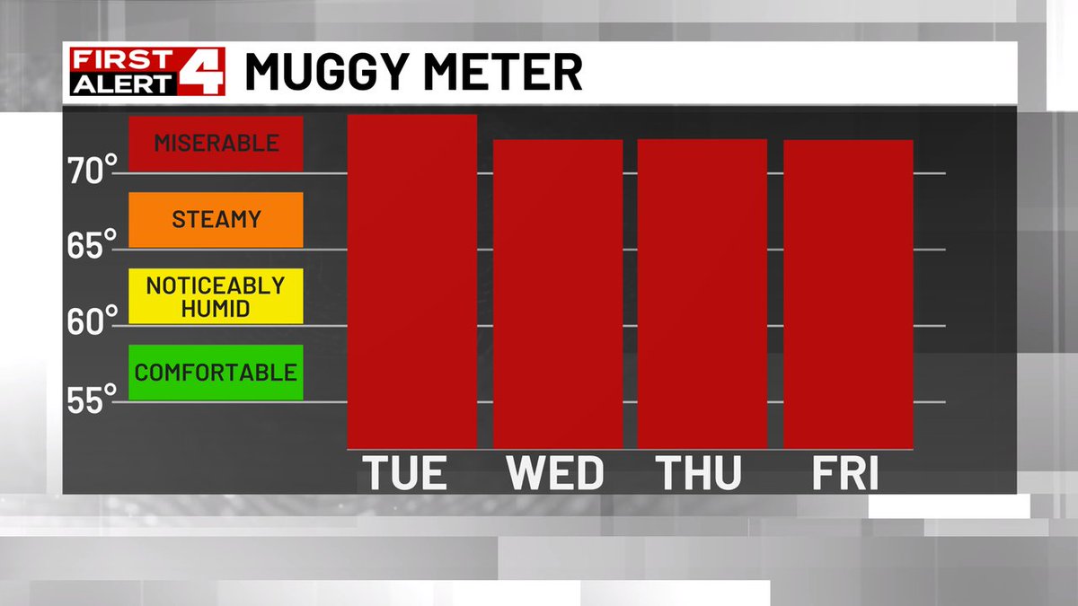
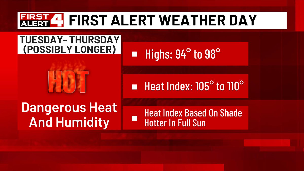
We are firmly in the Miserable humidity category all...week...long. While no record heat, this excessive humidity will make the heat index 105 to 110 through at least Thursday and perhaps beyond depending on storms developing and cooling it off #FirstAlert4
From First Alert 4 Weather...A new Tornado Warning issued for Montgomery, Macoupin. Get alerts and track the storms here shorturl.at/yjNPm #FirstAlert4
First First Alert 4 Weather...A new Severe Storm Warning issued for Montgomery, Macoupin, Madison, Bond. Track the storms & get alerts on the First Alert 4 Weather App shorturl.at/yjNPm #FirstAlert4
First First Alert 4 Weather...A new Severe Storm Warning issued for St. Charles, Madison, Jersey, Macoupin, Calhoun, Lincoln. Track the storms & get alerts on the First Alert 4 Weather App shorturl.at/yjNPm #FirstAlert4
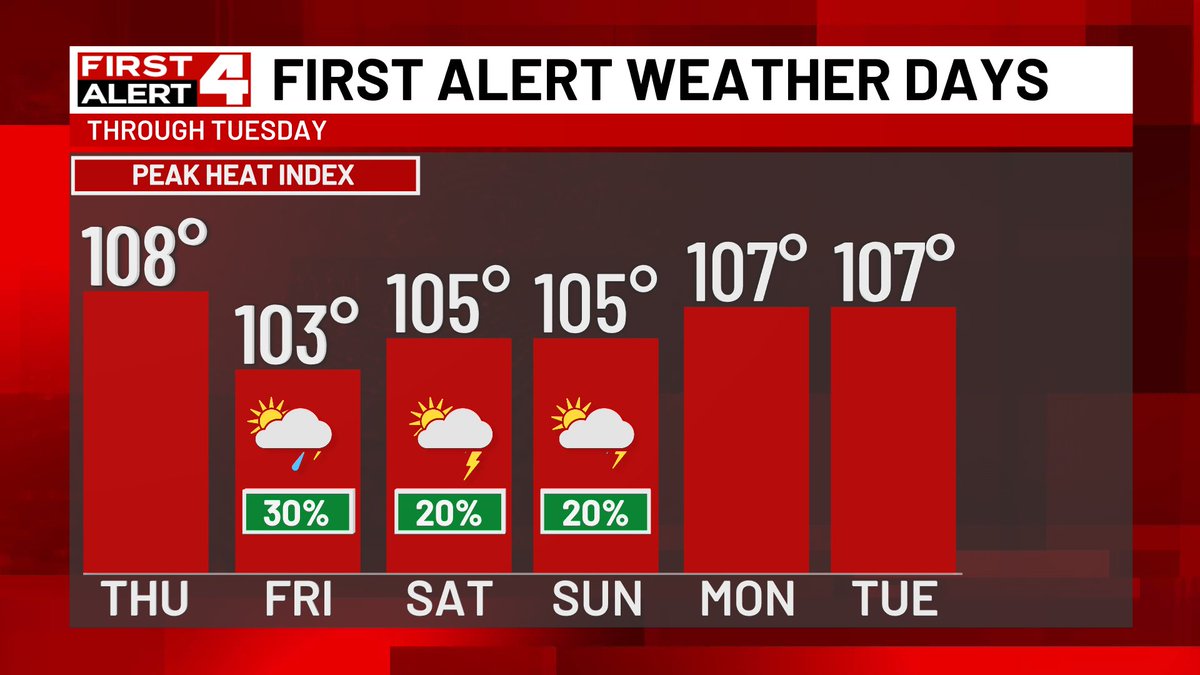
The tough stretch of heat and humidity continue until Tuesday next week. We may get a temporary cool down from storm chances, highest Friday and lower Saturday-Sunday. But we can't count on that, so check back for storm updates and plan for more heat and humidity #FirstAlert4
HELP! The last of 950 new A/Cs will be gone. Only 50 left go out the doors today. A sweet lady in St. Peter’s donated 2 new units Tuesday. Only seniors & the physically disabled without a working unit are being considered. CoolDownStlouis.Org to donate or @CommerceBank.
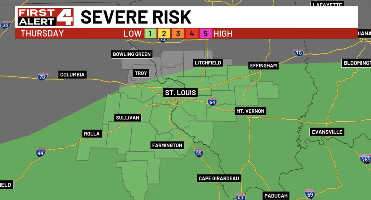
While we got a break Monday from intense heat due to the early morning storms and then clouds, we will be dealing with intense heat and excessive (really excessive) humidity Tuesday-Thursday. Those are First Alert Weather Days due to the dangerous heat index of 105 to 110
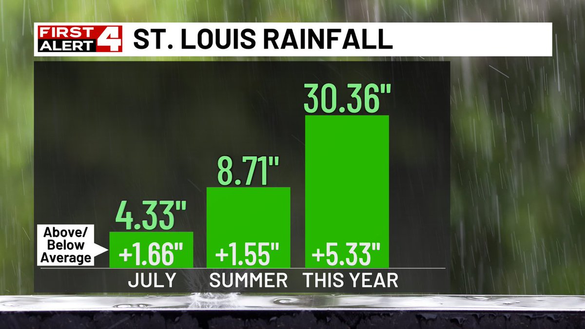
Rainfall of 2.15" officially at Lambert last night (although some spots had 4-6"+) and our official totals are all above normal for July and Summer rainfall #FirstAlert4
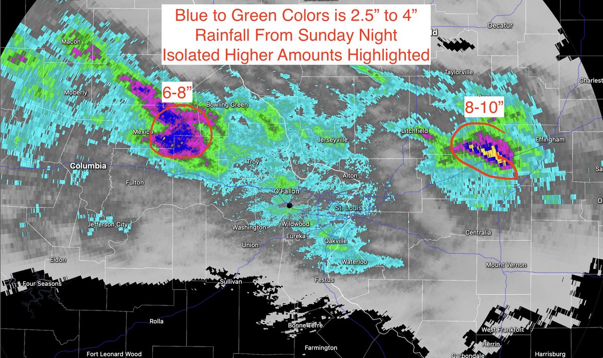
Big time rain totals from loud storms Sunday night, here's the radar estimate with a solid 2-4" in the metro but higher amounts in spots for sure. Temps won't be extreme today but intense heat ramps up again Tuesday and this week #FirstAlert4
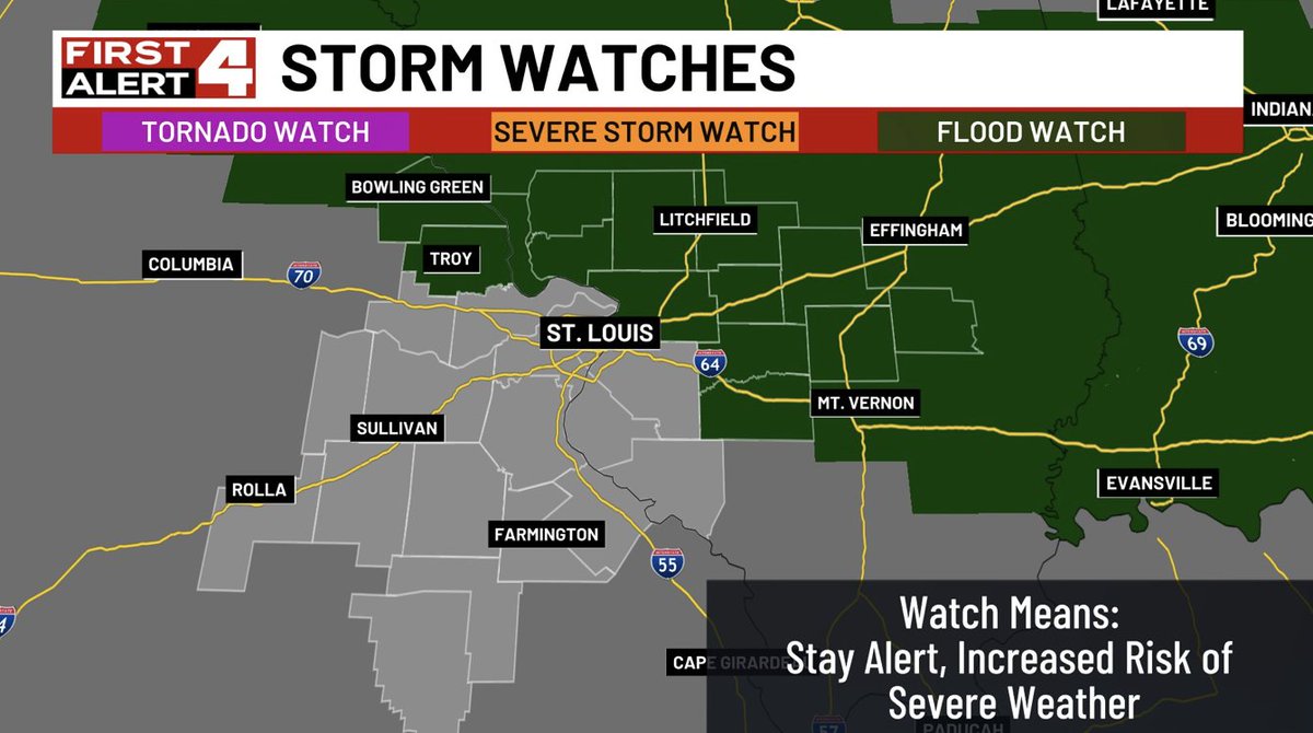
From First Alert 4 Weather...A New Severe Storm Watch issued for parts of the area until Jul 21 12:00AM. A watch means stay alert as there is an increased risk of severe weather. Get the latest radar & alerts here shorturl.at/yjNPm #FirstAlert4
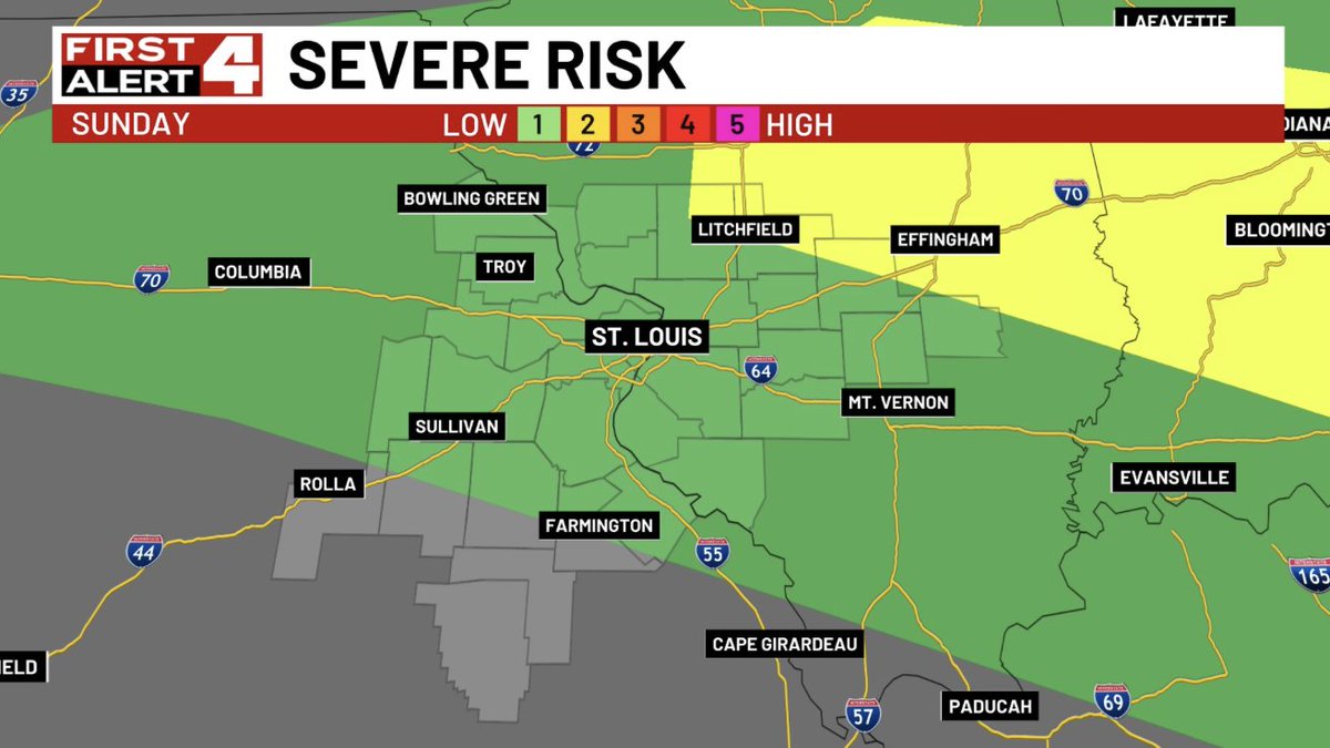
First Alert Update: Flood watch focused near and northeast of St. Louis later this afternoon through Monday afternoon. And storms across the region could be severe, it's a lower end threat for most but wanted you to know a severe storm or two can't be ruled out #FirstAlert4
First First Alert 4 Weather...A new Severe Storm Warning issued for St. Clair, Monroe. Track the storms & get alerts on the First Alert 4 Weather App shorturl.at/yjNPm #FirstAlert4
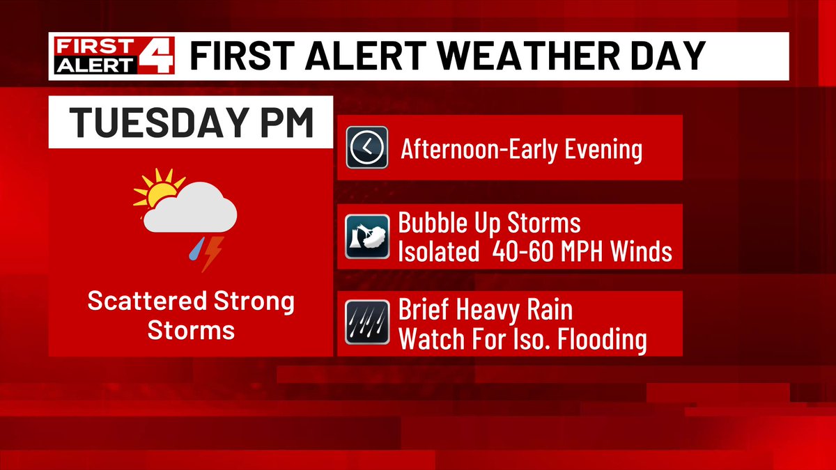
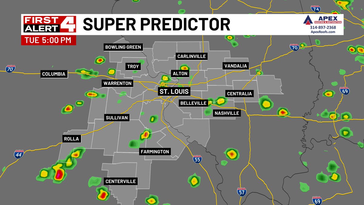
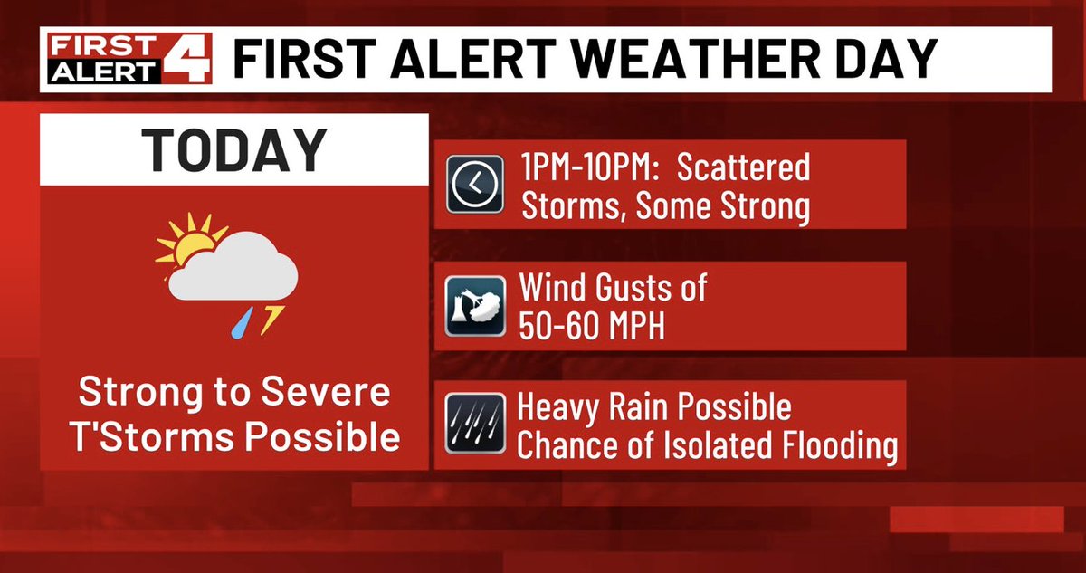
A few strong storms this afternoon and severe winds are possible as this a First Alert Weather Day. Winds are the primary threat, some brief heavy rain may cause short term flooding too. Stay alert with the Fist Alert 4 Wx App #FirstAlert4 firstalert4.com/page/download-…. .

First First Alert 4 Weather...A new Severe Storm Warning issued for Clay, Richland, Jasper. Track the storms & get alerts on the First Alert 4 Weather App shorturl.at/yjNPm #FirstAlert4
First First Alert 4 Weather...A new Severe Storm Warning issued for Marion, Fayette. Track the storms & get alerts on the First Alert 4 Weather App shorturl.at/yjNPm #FirstAlert4
First First Alert 4 Weather...A new Severe Storm Warning issued for Fayette. Track the storms & get alerts on the First Alert 4 Weather App shorturl.at/yjNPm #FirstAlert4
First First Alert 4 Weather...A new Severe Storm Warning issued for Jersey, Lincoln, Calhoun, Greene. Track the storms & get alerts on the First Alert 4 Weather App shorturl.at/yjNPm #FirstAlert4
The HEAT🔥 is on! It’s on the street and in the homes of area MO/IL most vulnerable, without air or electricity.
The dog days of Summer are here. While a weak front may give us some storms and a slight cool down late week, check out the trend for next week's more intense heat #FirstAlert4

Tuesday afternoon-evening will have some bubble up storms that can produce 40-60 mph winds & isolated flooding. This is not a widespread or high end severe threat, but these heavy storms can pack a punch of wind and flooding where they hit #FirstAlert4