
Soar
@Soar_Earth
Welcome to the new atlas. 🗺️ Explore at https://www.Soar.Earth
Creating an account on Soar in 30 seconds 👀 ⬇️ #Soar #TheNewAtlas
This single capture alone covers Starship related work at LC-39A & SLC-37, Relativity's LC-16 being upgraded for Terran R, Stoke Space's LC-14 under construction to support Nova, and even a Falcon 9 on SLC-40. You can browse the full image on @Soar_Earth: soar.earth/maps/136087
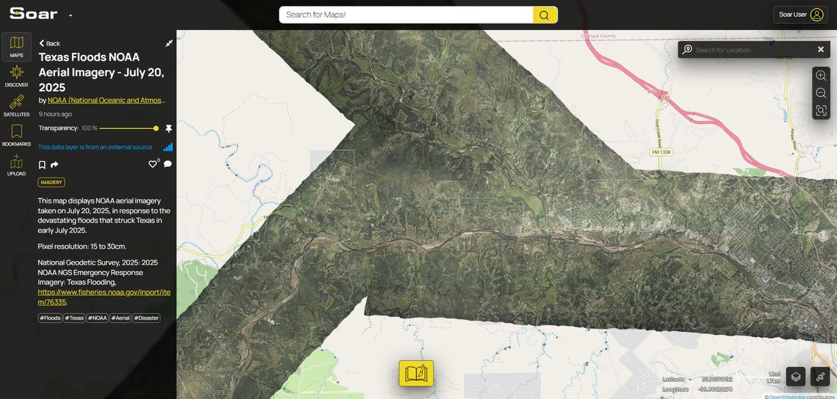
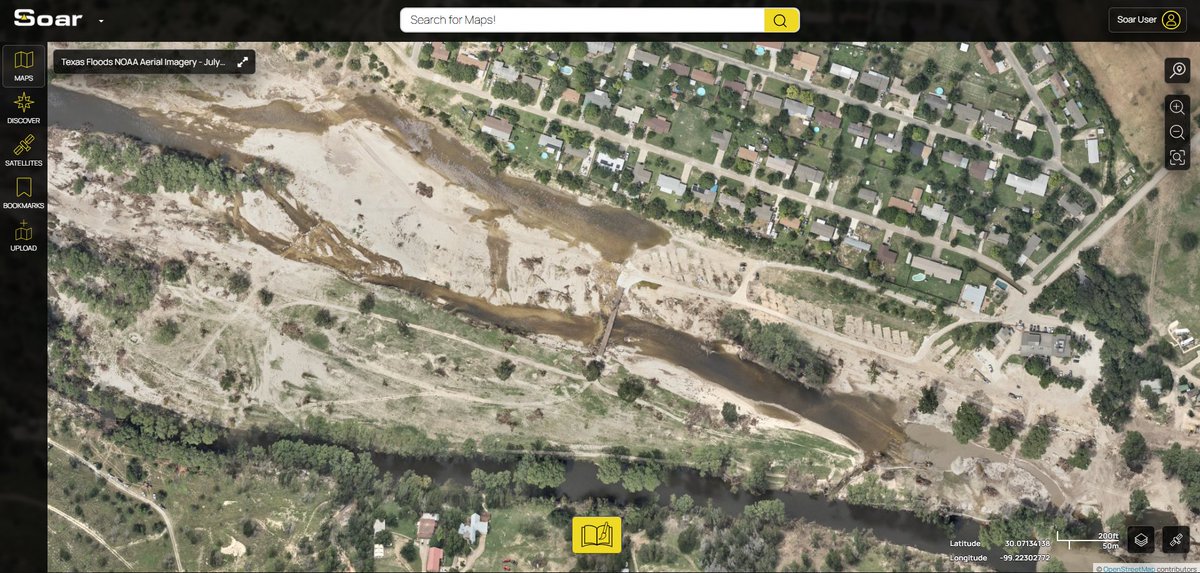
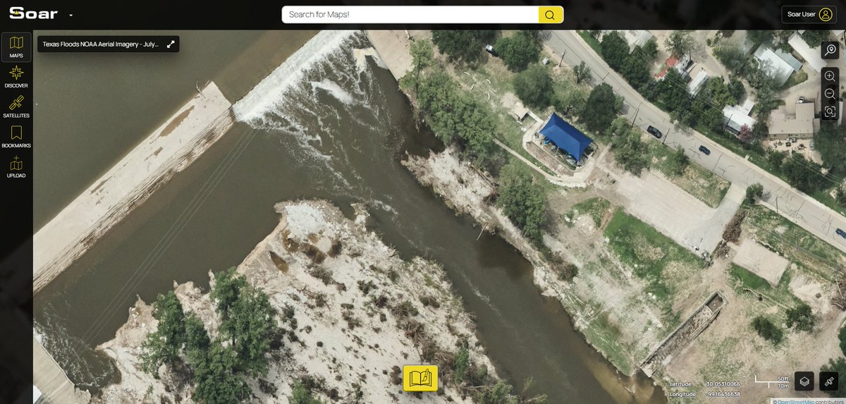
Once again, we have more imagery added to Soar from @NOAA, this time covering the #TexasFloods on July 20, 2025. This map is quite big with many different details of raised water levels across the river. Did you spot anything we missed? soar.earth/maps/texas-flo…
#تحديث للوضع الميداني في قطاع غزة بعد تحديث صور (Sentinel 2) ليوم 20.7 : يستمر التجريف والتقدم في بيت حانون, جباليا و مدينة غزة, كما لوحظ تقدم بسيط من محور نيتساريم لهدم بعض المباني السكنية كما يبدوا. -1-
@ucddublin UCD Belfield from a US spy satellite in 1966 soar.earth/maps/dublin-ir…
An amazing historical map of Los Andes! 😍
La version interactiva la pueden ver en soar.earth/maps/gobernaci…
We now have more imagery added to Soar from @Maxar covering the #TexasFloods. The destruction shown in the before and after through the transparency slider really puts into perspective how devastating these events can be. soar.earth/maps/texas-flo…
We also have @NOAA aerial imagery starting to roll in following the Texas floods. soar.earth/maps/135936?ba… This scene covers Marble Falls and Burnet. We're expecting more to come in over the weekend. Stay tuned.
Thanks to @Maxar for another look at the #TexasFloods. We believe this data should be viewed by everyone, so again, we’ve added it to Soar to be easy to explore. Explore the full map: soar.earth/maps/texas-flo… Here’s some closer looks… 🧵 [1/4]
Imagery from a July 11 flight is now up on @Soar_Earth. soar.earth/maps/135937?ba…