Shea Gibson
@SheaGibsonWx
Meteorologist - Wind Forecaster for WeatherFlow - Sail Race Forecasting - Tropics - Outreach - New Weather Station Projects - AMS Member - WRN Ambassador
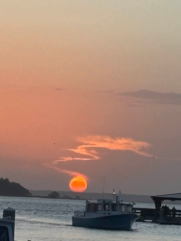
7/27/25 Sunday 8:30pm: From Harbortowne, Hilton Head SC as the sun is trying to smile at us in this brutal heat. Pics by Captain Fitz Lazenby .

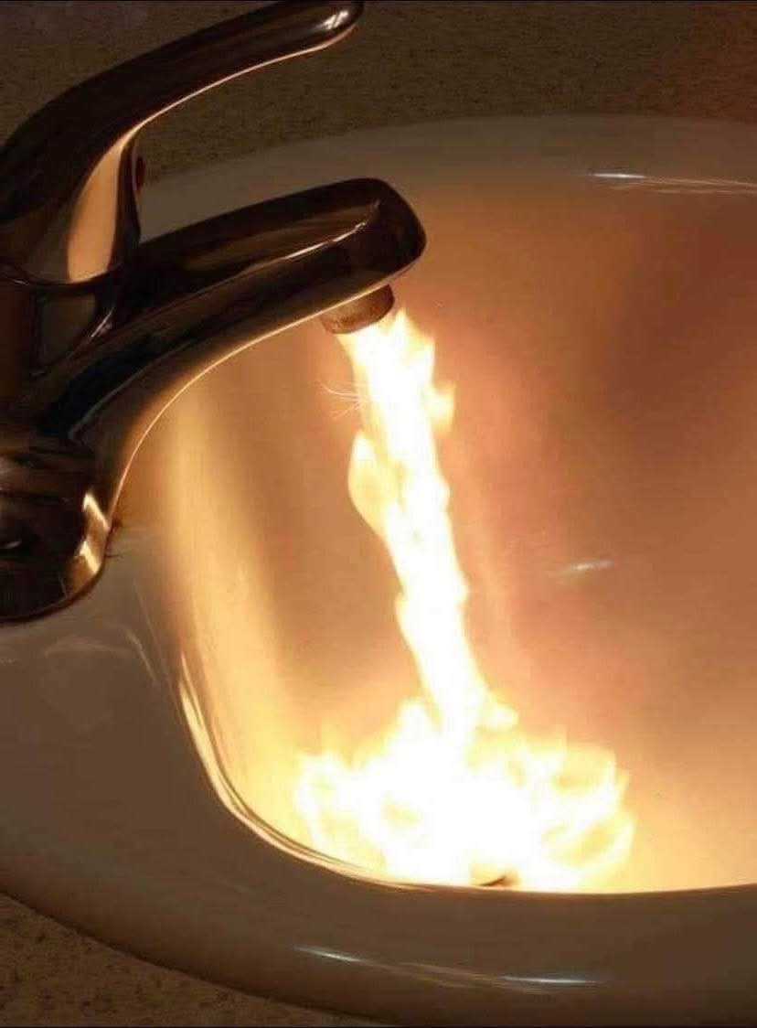
Tumred on the tap water about 30 mins ago. Bad mistake. #heatwave #scwx #chswx
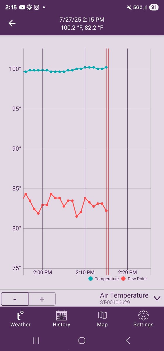
Yep I waited for the hottest day of the year to show off what's left of two snowballs from our winter storm this past January. It is now 100.2° out right here with a heat index of 109-113°. Wishing it was cooler! #chswx

INSIDE a tornado southwest of Elstow, Saskatchewan on Sunday! #skstorm
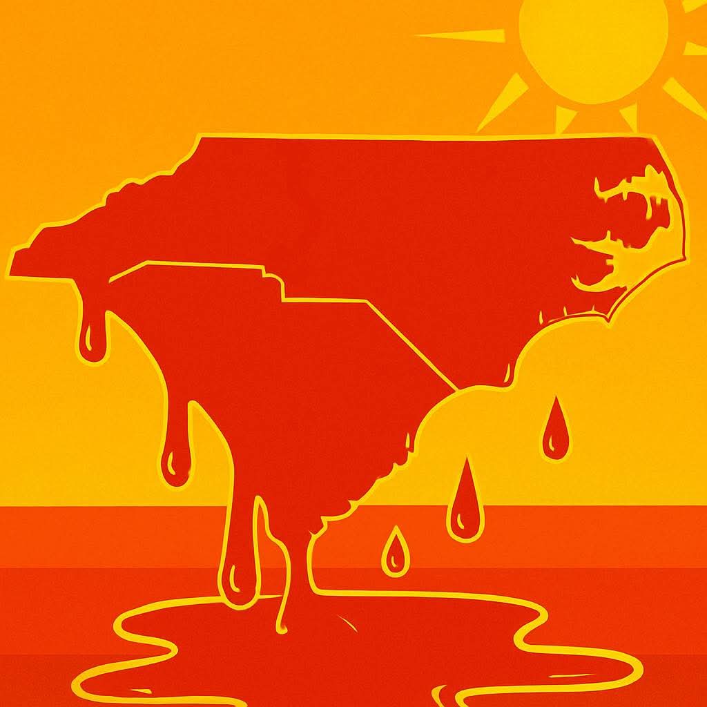
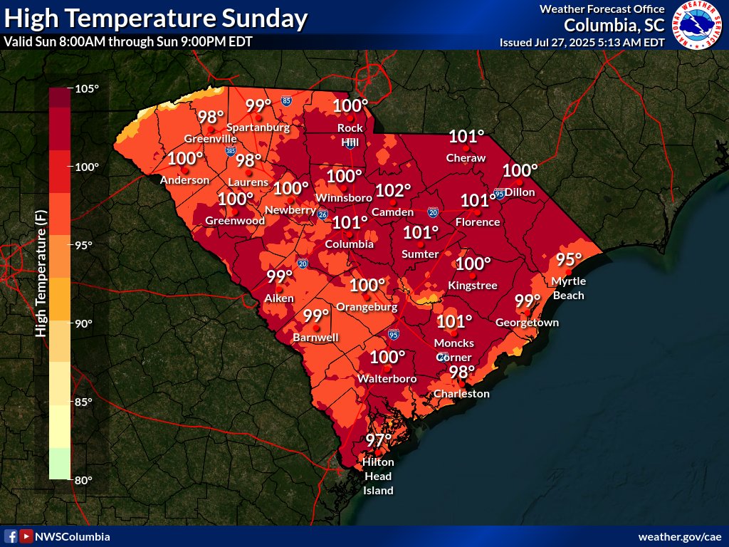
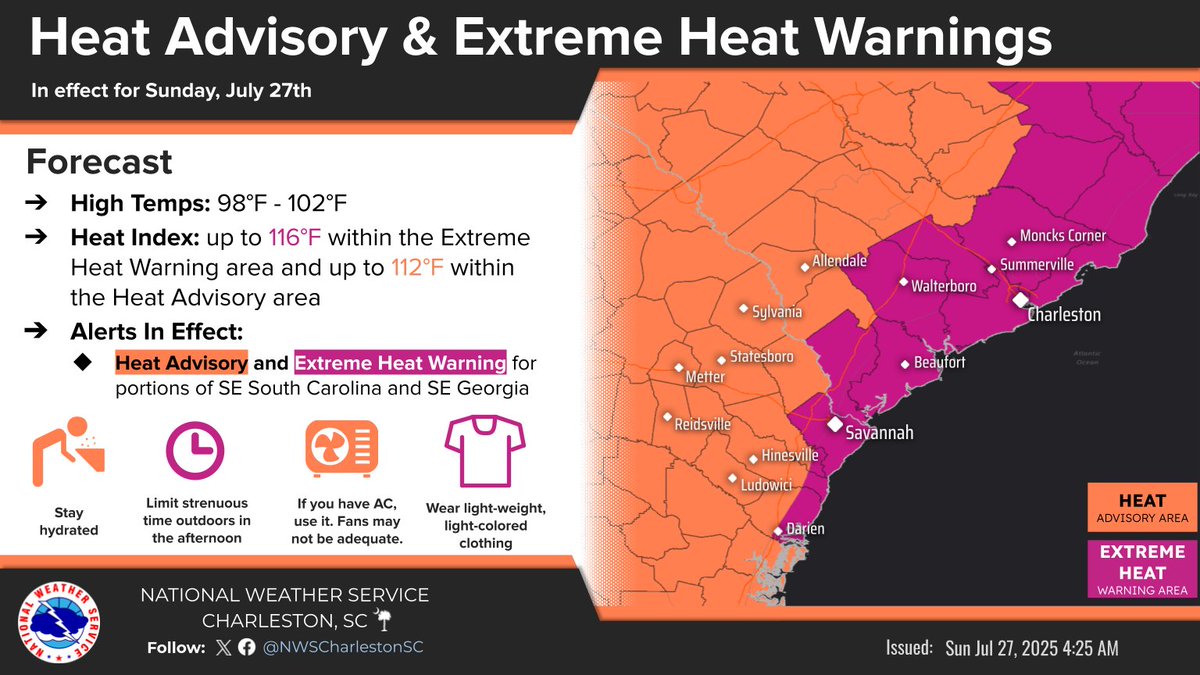
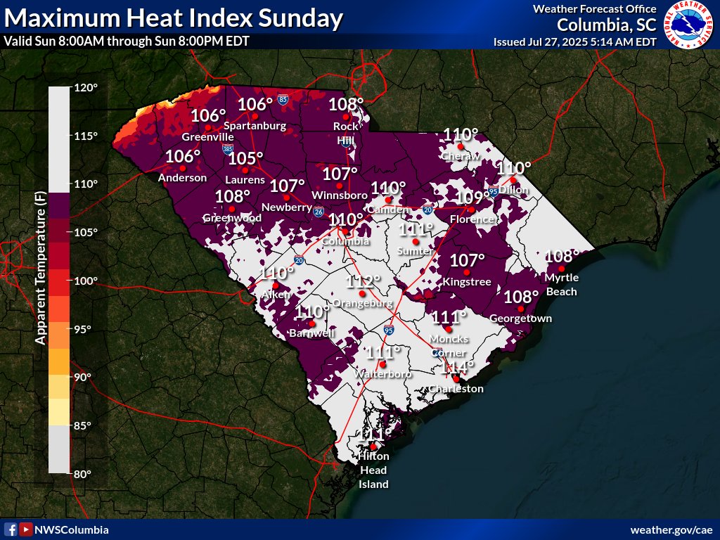
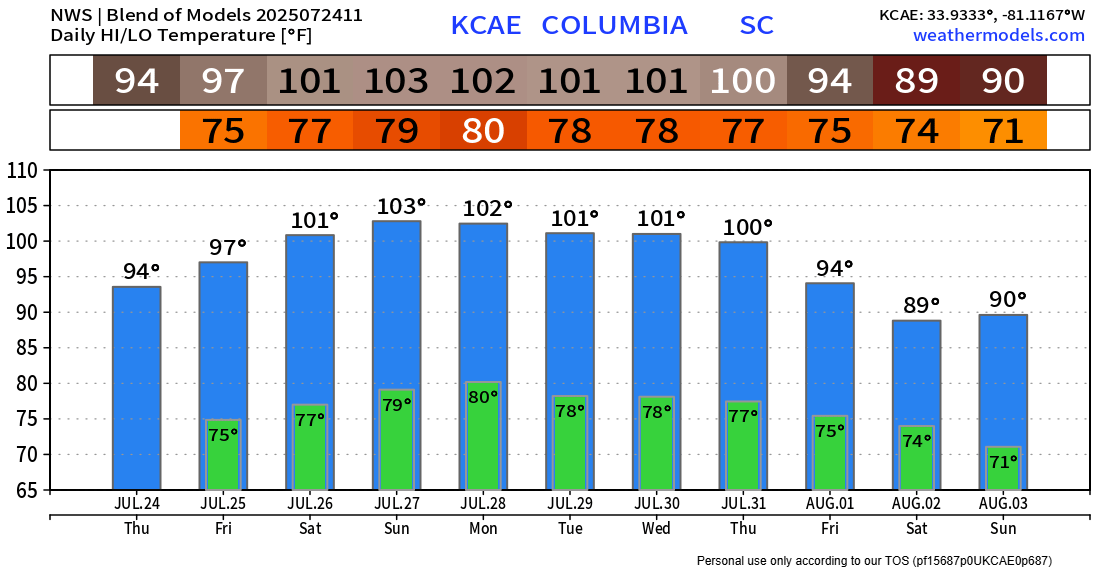
***Extreme Heat Warning for all of Coastal to inland SC*** High air temps are expected to reach 100-102° just inland and west, with upper 90's immediate coast. Peak heat indices will range between 108-112°F within the Heat Advisory area and 112-116°F within the Extreme Heat…
It's so hot along the sea breeze front inland that even storms trying to blow up fizzle out too fast. Not a chance! #chswx
Happy Gilmore 2 did NOT disappoint!
Shooter finally gets what's coming to him
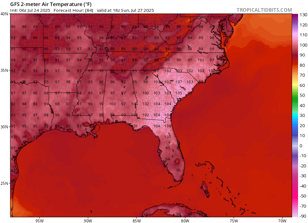
Here is the heat dome expanding west from today through Wednesday. Could see some records broken over the next 3 to 5 days.
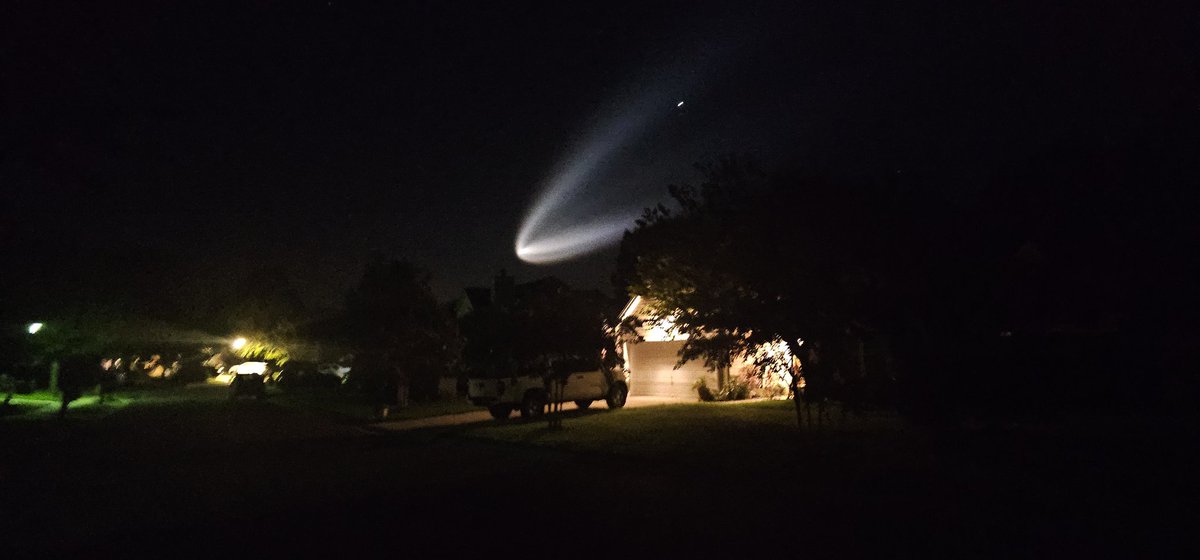
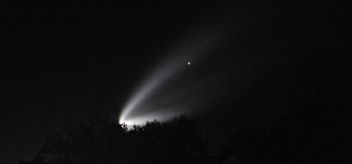
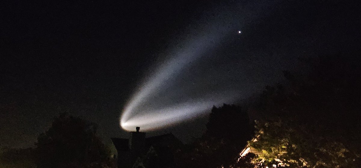
Wow! Great shots from @kcgar56 of the #SpaceX #Falcon9 vapor trail this morning as seen over the Morris Island Lighthouse, Charleston, SC. #chswx
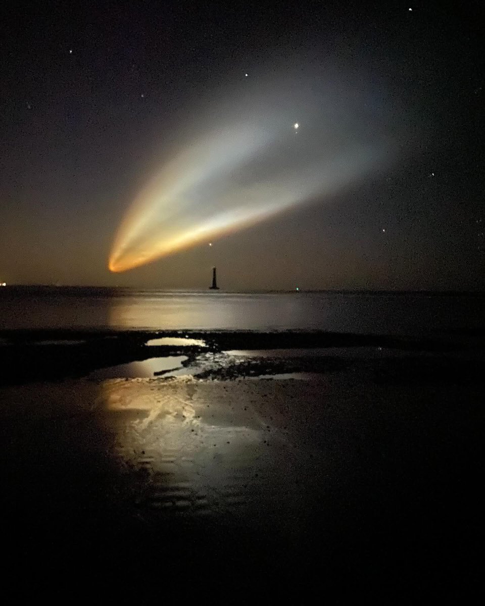
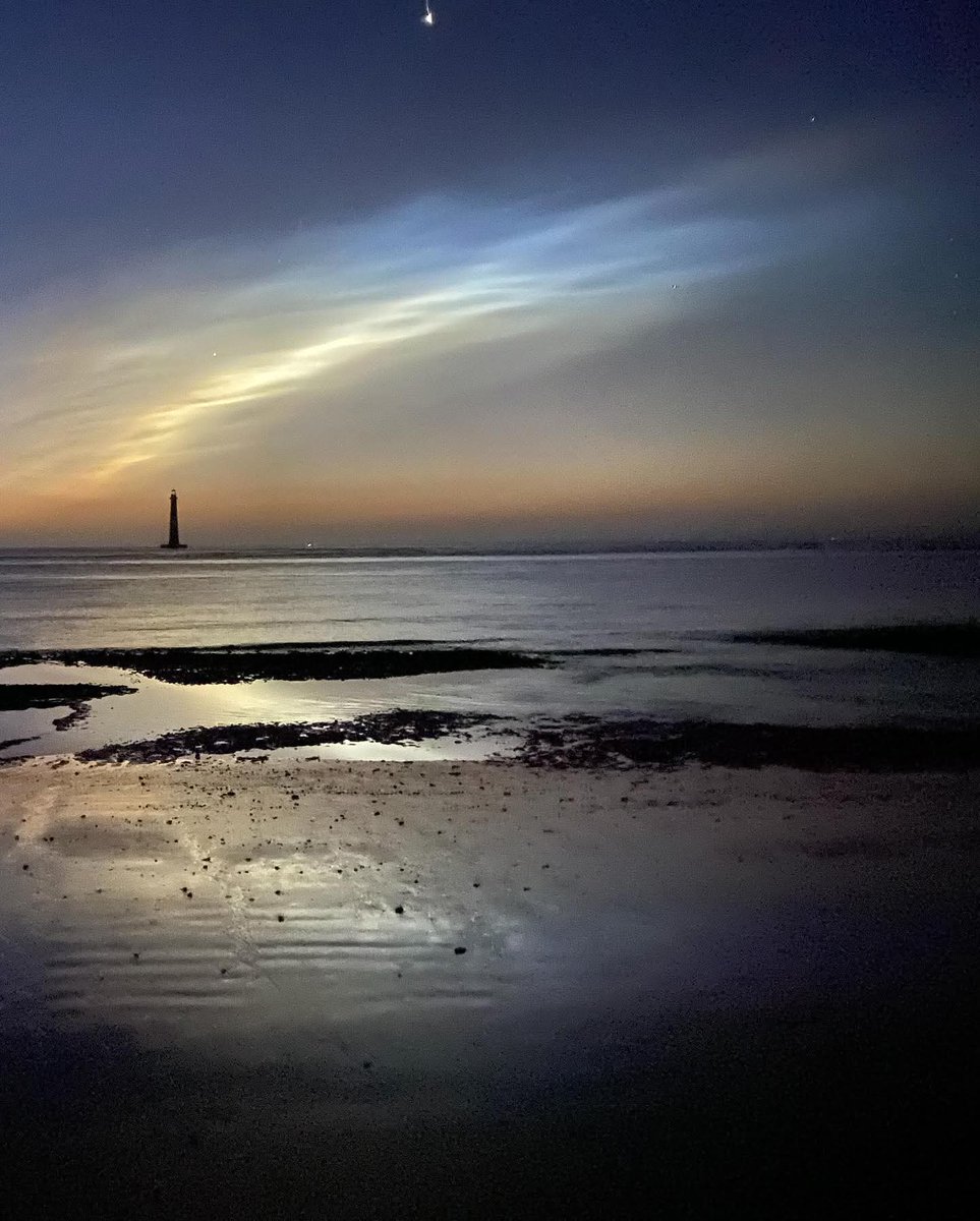
That was quite the trail! Pics don't do it justice! #SpaceX #Falcon9 #Starlink
Still have that little area in the corner of the Gulf wearing a 10% badge of shame. Likely will not form. Otherwise across the MDR (Main Development Region), it is quiet. Lots of talk from some in the industry showing Euro ensemble spaghetti without a meatball for something…
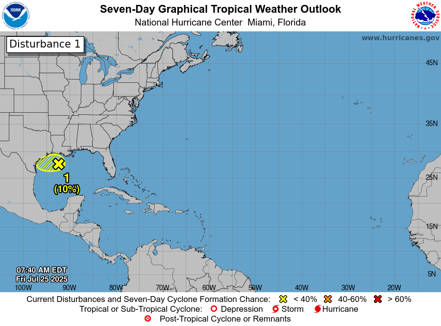
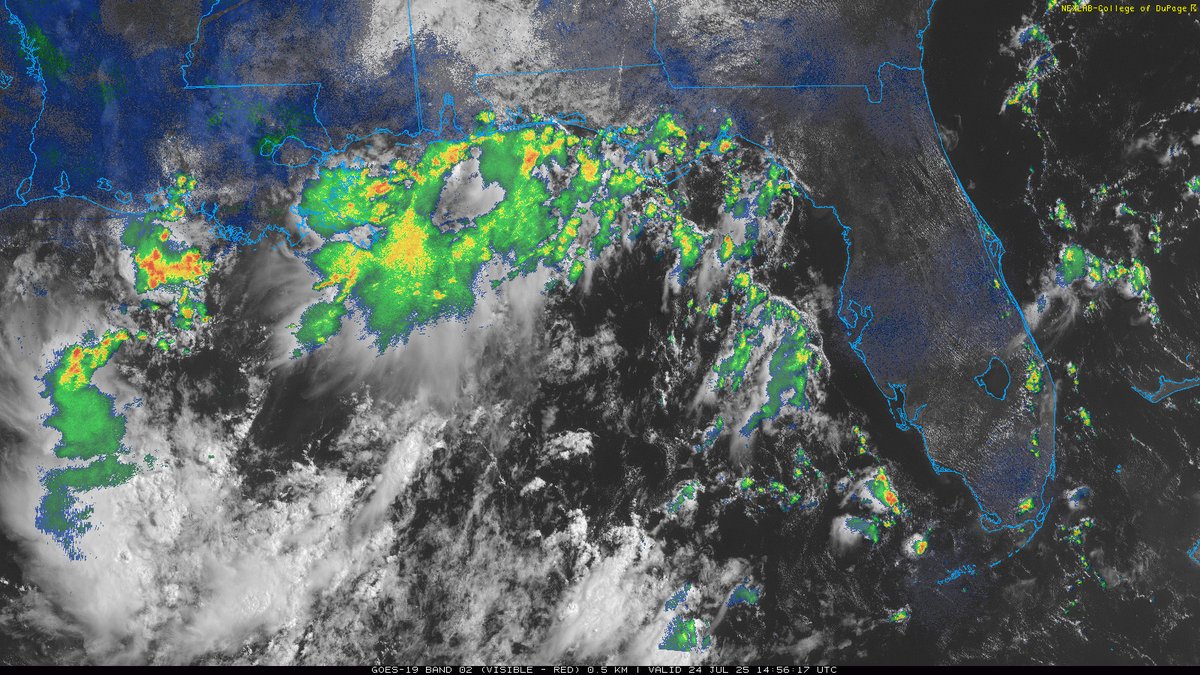
The area being watched in the Gulf is remaining low at a 10% chance. Lots of NE wind shear in that region with a lack of organization. Heavy rains and storms will be the main concerns for that zone of activity.

The hottest temps of the summer are on the way to SC. Chas alone could top 100° Saturday-->Monday with heat indices in 111-116° ranges. Midlands could see 103-107° with even higher indices. This heat wave could very well warrant Extreme Heat Watches/Warnings across the entire SE…

ALERT: Minor to moderate coastal flooding will occur along the coast of Charleston and Colleton Counties with high tide this evening. Expect flooding of roads, especially in Downtown Charleston and in areas along the backside of Edisto Beach as well as Isle of Palms. #scwx #chswx

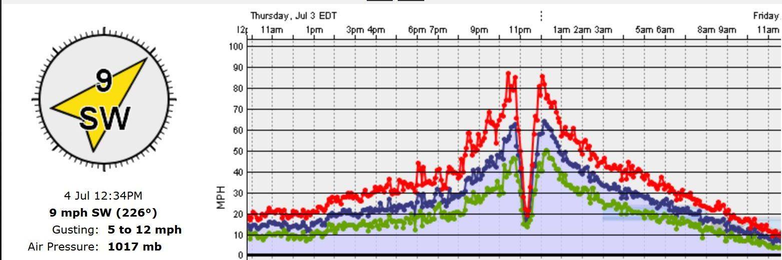
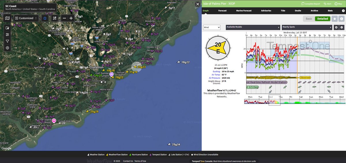
Backdoor sea breeze oscillations kicking in. Seeing 17-21kts along those barrier islands and outer Chas harbor. #chswx
Whoever said the humidity level would drop this morning lied. It waited a few more hours. Was still sweating buckets just after sunrise. Still the best time of the day to get those outdoor workouts in! #chswx
