
Boston Weather Consulting (by Owen)
@SNEWxCenter
Bringing you reliable forecasts for the Southern New England Area!
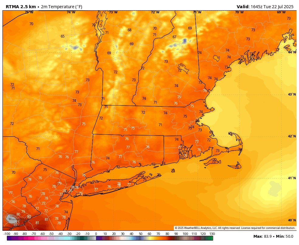
Perplexed regarding the issuance of a heat advisory today with dew points in the low 60s and max heat indices nowhere near 95 in most of the region. Yet again diluting the meaning of a heat advisory but who am I to judge 🤷♂️

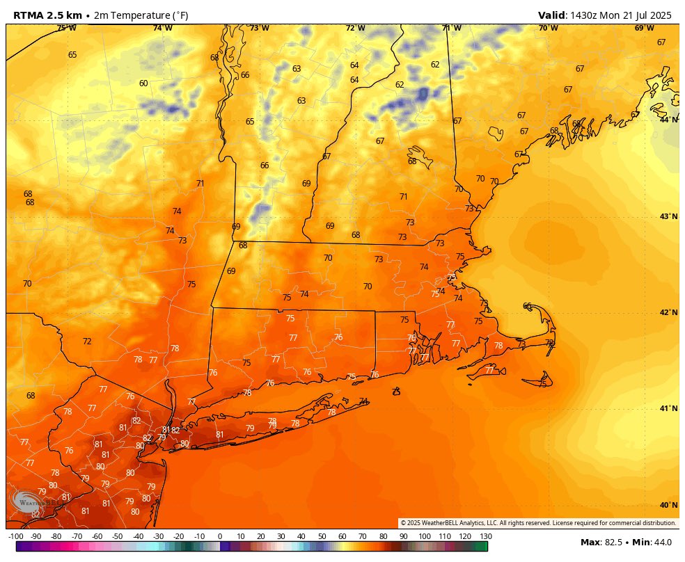
Warm today but rather pleasant with a steady breeze and dew points still in the low 60s. ☀️ Tomorrow we heat up to the mid-upper 90s

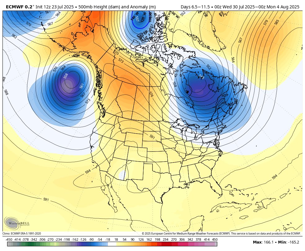
After the heat at the end of this week, it looks like we enter a much cooler period as a trough develops over the Eastern 1/3 of the US. A nice reprieve from the summer heat and humidity!
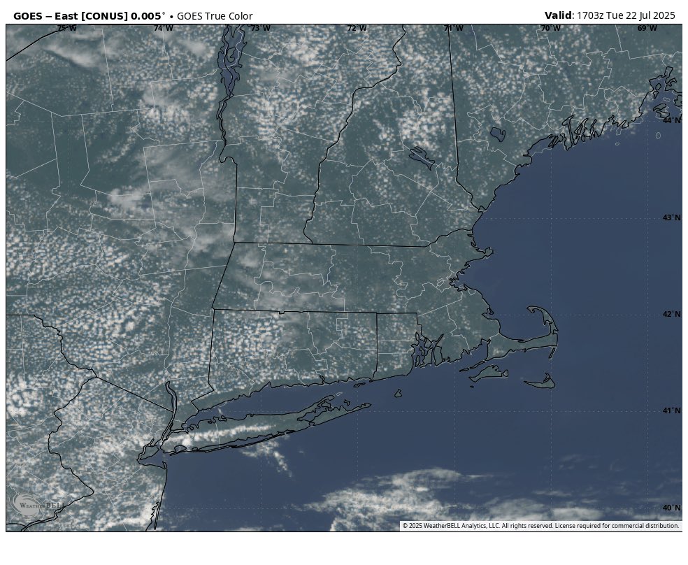
Another absolute stunner out there today. Hard to beat this ☀️
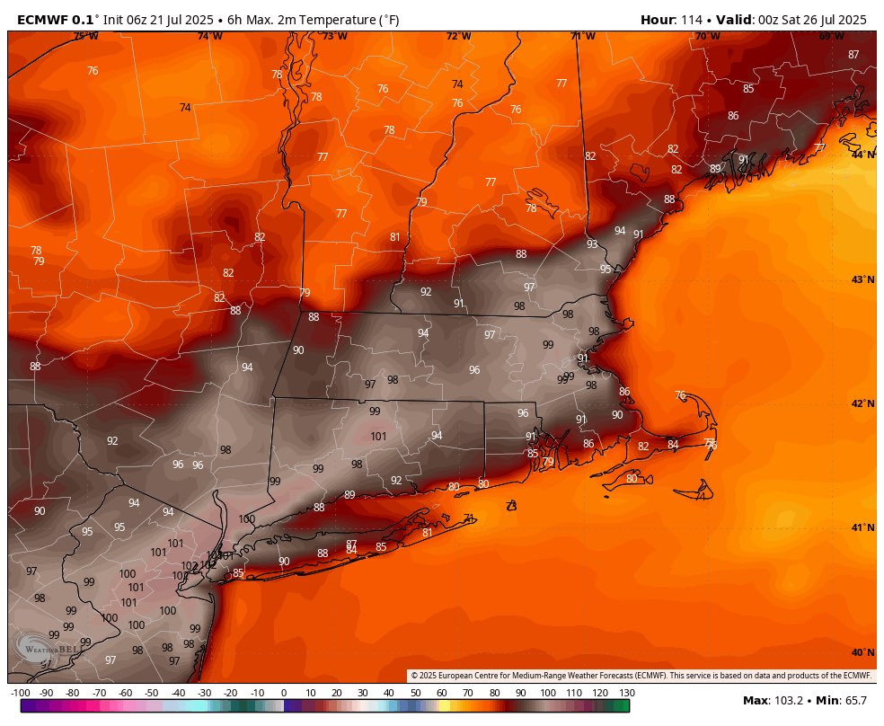
The good news is that the heat doesn’t last long: Thursday-Saturday looks the hottest, with temperatures returning back to normal after that
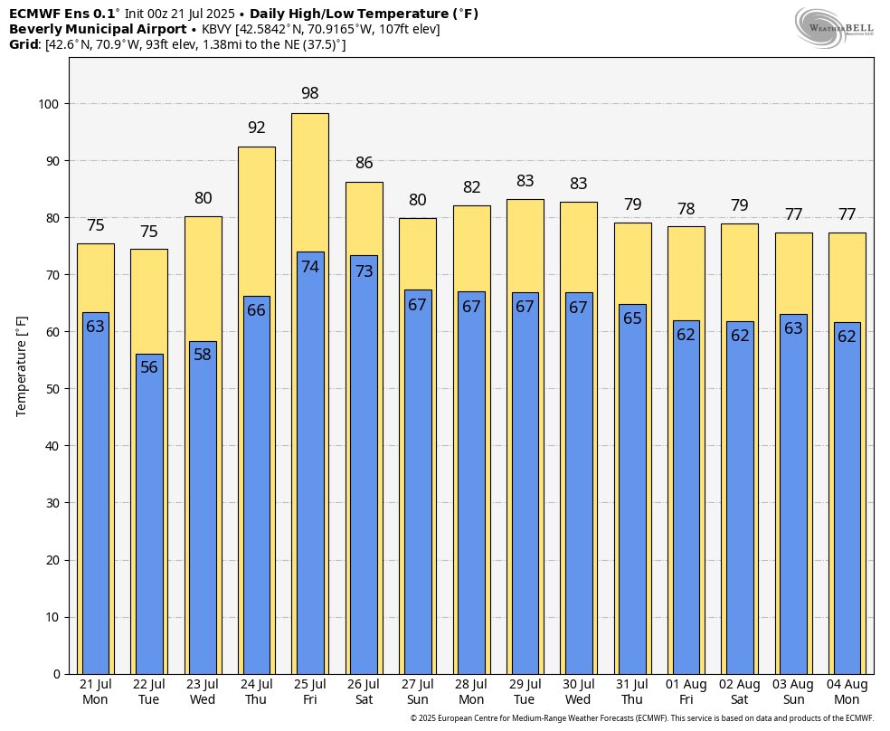
Enjoy the nice weather over the next few days, because it is looking more and more likely that the heat returns later this week and peaks on Friday. GFS/Euro advertising the potential for temps near 100°!

A stunner out there today… really cannot beat it ☀️
Manchester by the sea area getting hammered right now
These storms have lit up in the last 15 minutes as they hit the coast. Lots of lightning right now
NWS just hoisted a warning on this cell headed through Boston metro as well. Strong winds possible!
Lightning well out ahead of this storm moving into Boston… very important to get off the beaches and vulnerable outdoor areas ASAP

Storm in NE MA has gone severe… strong winds likely as it heads toward coastal areas
Few strong storms left out there, one on the MA/NH border, one headed toward Boston, and the strongest headed toward SE CT
Broken line of strong/severe storms headed to the coast. Gusty winds likely
Strong line of storms moving SE through Springfield
Here comes the line moving into SNE right on schedule
Severe thunderstorm watch just issued ->
A severe thunderstorm watch has been issued for parts of Connecticut, Maine, Massachusetts, New Hampshire, Rhode Island and Vermont until 9 PM EDT
Storms beginning to fire to the NW, these will move SE with time and ignite more storms in a decently favorable environment
Tomorrow and Tuesday look absolutely stunning weather-wise. Full sun with dew points in the 40s and 50s. Open those windows and air out the house!
We avoided a lot of morning convection in SNE so I am more confident in a solid line of storms tonight across the region. Damaging wind the biggest threat with these, timing is between 5-10pm