Ryan Morse
@RyanMorseWx
AMS Certified Meteorologist (#1004) @WISHNews8 | Former @WFRVLocal5 Meteorologist | Former @BOS25Weather Intern | Franklin, MA Native | Penn State alum
Big news! I’m very excited to share I signed a contract extension with @WISHNews8. I love forecasting for central Indiana and I appreciate the support over the years.

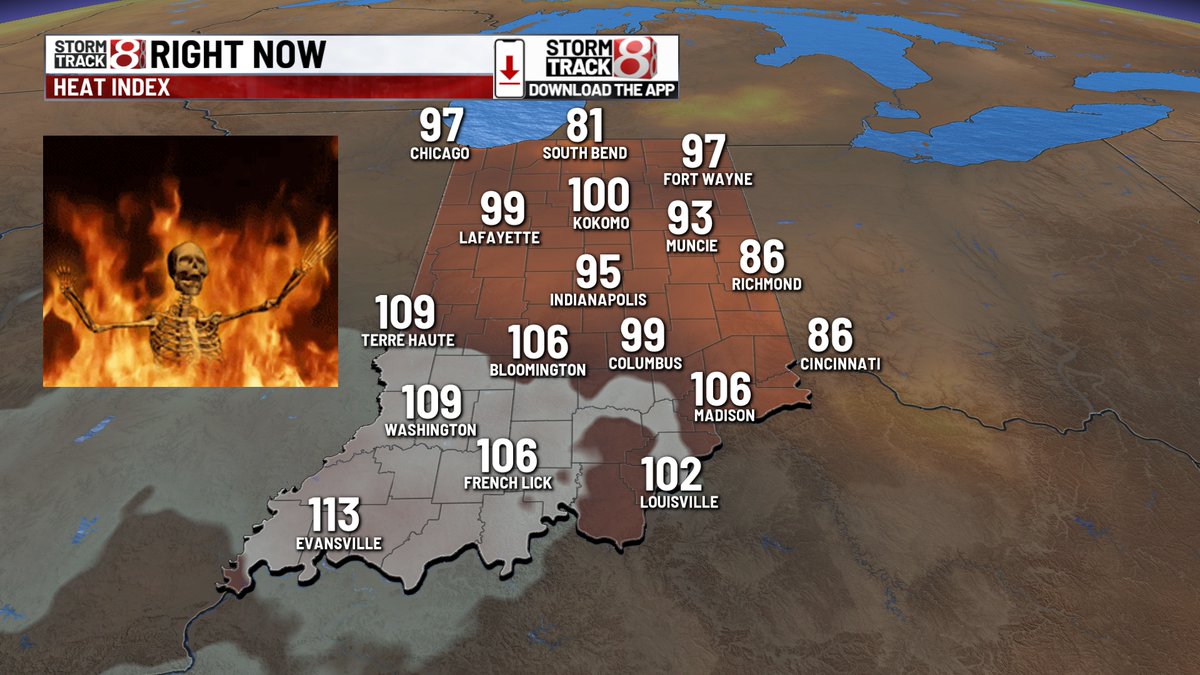
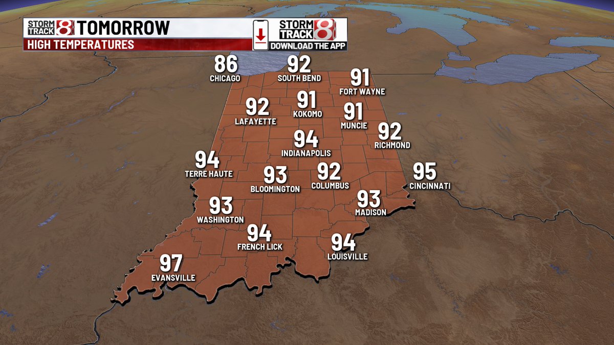
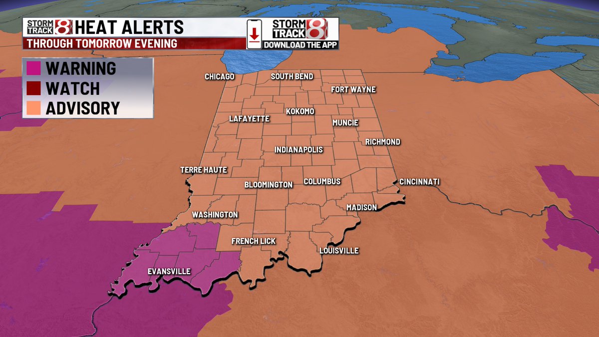
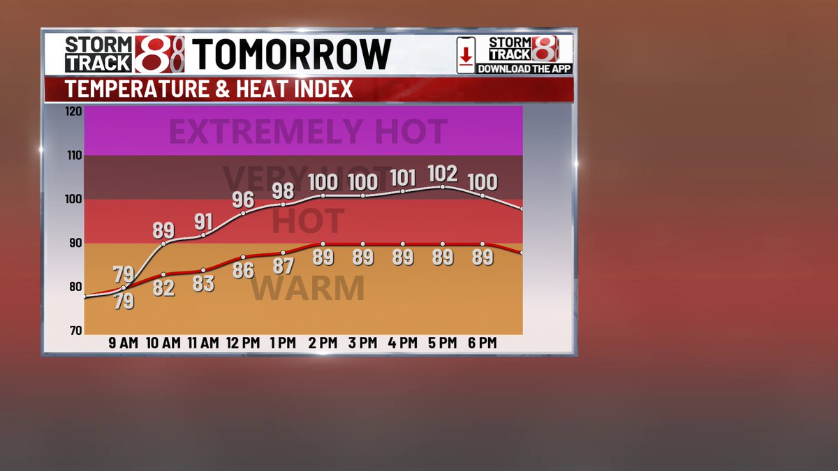
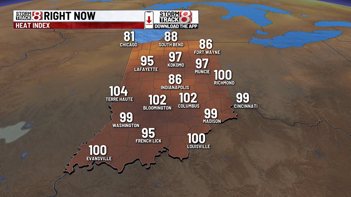
Safe to say some of Indiana is on "FIRE" right now. Clouds from this morning's shower/storm activity have mostly eroded. Can't rule out spotty rain/storms remainder of today. Patchy fog early TUE leads to potentially hottest day of 2025 & 100+ heat indices.
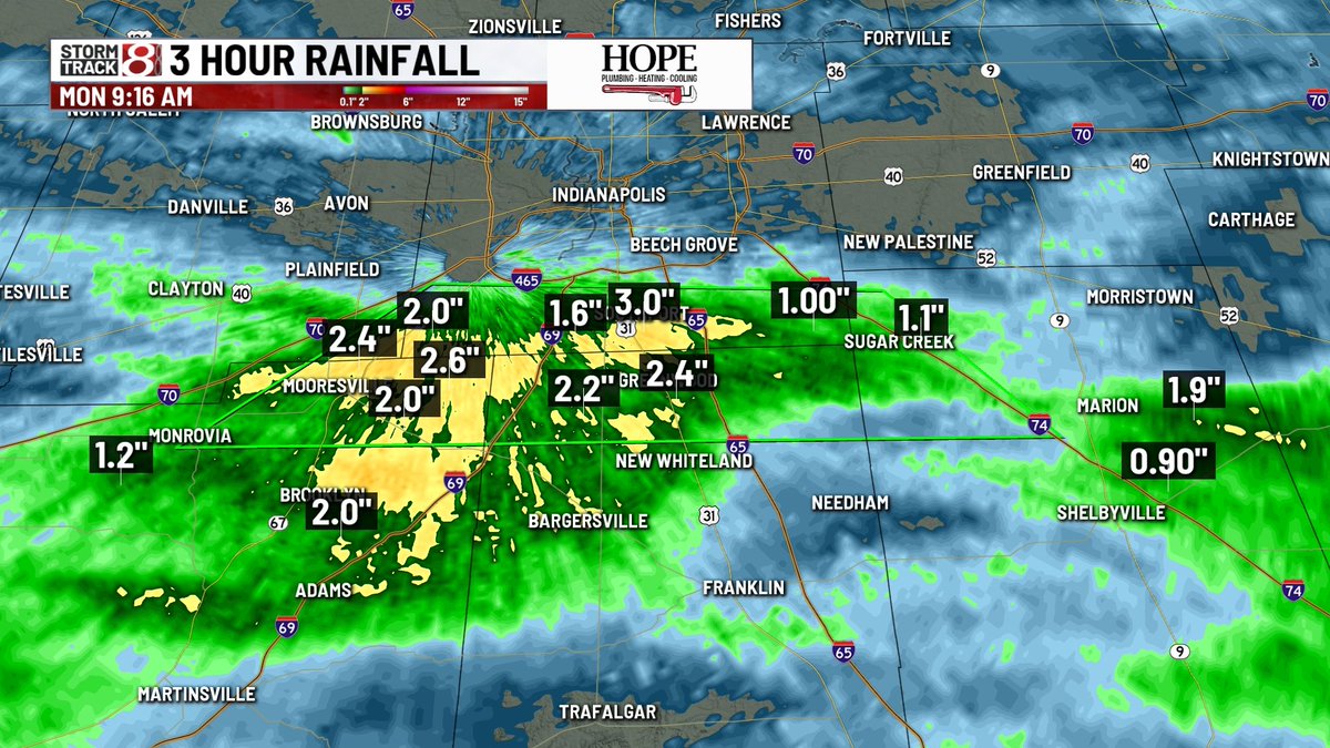
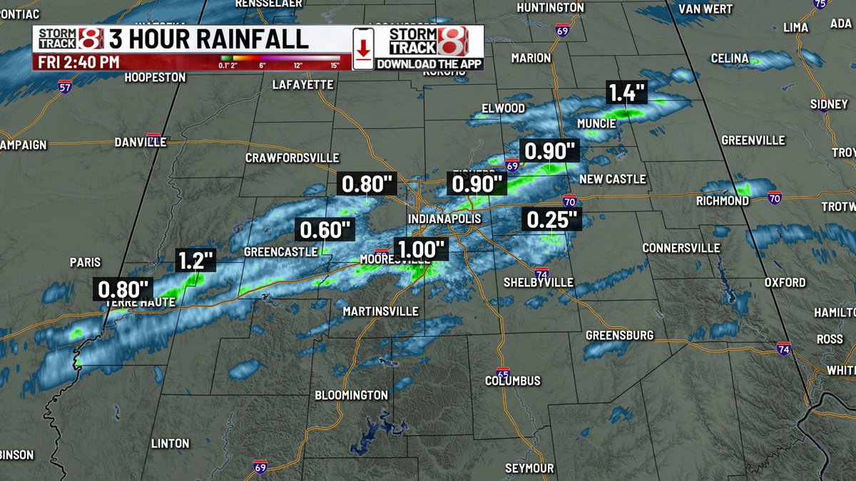
9:25 AM ET: Flood warning out for multiple counties on the southside. Rainfall estimates of 1"-3" in Johnson, Marion, and Morgan counties in just the last 3 hours. @WISHNews8
MONDAY, JULY 28: Strong wording from the SPC today in the northern Plains. “A derecho is likely…with several gusts expected to exceed 75 mph.” A moderate (4/5) risk is in play for Minnesota and South Dakota.

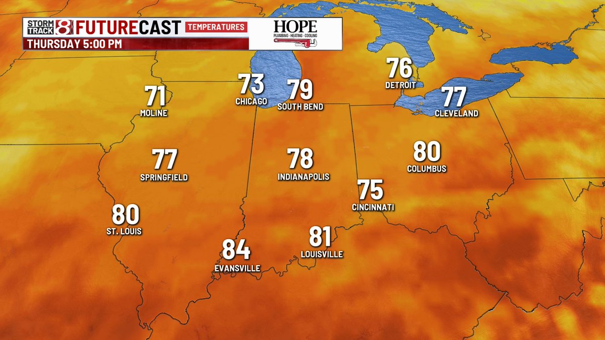
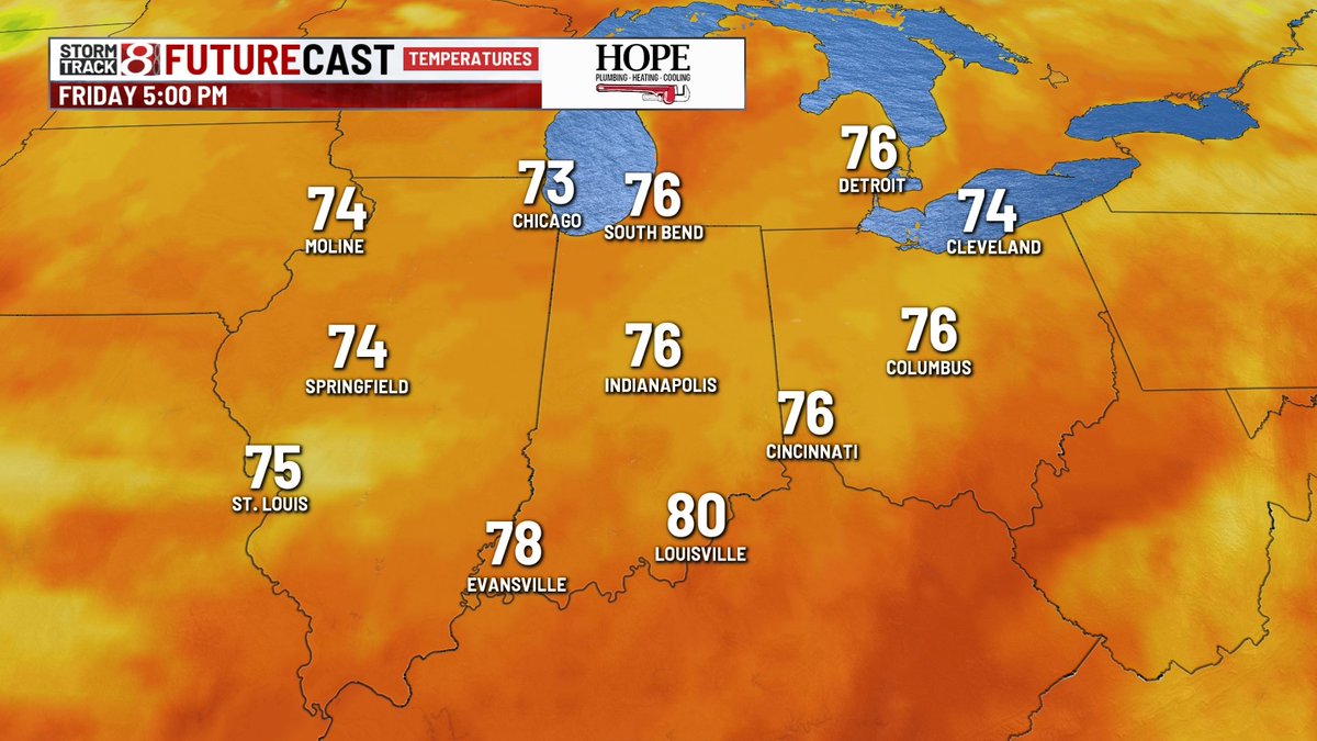
Time to start looking for Halloween decorations?🤣 Temperatures may be stuck in the upper 70s in Indy this Thursday & Friday. @WISHNews8
Not much behind the shower that just went over IMS. Looks like we are going to get all the laps in! @ADChernoff @WISHNews8
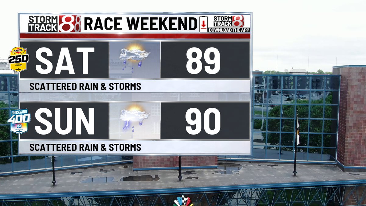
6 PM ET: Severe thunderstorm about 23 miles away from IMS moving NE 25 mph. In an hour, the Penzoil 250 will be impacted. @WISHNews8 @ACwishtv @ADChernoff @AngelaMoryanTV
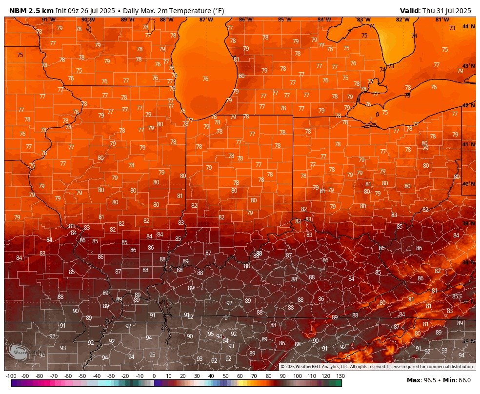
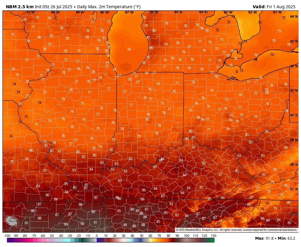
Relief on the way next week! Central Indiana will feature highs in the upper 70s and low 80s for Thursday, July 31 & Friday, August 1. Humid air will also be more comfortable. @WISHNews8
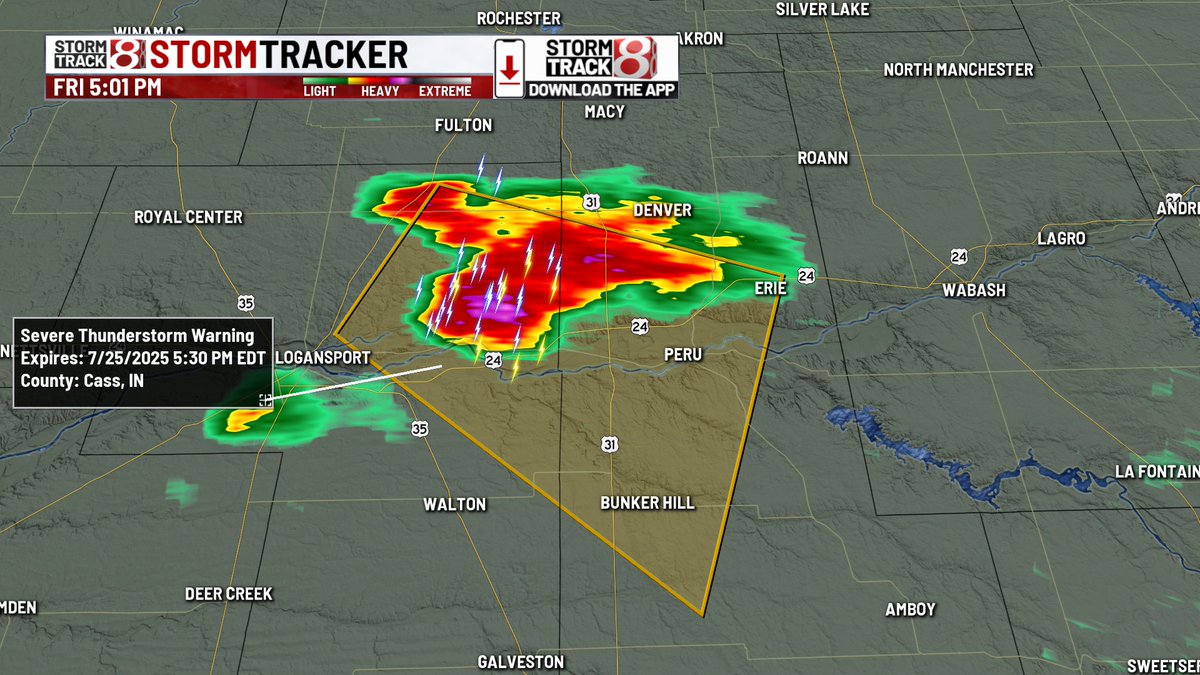
Storm heading towards Peru is now severe with a warning out for part of Cass/Miami counties until 5:30 PM for 60 MPH winds and quarter size hail.
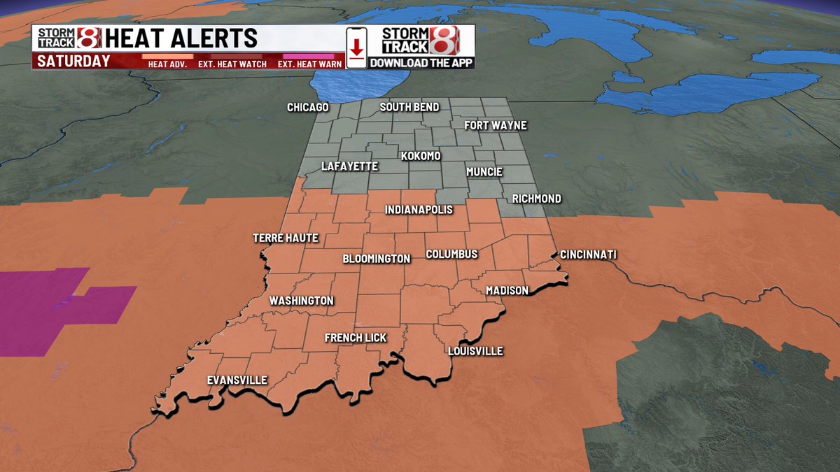
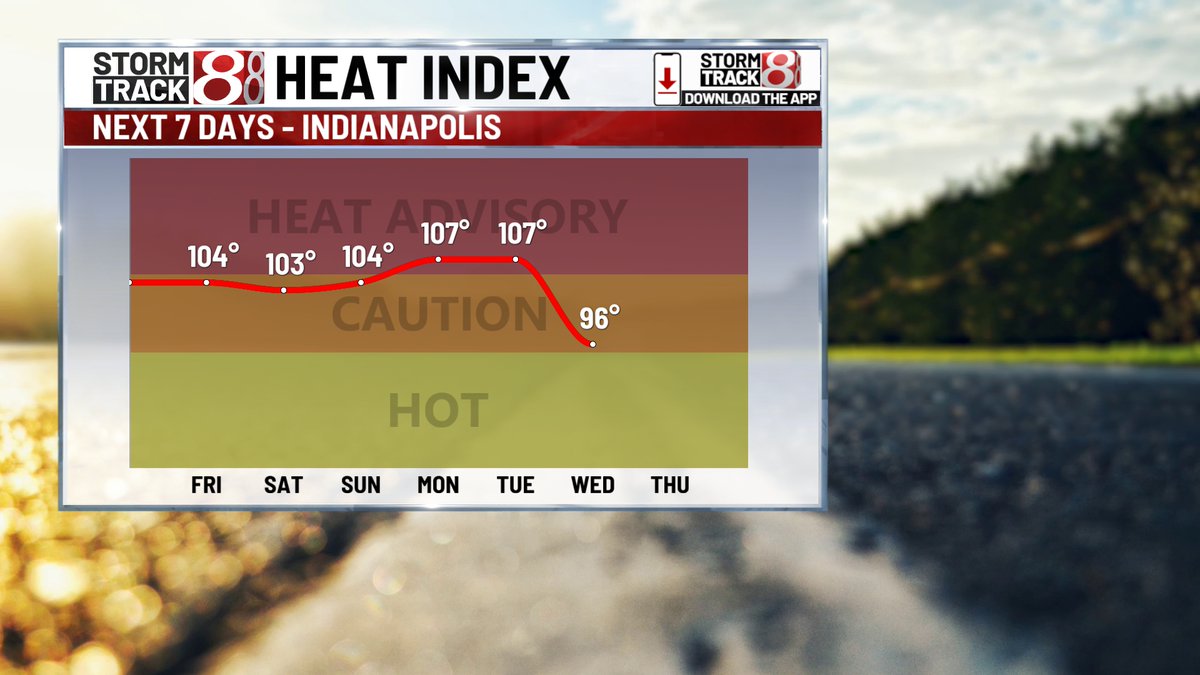
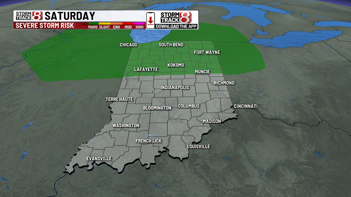
Pit of misery hangs onto us through the last weekend of July. 90s, high dew points, triple digit heat indices with sct'd showers/storms SAT and SUN. Some of the pop-ups SAT could be stronger with 40+ MPH gusts. May also have a decaying storm complex SAT night.
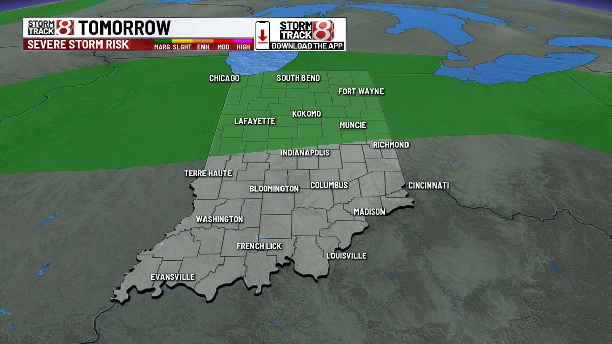
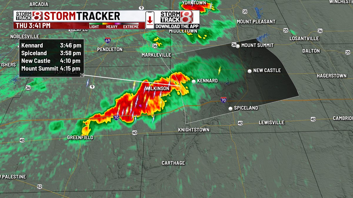
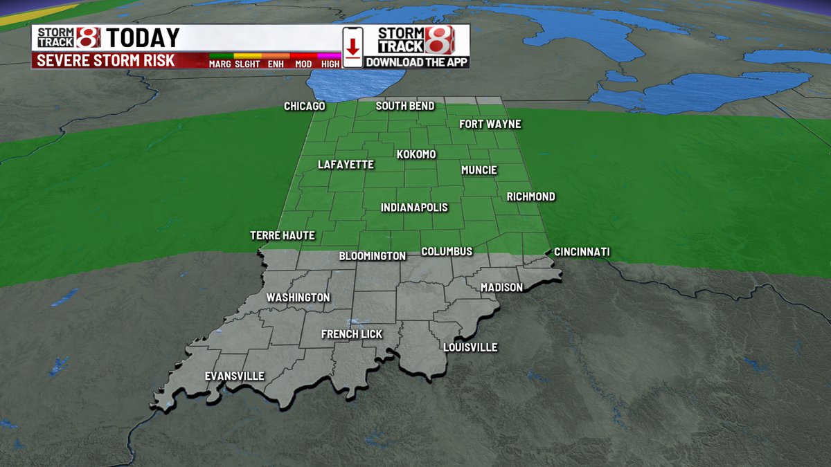
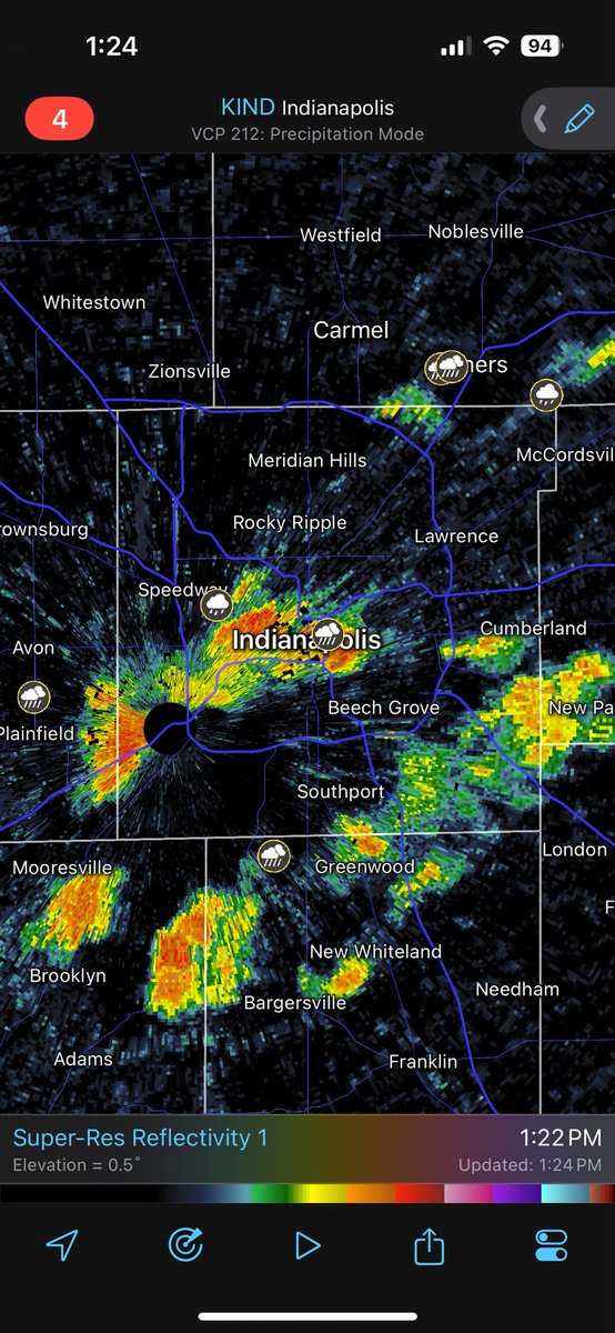
7/25/25 2:40 PM RADAR Cluster of showers/storms riding along near I-70 with bouts of heavy rain and some with wind gusts of 40+ MPH. Expect on/off activity into this evening and tonight with local flood concerns, a low risk for severe wind gusts (58+ MPH), and possible funnels.
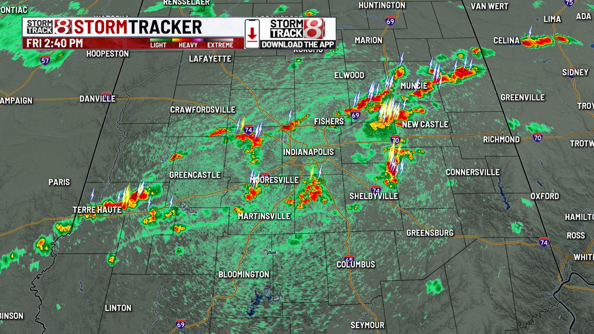
1:20 PM EDT, July 25: Heavy rain moving through downtown Indianapolis. Everything below severe limits, but may have some gusty winds at times. @WISHNews8
Atrocious heat & humidity continues through the final weekend of July and into early next week. Expect more of 90 degree highs, mid-upper 70s dew points, and triple digit heat indices. Rain/storm chances also daily into next week with low severe risk SAT.
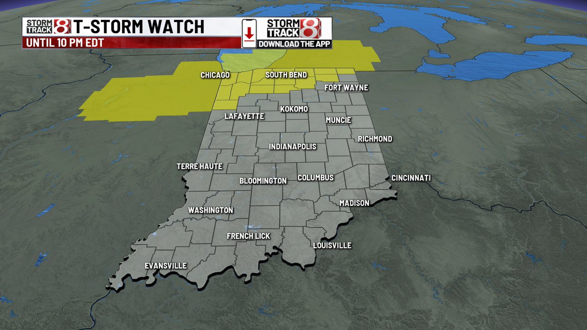
Severe Thunderstorm Watches have been issued in northern Indiana until 10 PM EDT. Main severe risk is to be well north of Indy into tonight. There is also a strong storm in eastern Hancock county with 50 MPH wind/small hail potential.