
Rusty Lord WOWT
@RustyLord
Senior Chief Meteorologist. I point at a big green wall early in the morning. Pet peeves: ATM fees and the phrase 'Is it gonna tornado?'
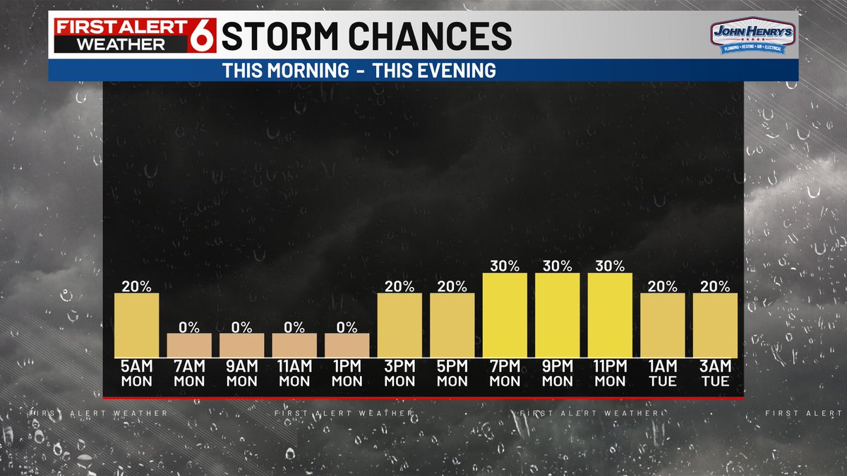
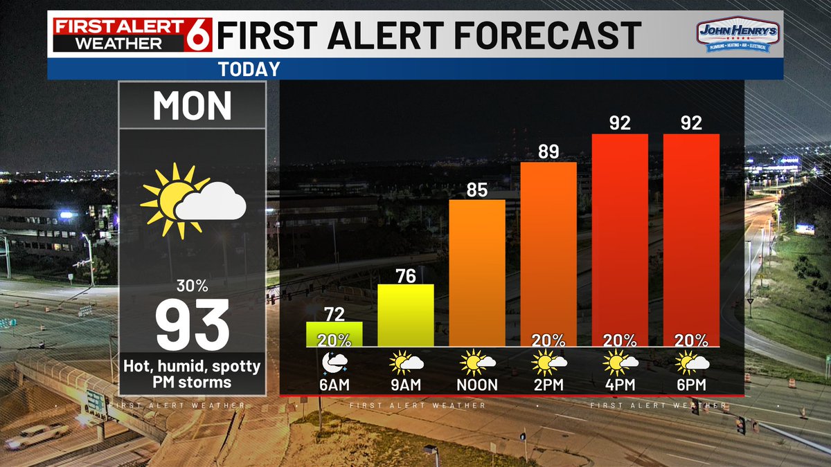
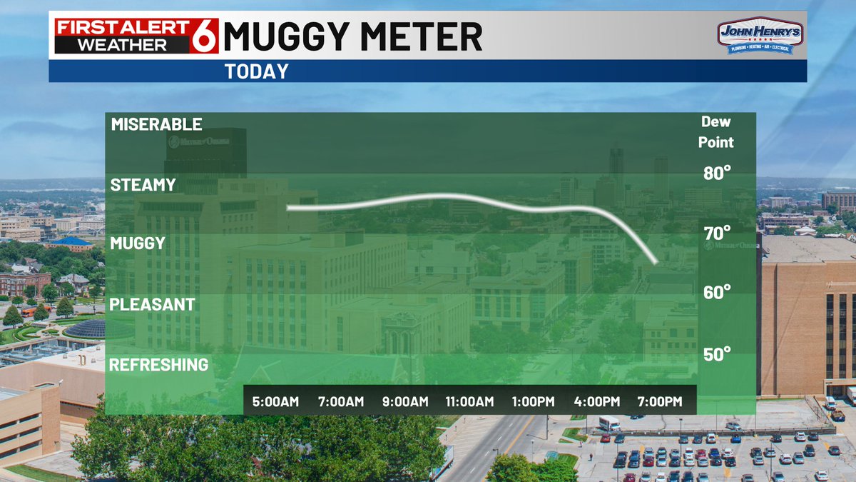
Scattered storms are developing south of the metro and could drift as far north as I-80 over the course of the afternoon and evening. Otherwise we'll warm into the lower 90s under the humid conditions.
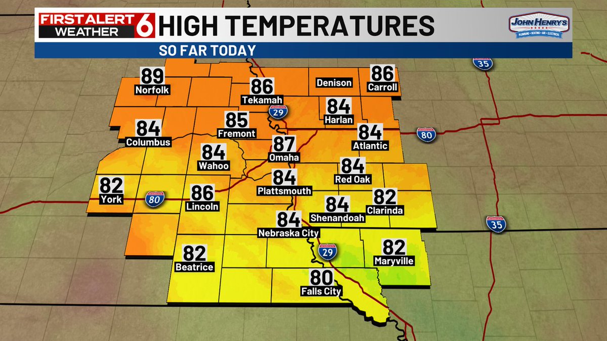
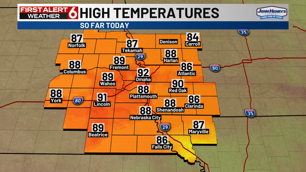
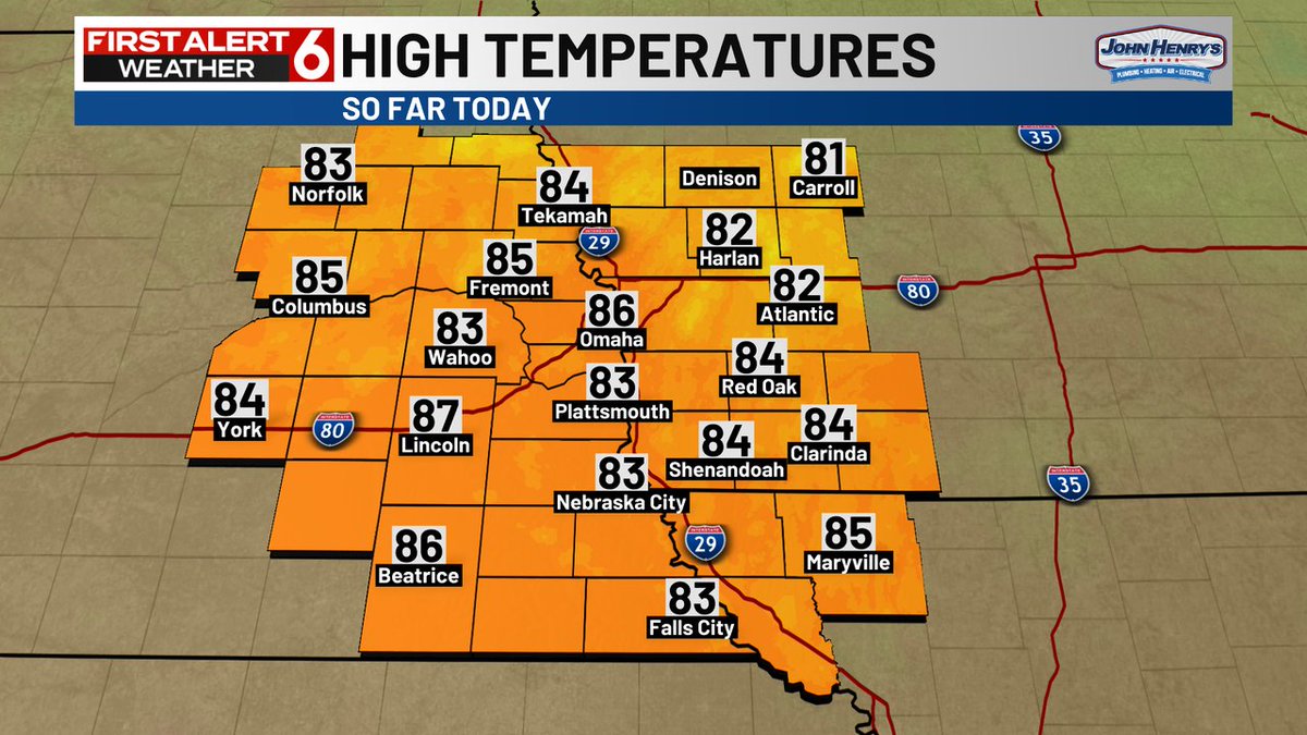
Here's a look at the high temperatures across our area from earlier today.
Southwest Airlines passengers will fly in assigned seats for the first time on Jan. 27, the carrier tells CNBC. Customers can start buying tickets with assigned seats on July 29. nbcnews.com/business/trave…
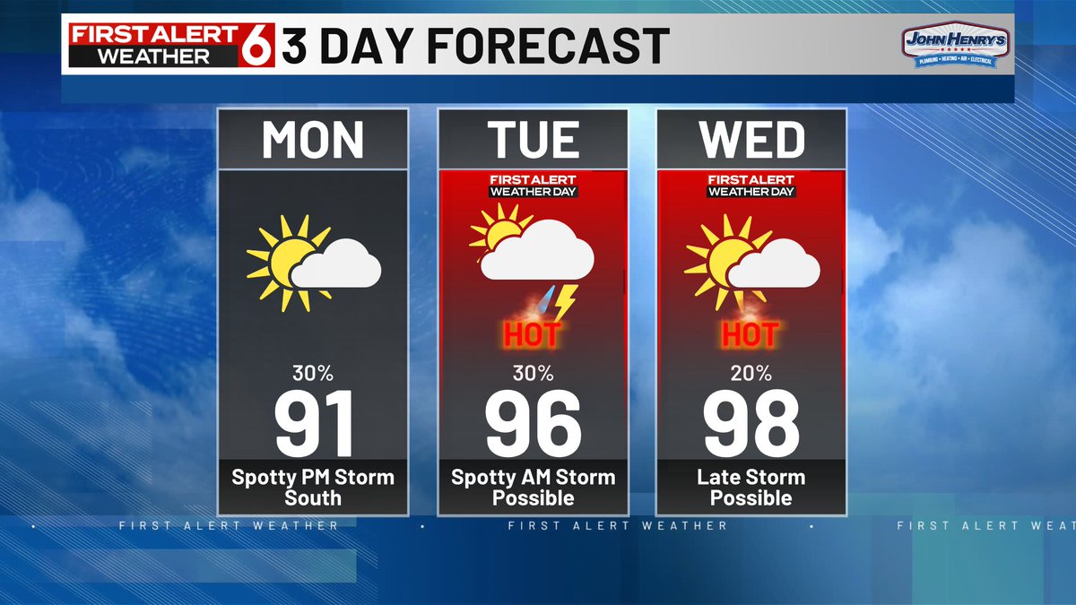
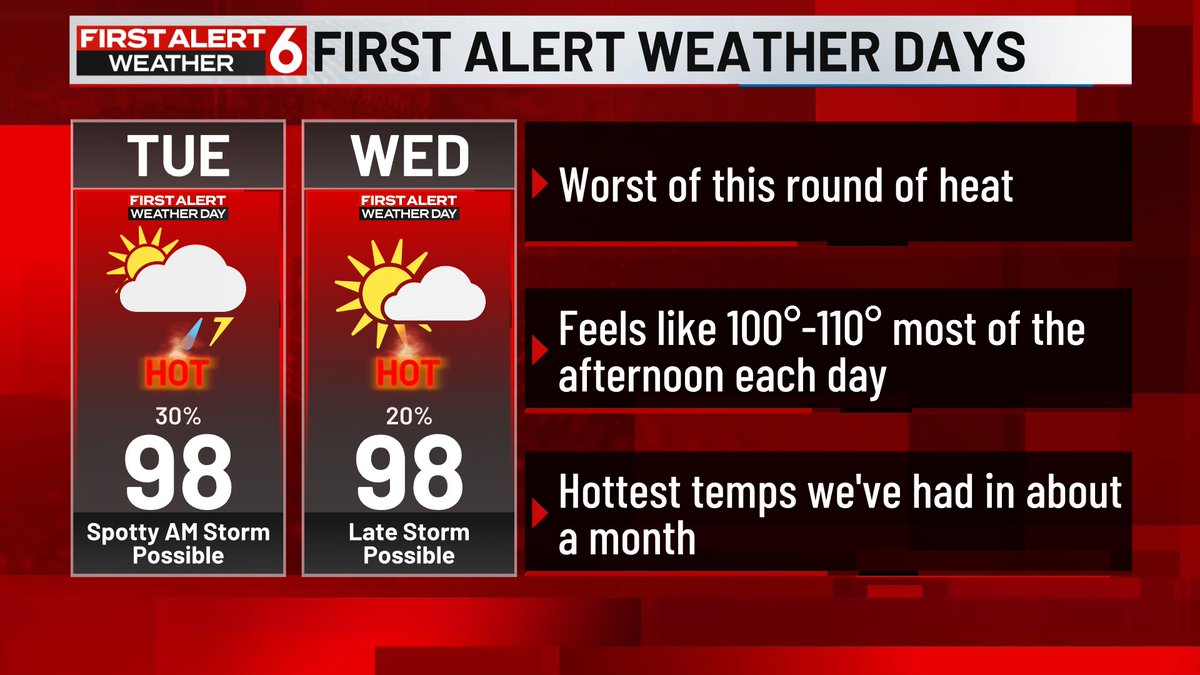
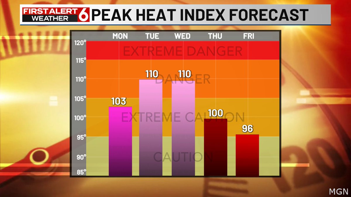
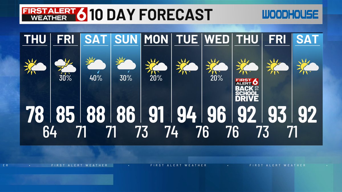
Subtle tweaks to the forecast given the lack of confidence in how any storms will develop today and how soon any clouds will exit today and Tuesday. Still plenty humid and Tuesday & Wednesday are still on track to be the hottest days we've had in a month.

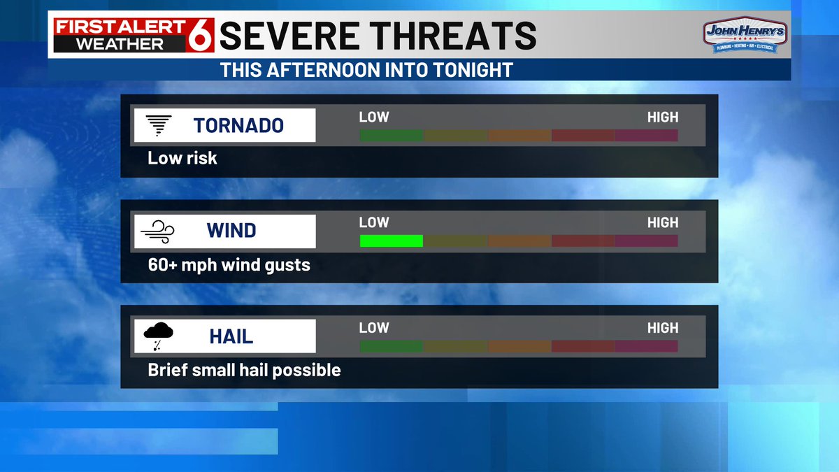
Spotty storms are possible later this afternoon and evening, mostly south of I-80. Mostly a downpour and lightning threat but a couple of strong wind gusts are possible. More small chances through Thursday afternoon with a lot of uncertainty in the timing.

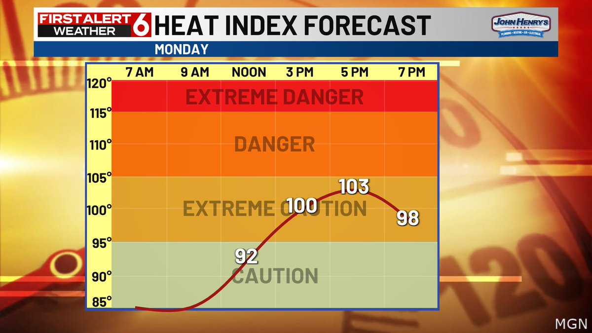
FIRST ALERT 6 Weather Days are in place for Tuesday & Wednesday due to the dangerous heat headed our way. Highs in the upper 90s will be hottest temps in the area in about a month. Heat index values will be in the 100-110 range all afternoon both days.
FIRST ALERT to a little more heat and humidity today. Highs in the 90s will feel just as uncomfortable as Sunday. There is a small chance of a couple spotty storms later this afternoon into the evening. The best odds are likely south of I-80 and there could be some wind gusts.

A muggy and hot day is likely again today. Some clouds are likely to give us some shade from time to time and there is a small chance of a few storms this afternoon and evening mostly south of I-80.
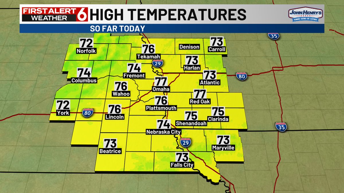
Here's a look at the high temperatures across our area from earlier today.
FIRST ALERT: A Severe Thunderstorm Warning is currently in effect for Platte, Colfax counties until Jul 20 1:15AM. Check the First Alert 6 Weather App and First Alert 6 on air for more information.

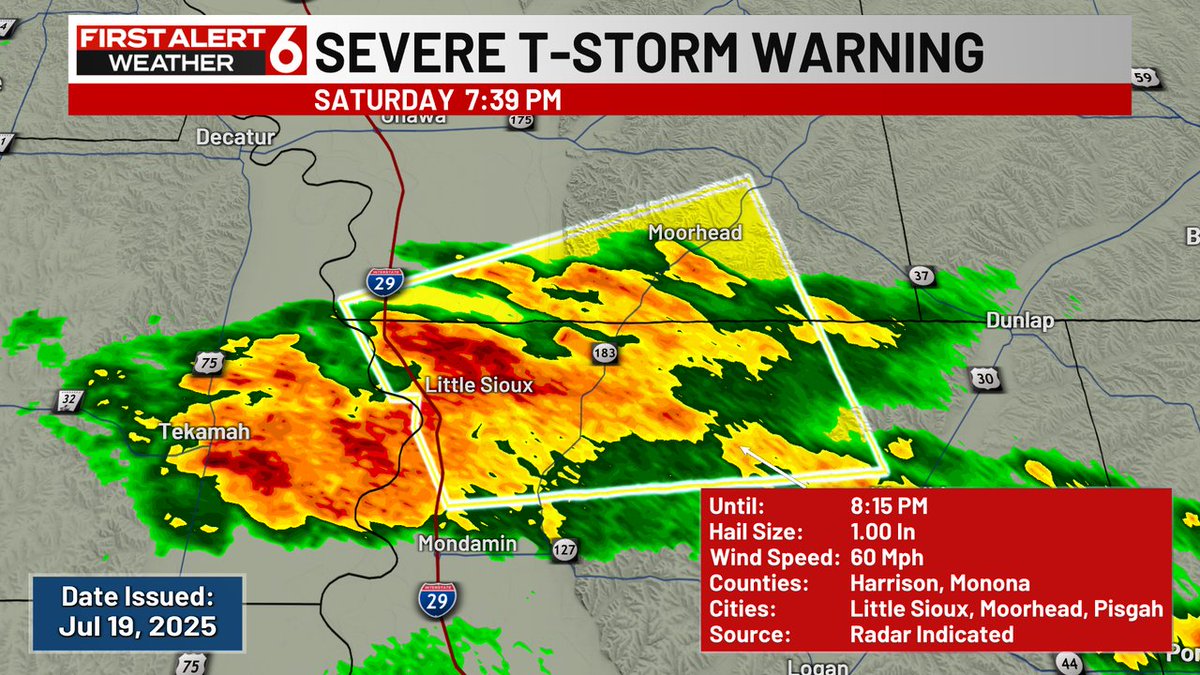
FIRST ALERT: A Severe Thunderstorm Warning is currently in effect for Harrison, Monona counties until Jul 19 8:15PM. Check the First Alert 6 Weather App and First Alert 6 on air for more information.
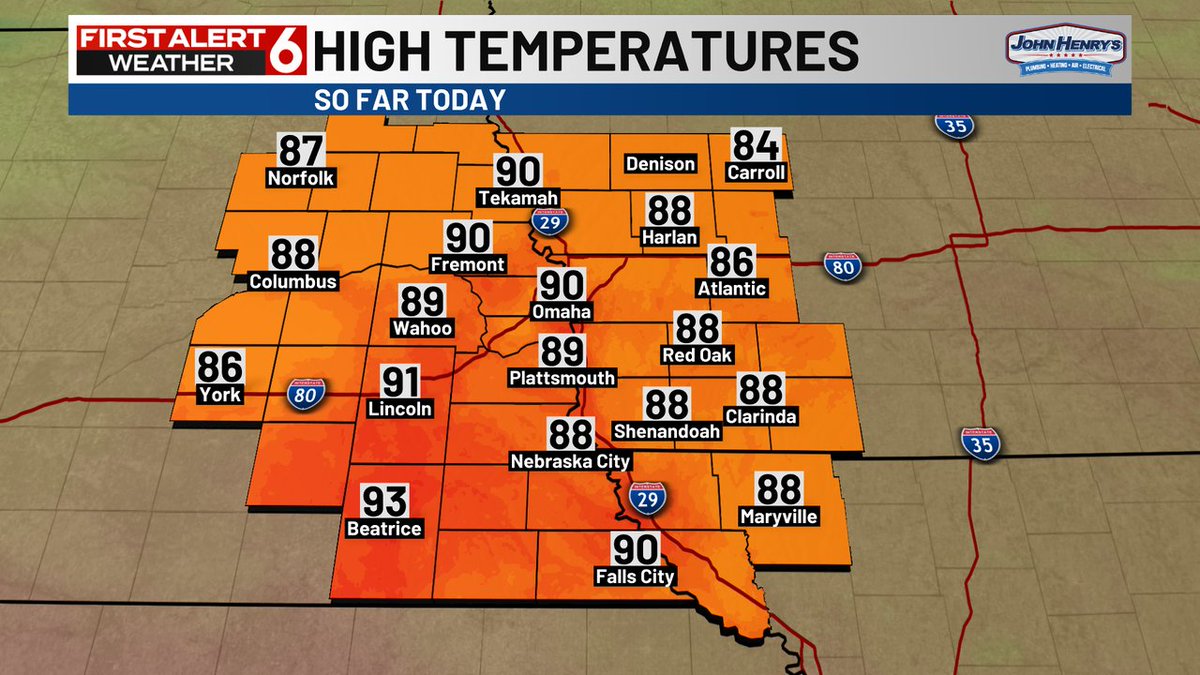
Here's a look at the high temperatures across our area from earlier today.
Here's a look at the high temperatures across our area from earlier today.
Here's a look at the high temperatures across our area from earlier today.
All signs point to summer heat and humidity being back on track next week. Should be our longest stretch of 90s this month. Likely to last through the end of the month too. Average high the rest of the month is 88 FYI.
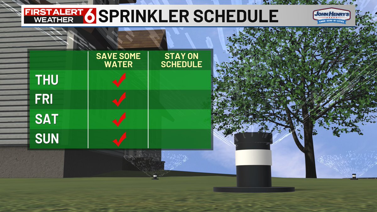
I think you can likely keep those sprinkler systems turned off through the weekend, especially if you just got 1"+ of rain from Tues Night storms. If you miss rain entirely this weekend, you'll want to flip those back on starting Monday. A lot of heat is on the way next week
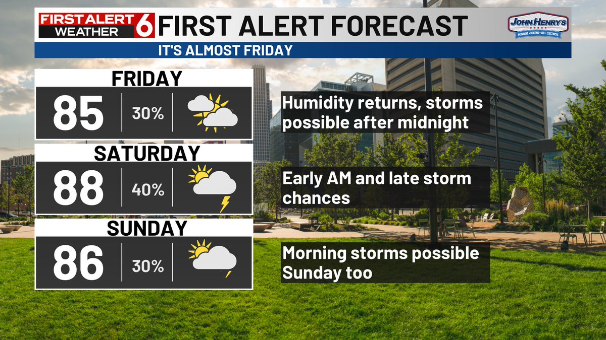
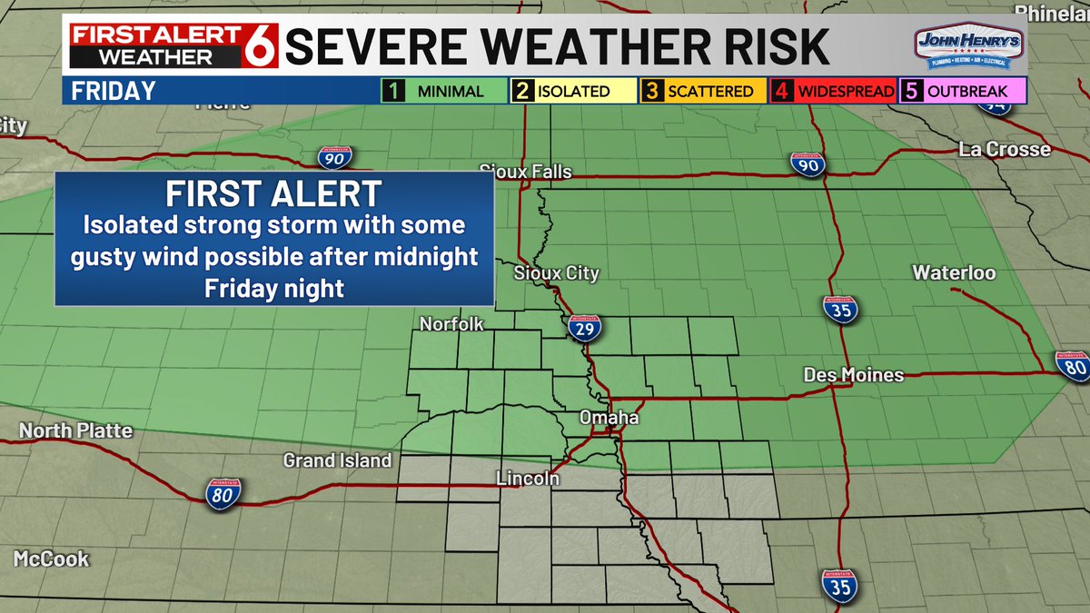
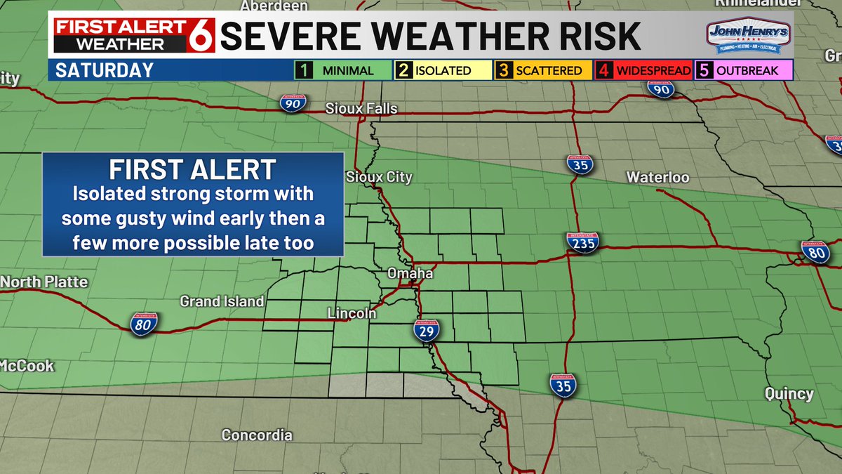
FIRST ALERT to a few spotty strong storms possible heading into the weekend. Best odds are after midnight Friday night into early Saturday AM then again very late Saturday. Gusty wind would be the biggest threat and most of the day time hours will be dry.
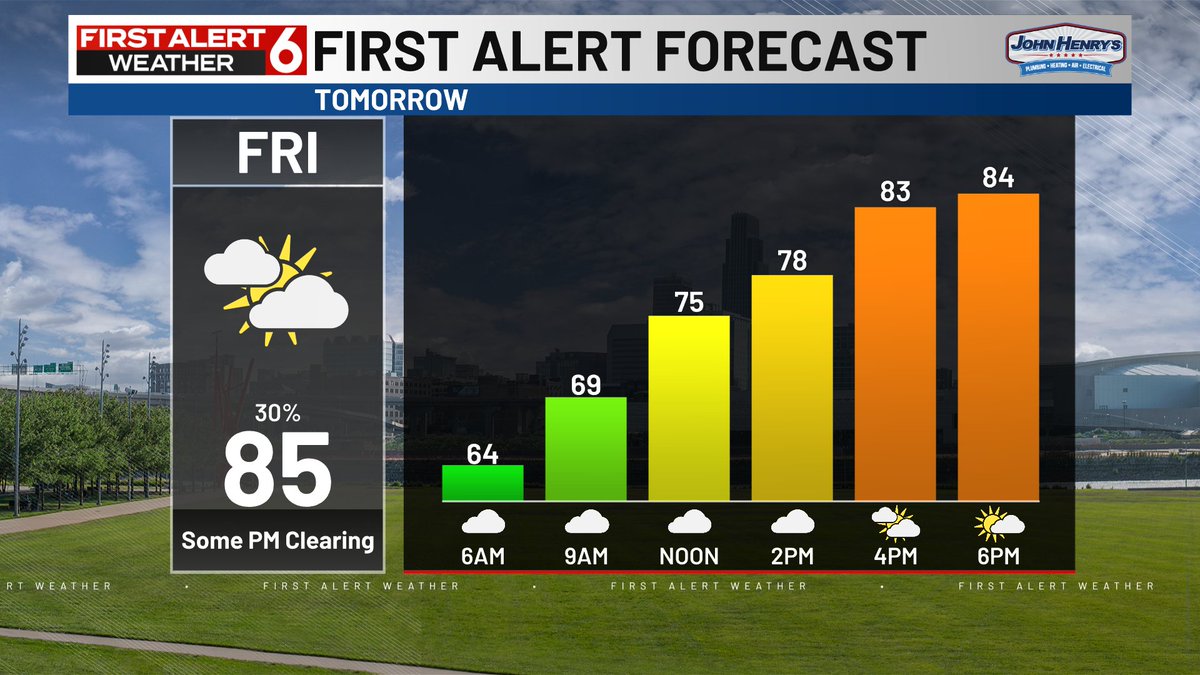
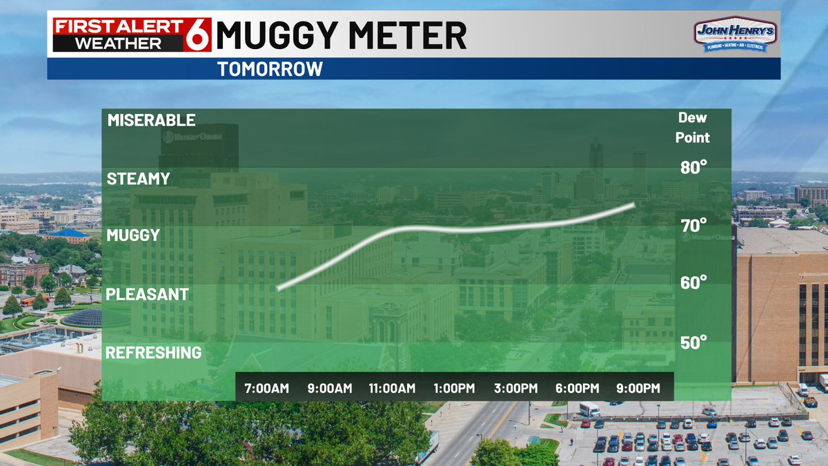
Enjoy today because along with summer time 80s returning Friday we'll see the dew points climb on the muggy meter all day. First Alert to a spotty strong storm with some wind possible after midnight though. Best odds are to the north of the metro.

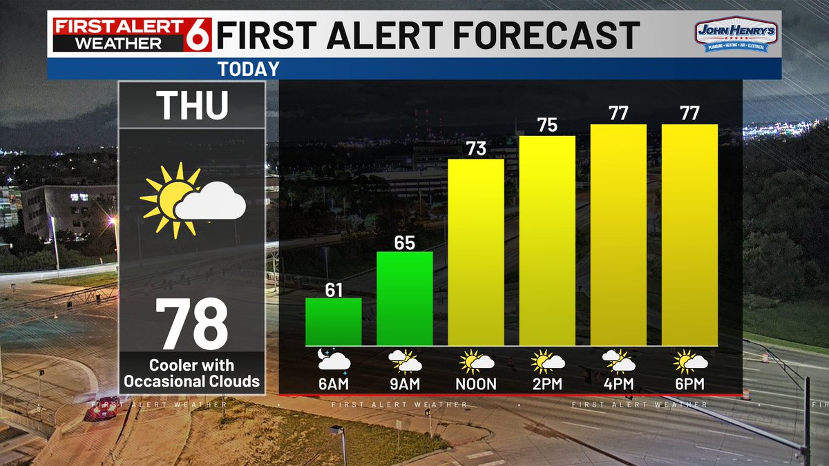
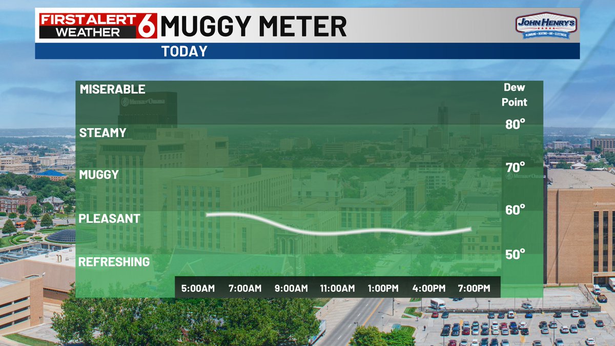
FIRST ALERT to a cooler and very comfortable July day. Afternoon highs in the 70s are likely with very low dew points on the muggy meter. Very light NE breeze at 5-15 mph too.
Some T-showers are near the Kansas border this morning and exiting east. They should gradually take the clouds with them and we'll be left with quite a nice July day with very low humidity.