NWS Duluth
@NWSduluth
Official X account for the National Weather Service Duluth, MN. Details: http://weather.gov/nws_x
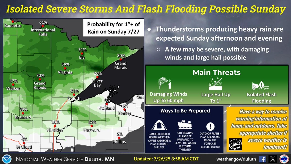
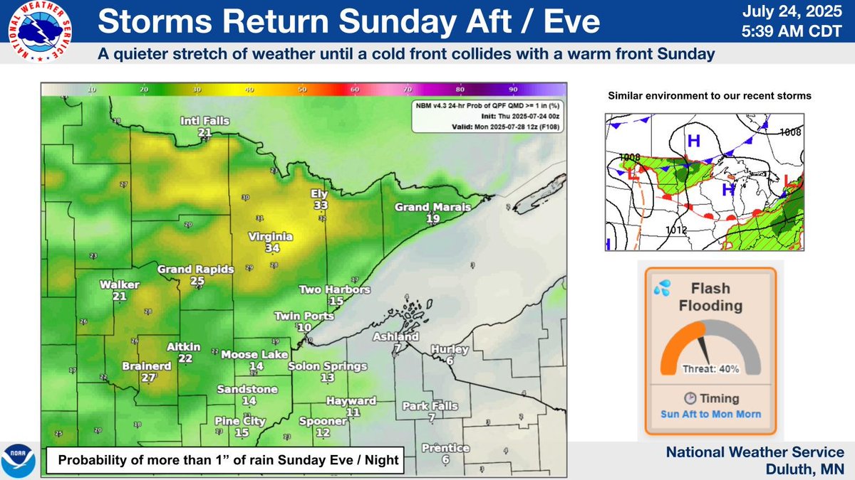
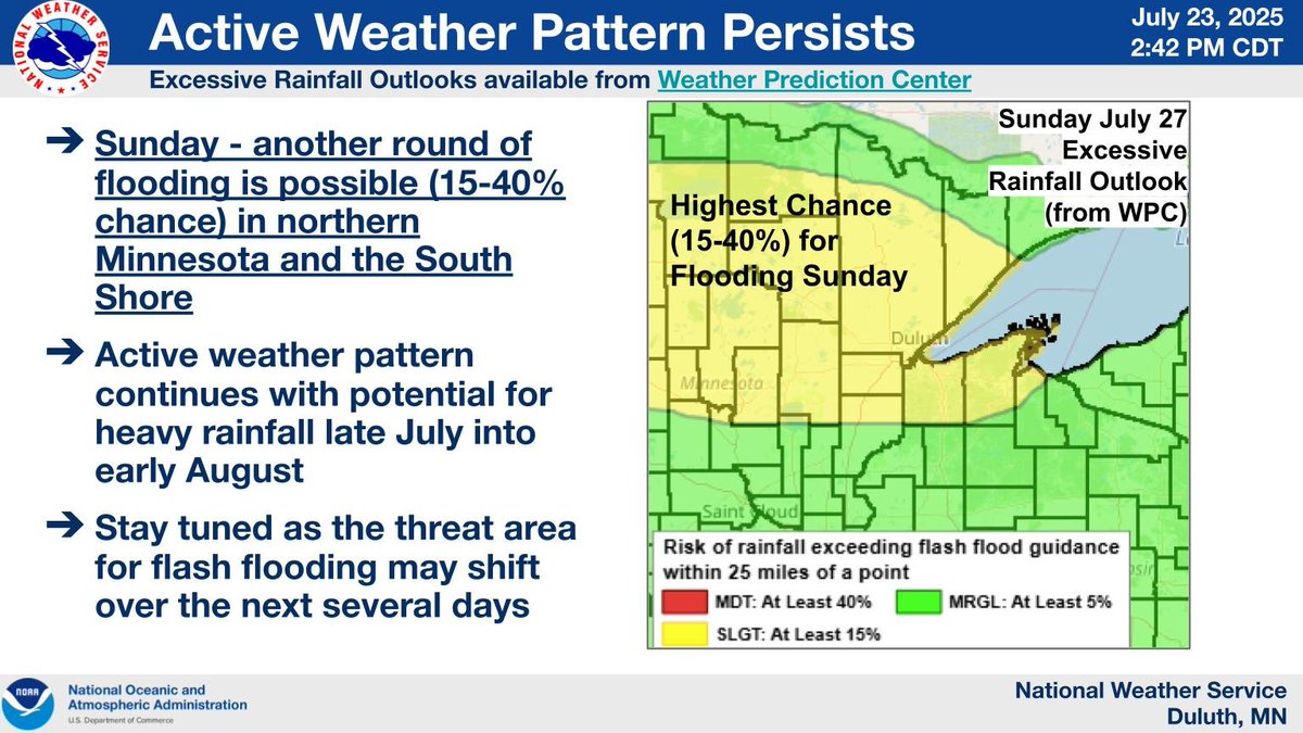
General thunderstorms are possible in the Northland today, but Sunday has the potential for a few strong to severe storms across the Northland. Rain totals over an inch are possible, especially in the Iron Range northward. Isolated flash flooding is possible.
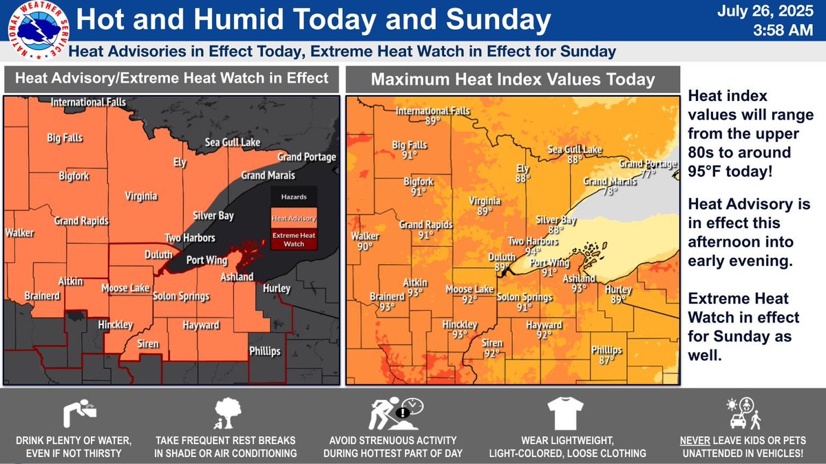
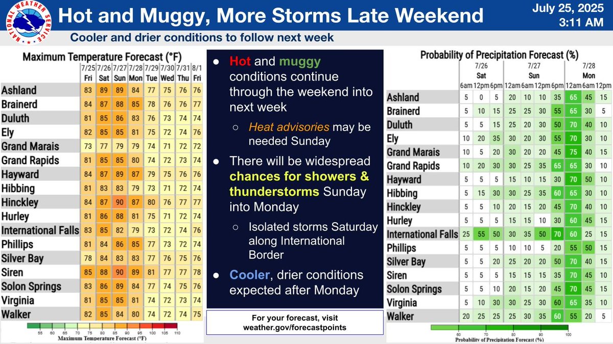
Hot and humid conditions continue throughout the weekend. Heat Advisories have been issued for today, and an Extreme Heat Watch is in effect for Sunday. Stay cool and hydrated!
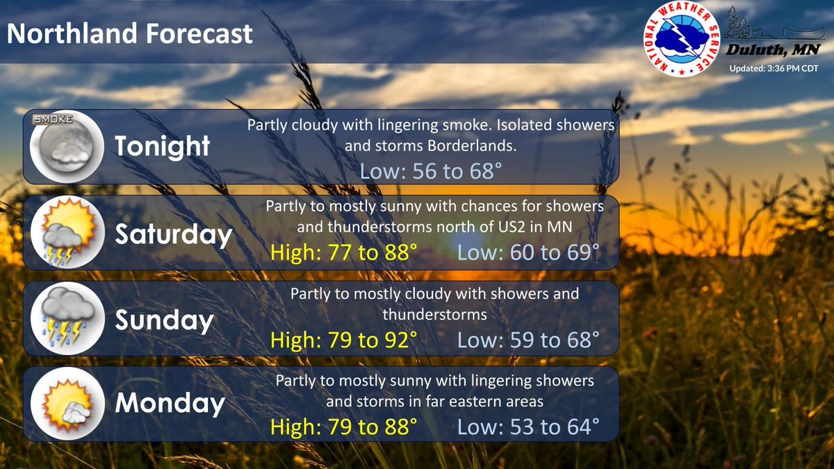
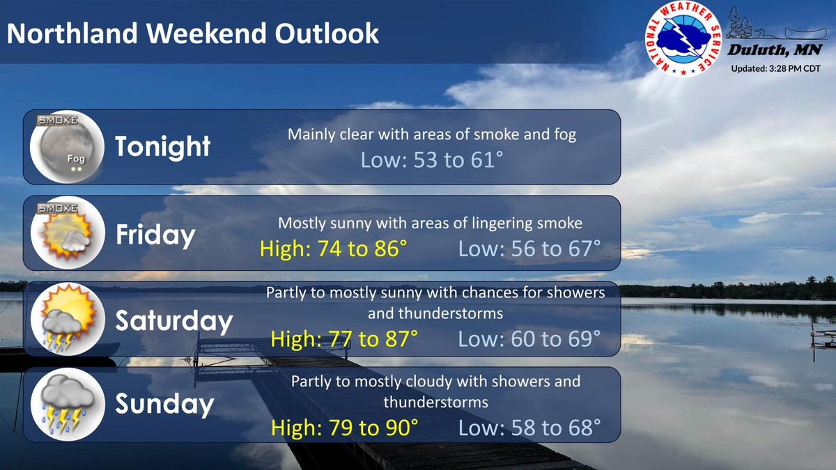
Smoke lingers tonight under partly cloudy skies. A few showers and storms will be possible late across the Borderlands. Partly to mostly sunny and warm Sat with chances for showers and storms north. A Heat Advisory has been issued for much of the Northland. #mnwx #wiwx
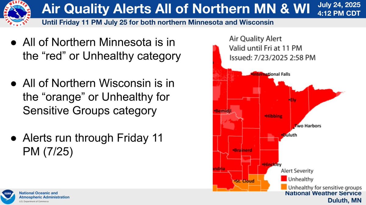
Smoky conditions linger throughout today, though will start to thin once winds switch to the south later today. Air Quality Alerts are in effect until late tonight.
Hot, muggy conditions continue through the weekend into early next week. The next widespread chances for showers and storms will be Sunday into Monday. After Monday, we will see some relief with highs in the 70s and drier conditions.
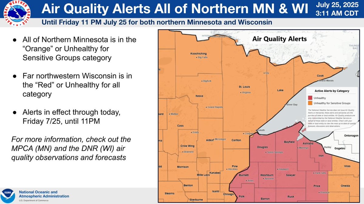
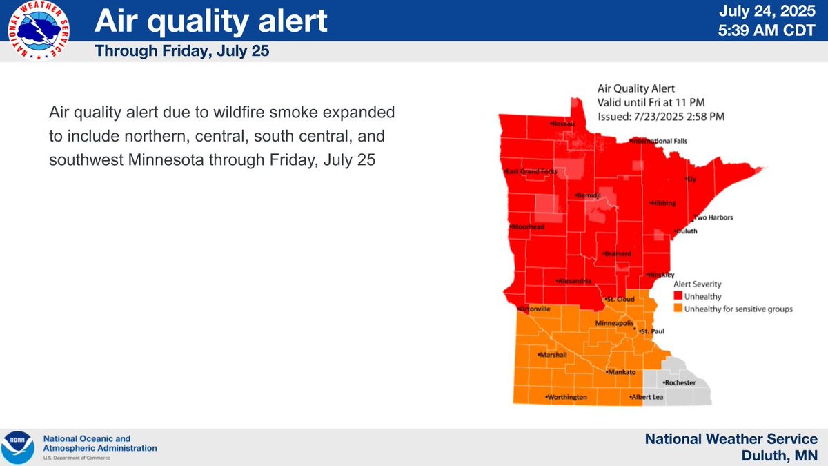
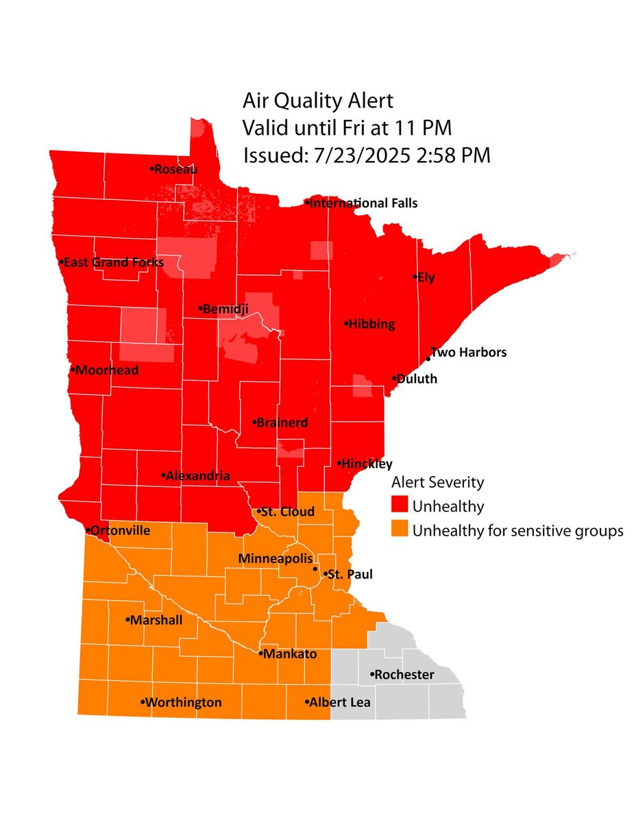
The entire Northland remains under an Air Quality Alert through Friday at 11 PM CT. These alerts range from Unhealthy for Sensitive Groups in northern Wisconsin to Unhealthy in northern Minnesota (shown in picture). #Mnwx #Wiwx
Areas of smoke and fog tonight with areas of smoke lingering for Friday. Warm and humid conditions return for the weekend with increasing chances for showers and storms, especially late Sunday, with heavy rainfall possible. #mnwx #wiwx
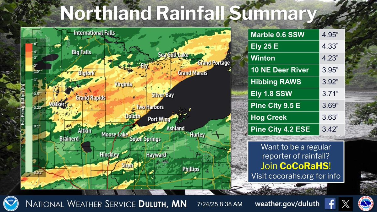
Parts of the region saw in excess of 3.50" of rainfall over the last two days. The highest report was from near Marble with 4.95". #mnwx #wiwx
Air quality alert due to wildfire smoke expanded to include northern, central, south central, and southwest Minnesota through Friday, July 25
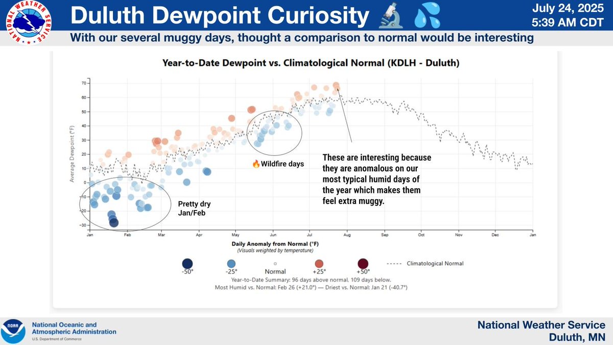
It's not just your imagination—the air has been unusually heavy and sticky. Because we are in the most humid part of the year, the recent dew points have been higher than normal, amplifying that oppressive feeling. Overall though, it's been a bit drier than normal this year.
A quieter stretch of weather until a cold front collides with a warm front Sunday bringing back the threat for thunderstorms and possibly flash flooding.
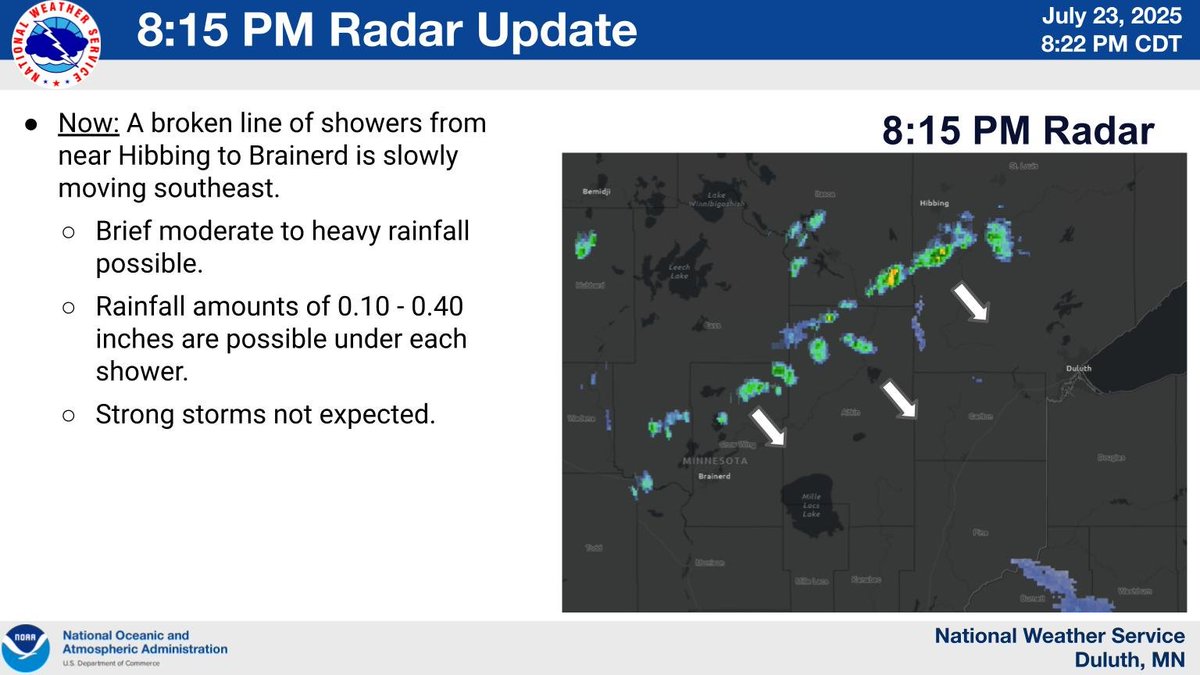
815 RADAR Update: A broken line of showers from near Hibbing to Brainerd is slowly moving to the southeast this evening. Rainfall amounts of 0.10-0.40 inches are possible, if a shower moves over you. Strong storms are not expected.
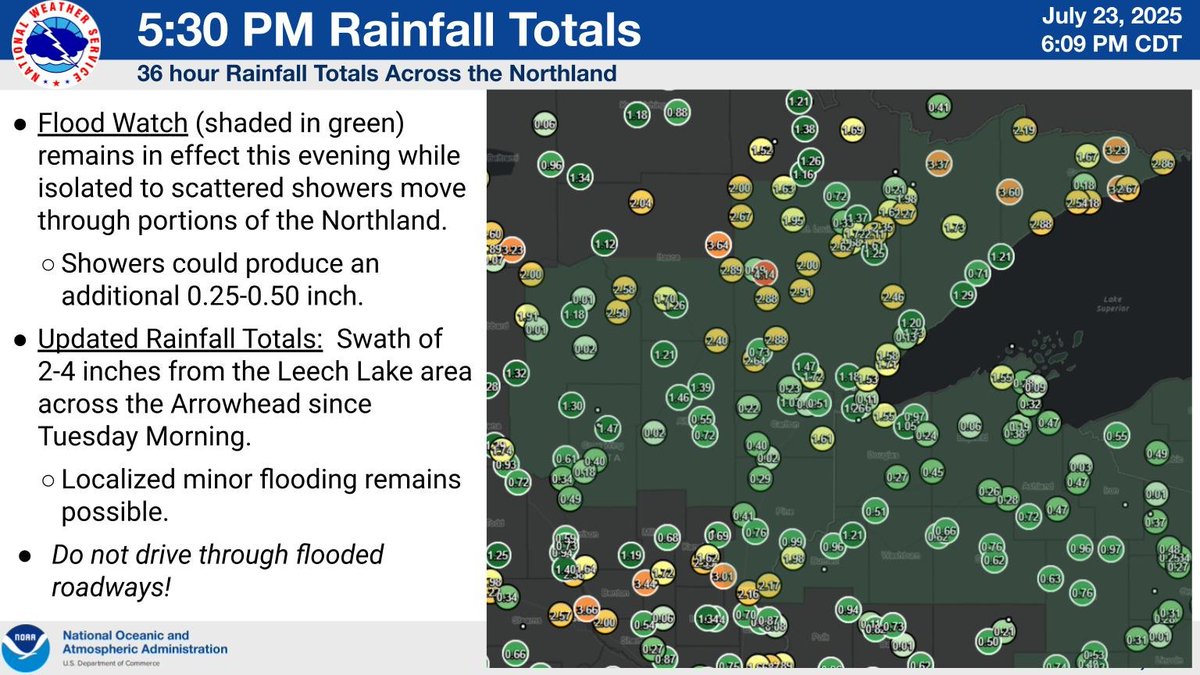
Updated (36hr) Rainfall Totals through 530pm. The Flood Watch remains in effect while isolated to scattered showers move through portions of the Northland. Where it does rain, an additional 0.25-0.50 inch of rain is possible.
An air quality alert due to wildfire smoke has been expanded to include northern, central, south central, and southwest MN through 7/25. Air quality is expected to reach the red AQI category in northern & central Minnesota, which is unhealthy for everyone. pca.state.mn.us/news-and-stori…
On Sunday another round of heavy rainfall is expected in northern Minnesota and more limited chances in northwest Wisconsin. After Wed. night flood chances end, this is the next better chance for another round of flooding. Keep an eye on the forecast for this weekend. #MNwx #WIwx
Heavy rainfall continues mainly in far eastern #MNwx and across northwest Wisconsin into Wednesday night. A Flood Watch remains in effect for most of the Northland until 7 AM Thursday. A few strong thunderstorms are possible into this evening in inland #WIwx.

Flooding is ongoing in parts of northern Minnesota and limited parts of Burnett County in northwest Wisconsin. Mainly minor flooding is occurring, but areas of more impactful flooding are also ongoing in the western Iron Range and the city of Ely. #Mnwx #Wiwx
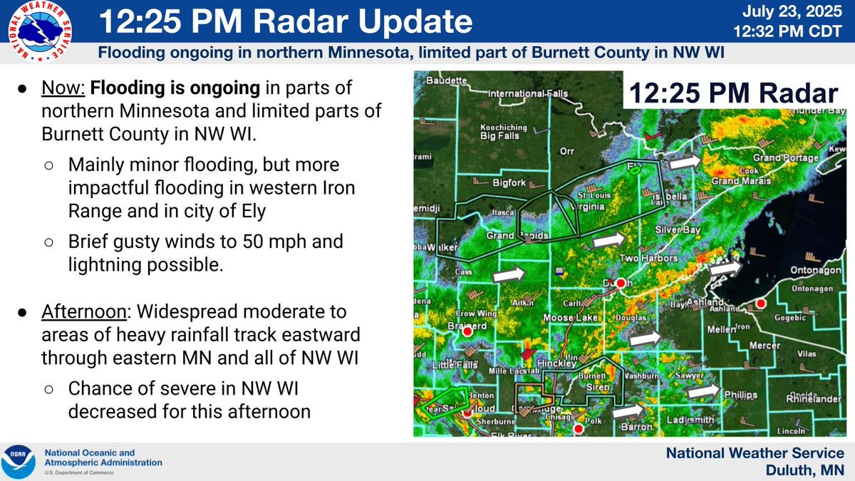

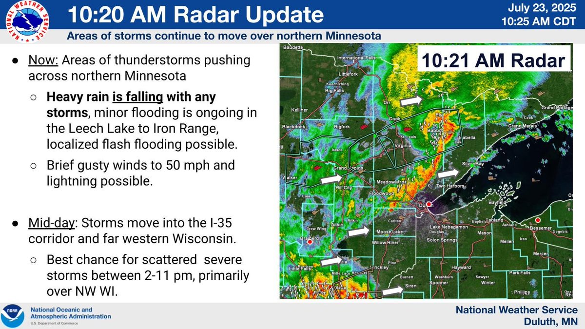
Flooding is ongoing across the Leech Lake to Iron Range region from multiple rounds of heavy rainfall. Thunderstorms will fill in across east-central Minnesota and far western Wisconsin over the next hour. #Mnwx #Wiwx
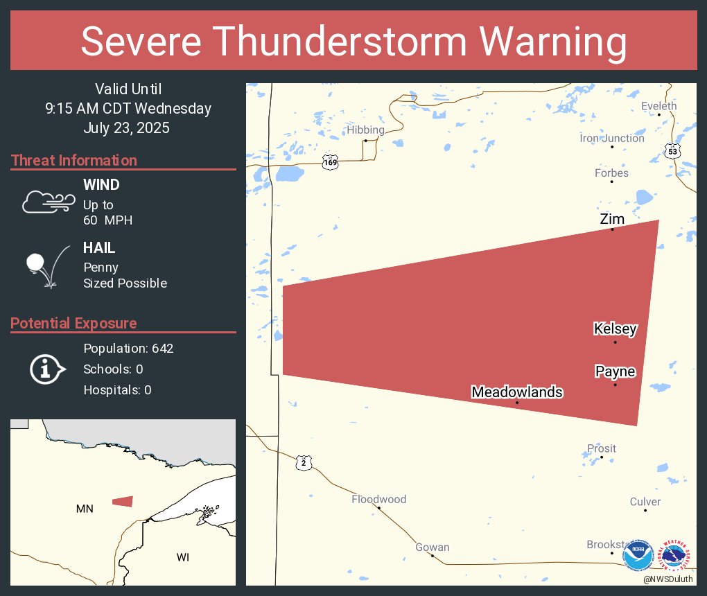
Severe Thunderstorm Warning continues for Meadowlands MN, Zim MN and Kelsey MN until 9:15 AM CDT