NWS Wichita
@NWSWichita
Official Twitter account for the National Weather Service Wichita. Details: https://www.weather.gov/nws_x
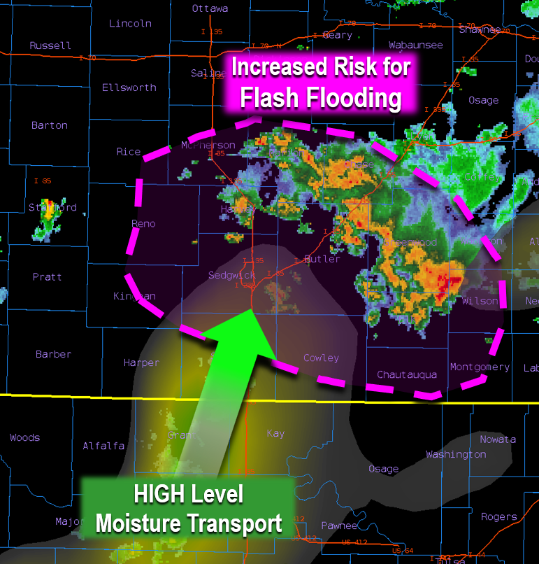
A low level jet will continue to bring HIGH levels of rich moisture into Kansas which will cause numerous showers/storms to keep redeveloping now through the overnight hours. Risk is for Flash Flooding will continue to increase mainly in the Pink Circled area! #kswx
Seasonal temperatures are expected today with highs climbing into the low and mid 90s. A couple storms will be possible across eastern Kansas. #kswx

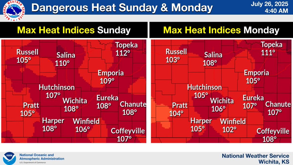
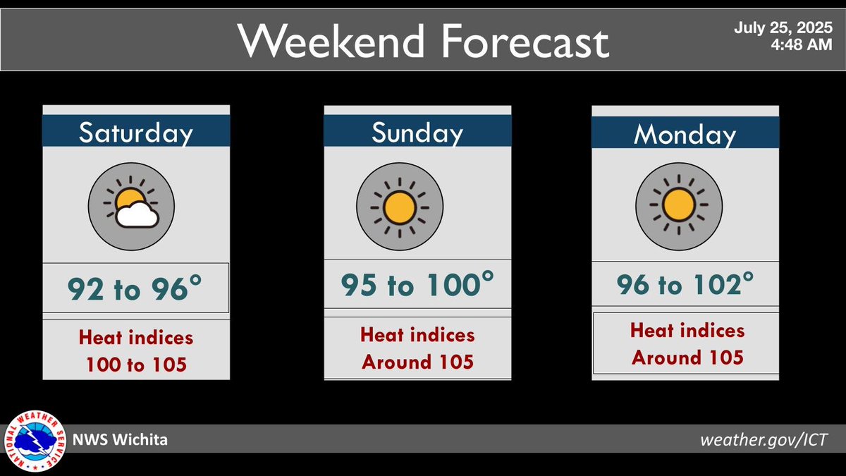
Heat indices for both Sunday and Monday are expected to climb into the 105 to 110 degree range. Be sure to stay hydrated and limit outdoor activity during the afternoon hours. #kswx
[ 12:15 am Saturday] - Scattered storms will continue through 3 am across mainly southern and eastern Kansas. The stronger storms will be capable of producing 50 mph winds and heavy rain that may lead to localized flooding. #kswx
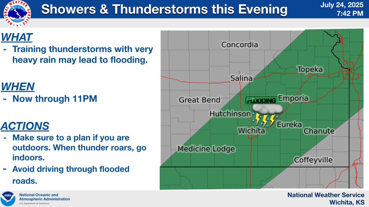
8:50 PM Updated: Through 11 PM, scattered thunderstorms with very heavy rain and gusty winds to around 40 mph will impact the Kansas Turnpike from the Matfield Green area southwest to Wichita. #kswx
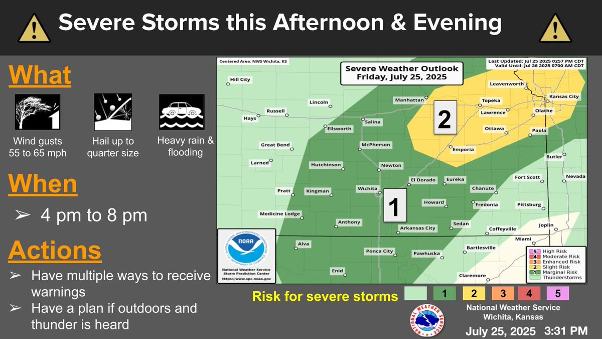
Some severe storms are expected from late this afternoon into the evening hours. The stronger storms will be capable of 55 to 65 mph winds along with hail up to quarter size and heavy rain producing flash flooding. #kswx
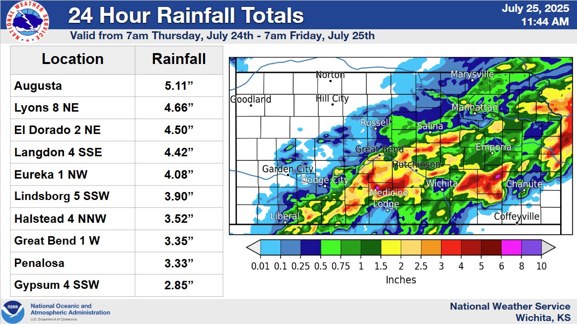
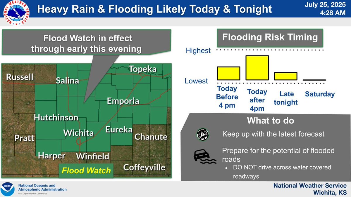
Heavy rain fell across much of the area yesterday afternoon through this morning, see the totals below! More rain and storms are expected later today. A Flood Watch remains in effect as additional heavy rain across saturated ground could exacerbate flooding concerns. #KSwx
[ 6:51am Friday] - Showers and storms will continue this morning. The stronger showers and storms will likely produce high rainfall rates and possible flooding. Do not drive across water covered roads! #kswx
[ 5:37am Friday] - Showers and storms will continue early this morning. The stronger showers and storms will likely produce high rainfall rates and possible flooding. Do not drive across water covered roads! #kswx
Above normal temperatures are expected for Saturday through Monday with highs generally in the mid and upper 90s to around 100 degrees. This will result in heat indices in the 100 to 105 range. #kswx
Scattered showers and storms will continue for today and tonight. High rainfall rates and associated flooding will be likely with the stronger storms. Do not drive across water covered roads! #kswx
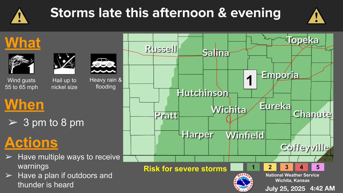
Some strong to marginally severe storms are expected from late this afternoon into the early evening hours. The stronger storms will be capable of 55 to 65 mph winds along with hail up to nickel size. #kswx
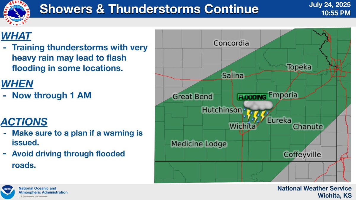
Widespread showers and storms will continue with heavy rainfall rates. Some areas could see flash flooding as training thunderstorms persist. #kswx

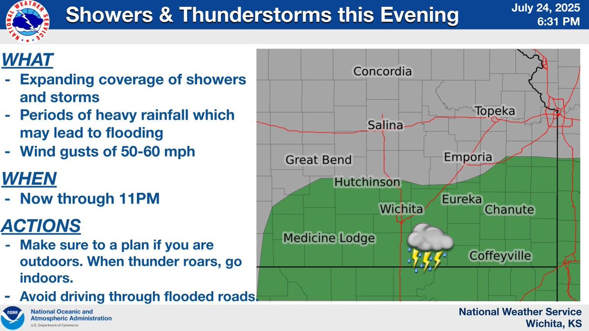
Showers and storms will continue to expand in coverage this evening and tonight across southern and eastern Kansas. Heavy rain may lead to flash flooding.. #kswx
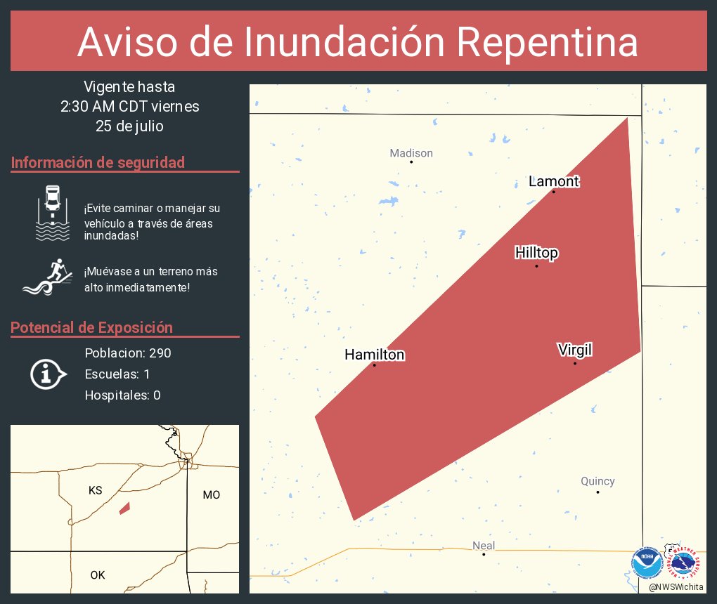
Aviso de Inundación Repentina incluye Hamilton KS, Virgil KS, Hilltop KS hasta las 2:30 AM CDT
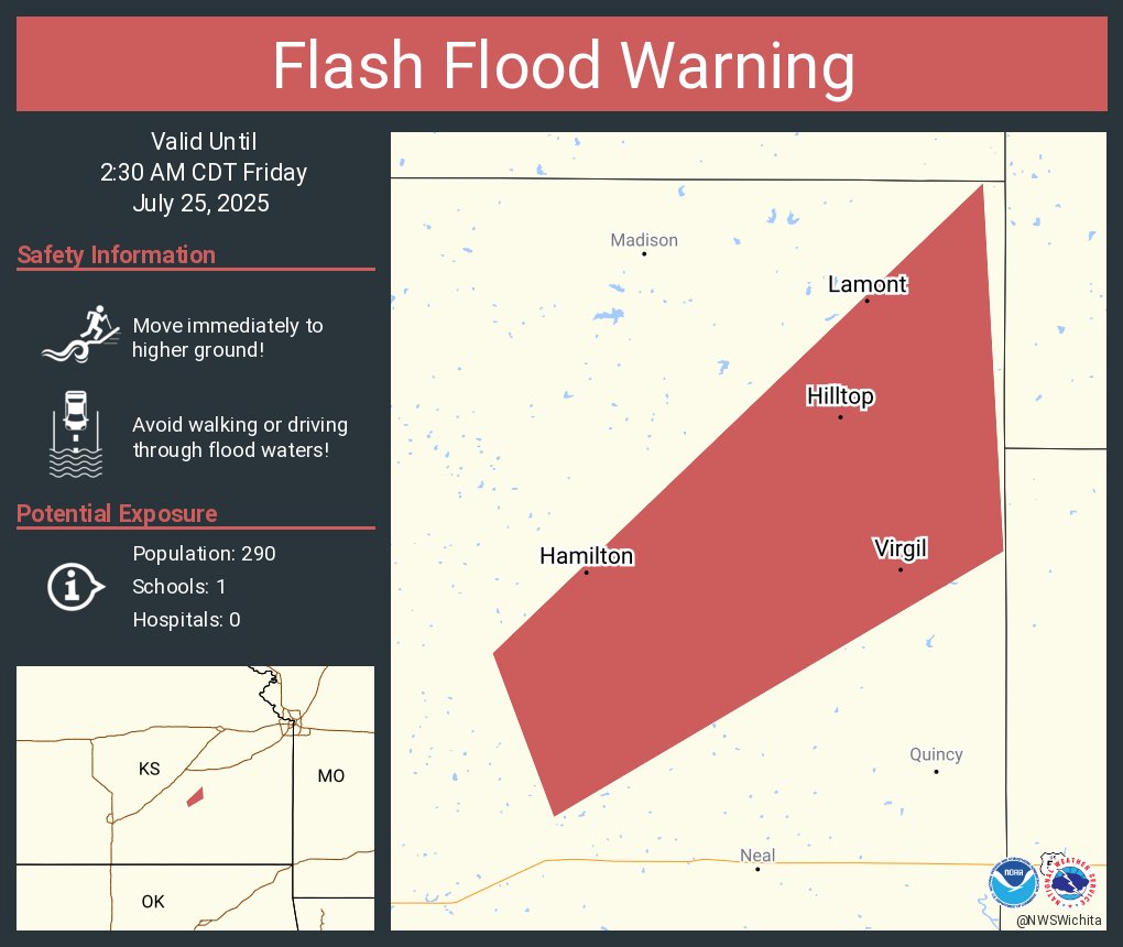
Flash Flood Warning including Hamilton KS, Virgil KS and Hilltop KS until 2:30 AM CDT
Showers and storms will continue to expand in coverage this evening across southern and eastern Kansas. Heavy rain may lead to flooding. If you are outdoors, make sure to have a plan for shelter. #kswx
Showers and storms will continue to expand in coverage this evening across southern KS. Heavy rain which could lead to flooding will be the primary threats. A stronger storm could produce wind gusts of 50 to 60 mph. If you are outdoors, make sure to have a shelter option. #KSwx
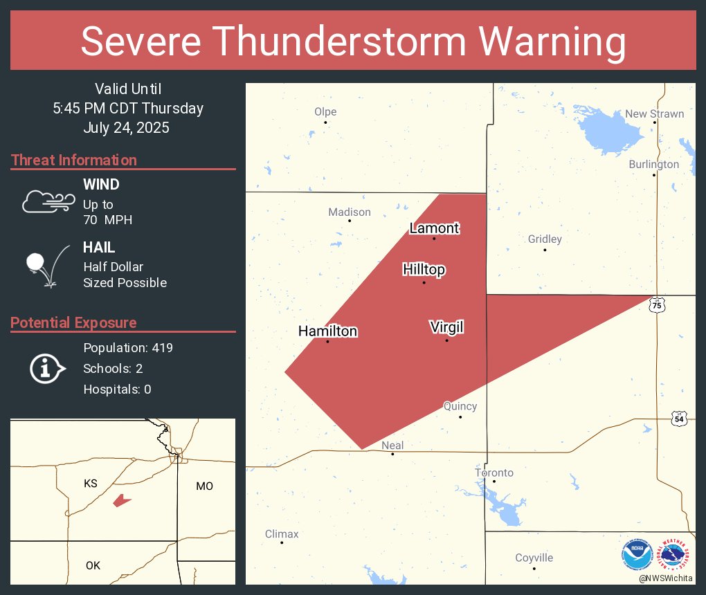
Aviso de Tormenta Severa continúa Hamilton KS, Virgil KS, Hilltop KS hasta las 5:45 PM CDT. ¡Esta tormenta contiene ráfagas de vientos de 70 MPH y granizo del tamaño

Severe Thunderstorm Warning continues for Hamilton KS, Virgil KS and Hilltop KS until 5:45 PM CDT. This storm will contain wind gusts to 70 MPH!