NWS Wakefield
@NWSWakefieldVA
Official X Account for National Weather Service Wakefield VA. Details: https://www.weather.gov/nws_x
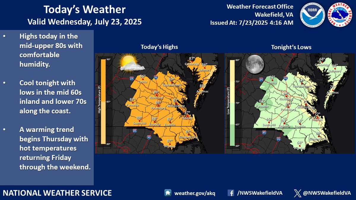
Another comfortable July day today with highs in the mid to upper 80s. Cool tonight with lows in the mid 60s inland and lower 70s along the coast. A warming trend begins Thursday with hot temperatures returning Friday through the weekend.
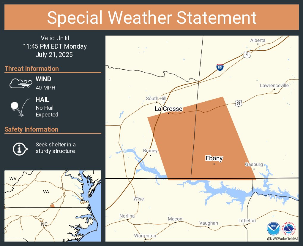
A special weather statement has been issued for La Crosse VA, Brodnax VA and Ebony VA until 11:45 PM EDT
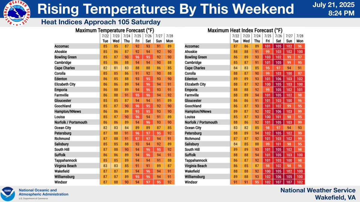
A front drops south of the area later tonight bringing a slight relief from the heat through midweek. The heat and humidity makes a return late this week/weekend, with heat indices approaching 105 by Saturday.
Another very warm and humid day ahead. But cooler and noticeably drier air is on the way for tonight through midweek. Before it arrives, though, we'll have another day of scattered afternoon showers and storms, mainly south of I-64. Gusty winds and frequent lightning possible.
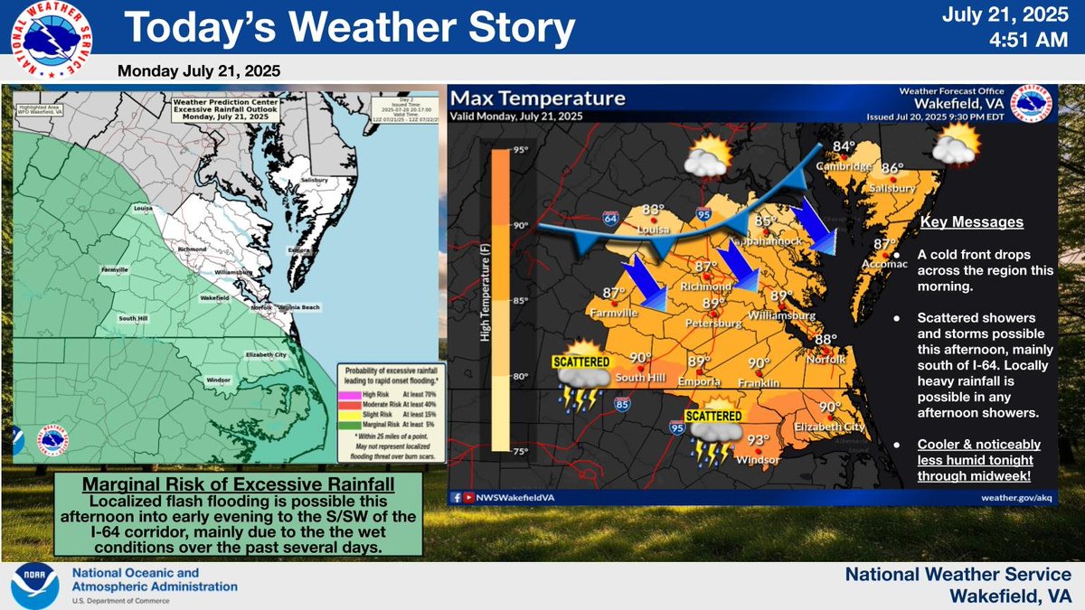
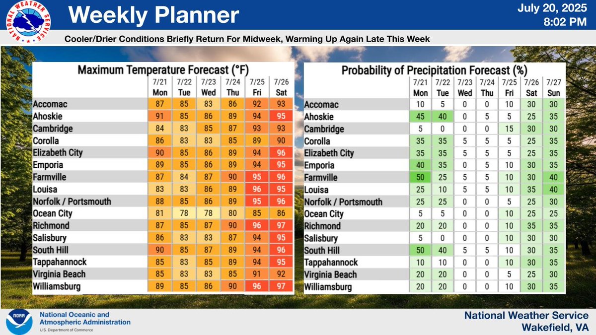
Looking ahead to this week, slightly cooler and less humid conditions are on the way along with drier weather for the midweek period. Warming up again and becoming unsettled later in the week and into the weekend.
Aviso de Tormenta Severa incluye Cambridge MD, Delmar MD, Hurlock MD hasta las 10:45 PM EDT
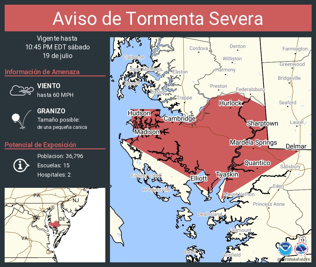
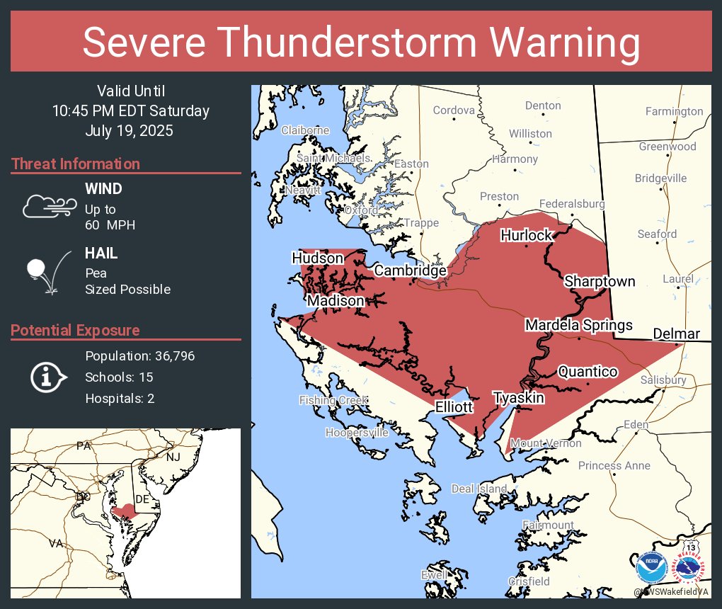
Severe Thunderstorm Warning including Cambridge MD, Delmar MD and Hurlock MD until 10:45 PM EDT
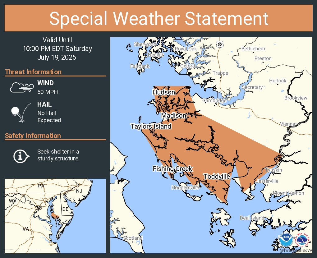
A special weather statement has been issued for Madison MD, Taylors Island MD and Fishing Creek MD until 10:00 PM EDT
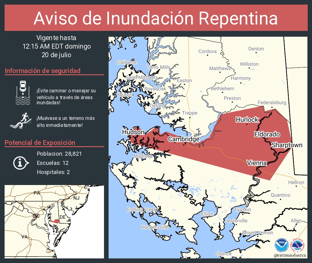
Aviso de Inundación Repentina incluye Cambridge MD, Hurlock MD, Sharptown MD hasta las 12:15 AM EDT
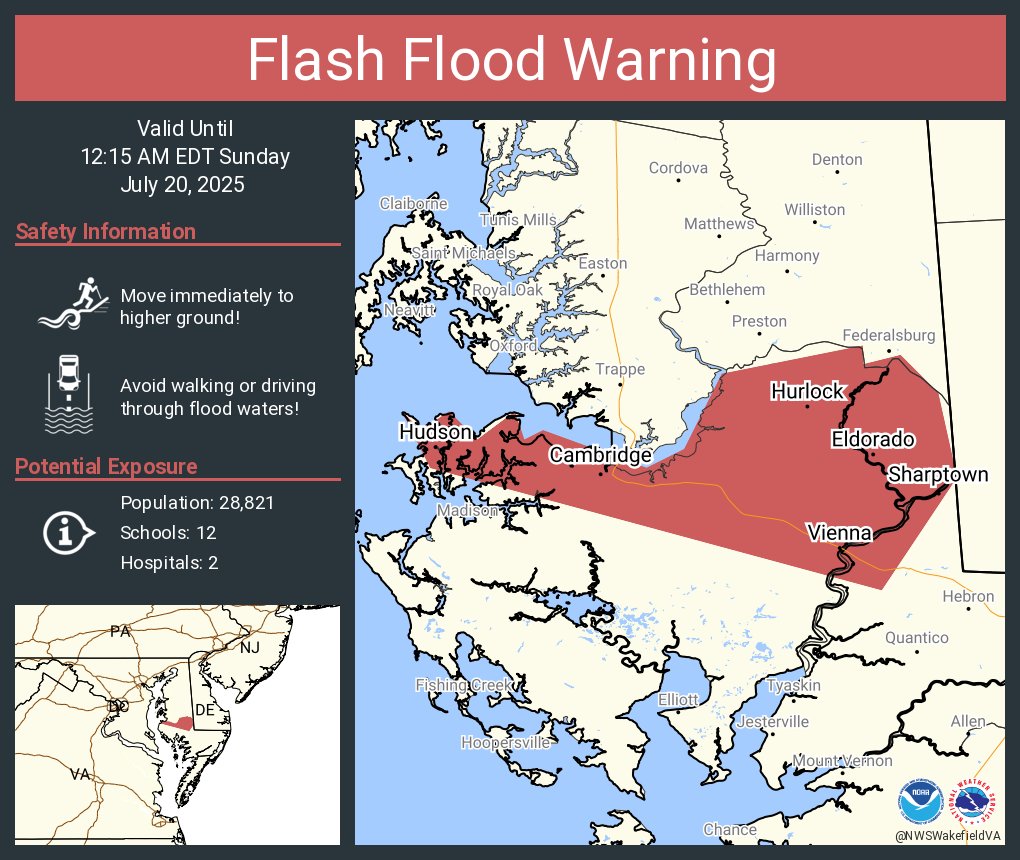
Flash Flood Warning including Cambridge MD, Hurlock MD and Sharptown MD until 12:15 AM EDT
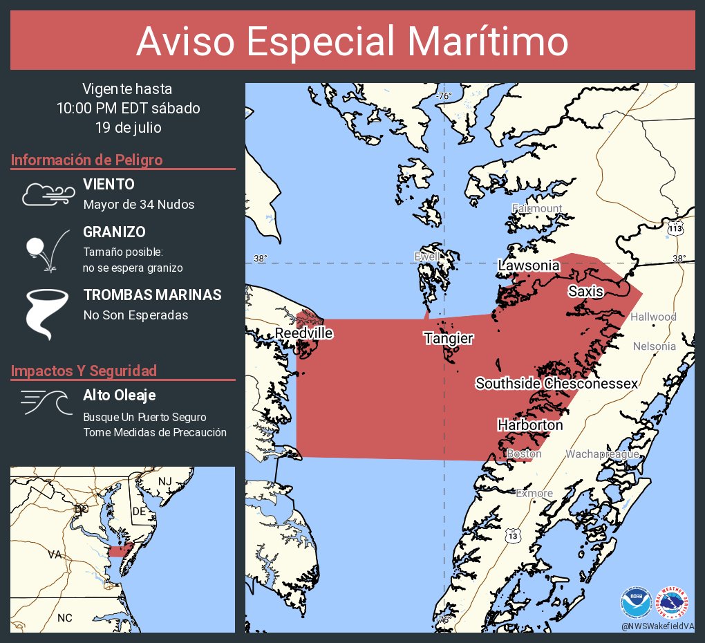
Aviso Especial Marítimo incluye Bahía de Chesapeake desde Smith Point a Windmill Point VA hasta las 10:00 PM EDT
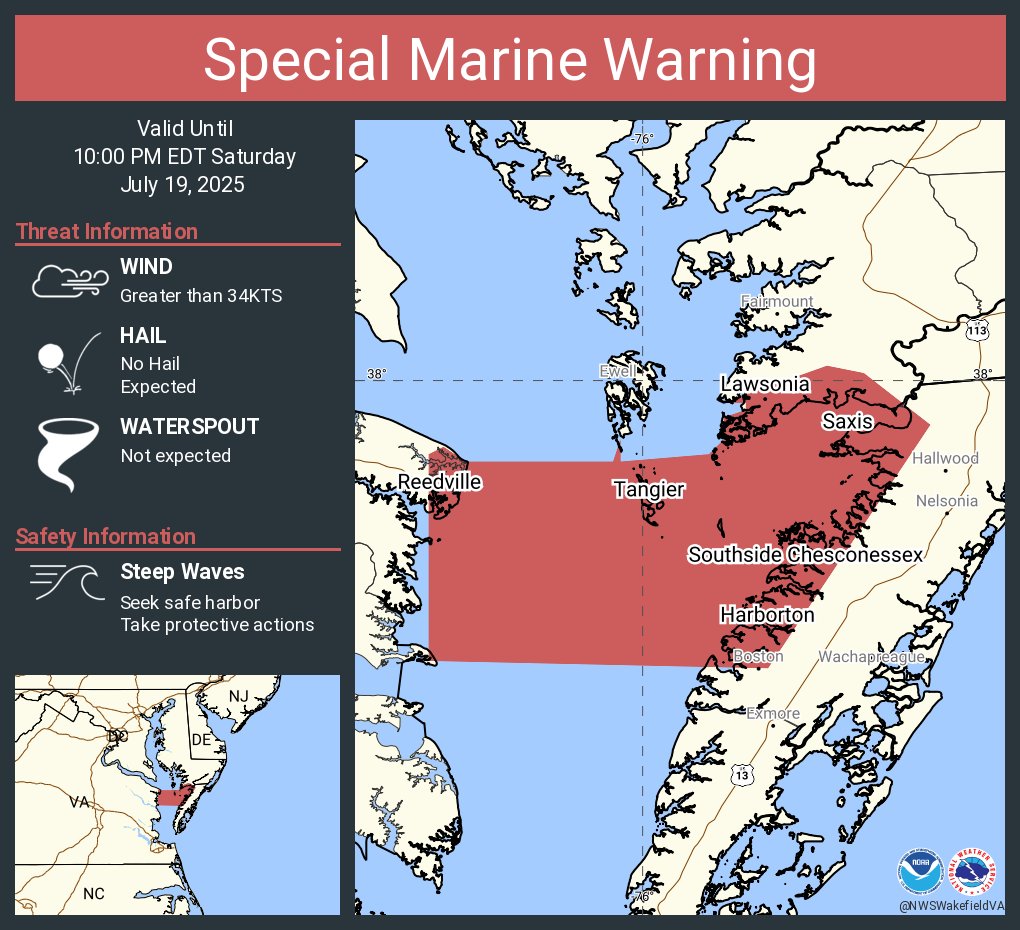
Special Marine Warning including the Chesapeake Bay from Smith Point to Windmill Point VA until 10:00 PM EDT
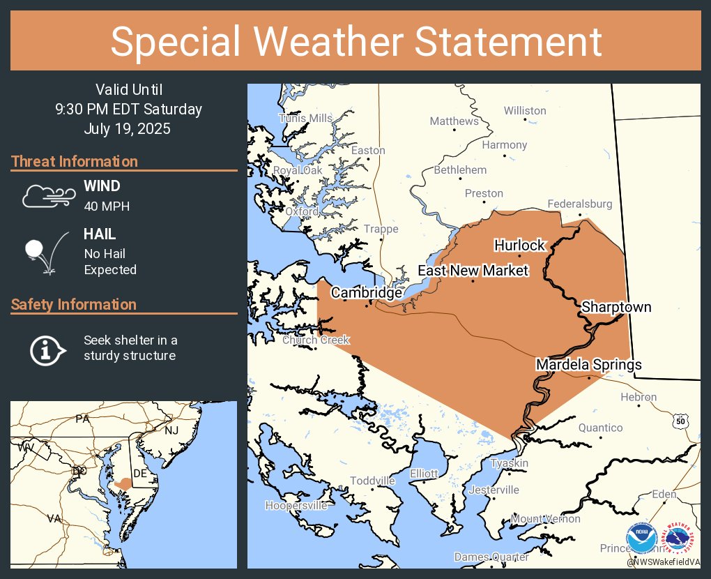
A special weather statement has been issued for Cambridge MD, Hurlock MD and Sharptown MD until 9:30 PM EDT
Aviso de Inundación Repentina incluye Saluda VA, Urbanna VA, Irvington VA hasta las 11:45 PM EDT
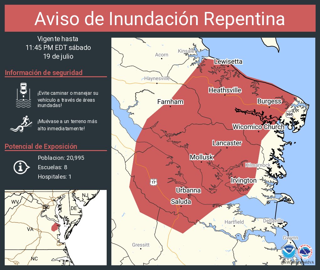
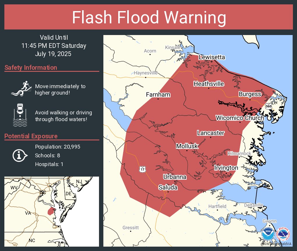
Flash Flood Warning including Saluda VA, Urbanna VA and Irvington VA until 11:45 PM EDT