NWS Tucson
@NWSTucson
Official X account for the National Weather Service Tucson. Details: https://www.weather.gov/nws_x
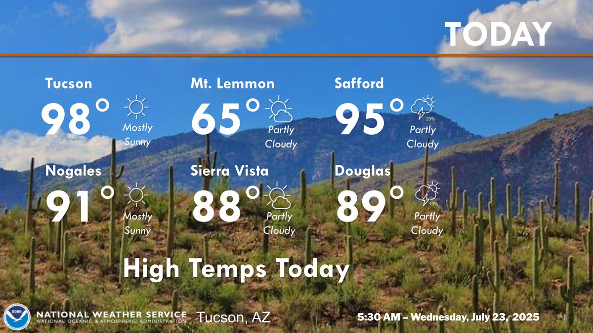
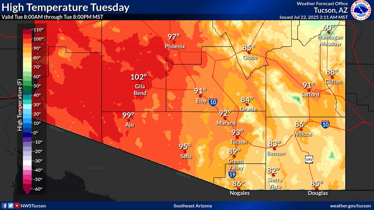
Drier air continues to move into the area which will limit any thunderstorm chances to areas mainly east of a Safford to Douglas line. Otherwise mostly sunny to partly cloudy with near normal high temperatures. #azwx
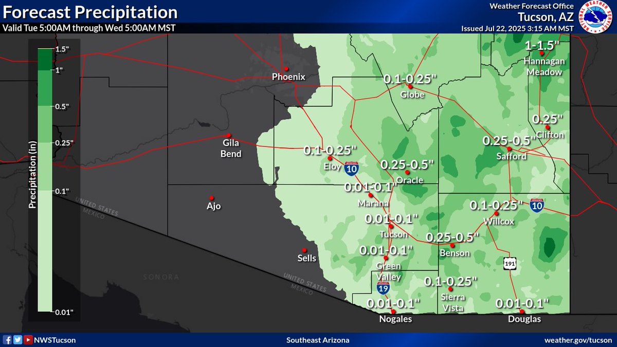
⛈️🌵 Here is a listing of 12-hour rainfall amounts across Southeast Arizona today (July 22, 2025). #azwx forecast.weather.gov/product.php?si…

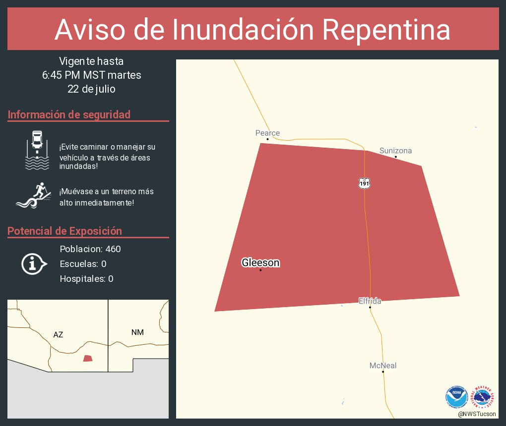
Aviso de Inundación Repentina incluye Gleeson AZ hasta las 6:45 PM MST

Aviso de Inundación Repentina incluye Vail AZ hasta las 6:45 PM MST
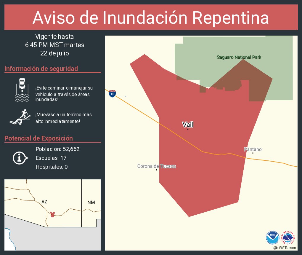

Radar Update: A cluster of showers and thunderstorms are producing heavy rain near Vail, AZ and have begun to slowly move north. Heavy rain & localized flash flooding is the primary impact with these storms. If you encounter any flooded roadways, Turn Around, Don't Drown!
📡⛈️2 PM Radar Update: Scattered clusters of showers and thunderstorms are producing locally heavy rainfall, especially in the vicinity of Mammoth, San Manuel, and Benson. Avoid flooded roads and washes. #azwx
#WPC_MD 0777 affecting Southeast Arizona, Southwest New Mexico, #nmwx #azwx, wpc.ncep.noaa.gov/metwatch/metwa…
Today showers and storms will form between 10 am and noon. After 5 pm, the majority of showers and storms will be east of Tucson. Storms will be capable of producing locally heavy rainfall and gusty winds. Do not drive through flooded roads. #azwx
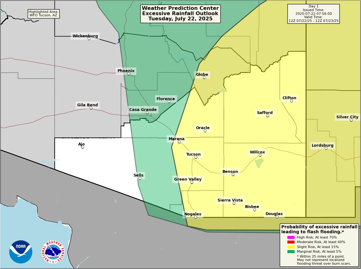
This morning: Mostly cloudy w/a few light showers. This afternoon: Scattered slow moving showers & thunderstorms w/some storms producing brief heavy rain. @NWSWPC has portion of SE AZ under Slight Risk of Excessive Rainfall leading to flash flooding. Highs below normal. #azwx
⛈️5:40 PM Radar Update: There are showers and t-storms across SE AZ with t-storms moving across Tohono O'odham Nation and light to moderate rainfall has exiting the Tucson Metro area moving northward towards Oracle. If you encounter flooded roadways turn around, don't drown.#azwx
3:30 PM Radar Update: Over the past hour rainfall rates have decreased, although showers and perhaps a rumble of thunder will continue this afternoon. Temperatures have cooled into the low 70s to low 80s across Tucson and surrounding areas. #azwx
A Flood Advisory has been issued for Arivaca Junction and areas west of Green Valley until 5:30 PM MST. Expect minor flooding in low-lying and poor drainage areas. Rises in small stream and normally dry washes is also expected. Turn around, Don't Drown! #azwx
TWC issues Flood Advisory for Pima, Santa Cruz [AZ] till Jul 21, 5:30 PM MST mesonet.agron.iastate.edu/vtec/f/2025-O-…
210 PM Radar Update: Strong thunderstorms producing locally heavy rainfall continue. #azwx
1 PM Radar Update: Ongoing slow moving storms south and east of Tucson are intensifying. Heavy rain is expected with these storms, especially near Green Valley and Three Points. Localized flash flooding possible. Do not drive through flooded roads. #azwx
#WPC_MD 0773 affecting Southeast Arizona, far Southwest New Mexico, #nmwx #azwx, wpc.ncep.noaa.gov/metwatch/metwa…
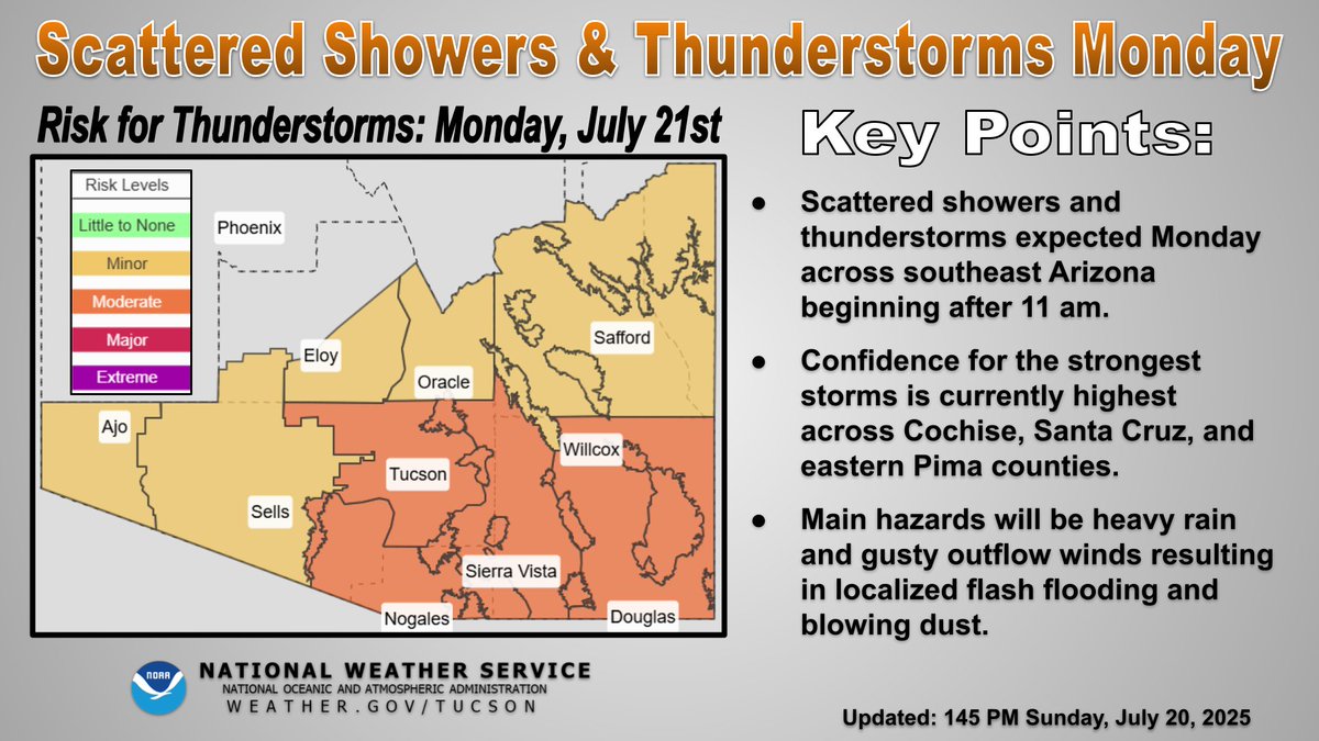
The work week begins with a more active day versus what occurred over the past weekend. Expect scattered showers and thunderstorms this afternoon and evening. Locally heavy rain, gusty winds and blowing dust are the main hazards. #azwx

While we are currently experiencing below normal temperatures, above normal temperatures are expected to return by next weekend. This will result in an uptick in heat related impacts. Remember to stay hydrated and take plenty of breaks when outdoors! #azwx

Tomorrow scattered showers and storms are expected across southeast AZ after 11 am. Confidence is currently highest for the strongest storms over Cochise, Santa Cruz, and eastern Pima counties. #azwx