NWS St. Louis
@NWSStLouis
Official Twitter account for the National Weather Service St. Louis. Details: http://weather.gov/nws_x
For most areas, the next two days will be the most uncomfortable days of the summer. Heat index values will range from 97-111+, with the highest values found in the St. Louis metro and southern areas. #stlwx #midmowx #mowx #ilwx

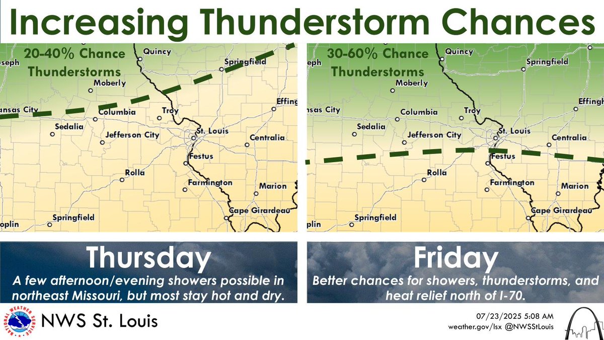
Chances for showers and thunderstorms are increasing from late tomorrow through Friday, mainly along and north of I-70 / 64. This will likely bring heat relief to some areas. #MOwx #ILwx #STLwx
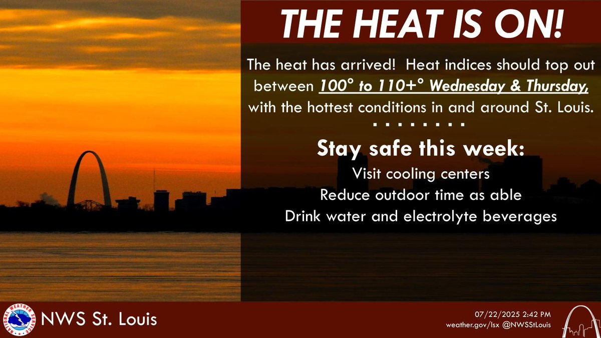
Heat Indices should top out between 100 and 110+ the next couple of days, particularly in the St. Louis metro. If you must be outdoors, limit your time outdoors and drink plenty of water or electrolytes. #stlwx #mowx #midmowx #ilwx
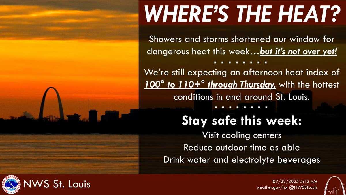
While showers and thunderstorms helped to cool things off a bit over the past couple of days, we are still expecting heat to return to many areas today, and even more areas tomorrow and Thursday. Don't let your guard down yet! #MOwx #ILwx #STLwx
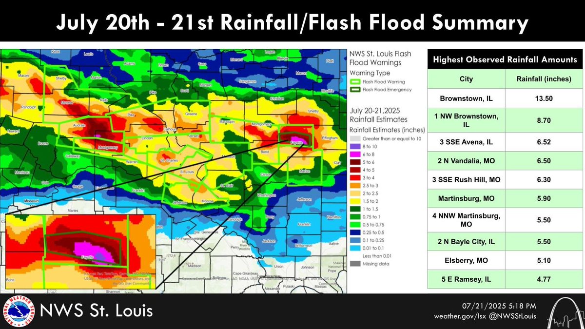
Portions of Missouri and Illinois received an abundance of rain last night. Brownstown, IL takes the top spot with 13.50" of rain reported. Other locations in the top 10 are almost exclusively in Audrain and Fayette counties, showcasing just how localized heavy rain can be.
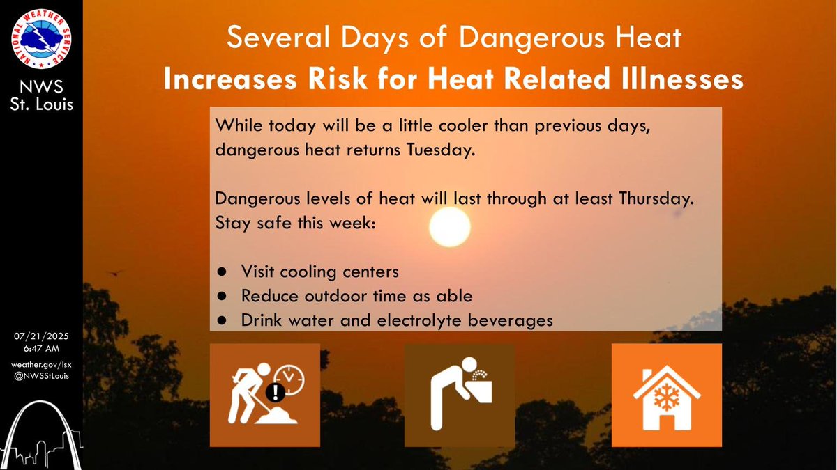
While today will be a little cooler than previous days, dangerous heat returns Tuesday. Dangerous levels of heat will last through at least Thursday. Stay safe this week: Visit cooling centers, reduce outdoor time as able, drink water and electrolyte beverages. #mowx #ilwx #stlwx
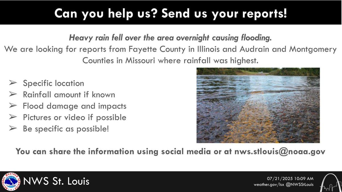
We are looking for reports from Fayette County Illinois and Audrain and Montgomery Counties in Missouri where rainfall was the heaviest.
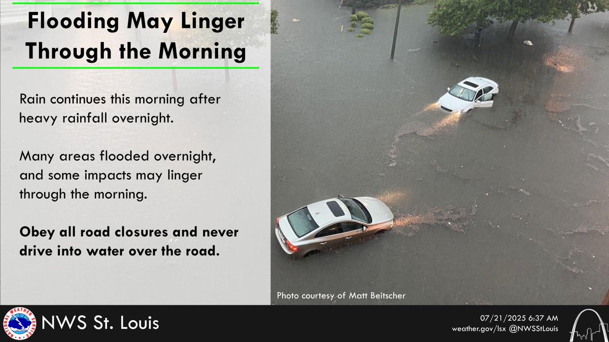
Rain continues across the area this morning after heavy rainfall from thunderstorms overnight. Many areas flooded, and some impacts may linger through the morning. Obey all road closures and never drive into water over the road. #mowx #ilwx #stlwx #midmowx
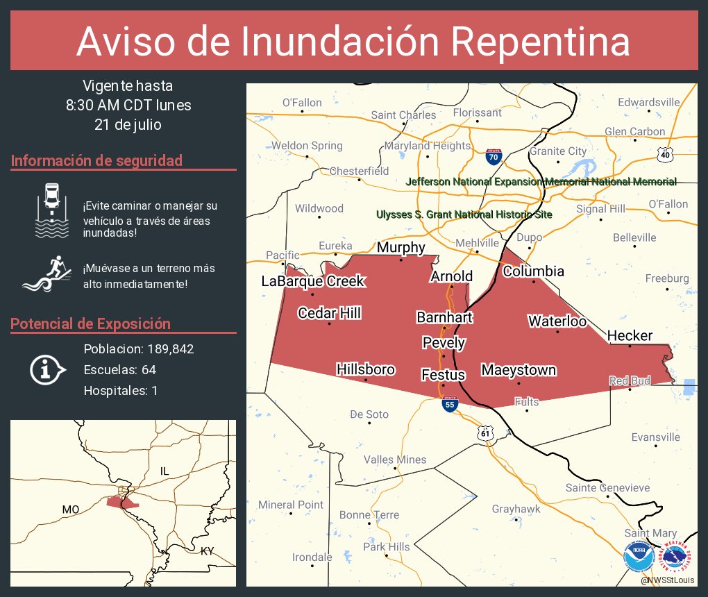
Aviso de Inundación Repentina incluye Arnold MO, Festus MO, Waterloo IL hasta las 8:30 AM CDT
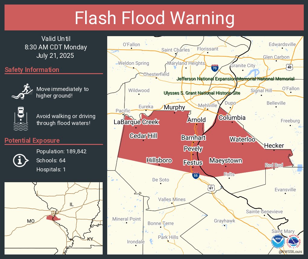
Flash Flood Warning including Arnold MO, Festus MO and Waterloo IL until 8:30 AM CDT
Aviso de Inundación Repentina incluye Saint Louis MO, Florissant MO, Chesterfield MO hasta las 8:00 AM CDT

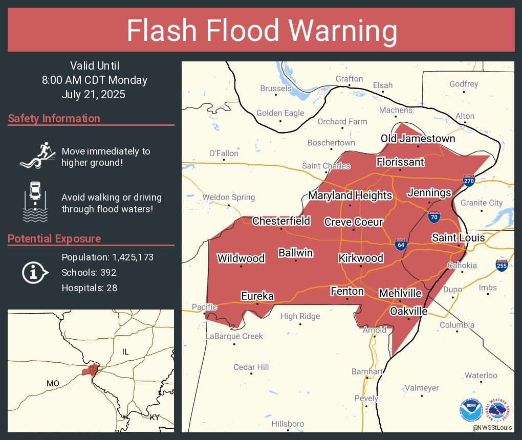
Flash Flood Warning including Saint Louis MO, Florissant MO and Chesterfield MO until 8:00 AM CDT
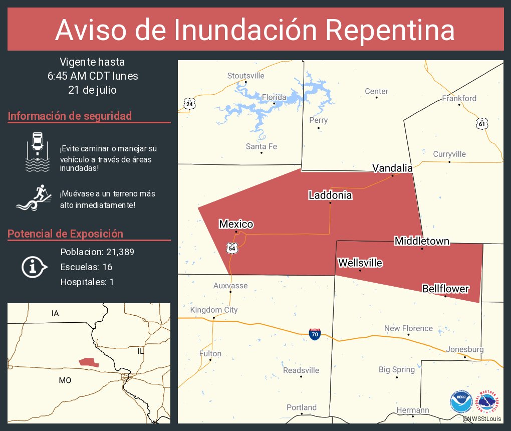
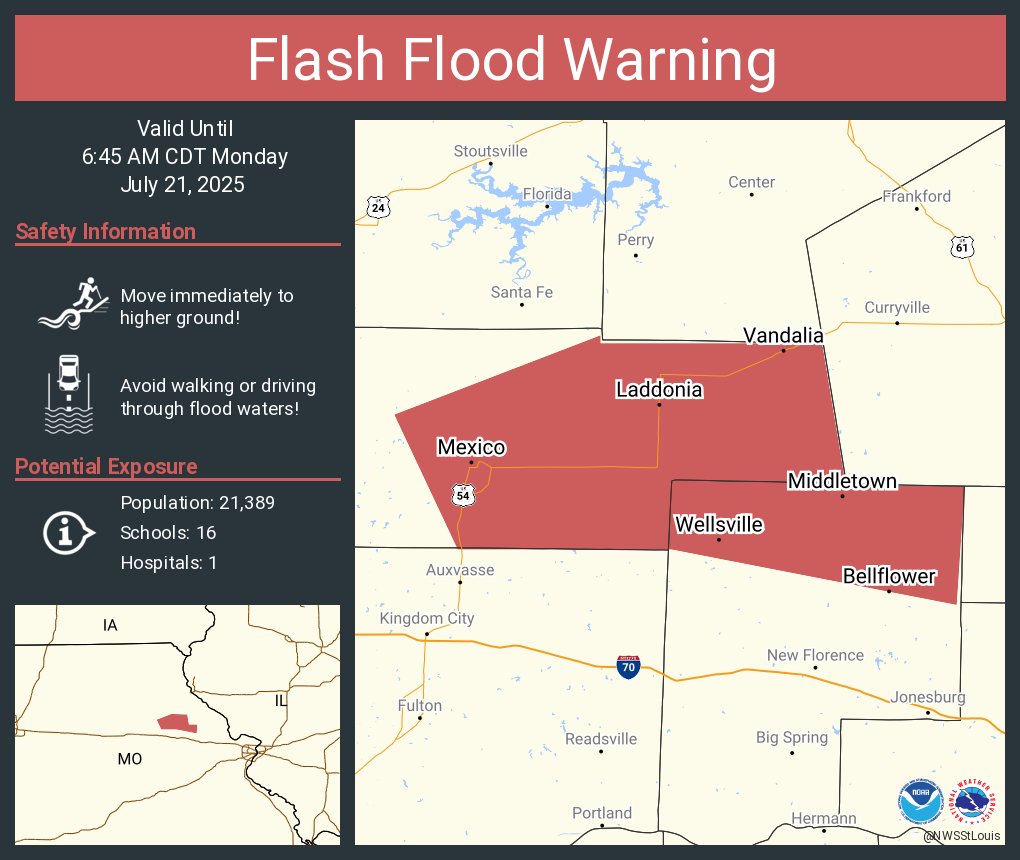
Aviso de Inundación Repentina continúa Mexico MO, Vandalia MO, Wellsville MO hasta las 6:45 AM CDT
Flash Flood Warning continues for Mexico MO, Vandalia MO and Wellsville MO until 6:45 AM CDT
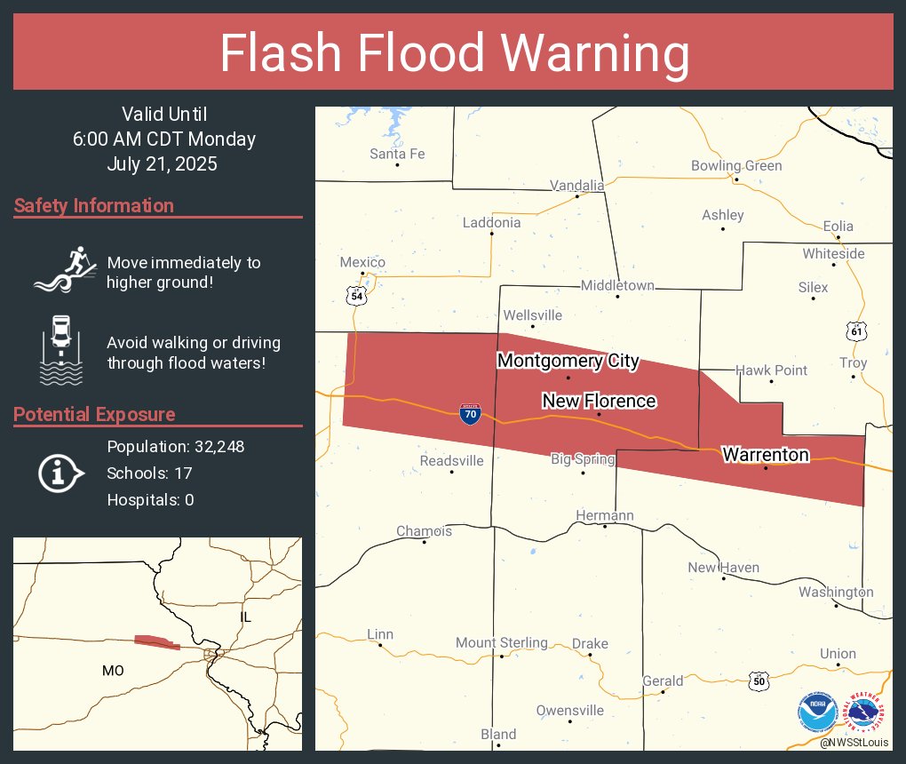
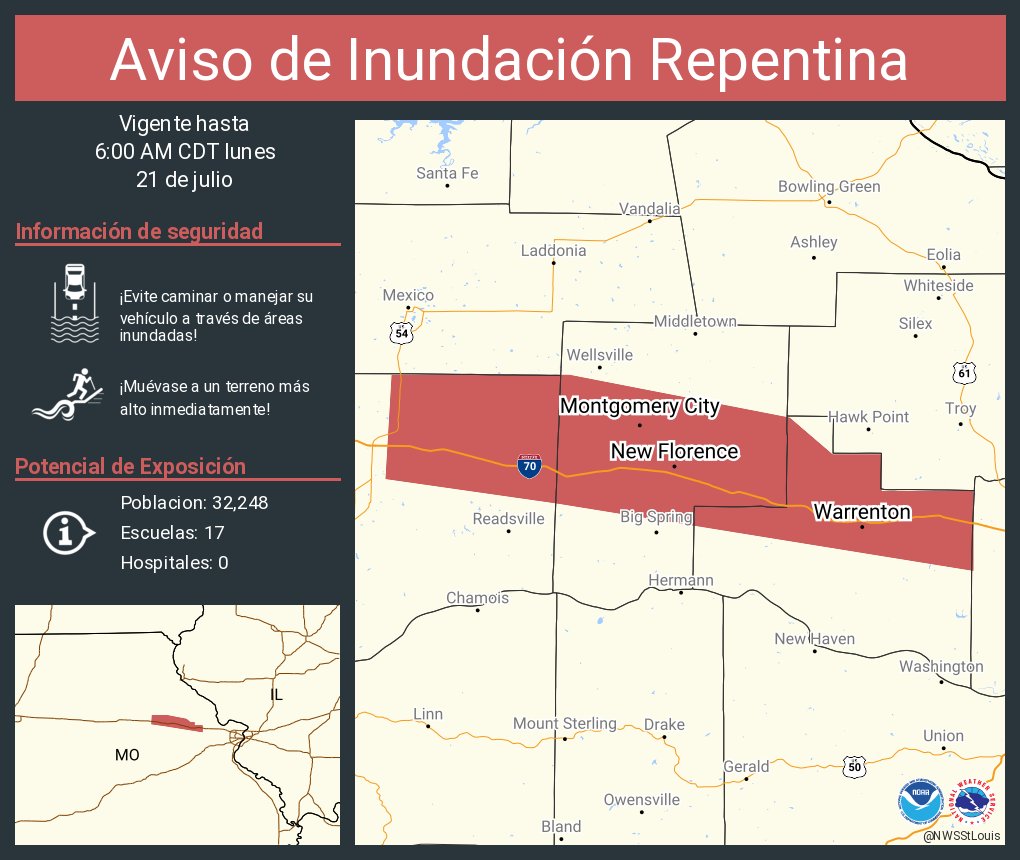
Aviso de Inundación Repentina continúa Warrenton MO, Wright City MO, Montgomery City MO hasta las 6:00 AM CDT

Flash Flood Warning continues for Warrenton MO, Wright City MO and Montgomery City MO until 6:00 AM CDT
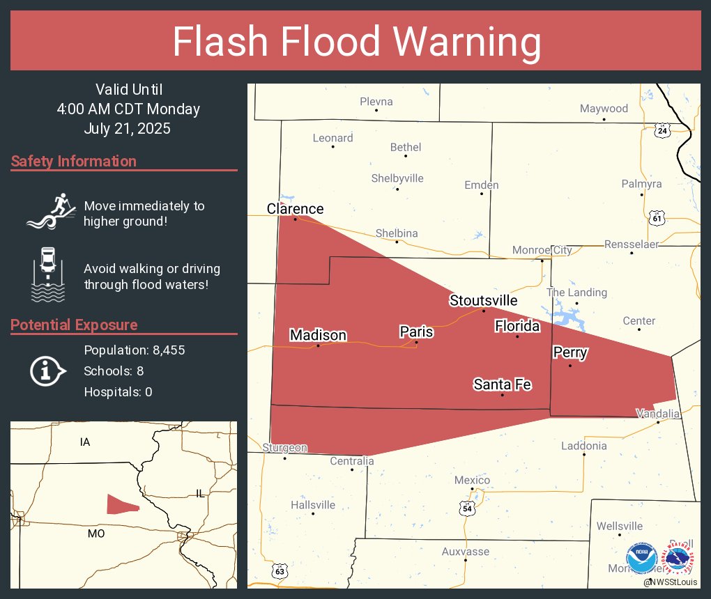
Aviso de Inundación Repentina continúa Paris MO, Clarence MO, Perry MO hasta las 4:00 AM CDT
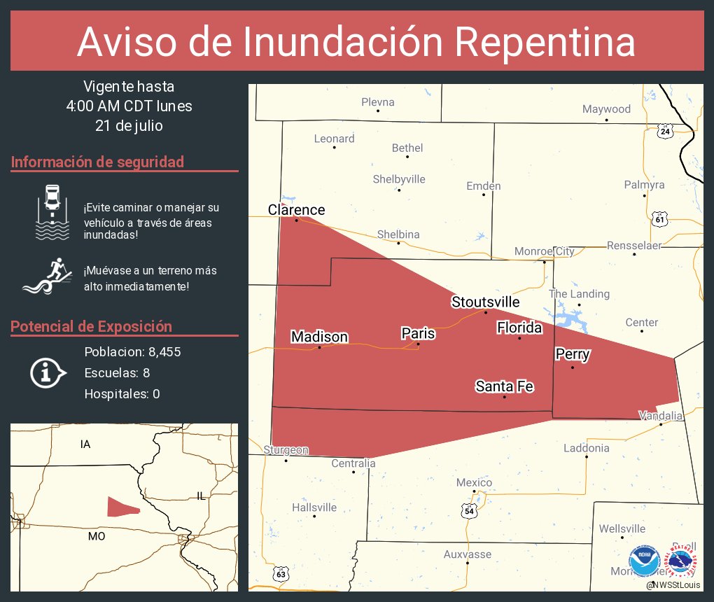
Flash Flood Warning continues for Paris MO, Clarence MO and Perry MO until 4:00 AM CDT
Aviso de Inundación Repentina incluye Warrenton MO, Wright City MO, Montgomery City MO hasta las 6:00 AM CDT
Flash Flood Warning including Warrenton MO, Wright City MO and Montgomery City MO until 6:00 AM CDT
