NWS San Juan
@NWSSanJuan
Official X account for the National Weather Service in San Juan. Details: http://www.weather.gov/nws_x. Use #prwx or #usviwx when reporting weather.
[ 29 de julio · July 29 ] 🚨 PR/USVI: ¡Atención! Calor🌡️, riesgo de inundaciones 🌧️ y Polvo de Sahara💨 hoy. ¡Mantente seguro! Heads Up! Heat, flood risk and Saharan dust today. Stay safe! #PRwx #USVIwx
![NWSSanJuan's tweet image. [ 29 de julio · July 29 ] 🚨 PR/USVI: ¡Atención! Calor🌡️, riesgo de inundaciones 🌧️ y Polvo de Sahara💨 hoy. ¡Mantente seguro! Heads Up! Heat, flood risk and Saharan dust today. Stay safe! #PRwx #USVIwx](https://pbs.twimg.com/media/GxA7ZI6WMAAzli1.jpg)
[29 de julio · July 29] 🔥 ¡Advertencia de Calor HOY! 🔥 Heat Advisory TODAY! Sin agua ni sombra, el calor pega fuerte. Cuida a niños, mayores y mascotas. No cooling? No hydration? Danger ahead! Drink up, chill out, watch your loved ones. #PRwx #USVIwx
![NWSSanJuan's tweet image. [29 de julio · July 29]
🔥 ¡Advertencia de Calor HOY! 🔥 Heat Advisory TODAY!
Sin agua ni sombra, el calor pega fuerte. Cuida a niños, mayores y mascotas.
No cooling? No hydration? Danger ahead! Drink up, chill out, watch your loved ones.
#PRwx #USVIwx](https://pbs.twimg.com/media/GxAtgTVWgAAuhPO.jpg)
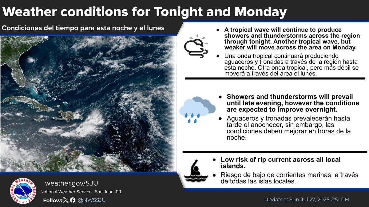
Tonights Weather | Condiciones del tiempo para esta noche #prwx #usviwx
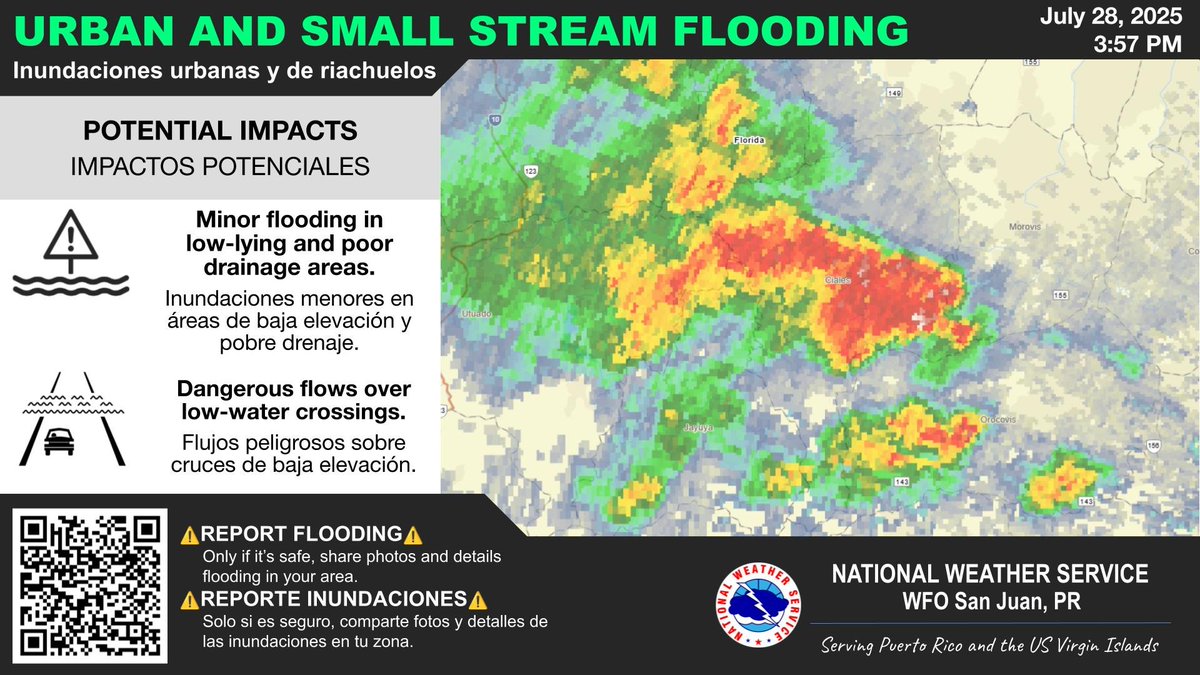
⚠️CIALES, FLORIDA and JAYUYA⚠️ Urban and Small Stream Flood Advisory. | Advertencia de Inundaciones Urbanas y de Riachuelos. Until | Hasta: 5:45 PM AST Jul 28 #PRwx
A special weather statement has been issued for Utuado PR, Lares PR and Jayuya PR until 3:30 PM AST

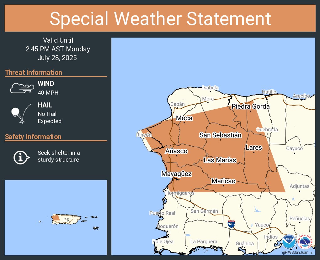
A special weather statement has been issued for Mayagüez PR, San Sebastián PR and Añasco PR until 2:45 PM AST
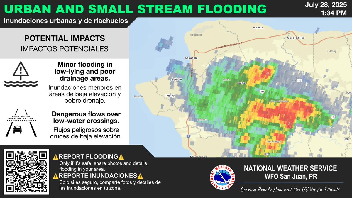
⚠️MOCA and SAN SEBASTIAN⚠️ Urban and Small Stream Flood Advisory. | Advertencia de Inundaciones Urbanas y de Riachuelos. Until | Hasta: 3:30 PM AST Jul 28 #PRwx
[28 de julio] 🌡️⚠️ Aviso de Calor Extremo en efecto para Puerto Rico - ¡el primero del 2025! 🚨🥵 Advertencia de Calor para Vieques, Culebra e Islas Vírgenes Americanas Hidrátate, evita actividades al aire libre y cuida a los más vulnerables. ¡El calor puede ser peligroso!
[ Jul 28 ] 🌡️⚠️Excessive Heat Warning in effect for Puerto Rico - the first of 2025! 🚨🥵Heat Advisory for Vieques, Culebra, and the U.S. Virgin Islands Stay hydrated, limit outdoor activity, and check on the vulnerable. Heat is serious, it can be deadly! #PRwx #USVIwx
[ Jul 28 ] 🌡️⚠️Excessive Heat Warning in effect for Puerto Rico - the first of 2025! 🚨🥵Heat Advisory for Vieques, Culebra, and the U.S. Virgin Islands Stay hydrated, limit outdoor activity, and check on the vulnerable. Heat is serious, it can be deadly! #PRwx #USVIwx
![NWSSanJuan's tweet image. [ Jul 28 ]
🌡️⚠️Excessive Heat Warning in effect for Puerto Rico - the first of 2025!
🚨🥵Heat Advisory for Vieques, Culebra, and the U.S. Virgin Islands
Stay hydrated, limit outdoor activity, and check on the vulnerable. Heat is serious, it can be deadly!
#PRwx #USVIwx](https://pbs.twimg.com/media/Gw8LXtAWgAA43Gc.jpg)
![NWSSanJuan's tweet image. [ Jul 28 ]
🌡️⚠️Excessive Heat Warning in effect for Puerto Rico - the first of 2025!
🚨🥵Heat Advisory for Vieques, Culebra, and the U.S. Virgin Islands
Stay hydrated, limit outdoor activity, and check on the vulnerable. Heat is serious, it can be deadly!
#PRwx #USVIwx](https://pbs.twimg.com/media/Gw8LYgBW0AABMp3.jpg)
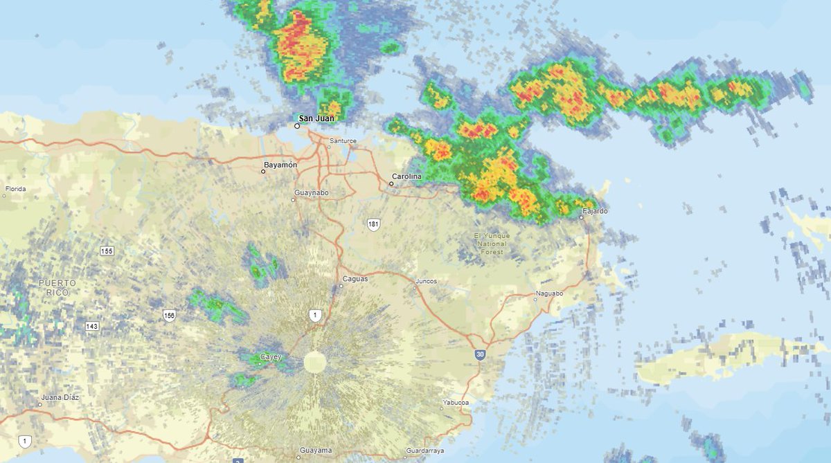
Fajardo, Luquillo, Río Grande. Loíza: Tormentas eléctricas se mueven sobre estos municipios. Favor ejercer precaución. Thunderstorms area moving over these areas. Exercise caution. #prwx
An area of showers and thunderstorms is approaching Vieques and eastern PR. Please exercise caution when outdoors. Un área de aguaceros y tronadas se acerca a Vieques y el este de PR. Favor de ser precavido si se encuentra en el exterior. #prwx
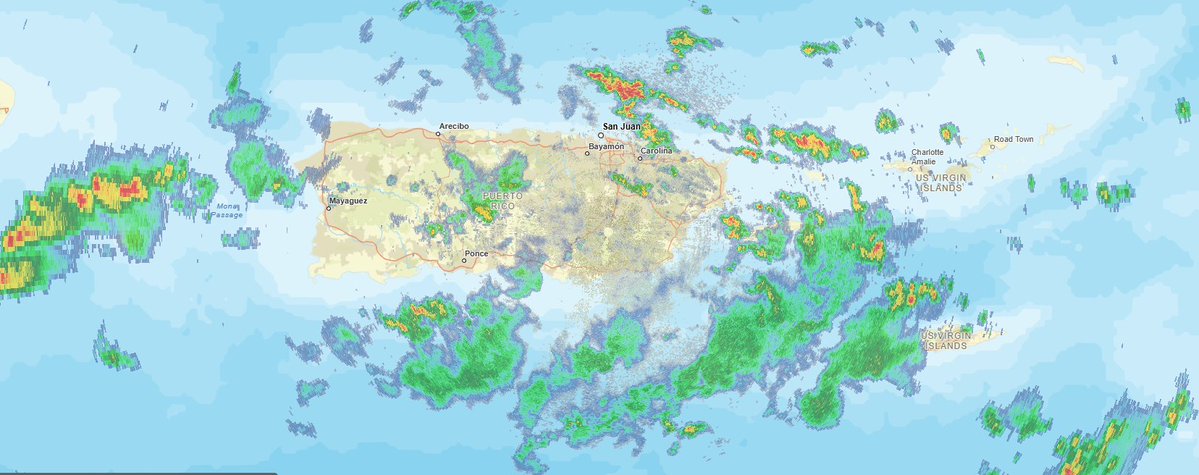
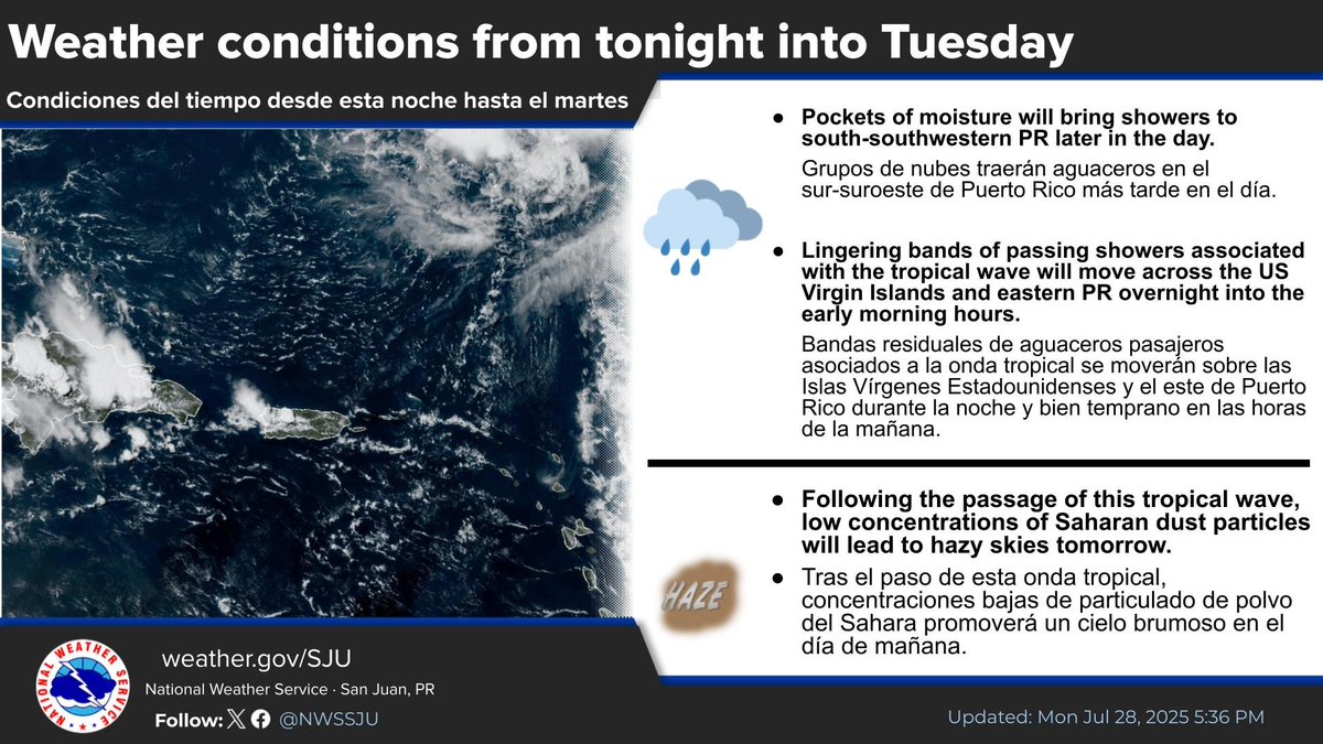
Tropical wave will continue to result in shower and thunderstorm activity through tonight across PR and USVI. Onda tropical continuará resultando en aguaceros y tronadas a través de PR y USVI. #prwx #usviwx
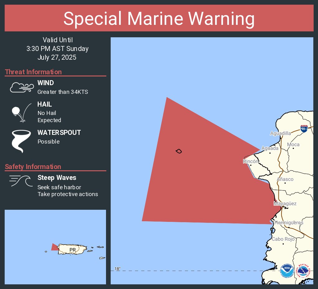
Aviso Especial Marítimo incluye Sur del Pasaje de Mona hasta 17 MN, Aguas Costeras al Noroeste de Puerto Rico hacia afuera 10 MN y Aguas Costeras al Suroeste de Puerto Rico hacia afuera 10 MN hasta las 3:30 PM AST

Special Marine Warning including the Atlantic Waters of Puerto Rico AND USVI from 10 NM to 19.5N, Mona Passage Southward to 17N, Coastal Waters OF Northwestern Puerto Rico out 10 NM and Coastal Waters OF Southwestern Puerto Rico out 10 NM until 3:30 PM AST
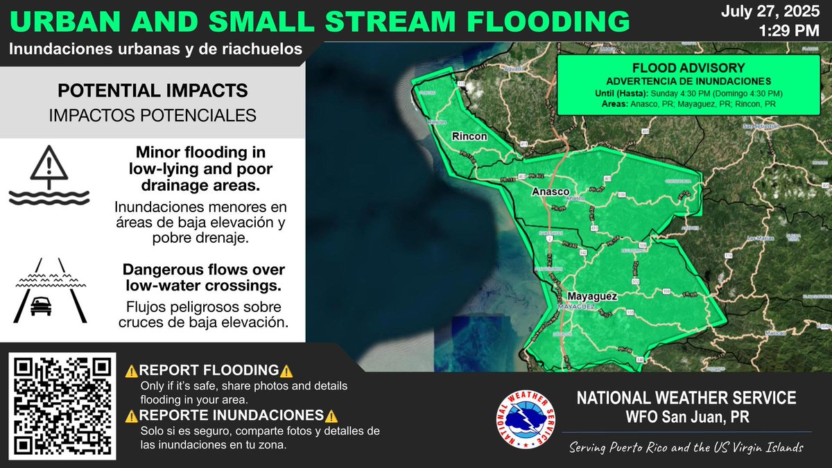
⚠️AÑASCO, RINCÓN and MAYAGÜEZ⚠️ Urban and Small Stream Flood Advisory. | Advertencia de Inundaciones Urbanas y de Riachuelos. Until | Hasta: 4:30 PM AST Jul 27 #PRwx
7/27/25-1:24 PM Ejerzan precaución al aire libre, ya que se han reportado incidentes asociados a impactos por rayos asociados a las tormentas eléctricas (o tronadas). Please be careful outdoors, as lightning strikes associated with t-storms have been reported. #PRWX #USVIWX
1:10 PM AST A line with thunderstorms will move over/near St Croix the next hour or so, producing heavy rain, gusty winds, and ponding of water in roads and poorly drained areas. #USVIWX
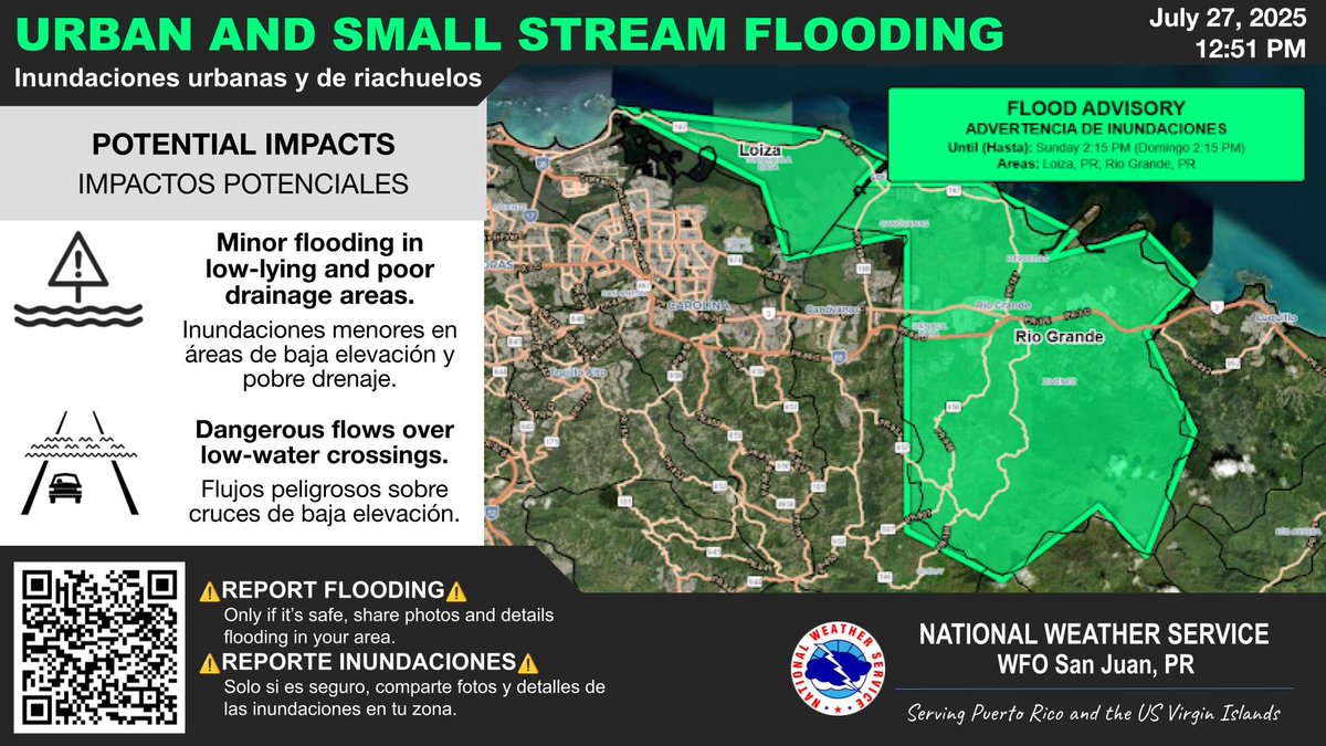
⚠️LOIZA and RIO GRANDE⚠️ Urban and Small Stream Flood Advisory. | Advertencia de Inundaciones Urbanas y de Riachuelos. Until | Hasta: 2:15 PM AST Jul 27 #PRwx